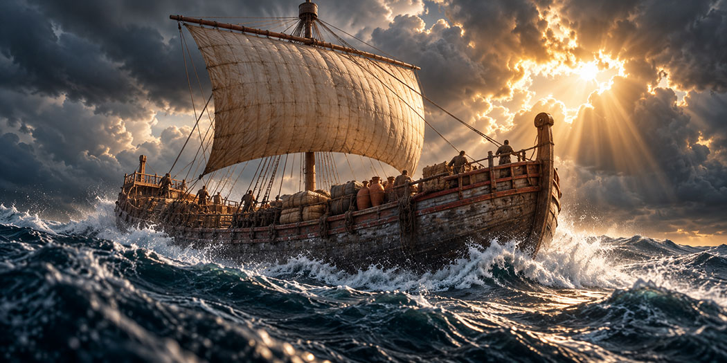
Introduction by Arthur de Graauw1.
The main reason for building ports was the human need to communicate and move people, ideas and products by sea. The Mediterranean region, a crossroads of three continents and the cradle of major cultures over the last 5,000 years, has been an important passage for trade and travel since the beginnings of seafaring. The Roman Empire controlled the Mediterranean from the end of the Punic Wars (264-146 BC)2 until the beginning of Late Antiquity (late third century AD). During this period, Roman ships sailed the semi-enclosed Mediterranean Sea. They transported and distributed products, people and ideas, introducing an early form of globalisation. Roman ports formed the cornerstone of this shipping. Throughout this period, ports were ubiquitous in the Mediterranean region, forming a maritime network that connected the coastal towns along the Mediterranean's 45,000 km coastline. The infrastructure of Roman commercial ports was the result of technological and construction developments that began in the Mediterranean region during the Bronze Age.
Foreword by Gerard Huissen
But what did these ports look like? What elements were they built from and what techniques did Roman engineers use? Important questions indeed for an organisation that calls itself Roman Ports. Fortunately, we can turn to our partner Arthur de Graauw. This Dutch/French port engineer has explained various aspects in several articles on his Ancient Ports website3. We have used these to create an account that we hope you will find clear and easy to understand.
First, I think it would be useful to identify the various aspects we may encounter in ports.
In a 2025 article, de Graauw states that only 15% of the 6,000 coastal sites he investigated had anything that could be called a harbour structure. Most had only a beach off which ships could anchor or onto which they could be hauled. For ports with some form of artificial structure, the following facilities could be useful:
A harbour basin that had to be brought to the correct depth for ships with draughts of one to three metres and regularly maintained because of incoming sediment;
Breakwaters, intended to keep waves out of the harbour as much as possible;
Quays along one side of which ships could moor, unload and/or load;
Piers extending from the shore into the harbour basin, where ships could unload and load on both sides;
Shipyards with slipways and shipsheds for building and maintaining ships;
Artificial channels for navigating ships;
Chain installations for closing the harbour entrance;
Lookout towers, light beacons and lighthouses;
Mechanical equipment such as lifting devices.
Combinations were of course also possible. For example, a loading and unloading quay on the lee side of a breakwater, as at Leptiminus and Acholla4.
We will discuss several of these aspects here and offer a glimpse of how the Romans were able to build these ports over 2,000 years ago using highly ingenious techniques.
FIRMITAS, UTILITAS ET VENUSTAS5
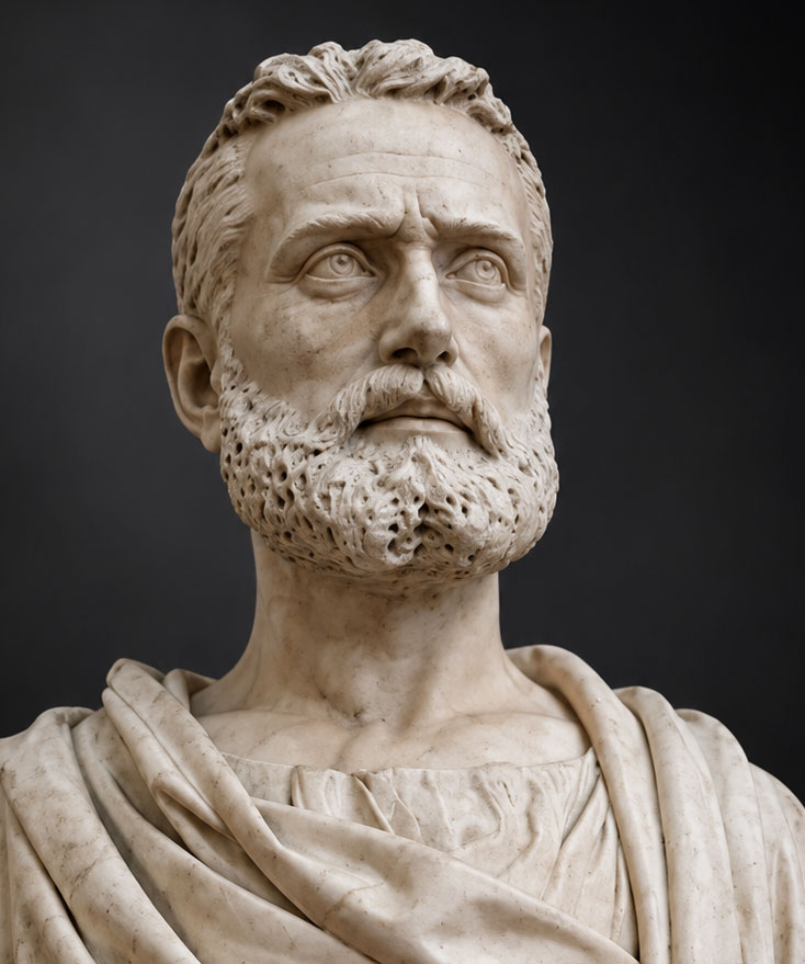
Strength, functionality and beauty. According to the Roman architect Vitruvius, these were the three requirements a good building had to meet. This therefore also applied to ports. He believed preference should be given to harbour sites where the coastline curved naturally inwards7.
Not a great deal of information has survived from antiquity. Besides Vitruvius, the most important information comes from a few other authors, such as Philo of Byzantium8, Pliny the Younger9 and Flavius Josephus10.
OPUS CAEMENTICIUM
What made Roman harbour works so remarkable that parts of them are still standing after 2,000 years?
At the end of the third century BC, the Romans developed a new type of concrete that could be used underwater, was relatively inexpensive and could be handled by unskilled workers. Concrete could also be poured into many shapes, making larger arches and domes possible.
By the middle of the 1st century, the Romans had fully mastered concrete construction, creating a dynamic architecture of endless, lofty spaces and daring spans that bore no resemblance to the traditional Greek construction methods customary until then.11
Around 20 BC, Vitruvius described in his De Architectura libri decem (10 books on architecture) how this new building material should be made. Essentially, it involved mixing sand and stones. For structural mortars, he recommended pozzolan, a volcanic sand from Pozzuoli with a brown-yellow-grey colour when quarried near Naples and a reddish-brown colour when sourced near Rome. Vitruvius specified a ratio of 1 part lime to 3 parts pozzolan for buildings and a 1 to 2 ratio of lime/pulvis Puteolanus for underwater structures. This mixture proved to harden underwater, which was truly revolutionary. It was poured in layers alternating with stones. The finished product was known as opus caementicium (concrete), without any iron reinforcement.
BREAKWATERS
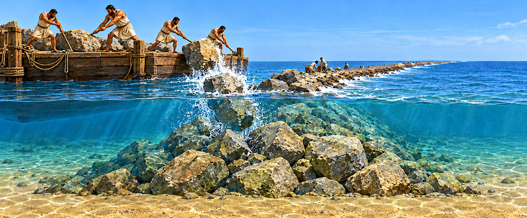
Today, a distinction is made between sloping breakwaters and vertical breakwaters (see figure 14).
Sloping breakwaters were already used by the ancient Egyptians12.
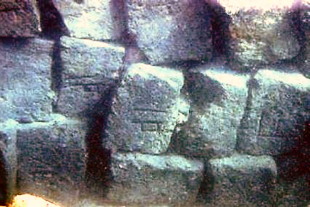
This type of structure was widely used for breakwaters in water deeper than a few metres, where it was easier to dump loose stones overboard from barges than to have divers place transversely laid dressed stone blocks, known as ‘ashlar’ blocks. This dumping method was later described by Pliny the Younger for Centumcellae (AD 103).
Early vertical structures were often made of dressed stone blocks, such as the northern breakwater at Tyre. This consisted of a double wall of transversely laid dressed stone blocks with a filling of loose material between them, such as inexpensive, unsorted quarry stone.
At Leptiminus and Acholla (Lamta and Ras Boutria, Tunisia), piers of dressed stone blocks, respectively 560 m and 460 m long, were also used to provide a sheltered quay on the lee side for small ships and at the end for larger ones.
Another method involved wooden caissons that could be placed directly on the seabed by driving piles. The caisson was then filled with a mixture of loose stone fragments and cement mortar. Once this concrete had hardened, the formwork was removed. An example survives in the remains of Claudius's northern breakwater at Portus.
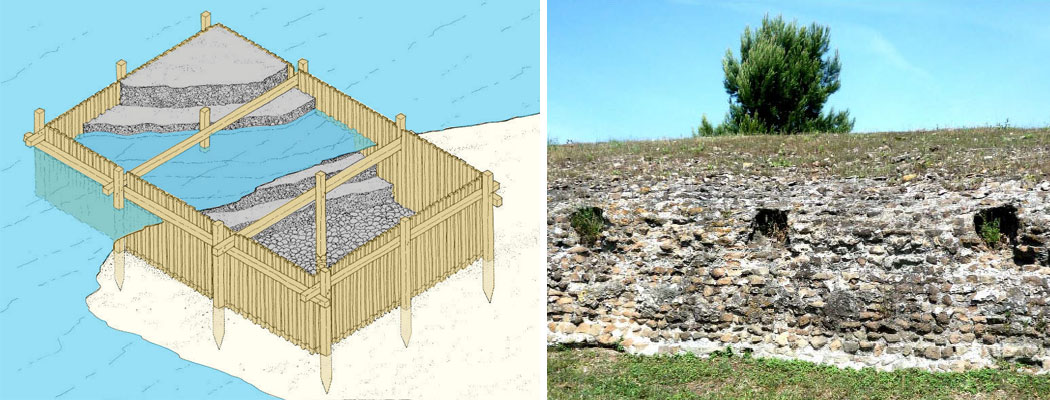
This type of construction was also used for a solid concrete pier inside a harbour basin protected by a ‘rubble-mound’ breakwater, at Cosa and Naples.
Wooden caissons, with or without a bottom, could also be prefabricated elsewhere and floated to their final location (see fig. 7). There, they were filled with concrete that could harden underwater, after which they came to rest on a foundation. This construction method was used, among other places, at Caesarea Maritima (Israel), where modern archaeological investigations have found concrete blocks measuring up to 14 × 7 × 4 m (approximately 1,000 tonnes)14.
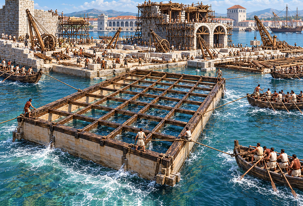
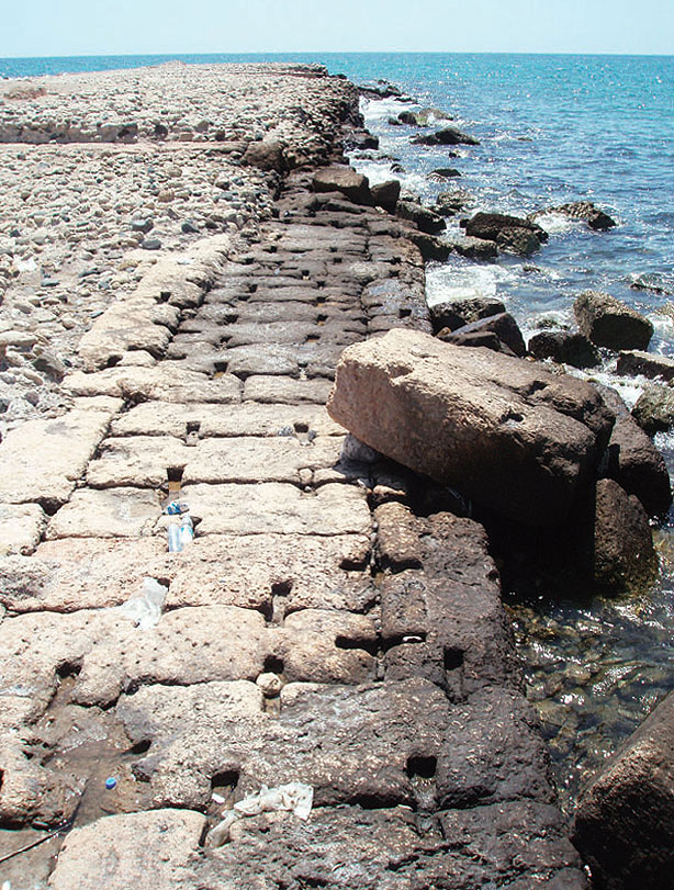
and Roman concrete on the left.
Much later, around AD 150, the Romans adopted the double-wall concept from the Phoenicians.
For the breakwaters at Pompeiopolis in present-day Turkey, the Romans used concrete that could harden underwater as filling between the lateral retaining walls of dressed stone blocks (see figure 8).
PILAE AND ARCHED BREAKWATERS
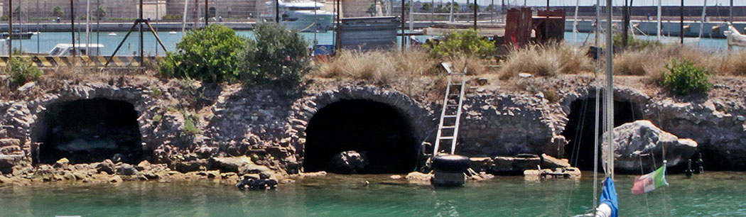
These breakwaters have arched openings to reduce sediment in the harbour through limited water circulation. The arches were supported by massive piers (opus pilarum) made of stone or concrete. Such a row of ‘maritime pilae’ resembles a single-tier aqueduct, but with smaller openings. The ratio between the spacing of adjacent piers and their width may depend on the angle at which the waves approach: the more perpendicularly the waves strike the row of pilae, the smaller the openings between the pilae must be to protect against wave penetration.
A clearly visible example of an arched breakwater can be found in the harbour of Centumcellae, present-day Civitavecchia. On the so-called Molo del Lazzaretto (figure 9), the arches appear to have been placed on a rocky shoal. Most sites with pilae are in Italy, especially around Naples. This is unsurprising, as the pozzolan needed to build pilae underwater came from the Campi Flegrei area near Naples.
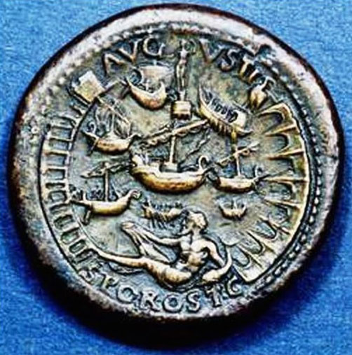
the harbour of Claudius.
A coin of Nero also suggests that the northern breakwater of Portus Claudius was an arched breakwater (figure 10). However, the stones of the arches have not been found to date.
The best-known ancient arched breakwater is at Puteoli (Pozzuoli). Its remains are now buried beneath a new breakwater, but until the 19th century, remains of the arches, known as the “Molo Caligoliano” (Caligula's pier), were still visible.
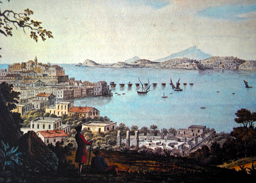
RUBBLE-MOUND BREAKWATERS (see figure 3)
Rubble-mound breakwaters consist of accumulations of stones sorted more or less according to their individual weight: smaller stones for the core and larger stones for the armour layer, which protects the core against wave attack. The stability of a stone structure depends mainly on stone size in relation to wave force. Breakwaters in open water, exposed to storms over an extensive sea that generate high waves, must consist of larger stones than breakwaters in sheltered areas.
Most breakwaters of this kind are now underwater as a result of 2,000 years of storms. If built too lightly, sooner or later a storm will displace the armour layer. The blocks on the seaward side then fall down, and after several centuries the rubble-mound breakwater has eroded into a submerged breakwater.
We will discuss a few remarkable ancient breakwaters built using rubble stone:
Portus (Fiumicino, Italy)
The northern breakwater of Portus consists of several sections. The deepest section consists of a rubble-stone embankment which investigations found to lie 13 to 3 metres below Roman sea level (80 cm below the present level). This submerged embankment could consist of approximately one million cubic metres of stone dumped into the sea, topped by a concrete crest structure (pilae), as Pliny the Younger described for nearby Centumcellae (Civitavecchia)16.
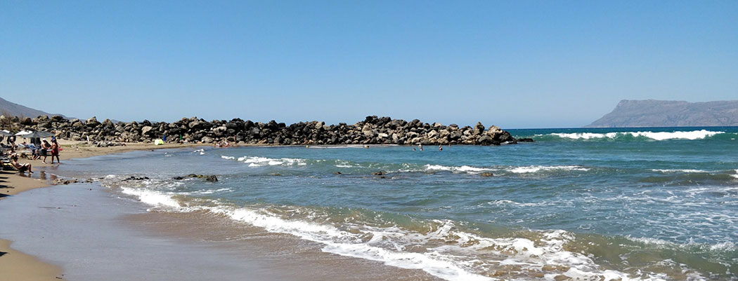
The breakwater at Kissamos on Crete was raised 6 metres by an earthquake in AD 365 and is probably the only rubble-mound breakwater still visible. (see image 14).
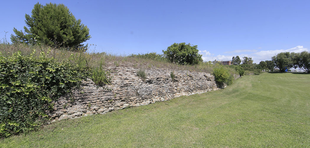
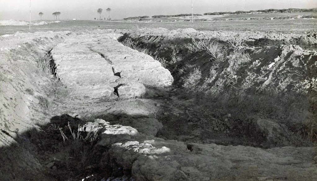
Thapsus (Tunisia)
The main harbour of Thapsus is sheltered by the third-longest known ancient breakwater. It is generally assumed that this breakwater consists of Roman concrete, but many scattered natural stones also lie on the site. The volume of the breakwater's remains (approx. 130,000 m³)18 could derive from a vertical breakwater built from layers of Roman concrete, a rubble-mound breakwater, or a combination of both (figure 15).
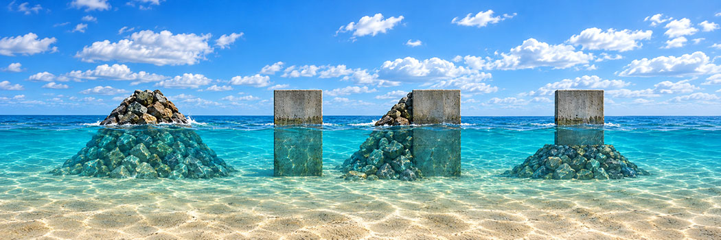
breakwater consisting solely of loose stones – vertical breakwater – vertical breakwater with stones – vertical breakwater on stones
Alexandria (Egypt)
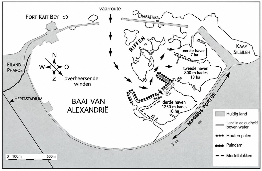
Alexandria's harbour complex consisted of three harbours probably built between 300 and 250 BC during the Hellenistic period, more than 200 years before Julius Caesar's arrival in 48 BC. Present-day statistics show that winds and waves around Alexandria come mainly from the northwest during the summer months and from the northeast during the winter months. This fact was extremely important for the development of the harbour, as it was the reason for building a double harbour20.
Two types of harbour structures have been found at Alexandria: protective breakwaters and quays.
The inner breakwaters protecting each of the three harbours consist of a gentle slope on the seaward side and, in most cases, a quay made of masonry blocks on the leeward side. The quays were made of wooden platforms on piles or on columns of stone blocks. The latter can be divided into three types:
- without mortar: dressed stone blocks, possibly with a filling material between their sides;
- with mortar, but without pozzolan: solid blocks cast on shore in wooden formwork (figure 17);
- with mortar and pozzolan: solid blocks cast underwater in wooden formwork21 (figure 6).
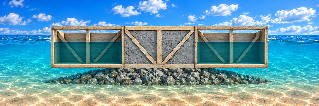
The early Alexandrians had no experience with pozzolan when they built the first Portus Magnus. We may therefore assume that each large block was probably built on shore in a caisson with extra buoyancy, which was then floated into position above the future quay and sunk to the bottom, where it came to rest on a previously prepared foundation. The caisson had to be sufficiently watertight and have roughly three times the volume of the block to keep the concrete block afloat.
Sullecthum (Tunisia) One of the first modern travellers to visit the harbour of Sullecthum was a certain Ch. Tissot. Around 1888, he wrote about the harbour and described its pier as follows: “A line descending towards the southeast that connected a chain of reefs with Ras-Djeboura (or Ras Salakta), thus forming a small sheltered bay open to the south and thereby creating Salakta's main harbour” 22
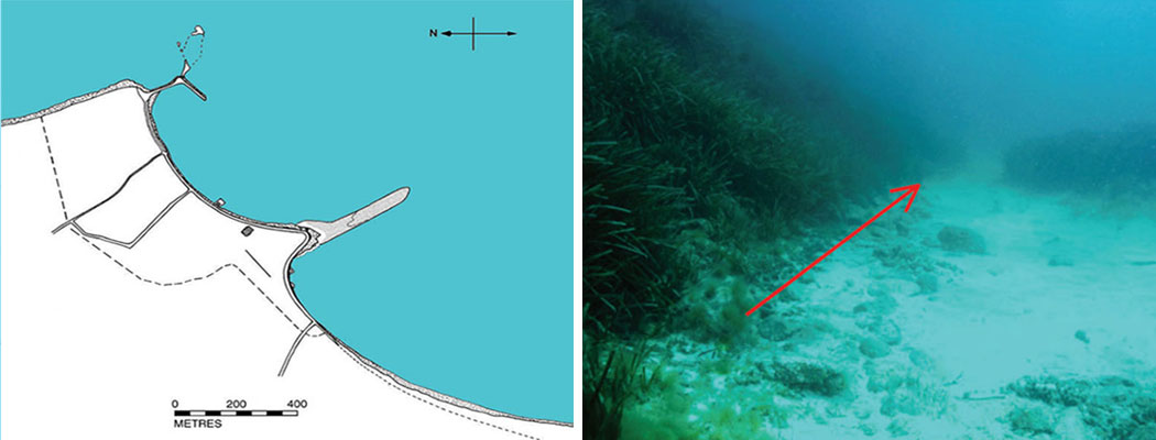
An expedition reported in 1966 that the harbour was divided into two bays and that the northern bay (see figure 19) was protected by a modern L-shaped jetty built on a chain of small reefs. Traces of ancient cement were found in the ‘elbow’ of the jetty. This suggests that this ‘modern’ jetty was built on the ancient Roman pier, which may still have been there in 1888.
On the northern side of the southern bay, a breakwater was discovered extending 260 metres from the shore into the sea beneath the water's surface, intended to protect the bay against the prevailing northeasterly wind. This breakwater was entirely continuous and was traced through concrete projections on the limestone covering layer. The water depth there was 3 metres.
Leptis Magna (Libya)
The techniques used to build the aforementioned breakwaters were also used for other purposes.
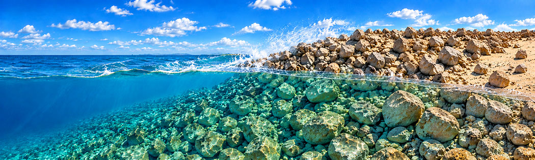
The northern coast of Leptis Magna, for example, was protected by what would now be called a ‘berm breakwater’: a stone structure deliberately designed to allow the stones to move under the action of waves.
Quarry stone was dumped on the beach and into the sea to a depth of approximately 5 m, about 50 m from the shore. The stones are rounded on the beach and angular on the upper part of the beach.
CHANNELS AND RIVERS
In antiquity, people often sought river mouths to find shelter from the sea and fresh water. This solved the problem of exposure to waves, but created another problem: the silting up of harbours by river sediment. Because sedimentation occurred at the river or channel mouth, harbour infrastructure had to be moved ever further downstream. This led, for example, to the diversion of a river using a dam, as at Leptis Magna.
Portus
At Portus, both Claudius and Trajan connected their harbour to a canal23. Trajan's canal, the Fossa Traiana, connected Portus with the River Tiber, which carried cargo directly to Rome. This canal is still used today and opens into the Mediterranean Sea to the west, near Fiumicino24.
Narbonne (France)
breakwater
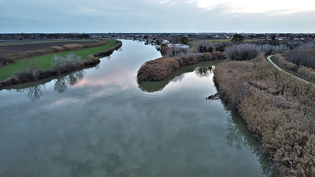
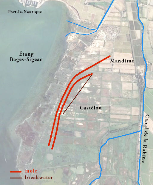
The ancient River Atax (the present-day Aude) flowed near the present-day Canal de la Robine and emptied into the Étang de Bages, south of Narbonne (see figure 21). Remains of the ancient harbour of Narbonne have recently been found near Le Castelou-Mandirac, in the river's ancient alluvial plain26.
The harbour structures consist mainly of two parallel embankments, 2 km long, which confine the river flow (now called ‘training walls’) to prevent unpredictable meandering at the river mouth.
The Atax/Aude carried large amounts of sediment, which settled as soon as the current slowed at the river mouth. This created a sandbank feared by seafarers because ships could easily run aground on it.
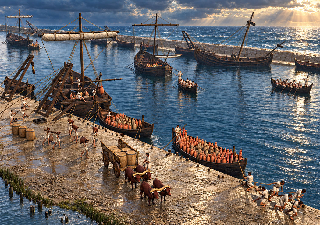
One solution was to maintain a high current velocity using training walls. This created a kind of jet effect that flushed the river mouth. The sediment would, of course, settle a little further downstream, requiring the training walls to be extended periodically. This resulted in a kind of canal harbour, such as the one found at Le Castelou-Mandirac.
PILE WALLS
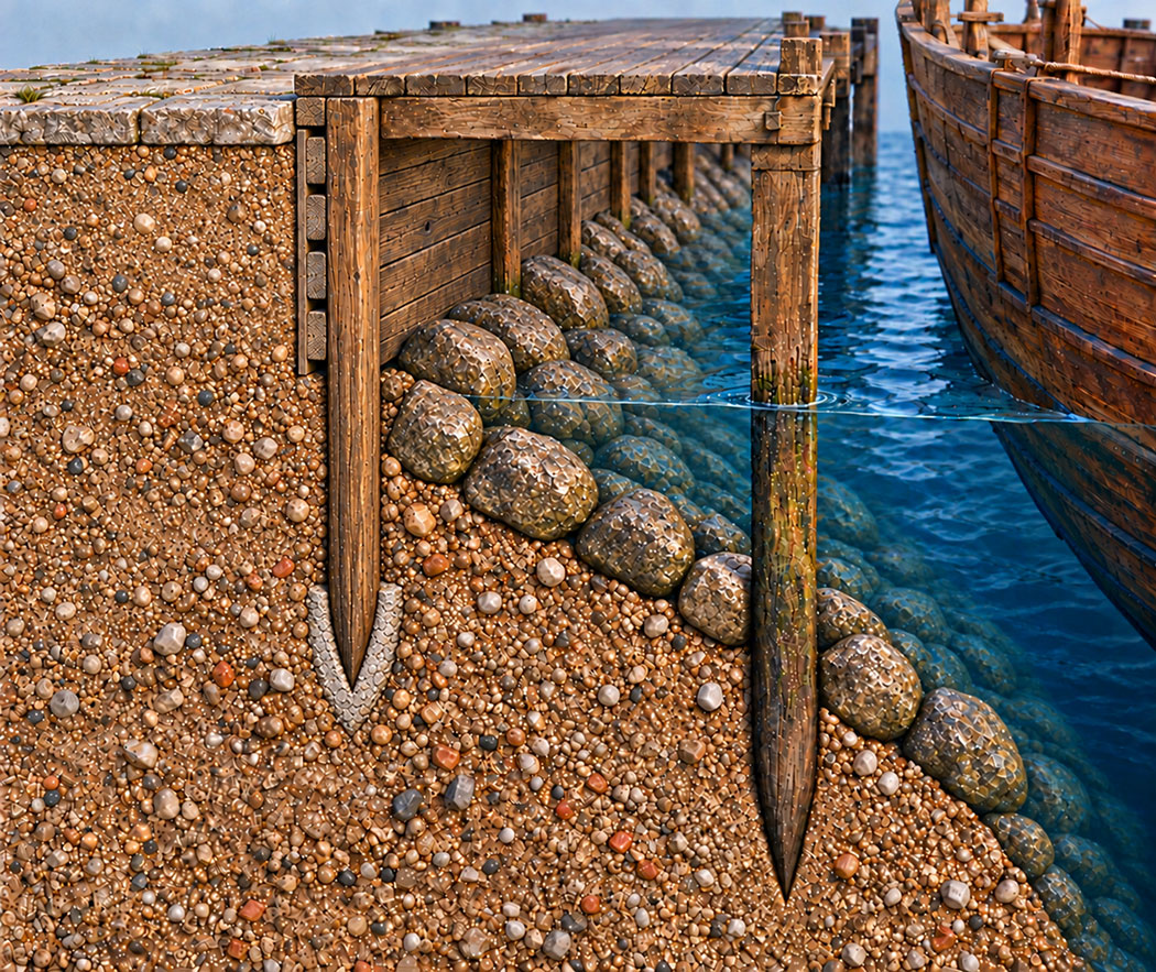
Wooden quay walls were used in sheltered areas and river ports. They usually consist of vertical piles holding horizontal planks in place (fig. 24). Similarly, a horizontal wooden deck can rest on piles, as at Alexandria.
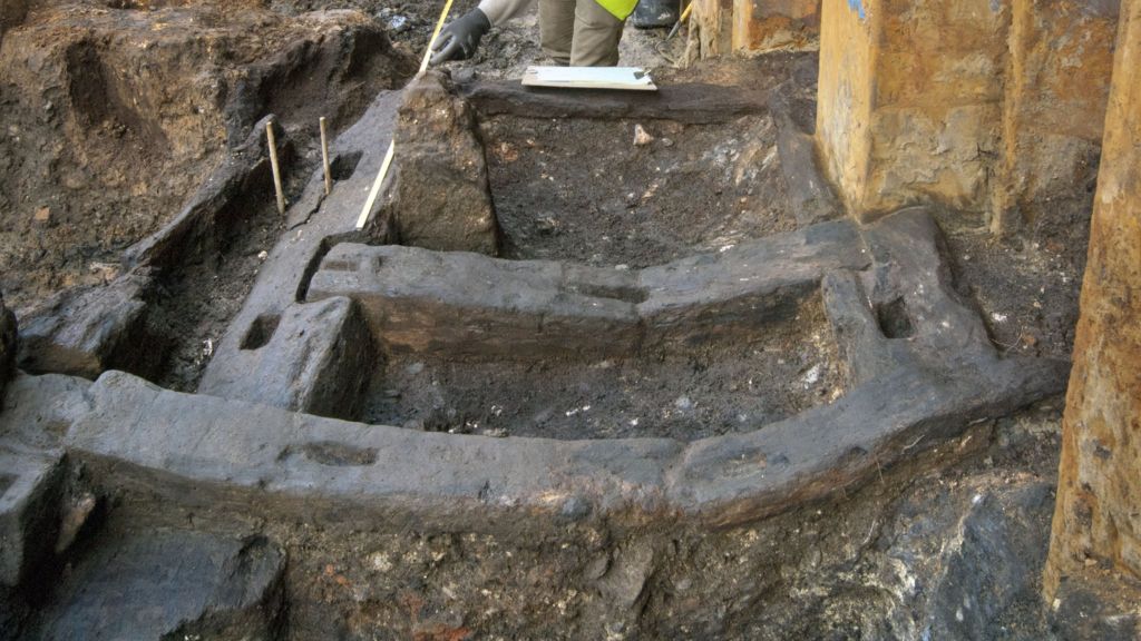
We also see examples of heavy quay walls where piles were attached to a bottom beam on the bed and heavy stones were placed between the piles, as at Londinium (London).
COFFERDAMS
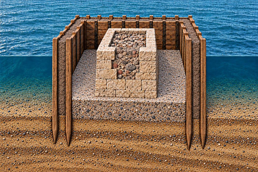
Vitruvius also described a construction method ‘in the dry’, mainly used to build ashlar pilae and bridge piers in rivers.
The watertight wooden structure (see figure 26), now called a ‘cofferdam’, allowed the water to be pumped out. However, the walls had to withstand water pressure, and braces may have been needed, even though the enclosure did not have to be higher than 1.5 to 2 m, a water depth sufficient for ancient ships. Furthermore, depending on the permeability of the ground, a large pumping capacity was needed. This made the method difficult to apply on a sandy seabed: water would seep into the enclosed space through the bottom. Vitruvius therefore rightly recommended excavating the area down to bedrock. He also stated that the foundation should be wider than the planned structure. This foundation could consist of a mass of concrete with pozzolan on the bottom, or of a mass of concrete on a series of wooden piles when the ground was unstable (for example, clay).
Editor's note:
This article mainly mentions examples of ports described in our digital magazine. These are clickable.
To learn more about this subject, read de Graauw's full article or visit his website https://www.ancientportsantiques.com.
- Sources
- - de Graauw – Ancient Port Structures A. (2022). Ancient Port Structures—Parallels between the ancient and the modern. Mediterranean. Geographical Review of Mediterranean Countries / Journal of Mediterranean Geography. https://doi.org/10.4000/mediterranee.12715
- -de Graauw, A. (2025). Palaeoportology, ancient harbours and coastal geomorphology: What can we learn? Proceedings of 38th Conference on Coastal Engineering, 38, 1–32. https://doi.org/10.9753/icce.v38.keynote.1
- -Jan Theo Bakker – Ostia-Antica.org
- Notes
- 1: Arthur de Graauw – 2022
- 2: See ‘Carthago Nova, the perfect harbour of the (new) new city’
- 3: https://www.ancientportsantiques.com
- 4: Stone, D. L. (2016). The Jetty with Platform: A Distinctive Port Structure from North Africa. African Antiquities. North Africa from Protohistory to the Arab Conquest, (52), Article 52. https://doi.org/10.4000/antafr.433
- 5: Around 25 BC, Vitruvius presented his magnum opus on building, ‘De architectura’, to Augustus. It is the only contemporary source on classical architecture to have survived in its entirety.
- 6: Bust by Giacomo Grigolli (19th century). After a photograph by MikCeo.
- 7: Vitruvius: De architectura, book V, chapter XII, 2
- 8: Philo of Byzantium (c. 280 BC - 220 BC), Greek engineer from Byzantium. Developed, among other things, a dredger.
- 9: Pliny the Younger (AD 62 - c. 113), a Roman writer and politician. See: ‘Centumcellae, Trajan's harbour’.
- 10: Flavius Josephus (AD 37 – 100), Jewish historian. See: ‘A Jewish harbour for the emperor’.
- 11:FIKRET YEGÜL, DIANE FAVRO, Roman architecture and urbanism: from the origins to late antiquity.(2019)
- 12:Flemming, 198
- 13:Noureddine, I. (2010). New Light on the Phoenician Harbor at Tyre. Near Eastern Archaeology, 73, 176–181. https://doi.org/10.2307/25754046
- 14:Oleson, J. P., Brandon, C., Hohlfelder, R., & Jackson, M. (2014). Building for Eternity: The History and Technology of Roman Concrete Engineering in the Sea. https://doi.org/10.2307/j.ctvh1dvk5
- 15:Engraving by Sir William Hamilton, Campi Phlegraei, Naples 1776.
- 16:Pliny the Younger, letters, 6, 31, to Cornelianus. (see: Centumcellae, Trajan's harbour)
- 17:Photo: American Academy Rome. This part of the breakwater now lies beneath the runway at Fiumicino.
- 18:Younes, A. (1997). Research on the port city of Thapsus and its territory in Byzacena in Antiquity [Doctoral thesis, Pierre Mendès France University (Grenoble, Isère, France ; 1990-2015)]. https://theses.fr/1997GRE29041
- 19:Plan – Arthur de Graauw
- 20:See ‘Alexandria, the greatest of all ports’
- 21:de Graauw, A. (2000). Port Engineering aspects of the Magnus Portus in Alexandria. PIANC Bulletin, (103), 31–41. https://doi.org/10.5281/zenodo.21078006
- 22:Tissot 1888, vol. 2, 179.
- 23:See Ostia-Antica.org
- 24:According to various researchers, the so-called Fossa Traiana was also built by Claudius.
- 25:Photo – Philip Markus Schmitt.
- 26:Sanchez, C., & Jézégou, M.-P. (2014). The ancient ports of Narbonne. The Park Notebooks, 15, 100.
- 27:After Patrice Cervellin - CNTS.GRAE - December 2014.
- 28:de Graauw, A. (2000). Port Engineering aspects of the Magnus Portus in Alexandria. PIANC Bulletin, (103), 31–41. https://doi.org/10.5281/zenodo.21078006.
- 29:Photo - Museum of London Archaeology (MOLA).
 We are committed to providing versions of our articles and interviews in several languages, but our first language is English.