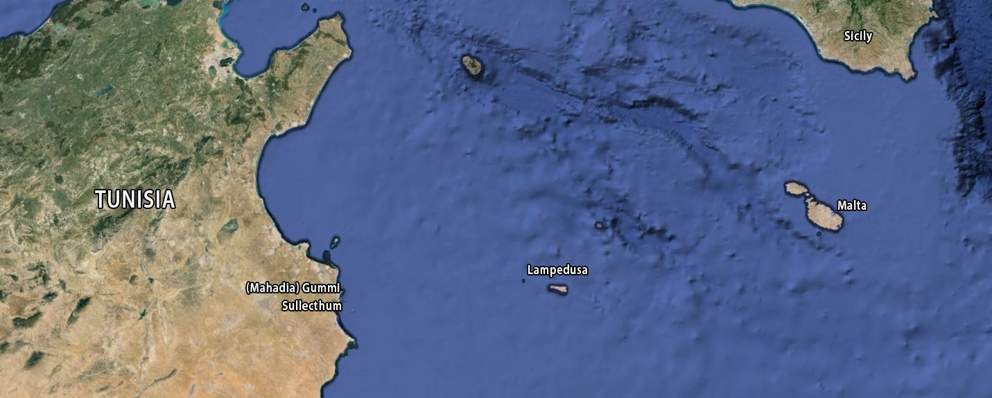
In the Sahel, in the Tunisian province of Madhia, by the sea we find the small town of Salakta. If you look at its location on the map, you immediately see why the place has been in the news so much in recent years. It is the shortest connection to get to Europe overseas, via the Italian island of Lampedusa. Many thousands of African people already tried to secure a new future on the other side of the Mediterranean via this route, for economic reasons or as refugees. Exploited by human traffickers, in mostly rickety boats with all the consequences.
By the way, this route is not new. Few people will realise that around 2,000 years ago, many ships with merchandise started their journey to Italy from the same spot, although the cargo was different then and today's small, rickety vessels were only used by local fishermen.
The Piazzale delle Corporazioni In Ostia, Rome's ancient port, still holds one of the few concrete evidences of this trade, between the Roman Empire and products from the hinterland of Sullecthum, as Salakta was called by the Romans.
Although we have very little information on the history of the ancient city, besides this mosaic, there are several other sources that recall Sullecthum. Pliny calls it an ‘oppidiumliberum’ (free elevated, usually fortified, place)2; the Stadiasmus Maris Magni3 states that (S)Alipota (= Sullecthum) was 120 stadia after Acholla4; The Peutingermap5 calls it Sullecti and gives a distance of 12 miles between Acholla and the city; Ptolemy6 placed it as 36°45' longitude and 31°45' latitude; finally, Procopius tells us that Sullecthum was the first city liberated by Belisarius in 533 AD. during his campaign against the Vandals7.
We know that before Roman supremacy, the city had been ruled or occupied by several other civilisations, including the Phoenicians.
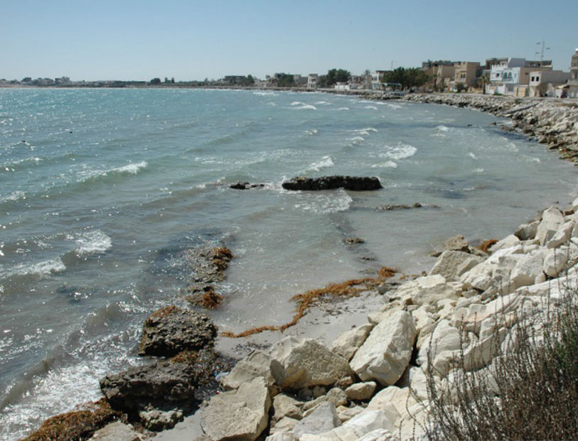
The few ruins that remain of the city are very confusing. With no cliffs present to slow the movements of the sea, the sandstone coast on Tunisia's eastern side is very prone to erosion. Much of the old city is therefore underwater.
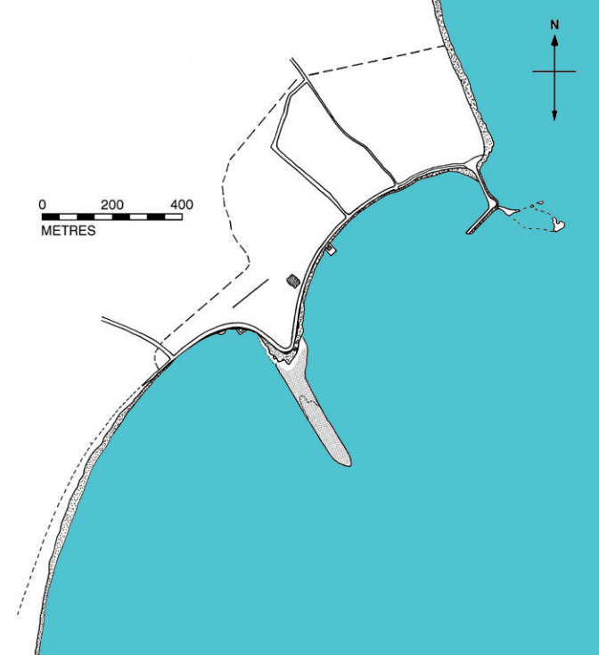
One of the first modern travellers to visit the port of Sullecthem was a certain Ch. Tissot. Writing about the port around 1888, he described the pier present there as follows: "A line sloping down to the south-east that connected a chain of reefs to Ras-Djeboura (or Ras Salakta), forming a small protective bay open on the south side and thus creating the main port of Salakta." 8
An expedition led by R. A. Yorke reported in 1966 that the harbour was divided into two bays and that the northern bay was protected by a modern L-shaped jetty built on a chain of small reefs. Traces of antique cement were found in the 'elbow' of the jetty. This suggests that this 'modern' jetty was built on the ancient Roman pier, which may still have been there in 1888.
On the north side of the southern bay, a breakwater was discovered that ran from the shore 260 metres below the surface water into the sea and was supposed to protect the bay from the prevailing northeast wind. This breakwater was by no means interrupted and was traced by protrusions of concrete on the limestone overlay. The water depth there was 10 feet.
The most remarkable remains are the underwater visible alignments of the walls that can be traced from south to north in the sea to more than 20 feet from the shoreline. On either side of this breakwater, tanks or cisterns have been dismantled by the sea. On land, an ancient fortification wall of broken stone and ashlar reinforcements surrounded this stretch of coast opposite the breakwater 10. It is identified as a Byzantine urban enclosure11.
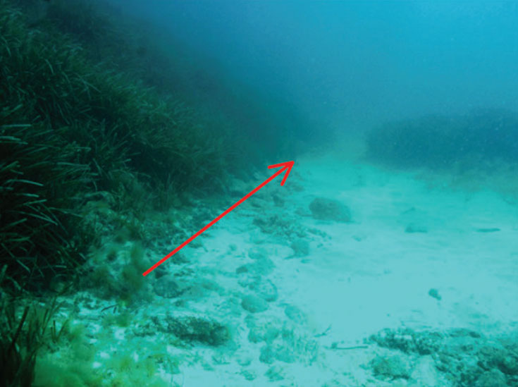
Underwater research by the University of Sousse (Tunisia) in the first quarter of the 21st century12 found that the breakwater was in perfect condition even though corrosion had damaged some parts of the cladding. At the base, divers found an abundance of ceramic shards.
Near the shore, researchers saw a number of large, square limestone blocks, column shafts and other architectural features indicative of a harbour structure that collapsed at the site.
About 50m south of the breakwater, the first group of cisterns with an arched outlet for the production of salted fish can be seen. Twelve metres further north, one can see a drain buried in the rock.
Above the fish processing plant are several groups of cisterns. The first group consists of five cisterns and 15 m further north is a second group of four interconnected cisterns. All these installations around the breakwater testify to the importance of Sullecthum's industrial and port activities13.
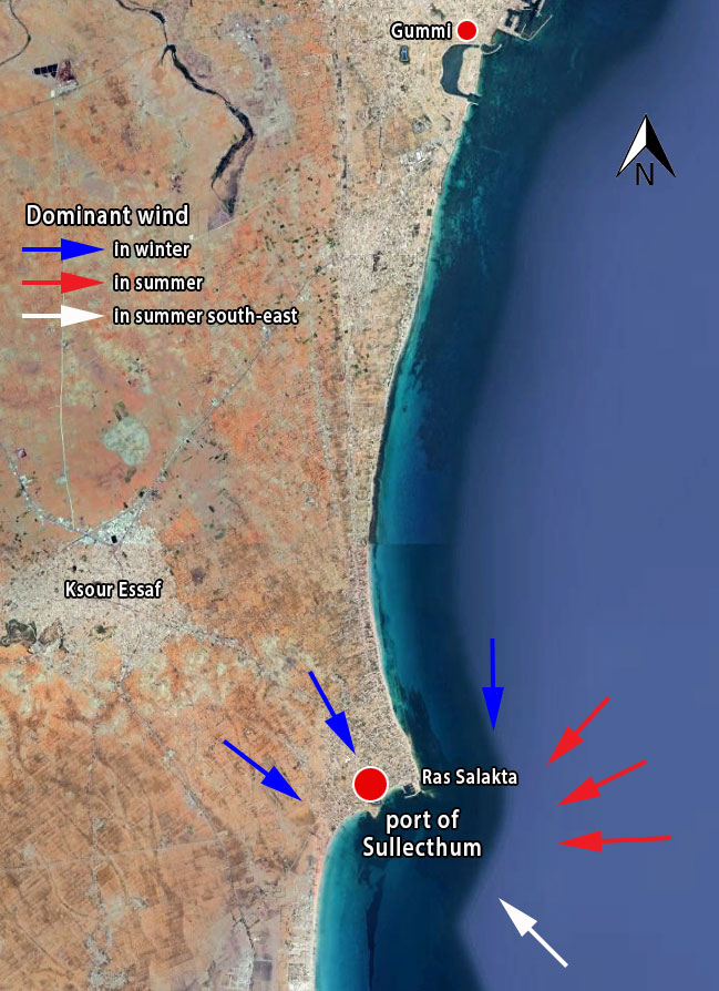
From Gummi (Mahadia), the coastline continues south to Ras Salakta with an uninterrupted sandy beach. As you approach Sullecthum, hills form the coastline and the beach is replaced by a vertical cliff. Ras Salakta is a rocky headland that forms the eastern end of the Ksour Essaf massif. Together with the two islets that extend it to the south-east, it forms a small bay sheltered from the north wind.
Along this part of the coast and especially up to 2 miles south of Gummi towards Sullecthum, the seabed is irregular. In contrast, Salakta Bay offers reasonably good mooring opportunities.
Like the coast of all of central Tunisia, the Salakta coast is subject to prevailing easterly winds in summer and strong northwesterly winds in winter. The hinterland of this coastal section is dominated by sebkas (salt pans) and very fertile plains.
For good navigation, some massifs can be used as landmarks. These include the Ksour Essef massif, of which Ras Salakta forms the eastern end. South of this Ras, at about 600 metres, is the old port of Sullecthum at a point now called Ras El Bled.
The Ksour Essef massif can be seen from far out to sea. It is the first thing one sees from the north and from the south too, the two distinct peaks are immediately noticeable, the highest being the Sidi Bou Alouah (82 m) and the other, the Hmadet Ahmed Saïd (56 m), being flatter.
In addition, one also supposes that, as in Thapsus14, there was a lighthouse that marked the end of the breakwater to the open sea.
The economic organisation of the port of Sullecthum
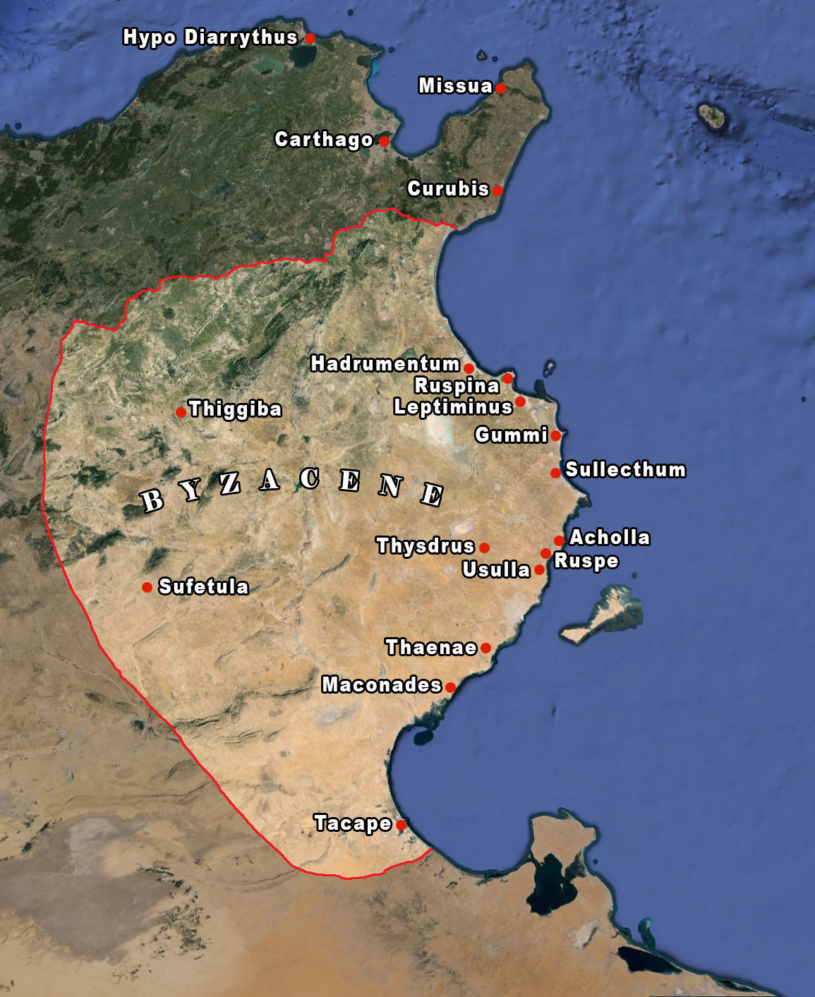
Like the other port cities of Byzacene15, this port was connected to the ancient Punic coastal road, which linked trading posts and was later used and maintained by the Romans16. This road served Hadrumetum, Ruspina, Leptiminus, Sullecthum, Acholla, Ruspe, Usulla, Thaenae, Macomades-Iunci, Tacape and runs along the Tripolitan coast.
A second road, which played a key role in the history of Sullecthum, links the latter to Thysdrus, one of the main economic centres of Byzacene at the meeting point of several routes. These roads provided fast connections between the port city and its hinterland.
The climate of Sullecthum's hinterland lent itself more to the cultivation of olive trees than to other crops. Olive cultivation became important from the end of the first century AD, mainly due to the growing demand for olive oil from Rome. The development of Thysdrus, soon to be the new oil capital, gave a boost to the neighbouring port cities. The first to benefit was Hadrumetum (Sousse)17.
Sullecthum also seems to have had some "specialisation" in this commodity, as suggested by Meiggs18:
"At the Piazzale of the cooperatives in Ostia, the African cities represented were involved in the wheat trade: Carthage, Missua, HippoDiarrytus, Gummi and Curubis. Sullecthum, on the other hand, does not seem to be one of them. Its navicularii seem to carry oil instead. "19.
Rising shortages of oil were soon felt in Italy and caused a crisis that peaked in the period from Trajan to Hadrian20 (the second half of the first century AD).
Emperor Antoninus (138 to 161) began to expand the annona21 ssystem with the distribution of oil alongside that of wheat and wine, which increased under the Severans22. At the end of the second century, in addition to the free oil trade, a state-controlled trade emerged, making distributions more regular.
Sullecthum's success seems to be linked to that of two inland cities in two different eras. These were Thysdrus and later Sufetula. Thysdrus played a very important economic role thanks to its location at the junction between the coast and the hinterland. This privileged commercial position of the city was already established in Caesar's time when Italian merchants and farmers could store here large quantities of wheat (10,000 m3) from inland and distant regions23. Later, Thysdrus grew to become the oil capital. This lasted until the end of the third century AD, after which that role was taken over by Sufetula. Sullecthum also benefited from this as there was a direct road connection from there to Sufetela. However, from the identification of amphora workshops in the hinterland of Sullecthum, it seems that this did not last very long.
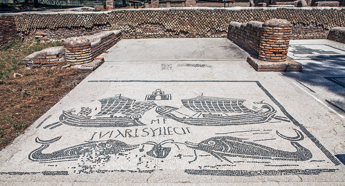
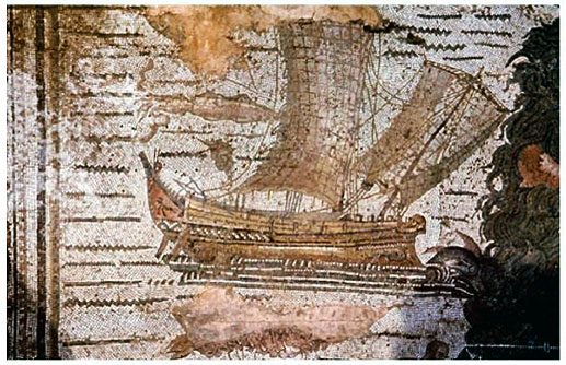
In any case, at the height of the oil trade, Sullecthum was thus present at the Piazzale delle Corporazioni in Ostia, as evidenced by the aforementioned mosaic showing two large trading ships facing each other around the city's lighthouse (see Figure 2). In the foreground are two dolphins devouring an octopus. In the text we read [NAVIC]VLARI SYLLECTI[NI] and above it, between the two boats, probably N[AVICULARIIS] F[ELICITER]24. This mosaic testifies to the presence of Syllectic shipowners who, like the rest of the navicularii, transported the products needed to feed Rome. These shipowners, who exported oil, carried out transports in the service of the state, participating in the publicity set up by the state but also for themselves25. In later times they became increasingly subject to state control than in the first centuries of the Empire, when they enjoyed considerable privileges and immunities26.
Coastal resources in Sullecthum's economy
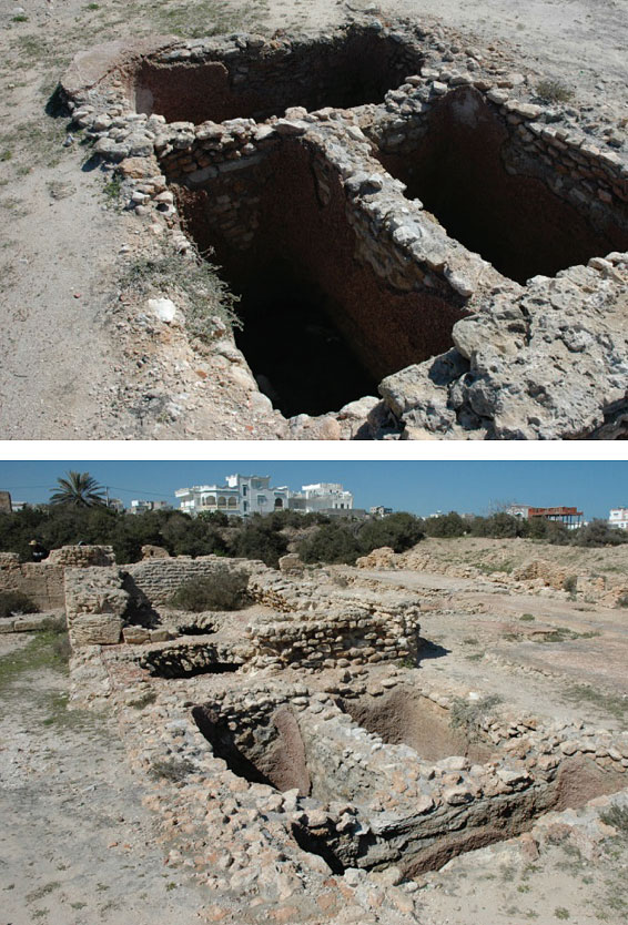
Along the coast near Sullecthum, large schools of tuna, mackerel, sardines and anchovies have been passing through since time immemorial. Even in ancient times, the alternation of small rocks protruding into the sea and beaches to the north and south of Sullecthum proved to be a good catch basin to fish for the shoals of fish approaching the coast at the same time every year. Consequently, collecting basins were built early on to process the fish. The tubs, grouped parallel and perpendicular, were built in opus africanum (a construction method originating from Africa with large natural stone blocks filled with brick)27.
The tanks had varying depths and reinforced walls against the reaction of the salt and the pressure of the large mass of fish. The walls were waterproofed with a variety of local materials. To facilitate work, the cisterns adjacent to the fish processing plant were not vaulted. A boiler house with accompanying vaulted cistern was also found at the site.
Two parallel walls at right angles to each other, now submerged, could have been used as fish ponds. The remains of these were connected to salt tanks.
The fish was mainly used to produce garum, the famous fish sauce. According to Pliny the Elder, the best garum was made from the intestines of tuna or mackerel, which at the time was produced in the fish processing factories of Carthage Spartaria (present-day Cartagena).
Several indications suggest that tuna and mackerel were also the basic products of the fish sauces produced in the port factories of Salakta28.
De export
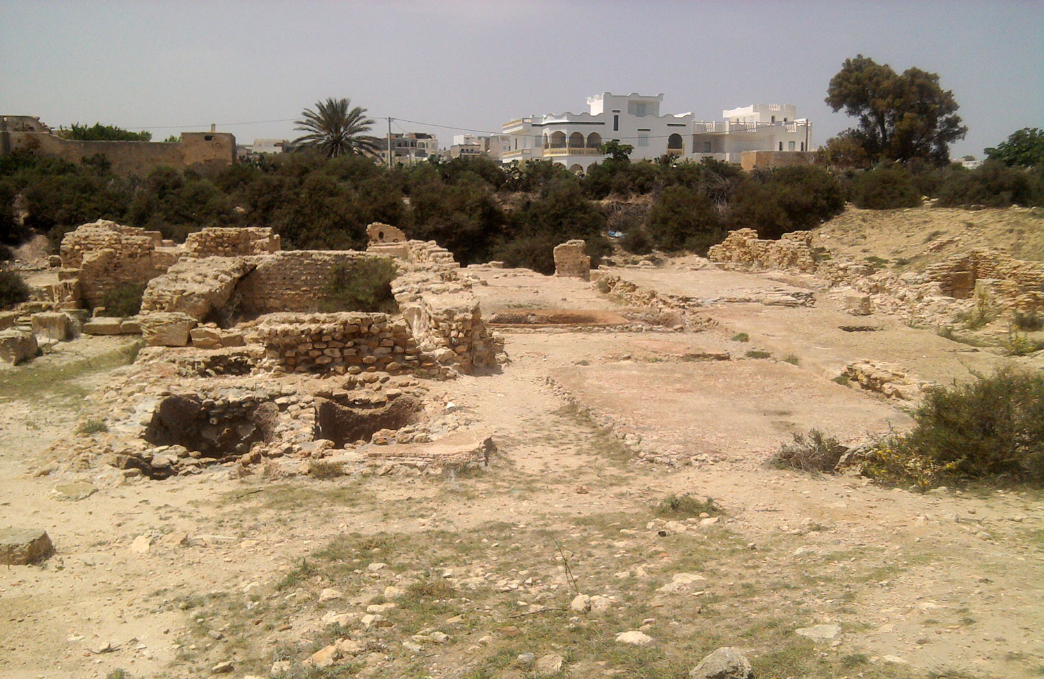
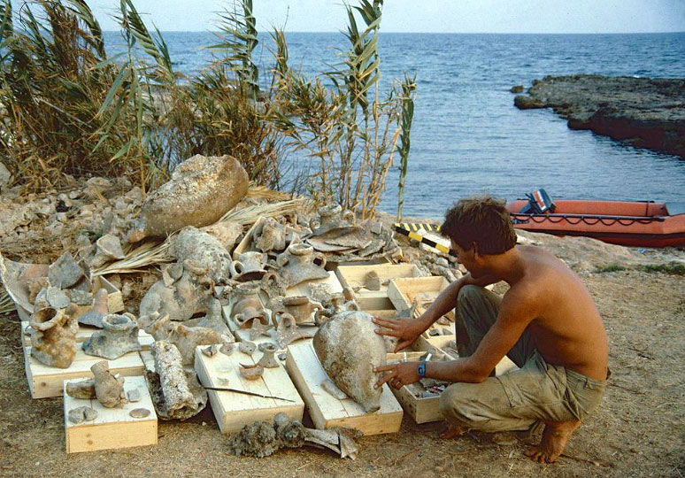
Figure 9: The fish processing plant from Salakta 29.
in the Salakta site (El Heri I workshops)
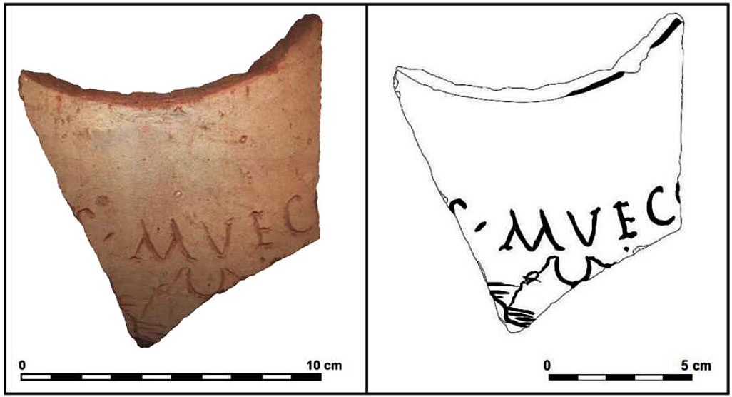
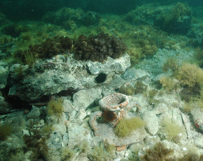
Interest in amphora production in Sullecthum has been growing for years. After the identification of the necks of amphorae with ASYL stamps by L. Foucher30, interest in amphora production in Sullecthum has been growing for years. After the identification of the necks of amphorae with ASYL stamps by L. Foucher31. They established for the first time the relationship between amphorae stamps and the workshops that produced them, especially that of Salakta. This shows further evidence of the commercial links between Rome and this port city, especially with regard to the oil trade.
The establishment of typologies based on consumption completed the city's picture. This was the case with C. Panella32, D. Manacorda33 and later, in the early 1980s, with S. Keay34 for late amphorae.
The various studies all point in the same direction and in general it appears that many different types of amphorae were produced in both urban and rural workshops in the Salakta area and, depending on the period, were used for different products. For example, the Punic Uzita 3 (4th/3rd - 2nd century BC) and the Uzita 2 amphorae ( 2nd - 1st century BC), were used for transporting wine35 and were found mainly in the material of the 'Maklou' workshop (about 7 km northwest of the port).
The African II amphora, which was used in the late 2nd century to the late 3rd century AD, could have carried salty fish as well as wine. Many other types were also produced in Salakta, such as the Leptiminus (3rd - 4th century) for transporting Salsamenta (salted fish) and the Dressel 30 (late 2nd and early 3rd century) imitation of the Gallic wine amphora 4 found on the wreck of PlemmirioB38. Finally, there are the late amphorae of Sullecthum Keay 25-1 (late 3rd-4th century) with wine-like contents.
Conclusion
First of all, it should be noted that the port city of Sullecthum offered a multitude of products, not only olive oil. The fish processing and amphora workshops for sauces and salted fish, next to the coastline indicate major fishing activities. We have also seen that the production of wine amphorae began as early as the Punic period and continued until the late Roman period.
It is certain that the port of Sullecthum participated in supplying Rome as part of the annona, as numerous studies have shown40. In contrast, studying new data have turned the certainty of olive oil exclusivity on its head. To begin with, analyses have allowed us to correct Zevi's 1969 hypothesis that large African amphorae (African II) were used as containers for olive oil and that the small African I amphorae were used for various other products. This hypothesis was reversed: the Afrikaans I would have carried mainly oil and the Afrikaans II another commodity, perhaps salted fish41 or wine.
All this gives reason to reconsider the activity of the port of Sullecthum, long described as an oil-exporting port. We can now assume that through this port, in addition to olive oil, wine, salsamenta, olives (often in combination with wine), other types of preserved food, such as wheat that came directly from the interior or from the crossroads city of Thysdrus reached Ostia c.q. Rome.
Although the profile we have given to this port is quite general with those of the port cities of the Northern Byzacene, on the other hand, it has some distinction with neighbouring ports and those of Little Syrte (present-day Gulf of Gabès). Taking into account the ease of docking and the adequate bathymetry 46 characteristic of this stretch of coastline, we can designate Sullecthum as a deepwater port. We can establish this from the following three factors:
The first is the great depth around the breakwater, which is sufficient even if we take into account 0.80 m relative sea level rise in the Salakta area and the tidal range of 0.60 m at spring tide 47.
The second factor we saw on the surface of the mooring quay, which appears smooth and paved. We can therefore speak of a "pavement" that is in a good state of repair here and there.
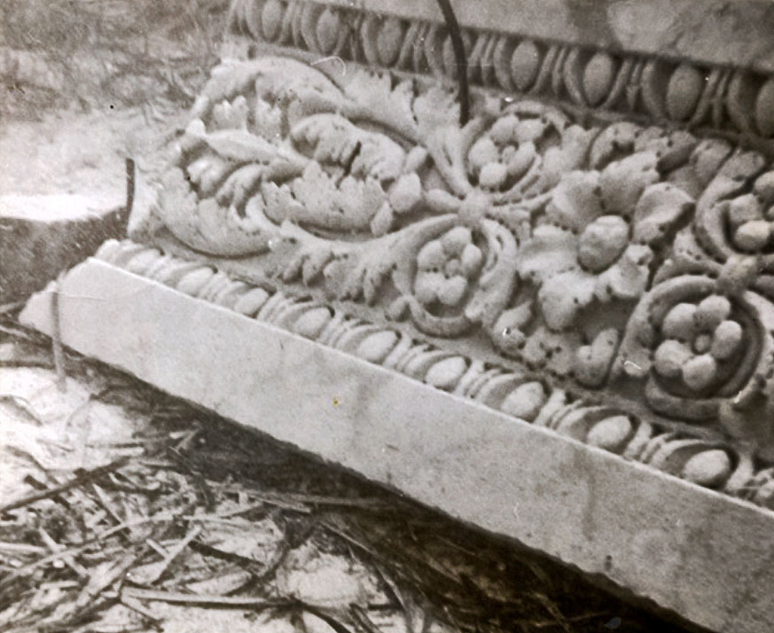
And thirdly, although no other structures or breakwaters have been found (yet) in the stretch of water protected by the jetty, several dozen metres from the shore, large blocks, limestone column shafts, rosettes and other decorated architectural elements have been found whose homogeneity argues for a monumental harbour structure collapsed on site.
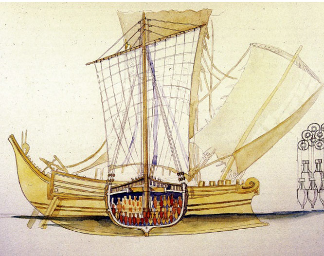
Such conditions belong to a large harbour capable of accommodating large ships referred to in the literature as myriophoroi (a large ship of 450-500 tonnes). See also the large Roman merchant ships depicted on the mosaic of the Syllectans on the Piazza delle Corporazioni in Ostia. The type of vessel matches the features of the wreck of the Madrague de Giens, a ship from the first century BC. The ship's cargo contained more than 6,000 Dressel I B type wine amphorae. The reconstructed dimensions of the ship are 40 m long by 9 m wide, with a hold depth of 4.50 m48.
in Themetra.
For a long time it seemed clear that we saw the image of certain ancient ports on the east coast of Tunisia, often as "specialised terminals" based on a monoculture or a "single product". The port of Syllecthum is a counterexample of this. Besides the variety of goods in transit, this port had the profile of an old, deep port destined to move cargo with vessels ranging from modest coasters to, for the time, colossal ships. The time has come to carry out large-scale land excavations with the utmost urgency to get ahead of urban development while contributing to the development of the area and extending underwater reconnaissance to areas where ships presumably converged, in search of new data that will shed more light on this unique port.
- Sources
- - Nouvelles Découvertes De Marques Amphoriques Et De Briques Épigraphes À Salakta (Tunisie) - Abdellatif Mrabet, Mohamed Riadh Hamrouni, Tarek Mani, 2020 & 2021
- - Le port de Sullecthum (Salakta) - Ahmed Gadhoum (Sousse 2019)
- - Developments in Mediterranean shipping and maritime trade from the Hellenistic period to AD 1000 - Andrew Wilson, 2011
- - Cambridge Expedition to Sabratha report 1966 – R.A.Yorke
- - Arthur de Graauw
- - Wikipedia
notes- 1: Read article: 'Overseas trade'
- 2: Pline, Hist. Nat., V, 4, 30
- 3: Stadiasmus of the Great Sea - an ancient Roman description of a voyage across the Mediterranean from the second half of the third century AD.
- 4: Stadia (plural: stadie) Greek/Roman length measure of 185.25 m.
- 5: Copy of a Roman travel map from the 3rd or 4th century.
- 6: Greek/Roman astrologer, astronomer, geographer, mathematician and music theorist who lived in Alexandria (87 - 150 AD).
- 7: Procopius of Caesarea, Bell.Vand., I, 16, 9 et 11; 17, 6.
- 8: Tissot 1888, t. 2, 179.
- 9: Yorke et al., Cambridge Expedition to Sabratha 1966
- 10: Slim et al. 2004, 146.
- 11: Hannezo 1890, 445-448.
- 12: Their report, on which this article is largely based, was published in 2019.
- 13: Slim et al. 2004, 146.
- 14: Yorke 1967, 24
- 15: The Roman province in which Sullecthum lay.
- 16: Foucher 1964, 131.
- 17: Foucher 1964, 145.
- 18: Russell Meiggs 1960, 287.
- 19: Read also 'Farm the dessert to illuminate Rome'
- 20: Carandini 1970, 101.
- 21: Free food supply (originally flour for bread) for Rome residents.
- 22: Morel 1995, 60.
- 23: Slim 1985, 66..
- 24: According to J. Th. Bakker, the M is an incorrect restoration of an original N (https://ostia-antica.org/piazzale/p-contents-stationes-frames.htm)
- 25: Meiggs 1960, 287.
- 26: Rougé 1966, 245-268. The privileges began with Claudius and were reinforced by his successors. They consisted mainly of legal privileges and exemptions from municipal duties. The naviculari also had guarantees against the risks of the sea.
- 27: Foucher 1970, 17-21.
- 28: https://inp.rnrt.tn/2023/12/15/la-ville-de-salakta
- 29: Photo: Rais67-Wikipedia
- 30: Foucher 1970, 17-21.
- 31: Zevi et Tchernia 1969, 181-182.
- 32: Panella 1973, 463-633.
- 33: Manacorda 1977, 116-227.
- 34: Keay 1984.
- 35: Fentress 2001, 249-268.
- 36: Peacock et al. 1989, 199.
- 37: Bonifay 2004, 471.
- 38: Gibbins 2001, 331.
- 39: Photo: Jim Coates
- 40: Carandini 1970.
- 41: According to Ahmed Gadhoum (Sousse 2019), A. Tchernia organised an analysis programme on type I and II amphora shards in 1980, (report unpublished).
- 42: Branch of archaeology that applies natural science methods and techniques to date archaeological finds.
- 43: Bonifay 2007, 19
- 44: Jean-Marie Gassend
- 45: Revilla Calvo 2001./li>
- 46: Measuring the topographic height of the seabed.
- 47: Slim et al. 2004, 146.
- 48: Pomey 1982, 145-146.
- 49: Foucher 1957, 7-23.


 We are committed to providing versions of our articles and interviews in several languages, but our first language is English.