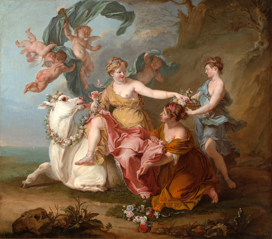
According to the Greek mythology Europe, daughter of a Phoenician king, was born at Tyre in Lebanon. She was abduct to Crete by the uppergod Zeus, who had taken the form of a bull. She became the first queen of Crete. Later on the continent Europe was named after her. Also the princess Elissa, commonly know as Dido, the legendary founder of Carthago, was born at Tyre.
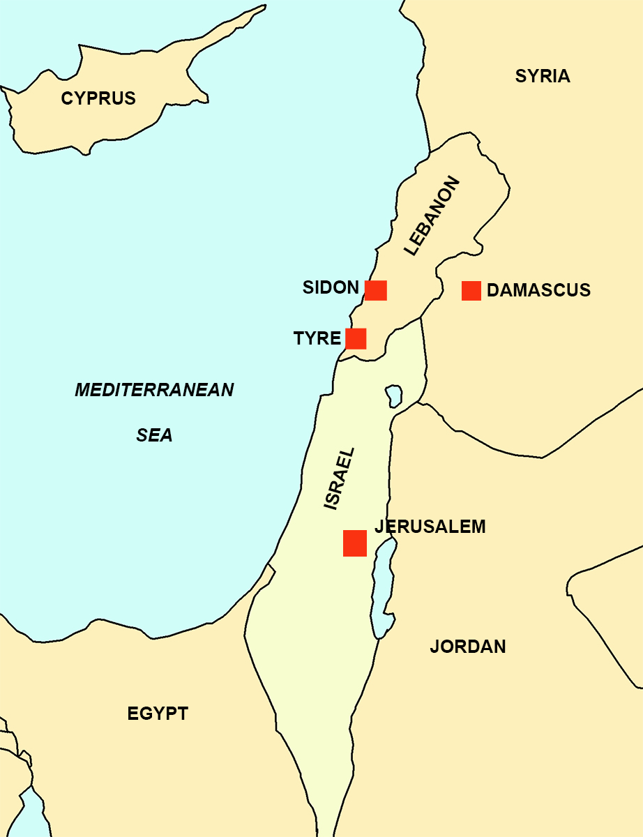
How important can it be, the small island of Tyre, located along the eastern bank of the Mediterranean, 83 kilometres south of Beirut in Lebanon?
The Roman historian Marcus Iunianus Iustinus (2e century AD.?) wrote that the original founders came from the nearby city of Sidon to establish a new harbour.
The Greek historian Eusebius of Caesarea (third century AD) tells us that the city, by the local population called Sour (Sur), was built by the deity Melqart as a favour for the mermaid Tyros1 and named it after her.
The first inhabitants of Tyre were the priests of the Temple of Melqart. The Greek historian Herodotus who visited Tyre around 450 BC heard from the local priests that the city was founded around 2750 BC as a walled place upon the mainland, now known as Paleotyre (Old Tyre). This founding date has been corroborated by archaeological evidence.
Tyre itself was on an island about 1.700 m. from the coast.
The deity Melqart and the goddess Ashtart were worshipped for millennia on the island. Old Funerary Stelae explain why2:
“Originally the island was not attached to the sea floor, but rose and fell with the waves. An Olive tree of the goddess Ashtart rose there, protected by a curtain of Flames. A snake was wrapped around its trunk and an eagle was perched in it. It was predicted that the island would cease floating, when the bird was sacrificed to the gods. The god Melqart taught people how to build boats, then sailed to the island. The eagle offered itself, and Sur became attached to the sea floor. Since then, the gods have never stopped living there..."
In 1580 BC, the settlement came under the supremacy of the Egyptian pharaohs and started to benefit from the protection by the Eighteenth Egyptian Dynasty and prospered commercially.
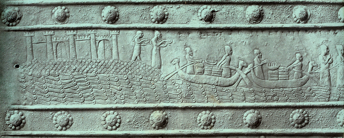
The Amarna Letters3 (1350-1335 BC) provide evidence of Tyre being an important, fortified city and that the town had already established the industrial production of purple dye by the middle of the second millennium BC. An old story says that the deity Melqart was walking on the beach with the nymph Tyros, whom he courted, when his dog bit a mollusc and the sea snail's blood stained its mouth purple. Tyros desired from Melqart a dyed dress of the same colour and thus the manufacture was born.
The colour, exploited from the Murex trunculus snail was in ancient cultures reserved for the use of royalty. The Tyrians brought their methods in the purple dye industry near to perfection. Their excellent technique of extraction and blending of dyes is the reason why Tyrian purple was so esteemed in the ancient world. Besides that the Tyrians were extremely discreet about their industry to ensure absolute monopoly.
The importance of the colour for Tyre we find also in the word “Phoenician” which is a Greek designation meaning “red” or “purple”. However, Strabo4 wrote, after he had visit the city himself, that the dye industry polluted the air so much that his stay in the city was very unpleasant. Experts have calculated that some 8.000 Murex had to be crushed to extract one gram of the dye, which may have cost the equivalent of twenty grams of gold.
Tyre became independent when Egyptian influence in Phoenicia declined in the 12th century BC. While neighbouring Sidon lost its role as the dominant metropolis around 1100 BC, the Tyrians began a commercial expansion. They established cities around the Mediterranean, like Utica in Tunisia, and Gadez in Spain (read ‘Gades comes back to life’). Under its most important leader, King Hiram, who ascended the throne in 980 BC, Tyre reached a golden era. Hiram expanded the urban territory by joining the two islands on which it was built and added a second harbour to take advantage of changing wind conditions.
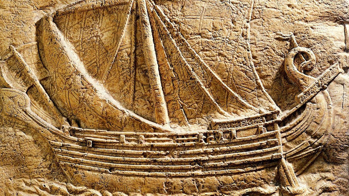
Ship manufacturing was highly developed, and Tyre enjoyed commercial relations with all parts of the Mediterranean world. The products traded ranged from imported textiles, purple dye, ivory, olive oil and cedar tree timber. According to the Bible, King Hiram sent cedar wood from Lebanon to Jerusalem to build Solomon’s Temple.
The dominance of the maritime trade was so big that the Mediterranean See became known as the Tyrian Sea.
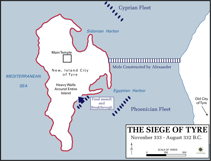
In 333 BC, when Alexander the Great defeated the Persian king in the battle of Issus most Phoenician cities surrendered, but the only city that refused to come to terms was Tyre. The Tyrians refused to allow Alexander to make a sacrifice at the temple of Melkart and instead suggested that Alexander sacrifices at another temple on the mainland. Angered by this rejection, Alexander decided to attack Tyre despite the city’s high walls. The Macedonian conqueror succeeded after a seven-month siege by demolishing the old town on the mainland and using its stones to construct a 20-metre-wide causeway to the island.
This causeway was repeated by Alexander the Great at Alexandria where he connected the island of Pharos with the mainland of Egypt (read ‘Alexandria-the-largest-port-of-all’) In 126 BC, Tyre regained its independence and minted its own currency. Alexander’s legacy still lives on today, since Tyre has remained a peninsula instead of an island ever since.
The Roman Period.
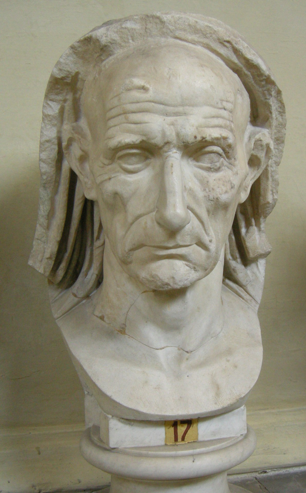
Scaurus 6.
In 64 BC the eastern end of the Mediterranean finally became a province of the Roman Republic and later on of the Roman Empire. Tyre was allowed to keep much of its independence as a ‘civitas foederati’5. According to a degree found in Tyre, Pompey’s deputy in the region, Marcus Aemilius Scaurus, played a key role in Tyre’s privileged status of a free city. Of course against a certain payment.
So, Tyre remained a city of commercial importance. Apart from purple dye, the production of linen became a main industry as well as the well-known fish sauce garum.
During the Roman period Tyre was linked through a road with the hinterland and became the ‘natural port of Damascus’, an important meeting point of the Silk Road. Under the reign of Claudius, Tyre became known as “Claudopolis”, and the city helped the emperors Titus and Vespasian to suffocate the Jewish revolt in Palestine in AD 66.
Later, Trajan allowed Tyre to mint official currency while his successor, the Emperor Hadrian, who visited the cities of the East around 130 AD, conferred the title of Metropolis of Tyre: "great city" mother of other cities. This status was of utmost importance, as it settled the ancient rivalry with Sidon in Tyre's favour.
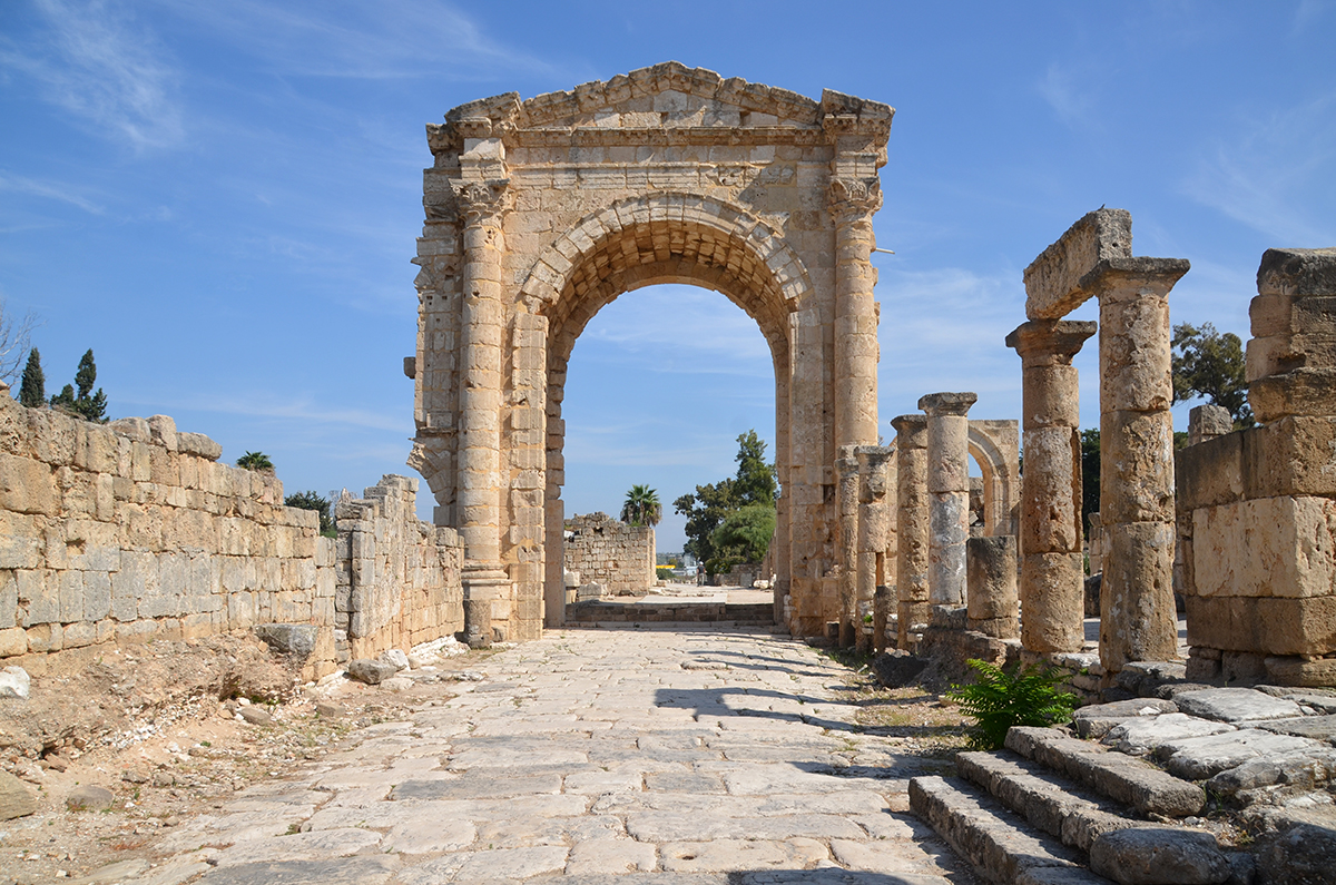
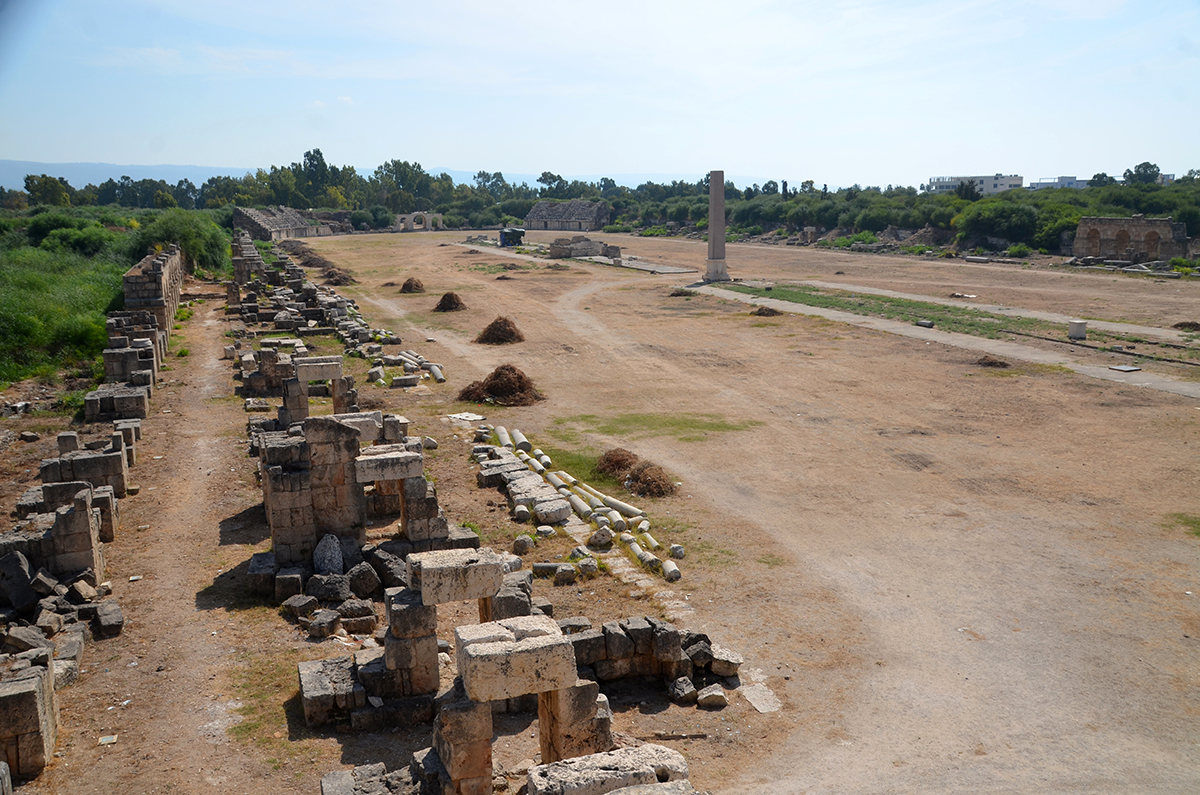
Subsequently, the famous Triumphal Arch and the Tyre Hippodrome, one of the largest hippodromes in the world (480m long and 160m wide), were constructed. The amphitheatre for the horse-racetrack could host some 30.000 spectators. An aqueduct of about 5 km length was built to supply the city with water.
Tyre was later, in 198 AD, elevated to colonial rank (Colonia Septimia Severa), following Tyre’s early support for Septimius Severus during the civil war in 194 AD.
Looking for the harbour(s)
Tyre was founded during the third millennium BC on an easily defendable offshore island. This sea bastion was particularly attractive to early societies as it possessed a number of natural low-energy basins that could be exploited as anchorage havens, with little or no need for human artificialisation. Ancient texts and iconographic evidence suggest that four harbour complexes existed in the Tyre area during antiquity:
- a northern seaport looking towards Sidon, Beirut and Byblos (referred to as the Sidonian harbour during the siege of Tyre by Alexander the Great9);
- a southern anchorage facing Egypt, known as Egyptian harbour;
- a number of outer harbours, taking advantage of the exposed sandstone ridges at this time10;
- a continental complex, located around Tell Mashuk and Tell Chawakir, which served as a transport hub for the inhabitants of Palaeotyre during the Bronze Age.
The Northern harbour
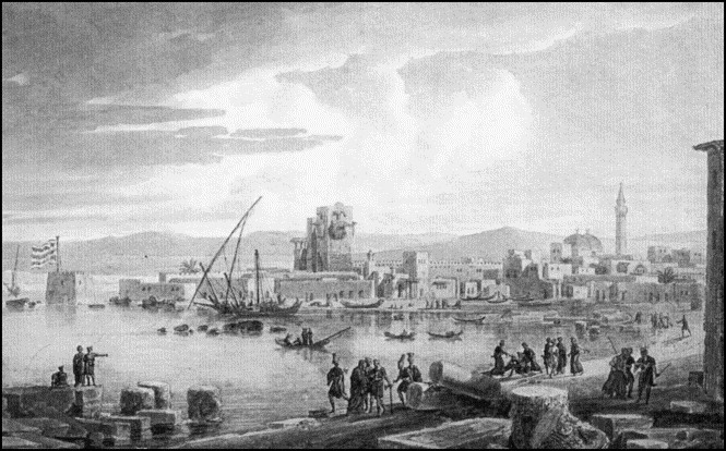
Tyre’s northern harbour has been a source of archaeological speculation since the 16th century when a number of religious pilgrims visited the Phoenician coast en route to the Holy Land.
In 1791 the French writer and orientalist Volney12 noted:
"The harbour, dug by the hand of man was silted up to such an extent that children could walk across it without wetting their upper body. ……that great tracts of the ancient northern port lay beneath the medieval and modern centres. This basin, it was argued, had been protected by an ancient breakwater which protruded from the eastern tip of the harbour and was known to many of the early workers.”
The existence of a harbour installation on the northern side of the island was documented in the 19th century by Jules de Bertou (Bertou, 1843), John Kenrick (Kenrick, 1855) and Ernest Renan (Re-nan, 1864), who may have observed several courses of the structure still extending above the waterline.
The heart of Tyre’s ancient northern seaport is presently buried beneath the medieval and modern city centres. Investigation has shown that the ancient northern harbour basin was twice as large as the present13.
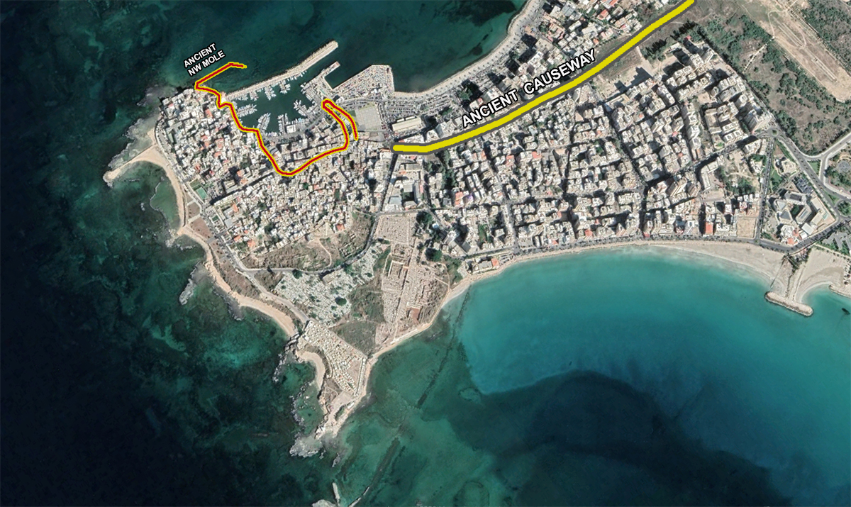
Figure 10:The ancient northern basin (red)
On the eastside and the northside were moles. The eastern mole has been continuously adapted and reinforced from antiquity through to present, as is commonplace with ancient seaport infrastructures.
construction of the southern wall of the jetty. (Photo A. Mior).
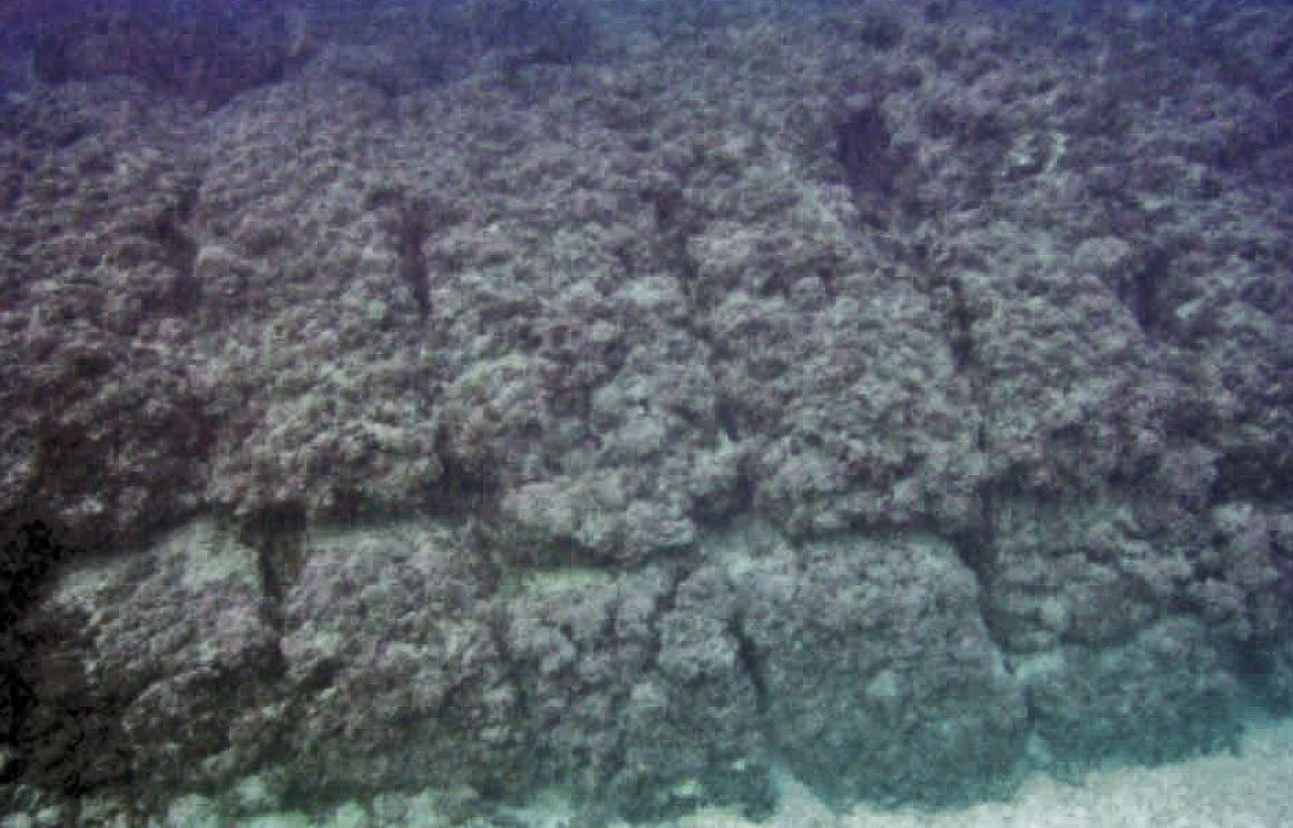
The submerged northern breakwater, which protrudes seawards from the extreme eastern tip of the island, closes the basin. This structure lies 57 m north of the present mole.
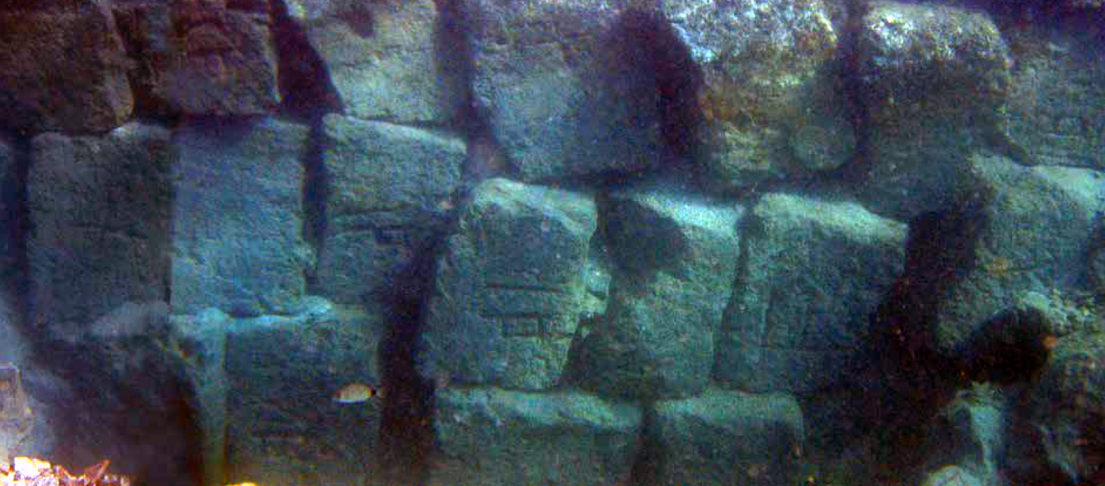
Research has shown an 80 m long breakwater, with a constant width of 12.7 m. The mole comprises two parallel walls made-up of ramleh14 headers, and whose surfaces presently lie 2 m below Mediterranean Sea level.
Excavations have put into evidence five foundations constituting a 3.1 m high wall.
Found ceramics and engravings on the stone blocks have attributed the mole to the Phoenician period. At Tyre, there is presently very little archaeological information pertaining to the nature of the harbour works in the northern cove. Tyre was artificially protected by the partially drowned sandstone ridge. Large-scale seaport enterprises were thus not required and researchers speculate that preceding structures were reinforced and added to at this time.
The main west - east trending breakwater shows evidence of Roman courses (Descamps, personal communication), and it seems probable that existing Iron Age port infrastructure would have been reinforced and added to at this time.
A cluster of radiocarbon dates centred on the 1st century BC and 2nd century AD, suggests a major overhaul of harbour infrastructure when Tyre fell under Roman control in 64 BC.
The Southern harbour
Although the question of a southern seaport was not properly evoked until the 19th century, drowned archaeological remains along the city’s southern coastal fringe had long attracted the curiosity of early pilgrims and travellers.
As early as the 12th century AD, Benjamin of Toledo, a traveller in Phoenicia, described the towers, palaces, squares and streets he observed drowned on the southern coast of the city. Later Henri Maundrell (1697)16, briefly touches on the subject when he observes that “the northern and southern bays are, in part, defended from the ocean, each by a long ridge, resembling a mole, stretching directly out, on both sides, from the head of the island; but these ridges, whether they were walls or rocks, whether the work of art or nature, I was too far distant to discern.’’
The idea of building a double harbour is motivated by the fact that there are two main wind and offshore wave directions at Tyre.
material pertaining to a submerged urban quarter still active during the late Roman period.15
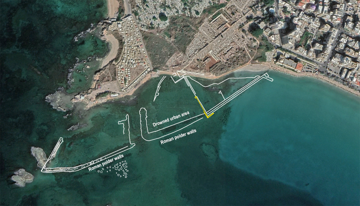
In 1939 Poidebard17 coupled aerial photography and diving surveys to investigate the underwater archaeology of Tyre’s southern coastal fringe (see figure 13). This southern area comprises an east - west trending basin around 700 m long by 200 m wide and runs parallel to the present island coastline. The marine bottom lies 3-4 m below present mean sea level. Today, the area is sometimes used as a fair-weather anchorage by local fishermen, but is, at least for the present, not sufficiently protected to be considered a harbour basin sensu stricto. After extensive research, eventually Poidebard diagnosed what he believed to be an artificial harbour basin enclosed by an imposing 670 m long mole. However, new underwater research undertaken in 2002 has confirmed that this locale is in fact a drowned quarter of the ancient city18.
The supposed mole yielded late Roman ceramics and therefore couldn’t be of Phoenician age. Today many scholars believe this mole to be a polder wall. The presence of urban structures, walls and drowned quarries within the basin further call into question its use as a seaport during antiquity. It is plausible that the drowned basin could have been used as a fair-weather harbour by small vessels during the Byzantine and later periods. There is no evidence to suggest, however, any elaborate seaport infrastructure. This may suggest the southern ‘harbour’ identified in historical records constituted an offshore anchorage rather than a physical man-made harbour installation close to, or connected to the island of Tyre.
While geoarchaeological work reveals the importance of Tyre’s northern harbour as the city’s main transport hub from the Bronze Age onwards, the role of its satellite infrastructures must not be underestimated.
Traditionally, research has focused on Tyre’s northern and southern harbours which catered for merchants during the Bronze and Iron Ages. New research shows that Tyre also possessed a series of secondary seaport complexes that were integral parts of this network, notably assuring the day-to-day running of Tyre (provision in water, food, building material, etc.). Lighter vessels would have interlinked these harbour complexes.
The partially drowned coastal ridge upon which the ancient city lay served as the protective umbrella structure for these harbour complexes. The evolution of the site means that the main seaports are today buried beneath tracts of coastal sediments, while the outer harbours have been drowned by subsidence of the Tyrian horst during the late Roman period.
- Sources
- - Carole Raddato: https://followinghadrianphotography.com/2020/01/20/tyre/
- - Nick Marriner e all: Ancient Tyre and its harbours: 5000 years of human-environment interactions – 2007
- -Arthur de Graauw - https://www.ancientportsantiques.com/the-catalogue/
- -Ibrahim Noureddine: Harbour Installations at Tyre North
- -Wikipedia/
- Notes
- 1:Tyro was a was a Thessalian princess who gave birth to a twin, sons of Poseidon
- 2: "Astarte in Tyre According to New Iron Age Funerary Stelae" - Abousamra, Gaby; Lemaire, André (2013).
- 3: Armarna letters: diplomatic correspondence between the Egyptian administration and its repre-sentatives in Canaan and Amurru during the so-called Armarna period of the heretic pharao Echna-ton.
- 4:Strabo: Greek geographer first century BC.
- 5:Civitas foederati: community bound by perpetual alliance to Rome.
- 6:Photo: Sailko (Wikipedia)
- 7:Photo: Carole Raddato (https://followinghadrianphotography.com/2020/01/20/tyre/)
- 8:Photo: Carole Raddato (https://followinghadrianphotography.com/2020/01/20/tyre/)
- 9:Arrian, An. II, 16, 7e27, 7; Diodorus of Sicily, XVII, 40, 2e47, 6; Quinte-Curce, IV, 2e4; Plutarch, Alex. XXIVeXXV and Strabo, XVI, 2, 23"
- 10: Achilles Tatius, II, 17, 3
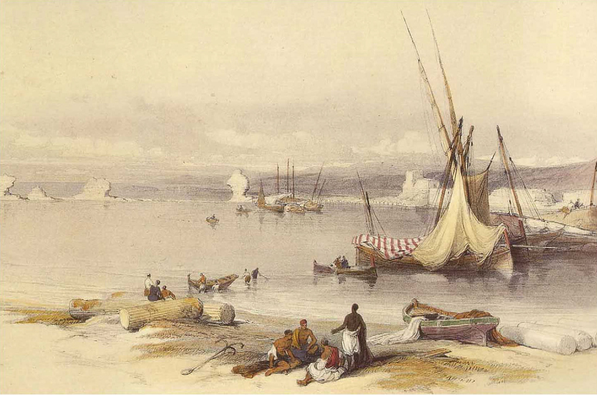
- 11: from D. Roberts: Port of Tyre dated April 27th 1839 in Roberts, 2000
- 12: Constantin François de Chassebœuf, comte de Volney ; Les ruines ou méditation sur les révolutions des Empires, 1791
- 13: Marriner et al., 2005, 2006a
- 14: Local sandstone.
- 15: Archaeological data from El Amouri et al. (2005) and Poidebard (1939)
- 16: Henri Maundrell: A Journey from Aleppo to Jerusalem: At Easter, A.D. 1697
- 17: Antoine Poidebard, 1939. Un grand port disparu, Tyr. Recherches ae´riennes et sousmarines,1934 -1936. Librairie Orientaliste Paul Geuthner, Paris.
- 18: El Amouri et al., 2005
- 19: Neo-Assyrian Empire (911-609 BC). British museum.


 We are committed to providing versions of our articles and interviews in several languages, but our first language is English.