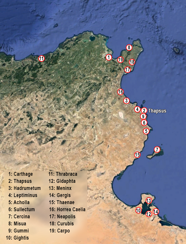
Tunisia is the closest African country to Rome. Perhaps that is why the coastal region of Tunisia is dotted with former Roman ports. One of those ports is the almost forgotten city of Thapsus, modern Bakalta.
The city was also called Thapsus Minor to distinguish it from the city of Thapsus in Sicily. Like so many other ancient ports, this one too was founded by the Phoenicians. Located at a cape and a salt lake, it was an ideal location for a port and the city grew into an important market and trading place.
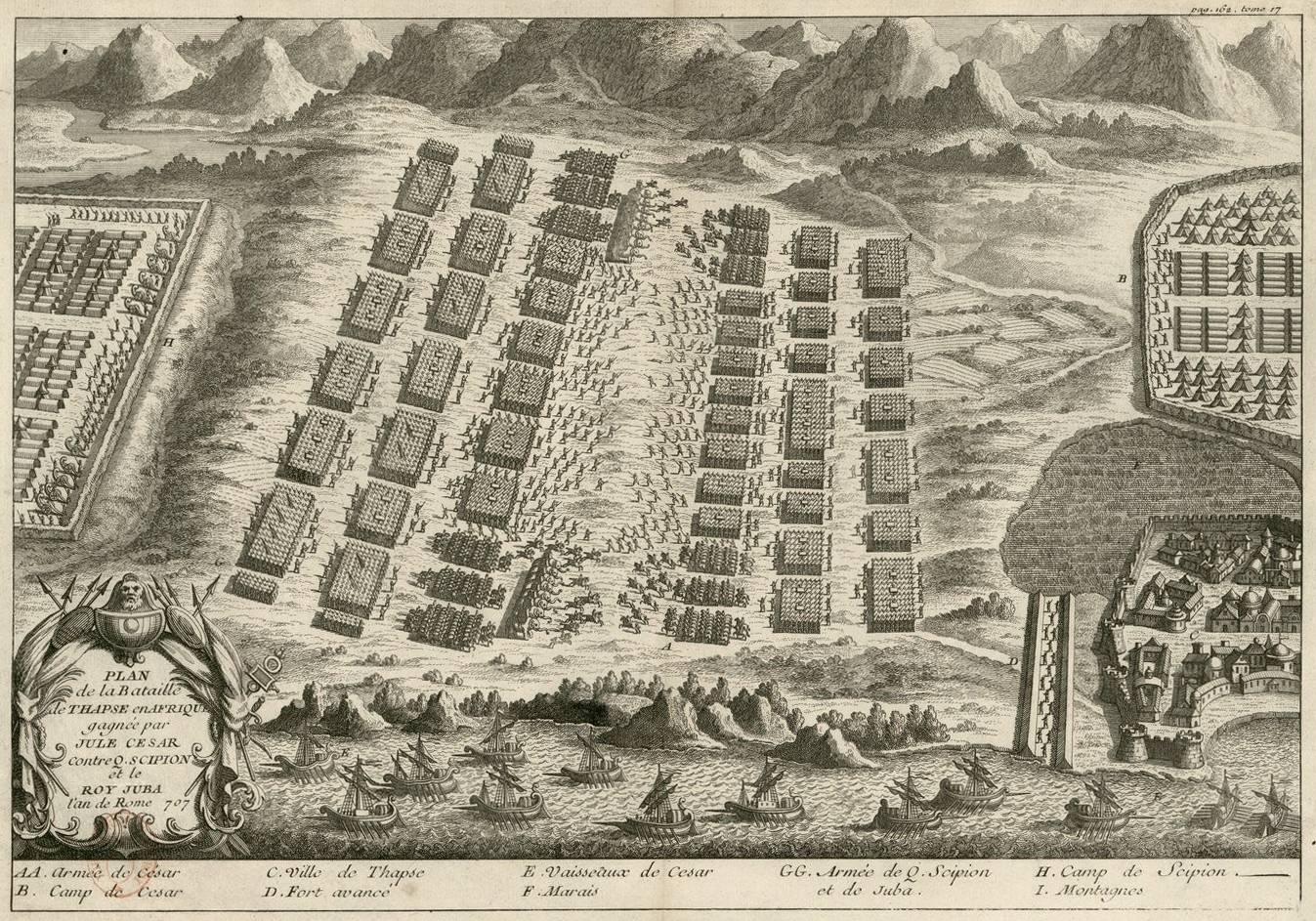
In the 6th century BC. Thapsus came under the control of Carthage, the most important Phoenician city in the region. When Carthage fought against the Romans in the Punic1 wars, Thapsus, with 6 other cities, sided with Rome. After the destruction of Carthage in 146 BC. the city became a civitas libera (free community) in the newly formed Roman province of Africa. Thapsus was fortified, given an amphitheater and the harbour was provided with breakwaters. In 46 BC, during the Roman civil war, Thapsus sided with Pompey. Julius Caesar fought the Pompeian army commanded by Metellus Scipio in the famous battle of Thapsus. The latter used, among other things, 60 elephants to destroy the right wing of Caesar's army. However, the elephants moved toward the center of Caesar's units and met so much resistance that they turned around and half overrun Scipio's army. Caesar took advantage of the chaos and emerged victorious.
Thapsus, as an ally of the defeated Pompey, was punished and received, among other things, a heavy fine.
We don't know much about Thapsus' legal status between 46 BC. and the government of Augustus. According to Pliny the Elder, it would have been an oppidum liberum (a small, free provincial town)3.
Later, presumably during the Flavians, Thapsus became a Roman colony in the province of Byzacena.
With the conquest by the Romans, a lively flow of trade started. Africa was given an important supply role for the Italian and Western Mediterranean markets. This also strengthened the activities of the ports of Byzacene, especially since this region benefited from the exceptional agricultural productivity, as we can read in Pliny the Elder: Libyphoenices vocantur qui Byzacium incolunt. ita appellatur regio CCL p. circuitu, fertilitatis eximiae, cum centesima fruge agricolis faenus reddente terra. hic oppida Leptis, Hadrumetum, Ruspina, Thapsus. inde Thenae, Aves, Macomades, Tacape, Sabrata, contingens Syrtim Minorem, ad quam Numidiae et Africae ab Ampsaga longitudo DLXXX, latitudo, qua cognitum est, CC.4
Seasonal migrations of fish (tuna or sardines) also occur in this maritime zone. The area is suitable for setting traps for fishing. In ancient times, fishing was a raw material for seafood processing and especially for the production of salsamenta (salted fish), an activity not yet documented for Thapsus, although it is very likely. However, there were fish processing sites all along the Tunisian coast, particularly in Lamta (Leptiminus) and Salakta (Sullecthum), respectively north and south of Thapsus.
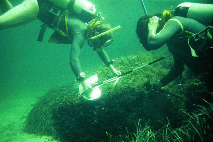
The city also benefited from a reasonably good connection to the African hinterland, for which the port was very useful, as demonstrated in the 1970s by the remains of a monumental pier from the Roman era5. There must therefore also have been a complete port system with quays, warehouses, tanks, workshops and offices. To date nothing of this has been found in Thapsus.
The harbour.
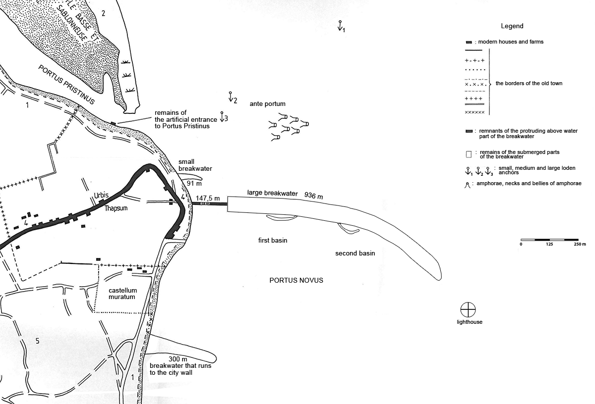
In the 1990s, the Tunisian historian and archaeologist, Ameur Younes, conducted systematic research on ancient Thapsus, including the harbour. He suggested that the harbour consisted of two parts: a harbour basin on the north side of the city, which was naturally protected by a sand island, and to the south-east, a large artificial basin protected by breakwaters.
This situation evolved from the Roman conquest of Africa in 146 BC. up to the 2nd/3rd century AD. where the enormous breakwater with a length of about 1100 m and a volume of about 130,000 m3 has not been built until the third century AD. by the emperors Gordianus I, II en III 6. Their reign was, incidentally, so short that the dam was never completely completed 7.
Portus Pristinus
The oldest harbour on the north side was Portus Pristinus (former harbour). This harbour was demarcated on the northeast side by a low island that gave hardly any protection to the ships at anchor. It is therefore not so surprising that quite a few amphorae and anchors have been found in this harbour.
On the south side of Portus Pristinus, on the landward side, the remains of buildings from the Roman period were identified by Younes as part of the artificial entrance to the harbour. Probably due to silting up, nothing has been found on the opposite side on the island.
Two ancient authors, Diodorus Siculus8 and Pseudo-Caesar9 tell us that warships were housed in the port of Thapsus. The first, although not a contemporary of the events he described (1st century BC), informs us that during his expedition against Carthage (311-310 BC) Agathocles10 had intended to subdue the port cities of Byzacene. After the capture of Hadrumetum, he sailed to Thapsus and assumed power. It is likely that his ships found shelter in the harbour of the city.
The second author, an eyewitness to Caesar, relates that the ships commanded by the owner Caius Vergilius were moored in the port of Thapsus before Caesar's arrival in this city and the great battle of 46 BC. It is probable that the warships of Agathocles took shelter in the Portus Pristinus protected by the low sand island and that Virgil's moored either in the Portus Pristinus or offshore in the so-called ante portum (outer harbour).
Ante portum (outer harbour)
The Portus Pristinus provided a shallow anchorage (between 1 and 2.5 m) and was not suitable for merchant ships to dock there. So they anchored in the outer harbour located to the west and northwest of the original harbour where barcae (small boats) took care of the loading and unloading of their goods. Ships lay here almost unprotected and therefore quite a lot of archaeological material from the first century BC. have been found in the form of anchor shafts, sometimes in the vicinity of the wrecked ship to which the anchor belonged and a large amount of shards of amphorae and pottery.
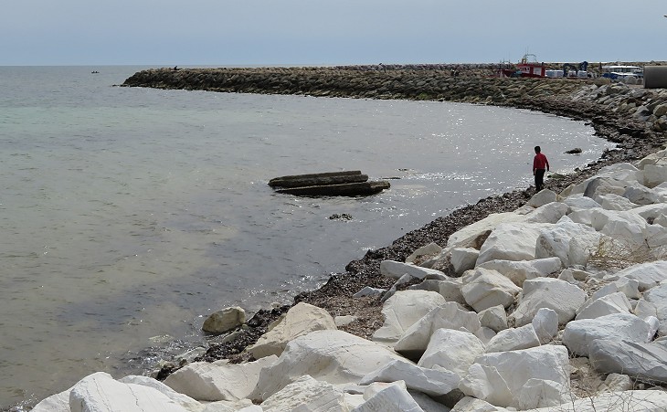
For this reason, long before the large, new breakwater was built, a small, slightly curved breakwater of approximately 91 meters was built on the southwest side of the outer harbour (see figure 3). This was in deeper water than Portus Pristinus and offered ships more protection against the northeasterly wind. Probably from that time Portus Pristinus was no longer used as a commercial port.
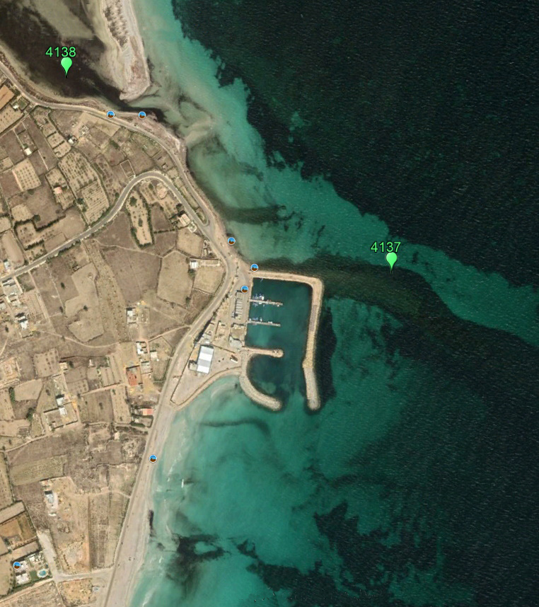
4138 is Portus Pristinus and 4137 is the old breakwater.
Portus Novus (new harbour)
Portus Novus was an artificial harbour, located south of the Portus Pristinus, which was formed by a large breakwater that, south of the small breakwater, jutted from the coast into the sea for a length of 1,100 meters from west to east and a lighthouse.
This created a 63-hectare harbour basin that was more than 10 meters deep in some places, responding to the growth of commercial activities linked to the economic development of the city in the 2nd century AD.
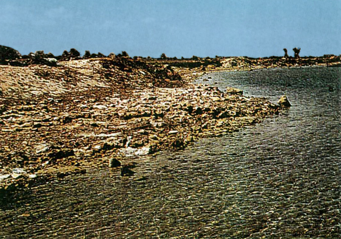
The breakwater consisted of an onshore part, 147.5 m long (the black stripe in figure 3) and the offshore part of 936 m that is submerged. The onshore part has completely disappeared under the modern breakwater of our clever engineers who have used the very valuable old caisson construction as a foundation for the modern breakwater. The offshore part can still be found underwater and clearly visible on the GE photo (see point “4137” in figure 6).
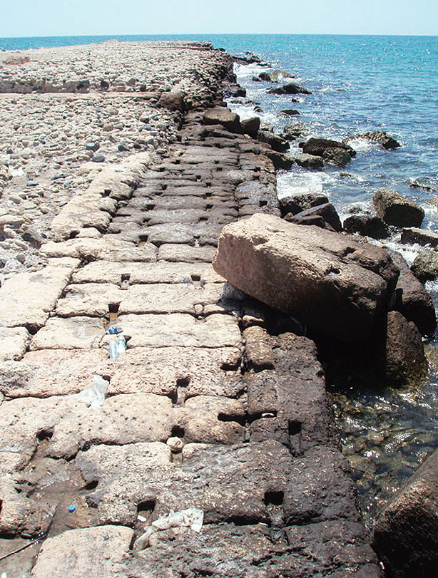
It is generally believed to be made of Roman concrete, although the site is also strewn with natural rock. Opinions differ widely about the explanation and the original form.
A. de Graauw, expert in the field of modern and antique harbour construction11, shows us the following logical options:
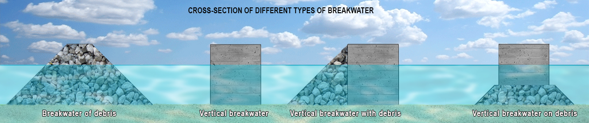
The breakwater could be made of:
- only deposited rocks and rubble;
- caissons filled with marine concrete (so-called vertical breakwater);
- caissons filled with marine concrete with a rubble back on the side where the waves hit;
- caissons filled with marine concrete on a mound of rubble.
Based on a study on the wind and wave flows around Thapsus, de Graauw believes that this concerns option three: a vertical breakwater with a ridge of rubble on the north side, where the wave action usually originates. He suspects that the entire breakwater was built according to options two (onshore) and three (offshore).
De Graauw therefore does not agree with a certain Davidson12 who was on site in 1966, together with Yorke, and reports on his findings: ”The visible part of the construction is clearly made according to the classical Vitruvian process13 of pouring concrete into wooden caissons. This is confirmed by the presence of holes in the remaining part of the breakwater, which once connected the sides of a caisson. The part of the breakwater that is under water was made according to a different Roman process. Loose rocks were dumped from carts or boats in the right place so that a back of stone rubble was created that broke the waves and offered shelter from the weather ”.
The lighthouse
The lighthouse is located approximately 125 m southeast of the end of the main breakwater at a depth of 7.5m. R. Yorke identified it as a fortification or a lighthouse! The recessed masonry is almost in the shape of a circle with a circumference of 197 meters. It is constructed of clad concrete blocks identical to those of the submerged portion of the breakwater. The original shape of the lighthouse would allow ships from all directions to point the entrance to the Portus Novus.
The Southern Breakwater
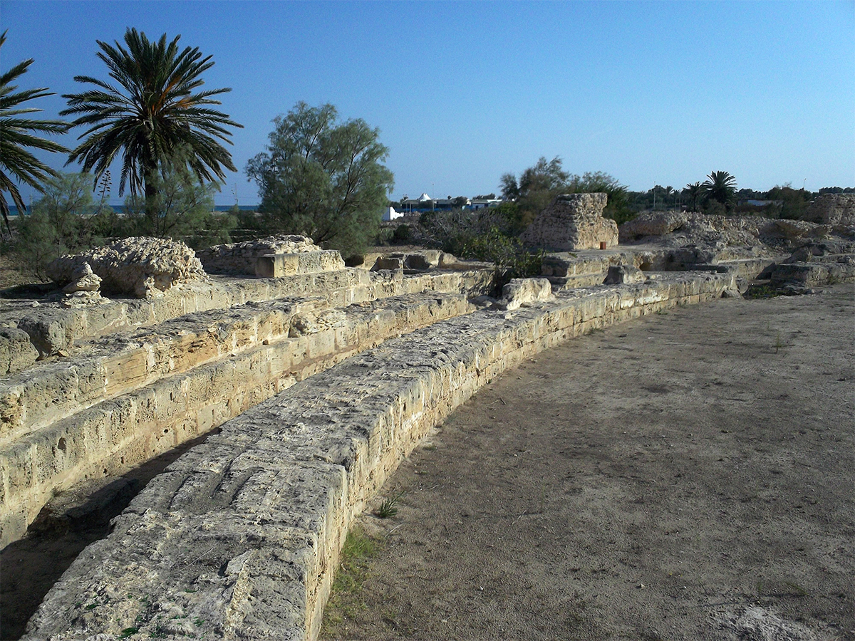
Finally, there is a breakwater that extends the southern city wall into the sea. The ruins of this breakwater are located about 580 meters south of the large breakwater. This pier was built of large blocks and had a length of approximately 300 meters. According to the masonry, we are dealing here with a Roman pier which probably dates from a period prior to the construction of the large breakwater due to the lack of wooden reinforcements.
The pier was originally built to extend the city walls from the shore into the sea and in that way to provide better protection; and after the construction of the large pier, it also took on the role of demarcating the large harbour basin of the Portus Novus over a length of 580 meters.
With its various basins, the harbour of the city of Thapsus can be considered one of the largest ports of the Roman Empire. The ruins of the artificial entrance to the Portus Pristinus, as well as those of the small breakwater and the one that extends the city wall into the sea provide new evidence of the advance of overseas trade.
What did Thapsus import and export?
Thapsis imported marble and African sigillata ceramics (red brown pottery) from the interior.
During research, fragments of white and coloured marble have been found in the city. The original African and Mediterranean quarries can often be located on the basis of colour and grain size. Such as the Filfila quarry (Guard Cape in Algeria) and the Sumitthu quarries (Chemtou in Tunisia). It is almost certain that the slabs and blocks of which marble fragments have been found in Thapsus were brought in by sea in Roman times.
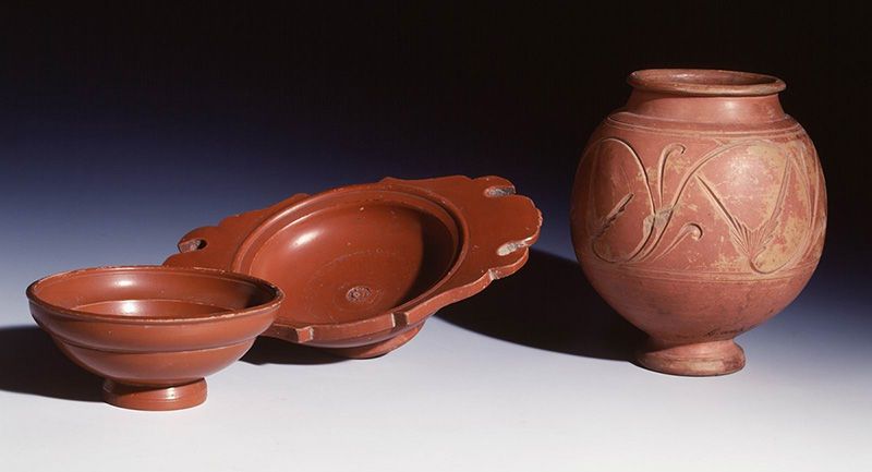
The pottery found also came from the interior and was produced in workshops in Northern Tunisia and Western Byzacene between the year 150 and the 4th century AD. It was probably sent overland to the port of Carthage and from there overseas to Thapsus because many shards of African pottery have been found in both the ante portum and the Portus Pristinus.
Marble and granite were imported from abroad and ceramics and olive oil were exported in return. Marble was imported from Asia Minor (bigio africanato16), the south of the Peloponnese (rosso antico) and from Italy (gray). Granite came from Elba.
So the granite columns and slabs and blocks of marble were transported to Thapsus by ship. Ceramics were also imported from the Italian regions of Campania and Tuscany, as were the wine amphoras found in Thapsus. A large part of this ceramic was probably used by the Conventus Civium Romanorum17 which had probably been based in the city since the alliance with Rome from the third Punic War.
Various types of amphorae have been found in the outer harbour of Thapsus. These were produced from the second century BC. until the end of the first century AD. both along the entire Tyrrhenian coast of Italy (Etruria, Lazio, Campania and Samnium) and in the east (Cos, Cnidu, Myndos). Much of this wine will have been consumed by the aforementioned conventus.
Thanks to the ager thapsitanus (fields of Thapsus), a lot of oil was also exported.
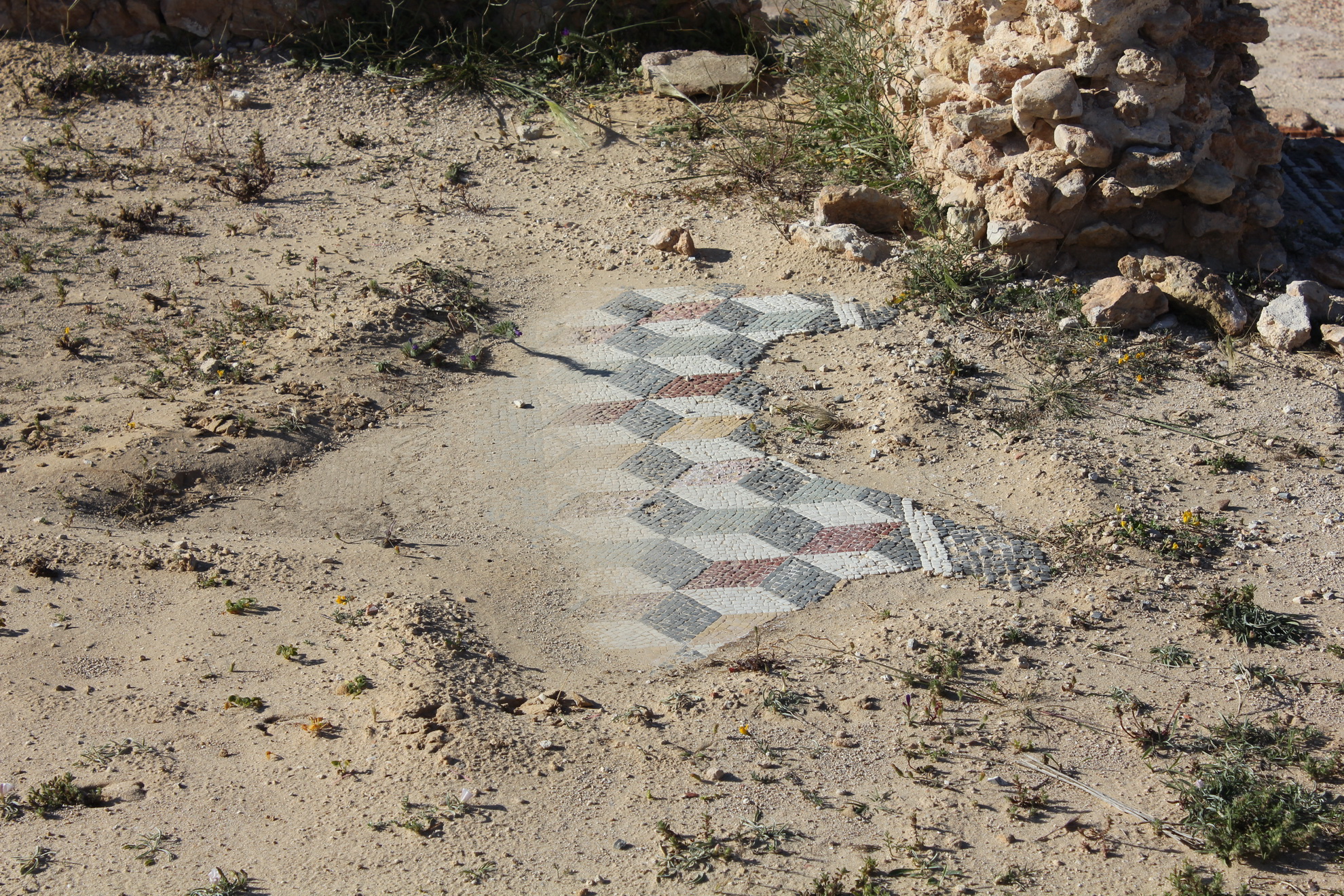
The City
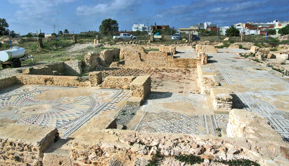
Little of the city itself has survived. In 1835 Sir Grenville Temple wrote of Thapsus in 'Excursions in the Mediterranean': "In Tunis I had several splendid descriptions received from the extensive remains of the city, and now I feel very much disappointed because I saw so little of it and the few I observed were in a perfect state of decomposition.”
A certain Guérin wrote: “The famous city of Thapsus is now completely destroyed. The land on which it stood is completely agricultural so that the evidence of houses and public buildings has completely disappeared. (..) The farmers use the stones from old buildings that they find here and there to build low walls separating their lands.”
These reports are very dark. Fragments can still be seen in Thapsus: the triple fortress, cisterne (water reservoirs), the remains of the amphitheater and the harbour, remains of ancient buildings including a bathhouse and adjacent villas and a Punic cemetery.
Fortunately, there is also the good news that completely ignoring the monuments of Thapsus may be called a stop. In March 2019, restoration work was carried out on the Thapsus large Roman villa next to the bathhouse.
- Sources
- - Ameur YOUNES (Université de Tunis)- Quelques aspects de l'activité du portus thapsitanus antiquus: 2000
- - Ameur YOUNES (Université de Tunis)- l'installation portuaire à Thapsus mise au point à partir des textes anciens et de la documentation archéologique: 1999
- - Arthur de Graauw - www.AncientPortsAntiques.com
- - https://www.romeartlover.it/Thapsus.html
- - https://www.casadevelazquez.org/recherche-scientifique/fouilles-archeologiques/thapsus-rass-dimass-tunisie/presentation-et-objectifs/
- - https://portuslimen.eu/site/thapsus/ by N. Carayon
- - DAVIDSON, D., 2014, “The Enigma of the Great Thapsus Harbour Mole”, International Journal of Nautical Archaeology, 43.1, (p 35-40).
- - YORKE, R. et al. (1966) « Cambridge expedition to Sabratha, 1966 report » Cambridge, (43 p).
Notes- 1: The Carthaginians were called "Punians" by the Romans; this name is derived from 'Phoenicians'.
- 2: Photo - https://gallica.bnf.fr/ark:/12148/btv1b530589500
- 3: Pliny the Elder (HN V, 3)
- 4: Pliny the Younger (HN V, 24-25) translation: Byzacium is the name of a district which is 250 miles in circumference, and is remarkable for its extreme fertility, as the ground returns the seed sown by the husbandman with interest a hundred-fold. Here are the free towns of Leptis, Adrumetum, Ruspina, and Thapsus; and then Thenæ Macomades, Tacape, and Sabrata which touches on the Lesser Syrtis; to which spot, from the Ampsaga, the length of Numidia and Africa is 580 miles, and the breadth, so far as it has been ascertained, 200.
- 5: Younes 1999a, 234.
- 6:GGordianus I, II en III were from the province of Africa and reigned from 238-244 AD.
- 7: Davidson & al. (2014), p. 38
- 8: Diodorus Siculus (c. 90 BC – ca. 30 BC) historian; Historical Library, 20. 7017
- 9: Bellum Africum, 28. 1
- 10: A tyrant of Syracuse 361-289 BC.
- 11: Arthur de Graauw, Dutch/French harbour engineer: https://www.ancientportsantiques.com/
- 12: D.P. Davidson en R.A. Yorke: The Enigma of the Great Thapsus Harbour Mole (2014) en YORKE, R. et al. (1966) « Cambridge expedition to Sabratha, 1966 report » Cambridge, (43 p).
- 13: See A. De Graauw: https://www.ancientportsantiques.com/ancient-port-structures/vitruvius/
- 14: Photo: Romeartlover.it/
- 15: Photo: Rijksmuseum van Oudheden, Leiden
- 16: Beige marble.
- 17: Association of Roman citizens living in the province.
- 18: Photo: arpamed.fr
- 19: Photo: Wikimapia.org


 We are committed to providing versions of our articles and interviews in several languages, but our first language is English.