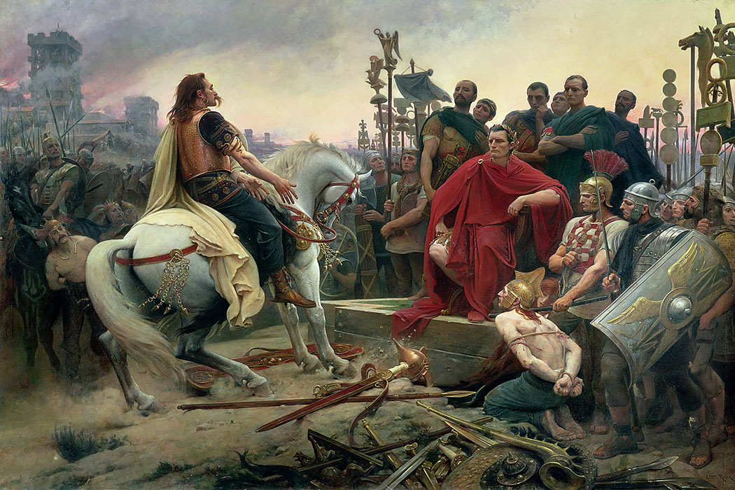
When the city-state of Rome emerged, it soon became clear how great the expansionist ambitions of this new power would be. Initially, Rome expanded overland. The Romans were not natural seafarers2. The sea was unknown, unpredictable and therefore dangerous, so the legions marched overland to the south and north of Italy to bring the peoples living there within their sphere of influence. In time, this expansion even extended into Northern Europe.
One effect of the success of this land army was that Rome's population also grew explosively. This created an ever-greater need for drink and food, building materials and all kinds of luxury goods that were scarcely, if at all, available in Rome. For practical and economic reasons, these had to be brought in from the conquered territories. Around 300 BC, the ever-expanding Roman Empire's need to gain greater influence at sea also increased. After all, the entire peninsula was surrounded by the waters of the Mediterranean, which the Romans soon called Mare Nostrum, Our Sea.
The Punic Wars
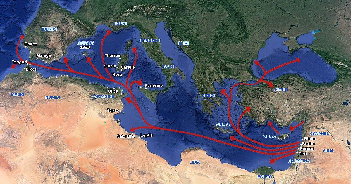
There was only one small problem. On the other side of the Mediterranean was a much older city-state that had exercised hegemony over the Mediterranean for many years: the Phoenicians from Tyre in present-day Lebanon3. These Phoenicians, called Punic people by the Romans, had already established numerous cities with ports from which they traded throughout the Mediterranean (see Figure 2).
One of the most important of these cities was Qart Hadasht, meaning ‘New City’. This city in present-day Tunesia was called Carthage4 by the Romans. From that city, the Phoenician Hasdrubal the Fair founded a second colony of the same name on the Iberian Peninsula in 228 BC, at the site where the ancient port city of Mastia5 is believed to have stood for centuries. The city had one of the finest harbours in the western Mediterranean.
After Hasdrubal's death, his nephew Hannibal became commander-in-chief of the Carthaginian forces in Hispania. He built a large army and a series of watchtowers along the coast. This gave Carthage considerable power. It is clear that the Romans, whose interests were the same as those of the Phoenicians, saw this as a threat, and the two powers clashed. The struggle that flared up as a result led to three wars, known as the Punic Wars, which, as we shall see, were ultimately won by the Romans.
The First Punic War
The first war broke out after the Romans sent an army to the island of Sicily, where the Phoenicians held sway. This war lasted from 264 to 241 BC.
As already mentioned, unlike the Phoenicians, the Romans were not originally a seafaring people and therefore had scarcely any experience of naval warfare.
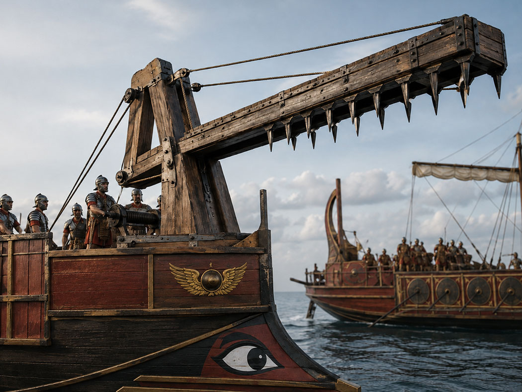
What they did possess was a great capacity for innovative thinking. Although the Phoenicians initially had the upper hand, new Roman inventions, such as large ships fitted with movable boarding bridges (the corvus)6, gradually came to determine the course of the conflict.
Ultimately, the Romans won the war; Sicily became the first Roman province, and agreements were made about which part of the Iberian Peninsula would fall under Roman control and which part would remain within Carthage's sphere of influence. The territory south of the River Ebro remained under Carthaginian influence, while that north of the river fell under Roman influence. In time, this division became the cause of a new war.
The Second Punic War (218–201 BC)
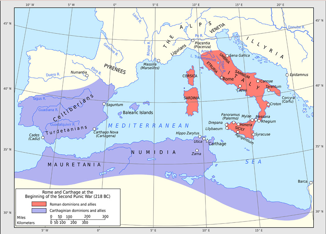
The Second Punic War took place mainly on the Italian and Iberian mainlands. It began with the alliance the Romans concluded with the Spanish city of Saguntum, which lay south of the Ebro and therefore belonged to Carthage.
The Carthaginian general Hannibal Barca refused to accept this and laid siege to the city. Saguntum therefore appealed to Rome for help, and Rome demanded that Hannibal leave the city alone. Hannibal nevertheless captured it, whereupon Rome declared war on Carthage. Hannibal then decided to attack the Roman Empire first.
Because the Carthaginian fleet had been almost completely destroyed during the first war, he had to reach Rome overland. The first step was to subdue the peoples living between the Ebro and the Pyrenees who were within Rome's sphere of influence. After fierce fighting, he succeeded and, according to Polybius8, set out across the Alps towards the Italian Peninsula with 50,000 infantrymen, 9,000 cavalrymen and 40 elephants, inflicting major defeats on the Romans for years.
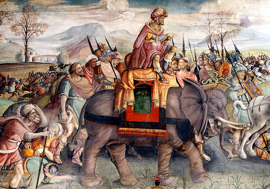
The Romans nevertheless managed to prevent Rome itself from being attacked and launched a counter-offensive.
The Roman commander Gnaeus Cornelius Scipio Calvus was sent to the Iberian Peninsula to fight the Carthaginian army units still present there, thereby cutting Hannibal off from supplies from his home port.
At a strategic point in the north, he expanded a small harbour for his ships and stationed his men in the port that the Romans called Tarraco (modern Tarragona)10. The Romans would remain there permanently.
Meanwhile, a Roman army also advanced into North Africa to besiege the mother city of Carthage together with the Numidians. Hannibal was consequently forced to return to defend his mother city, but was defeated at the Battle of Zama11. Carthage was eliminated as a serious rival to Rome, and Hannibal was exiled.
The Third Punic War (149–146 BC)
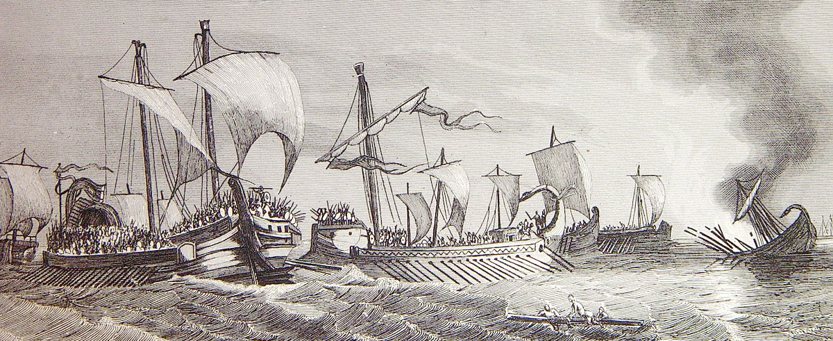
In this war, Rome wanted to settle matters with the Phoenicians once and for all. The original Carthage in North Africa was captured after a three-year siege, fulfilling the wish of the Roman politician Cato the Elder (234–149 BC): “Ceterum censeo Carthaginem esse delendam” (Furthermore, I consider that Carthage must be destroyed). Carthage was completely destroyed by Scipio's grandson, Publius Cornelius Scipio Aemilianus Africanus Minor. The surviving inhabitants were sold into slavery.
Carthago Nova
After the city in Spain was conquered in 209 BC by the Roman general Scipio Africanus, the Romans called it Carthago Nova (in effect, the new New Carthage) to distinguish it from the mother city.
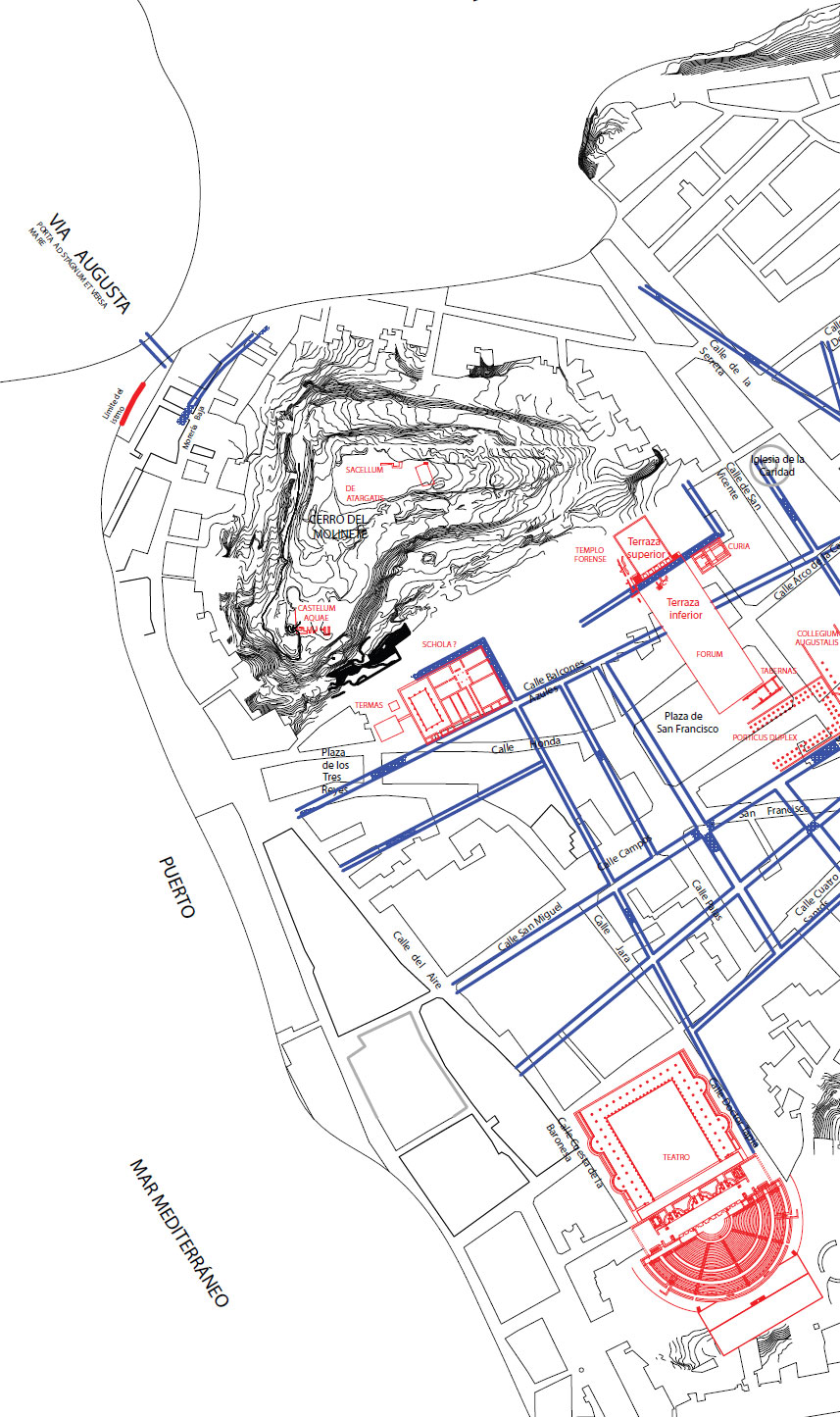
Julius Caesar granted the city Latin rights, and Octavian renamed Carthago Nova in his own honour and glory: “Colonia Victrix Iulia Nova Carthago” or “Colonia Urbs Iulia Nova Carthago” (C.V.I.N.C.). The title Urbs was enjoyed in Hispania only by Carthago Nova and Tarraco.
The Roman historian Livy (59 BC–AD 17) wrote:
“Potiemur praeterea cum pulcherrima opulentissimaque urbe tum opportunissima portu egregio unde terra marique quae belli usus poscunt suppeditentur; quae cum magna ipsi habebimus tum dempserimus hostibus multo maiora... huc rectus ex Africa cursus est; haec una inter Pyrenaeum et Gades statio; hinc omni Hispaniae imminet Africa” 13 (translation: We shall also take possession of a city that is not only beautiful and wealthy but also extremely useful because of its excellent harbour, so that from here we shall have by land and sea everything we need for war. We shall gain much, but the loss to the enemy will be far greater. This is his fortress, his granary, his treasury, his armoury, his storehouse of everything; this is his direct route from Africa; this is his port of call between Gades and the Pyrenees; this is the point from which Africa threatens all Spain.)
In Roman times, the city was also known for its silver mines, the production of the fish sauce garum and the esparto grass found there15. In AD 298, the city was therefore renamed Carthago Spartaria after this grass, as the capital of the new province of Carthaginensis established by Emperor Diocletian.
Carthago Nova now formed part of Hispania Citerior and was described by, among others, the Greek geographer Strabo (64–24 BC) as one of the most important ports in the western Mediterranean. This, together with the presence of the mines, attracted large numbers of Romans and Italians, and the city had to be prepared accordingly.
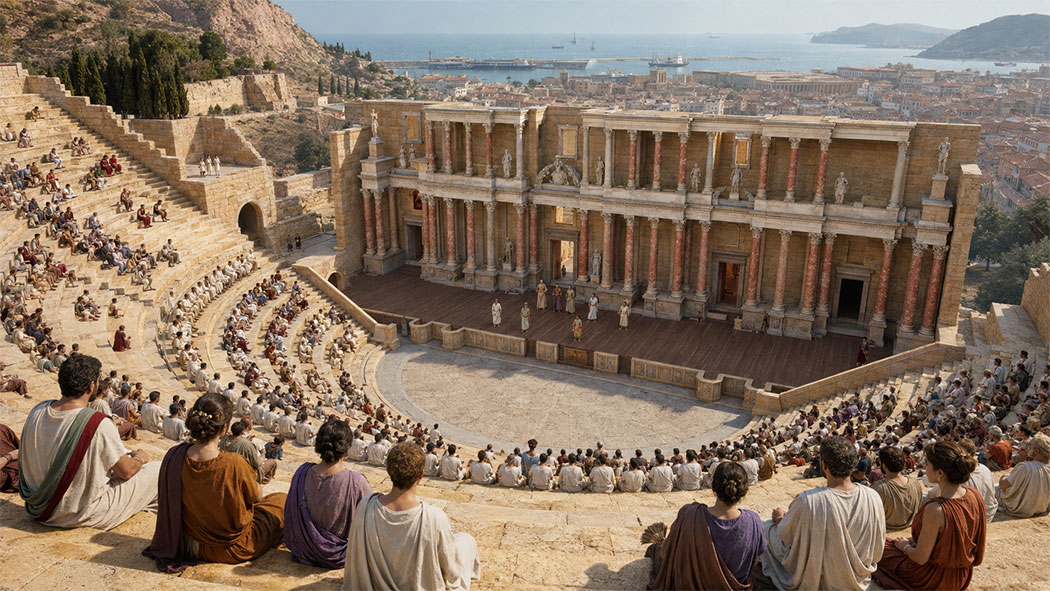
Under Augustus, the urban structure of the Republican period was abandoned. Large buildings appeared to display the splendour of the empire. One of the buildings that best reflects the political and cultural atmosphere prevailing in imperial Carthago Nova was the theatre, situated on the western slope of Monte de la Concepción. It was characterised by the perfection with which the project was executed, the quality and quantity of its ornamental elements and its comprehensive epigraphic programme, enabling us to date its construction to the 1st century BC.
THE HARBOUR
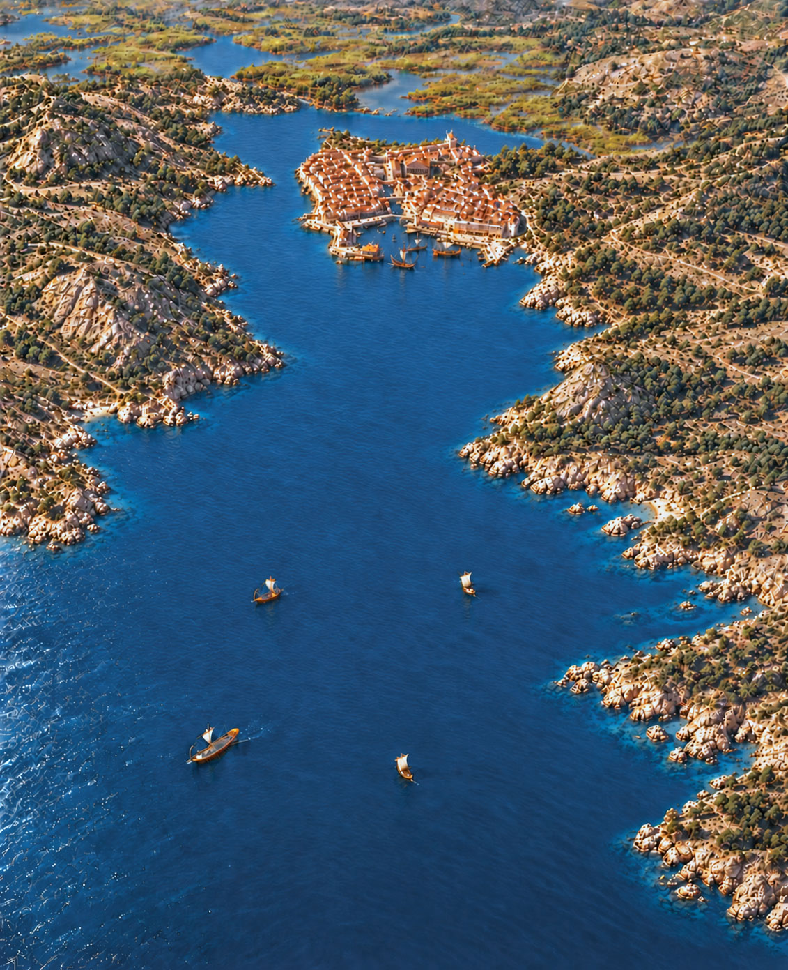
The strategically situated harbour of Carthago Nova was one of the most coveted defensive harbours in the western Mediterranean. Its importance was further enhanced by the presence of silver mines in the immediate vicinity. In his Geographia, the Greek historian, geographer and philosopher Strabo16 describes what his Greek colleague Polybius17 wrote about it in his Histories (Ἱστορίαι / Historíai):
“Polybius mentions the silver mines of New Carthage and says that they are very extensive; that they lie about twenty stadia18 from the city and cover an area with a circumference of four hundred stadia; and that forty thousand workers are employed there, producing (in his time) a daily revenue of twenty-five thousand drachmas for the Roman treasury”.
The mountain ranges that run into the sea in the western part of this region make the coastline rugged, with small and large inlets appearing from time to time: natural harbours suitable for anchorage.
One of the best harbour locations on that coast is Carthago Nova.
The deep basin, flanked by high ground to the east (maximum 280 m) and west (maximum 205 m), with genuine watchtowers, is protected on practically all sides from the prevailing wind by the two mountain headlands to the east and west that mark its entrance. Together, the latter form a narrow corridor of about 900 m, initially narrowing to 720 m and gradually widening to 1,400 m in the centre of the bay, which is about 1,850 m long. The urban centre was built on a small peninsula connected to the mainland in the east by a narrow isthmus. The outer edge of this centre was bounded by five hills. In the south, the largest and highest hill (65.56 m) overlooks the Mediterranean and the harbour and has therefore been of great strategic importance throughout Cartagena's history.
According to Polybius, a temple dedicated to Asclepius, the god of medicine, stood on the summit of one of the hills19.
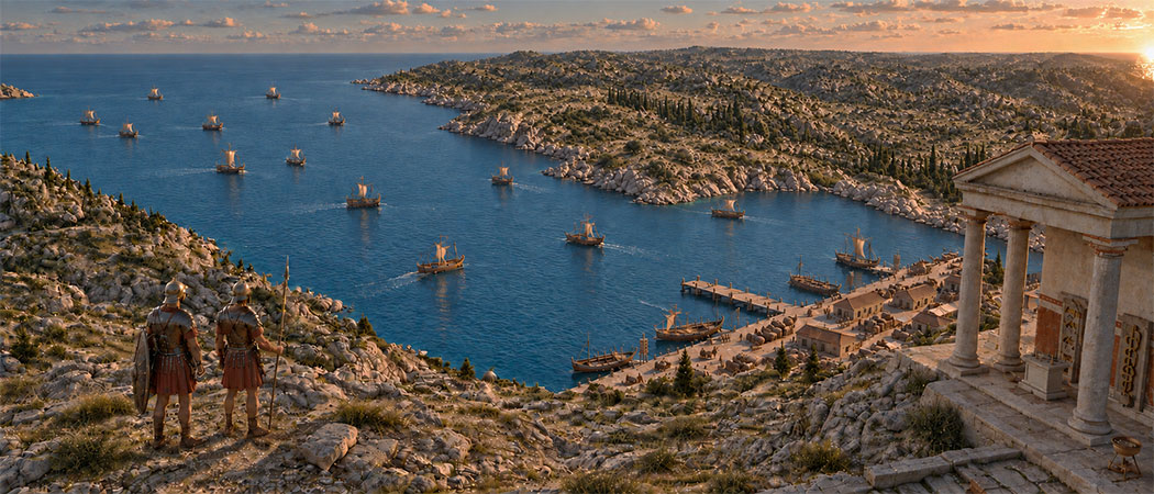
At the beginning of the imperial period, in addition to the aforementioned theatre on the western slope, a new amphitheatre was built on the eastern slope, on top of a theatre dating from the Republican period. The various ancient sources leave no room for doubt:
Livy writes: ”nauali alia materia ad classem aediicandam” (it has shipyards with facilities for shipbuilding)20. Livy also says that it is “…the only statio (roadstead) between the Pyrenees and Cádiz” 21, while Polybius believed that “… it was the only harbour capable of accommodating a fleet” 22.
A small island is said to have lain off the entrance, protecting the harbour from the waves23.
The natural sea inlet at Cartagena is still used as a seaport today and has therefore been altered and modernised repeatedly over the centuries as needs required. Moreover, as research over the years has shown24, large quantities of sediment washed in from the sea had accumulated from as early as the time of the Roman Republic. It was found that during the period 40 BC–AD 150, sediments were already present above sea level or only 15 cm below it. This progressive silting caused the coastline to shift naturally seawards. Much of the harbour basin has therefore become considerably smaller over the centuries, and the city has expanded onto this new land (see Figure 11).
Almost all the ancient harbour structures lie beneath the built-up ‘new land’. Traces are therefore scarce and must be sought on the bed of the harbour basin and, above all, beneath the aforementioned modern development.
The harbour basin nevertheless remained navigable and suitable for anchoring almost all types of vessel.
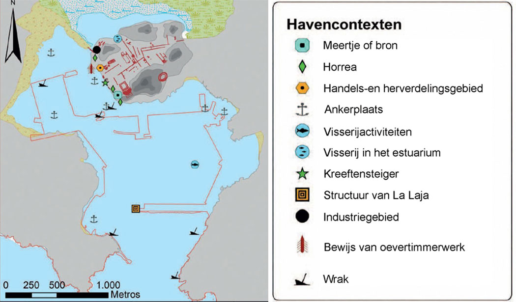
All in all, extensive depth surveys of the seabed, together with various traces and especially shipwrecks, now allow us to reconstruct the ancient harbour and its possible anchorages with a high degree of certainty.
Archaeological finds were already being made several centuries ago by enthusiasts and local scholars in Cartagena's preserved ‘underground city’. These included discoveries that were important to the archaeology of the harbour. Together with descriptions in ancient writings, they provide a wealth of information about the classical harbour.
Since 2012, the so-called Arqueotopos project has made it possible to reconstruct the palaeotopographical26 development of the city and harbour in several phases.
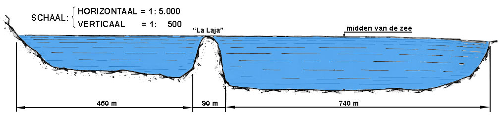
For example, a structure of opus caementicium28 has been found on La Laja del Puerto. Ancient documents state that “it appears to have been made from mortar from the same works as that of the Colosseum in that city”.29 This conical limestone bank in the middle of the harbour lies 0.6 metres below the water's surface and descends to the seabed at 10.05 metres. Its upper surface measures 610 m2 and its base 77 by 56 metres, and it has been known to sailors since time immemorial — and therefore in antiquity as well. Remains of mortar and caementicium were found there which, on the basis of their construction and decoration, date from the Roman Republican period.
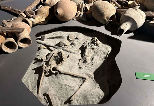
The structures discovered probably formed part of the foundations of a beacon or watchtower. Various Punic and Roman wrecks, as well as cargoes of tin, lead and tusks, have been found around the islet.
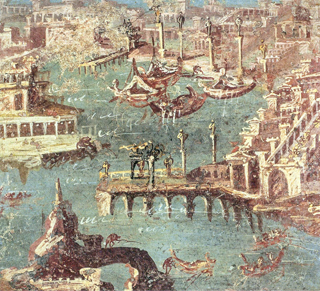
It is currently hidden from view by harbour works featuring a modern lighthouse.
Further remains were found of possible fisheries or fish farms in the Santa Lucía area, harbour-bed contexts in the Arsenal area, ancient boats and even harbour-like structures along the Calle Mayor waterfront.
Epigraphic sources are also an important source of knowledge about the maritime cultural landscape, recording not only occupations and activities, such as collegia, but also harbour or storage infrastructure.
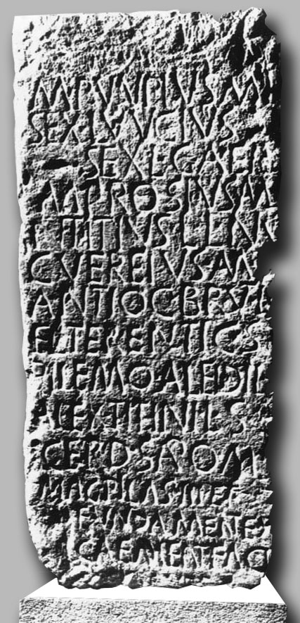
Figure 14:Inscription CIL I 2271 – CIL II 3434
The inscription CIL I 2271–CIL II 3434, for example, refers to a collegium of freedmen and servants responsible for constructing an ex caemento work consisting of pillas III et fundament(a) ex caement(o)faci(undas)30. This last addition may relate to a harbour structure of the breakwater type or an opus pilarum pier such as those at Puteoli (Italy) (see Figure 13). ·
PVVPIVS · M(arci) · (ibertus)
SEX(tus) · LVVCIVS
SEX(ti) · L(ibertus) · GAE‚P(—-)
M(arcus) · PROSIVS · `M(arci) (ibertus)c
N(umerius) · TITIVS · L(uci) · L(ibertus) · NV(—-)
C(aius) · VEREIVS · `MA (rci) (ibertus)c
ANTIOC(us) · BR`VTc I · [ S(ervus)]
EL(euterus?) · TERENTI · C(ai) · S(ervus)
PILEMO · ALEIDI L(uci) · (ervus)
ALEX(ander) · TITINI · L(uci) · S(ervus) ‚
ACERD(o?) · S`APc O(ni?) · M(arci) · (ervus)
MAG(istreis) · PILAS · III · ET ·
FUNDAME`NTc (a) · EX
CAEME`NT (o) ·FACI(unda) C.O.E.R.A.V.E.R.E (?)
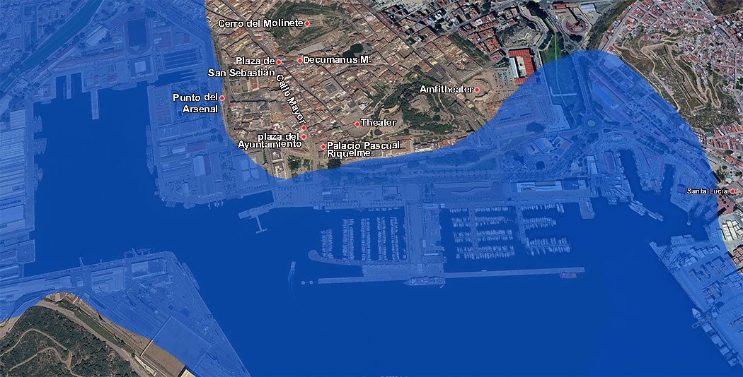
Most of the finds are located along the axis of the main street, Calle Mayor. It is the only broad, low-lying area where easy communication between the maritime and urban spaces was possible.
In the south-west corner of the city is the Town Hall Square, Plaza del Ayuntamiento. This was one of the most important areas of the ancient harbour. Punic warehouses originally stood here, but after the Roman conquest they were demolished and replaced by new buildings oriented towards the now-vanished western Mandarache Sea, the main anchorage (see Figure 11). This waterfront appears to have been monumentalised with a frontage of colonnades in the Tuscan order, which may have provided access to new storage structures such as those found on the site of the Pascual Riquelme Palace31 or in the surrounding area32. A lacus (small reservoir) was also built in this area, connected to an aqueduct and a natural spring, which provided the harbour's principal supply of drinking water.
Research has also shown that a deep inlet towards the old city probably existed from Punic times onwards. Several horrea (warehouses) dating from the mid-50s BC stood there and were reused during the imperial period33.
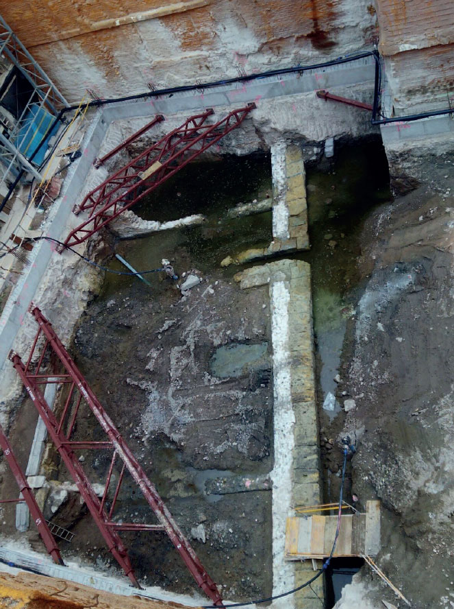
At numbers 21–22 on the aforementioned main street, Calle Mayor, remains of a sandstone quay with caementicium tie bars were found under the direction of the archaeologist Francisco Fernández Matallana. About five metres inland from the edge of the harbour basin are the limestone plinths of the harbour warehouses (see Figure 16). These finds probably date from the late Republic, with repairs from the reign of Nero.
This large quay appears to run parallel to part of the main street and is closely associated with a large Republican storage area with porticoes on the present-day Plaza de San Sebastián35. This large square was connected on one side to the city gate leading towards Baetica, on the other to the Decumanus Maximus leading towards the forum, and in the south to the harbour.
Structures have been found on Cerro del Molinete that were probably dolia warehouses36, together with kilns and various workshops indicating an important industrial area37.
Epilogue
The various articles we consulted suggest that activity in the ancient harbours of Carthago Nova must have been enormous, not only because of the major commercial interests in the Mediterranean but also because it served as the home port for various military vessels. Yet the visual evidence is fairly scarce.
The real research is only just getting under way, unfortunately by trial and error. A great deal more water will flow through the entrance into the harbour before we obtain a much fuller picture of how this sea inlet at Cartagena functioned as a Roman port. In any event, we are fully confident that, in the not-too-distant future, Spanish archaeologists will be able to lift the veil and tell us more about the workings of this spectacular harbour in antiquity (editors).
- Sources
- - Felipe Cerezo-Andreo: Los puertos antiguos de Carthago Nova, nuevos datos desde la arqueología marítima y geoarqueología portuaria
- - Wikipedia
- - Integra: Historia de Cartagena
- - Eloy Andrés Gómez Motos: Trabajo sobre recursos en Carthago nova (pec1)
- - Sebastián F. Ramallo Asensio, Miguel Martínez Andreu: El puerto de Carthago Nova: eje de vertebración de la actividad comercial en el sureste de la Península Ibérica
- - CTA: Cartagena Actualidad
- - Arthur de Graauw
Notes- 1: Lionel Noel Royer, 1899. Musée CROZATIER du Puy-en-Velay
- 2: See also Winter shipping
- 3: See also Tyre, birthplace of Europe
- 4: See also Carthage
- 5: Mastia or Massia: the first description of this Tartessian city comes from a poem by the Roman poet Rufius Festus Avienius (1st century AD) entitled Ora Maritima (Sea Coast): ... then there is the harbour of Namnatius, which extends inland from the sea in a curve near the city of Massienos, and at the end of the gulf rise the high walls of the city of Massiena ...
- 6: Roman boarding bridge: first used during the Punic Wars.
- 7: William Robert Shepherd, 1923
- 8: Greek historian, 208–118 BC; Historiae
- 9: Jacopo Ripanda – Palazzo dei Conservatori, Musei Capitolini, Rome, 2016
- 10: See also Tarragona
- 11: The battle took place on 19 October 202 BC near the town of Zama Regia (modern Siliana, Tunisia), close to Carthage.
- 12: Engraving from 1852: History-maps.com
- 13: Livy, XXVI, 43
- 14: Plan of Carthago Nova, José G. Carrasco Gómez, reproduced in Ramallo Asensio (2011)
- 15: Esparto grass: used in the production of rope, baskets, etc.
- 16: Strabo, 64 BC–AD 24
- 17: Polybius, 203–103 BC
- 18: Greek unit: one stadion is approximately 185 m
- 19: Polybius: X, 10, 11
- 20: Livy: Liv.26.47
- 21: Livy: Liv.26.43, 8
- 22: Polybius: X, 8, 2
- 23: Ramallo Asensio and Martínez Andreu, 2010.
- 24: Felipe Cerezo-Andreo: El puerto de Carthago Nova: eje de vertebración de la actividad comercial en el sureste de la Península Ibérica.
- 25: Plan: Felipe Cerezo-Andreo
- 26: Palaeotopography: the form and variations in elevation of a landscape from a specific geological period.
- 27: Drawing of La Laja: CTA Cartagena Actualidad
- 28: Opus caementicium: Roman concrete, a strong building material that the Romans used extensively from the 2nd century BC onwards and which is resistant to seawater.
- 29: Munuera Navarro, 2010, 618).
- 30: Ramallo Asensio and Abascal Palazón, 1997, 71–77
- 31: Ramallo Asensio et al., 2007
- 32: San Martín, 1985
- 33: Ramallo Asensio and Vizcaíno Sánchez, 2011, 225–230
- 34: Photograph: Felipe Cerezo-Andreo
- 35: Ramallo Asensio, 1989, 88
- 36: Dolia: singular dolium; a large, rounded earthenware jar used for the production and storage of wine and foodstuffs.
- 37: Martín Camino and Roldán Bernal, 1997; Egea Viváncos et al., 2006.
 We are committed to providing versions of our articles and interviews in several languages, but our first language is English.