Videsne illam urbem, quae parere populo Romano coacta per me renovat pristina bella nec potest quiescere? 1
This is how, in 54 BC, the Roman orator and politician Marcus Tullius Cicero looked back on the times of ancient Carthage2.

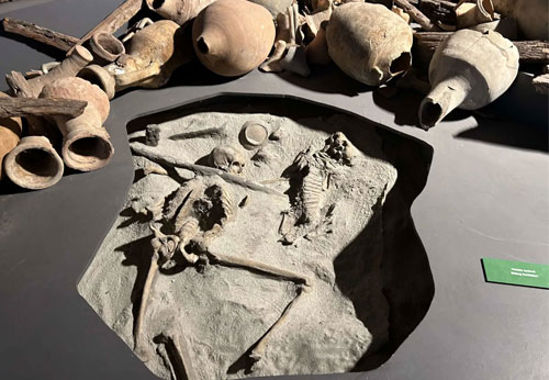
CARTHAGE
Carthage was founded in the ninth century BC on the coast of North Africa as a Phoenician colony.
According to a legend4 a princess from Tyre5, named Dido or Elisa fled from her brother, King Pygmalion, with a large group of followers. Arriving in a bay in what is now Tunisia, she convinced the local ruler, the Mauritanian king Hiarbas, to sell her a piece of land as large as she could mark out with a cowhide. Her people would then be able to rest there. The king agreed and Dido cut the skin into very thin strips which she then laid one after the other, creating a considerable area on a hill which she called Byrsa (possibly based on the Phoenician word brt 'citadel'6, or on the Semitic word bostra meaning 'steep slope'7). Because the Ancient Greek word for ox skin (βυρσα) sounds the same, it seems likely that the basic story of the legend is derived from the name of the hill.
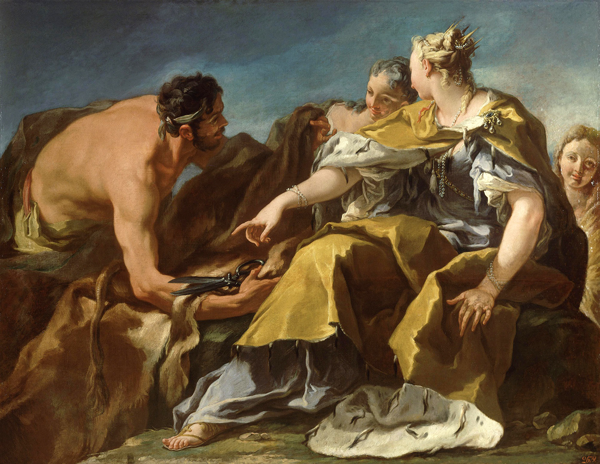
Another legend says that the Mauritanian9 chief Hiarbas negotiated with the king of Tyre to be allowed to marry his daughter Dido in exchange for some buildings. This place grew into Qart Hadašt, the New City, or Carthage.
Carthage became one of the most prosperous and powerful city-states around the Mediterranean Sea and by the 5th century B.C. it had 400.000 inhabitants, an enormous harbour and a permanent war fleet.
Throughout the centuries, and especially when original Phoenician sites such as Tyre, Sidon and Byblos were dominated by other peoples, Carthage managed to make a political and cultural mark on many surrounding areas, so that a large part of the inhabitants of the southern Iberian Peninsula, Sardinia, Sicily, the Balearic Islands and North Africa gradually became part of its sphere of commercial influence.
At the time, around 300 BC, Rome had a much smaller territory and economy than Carthage, but it nevertheless went up against its much larger rival and started the greatest warlike conflict of antiquity: the Punic Wars.
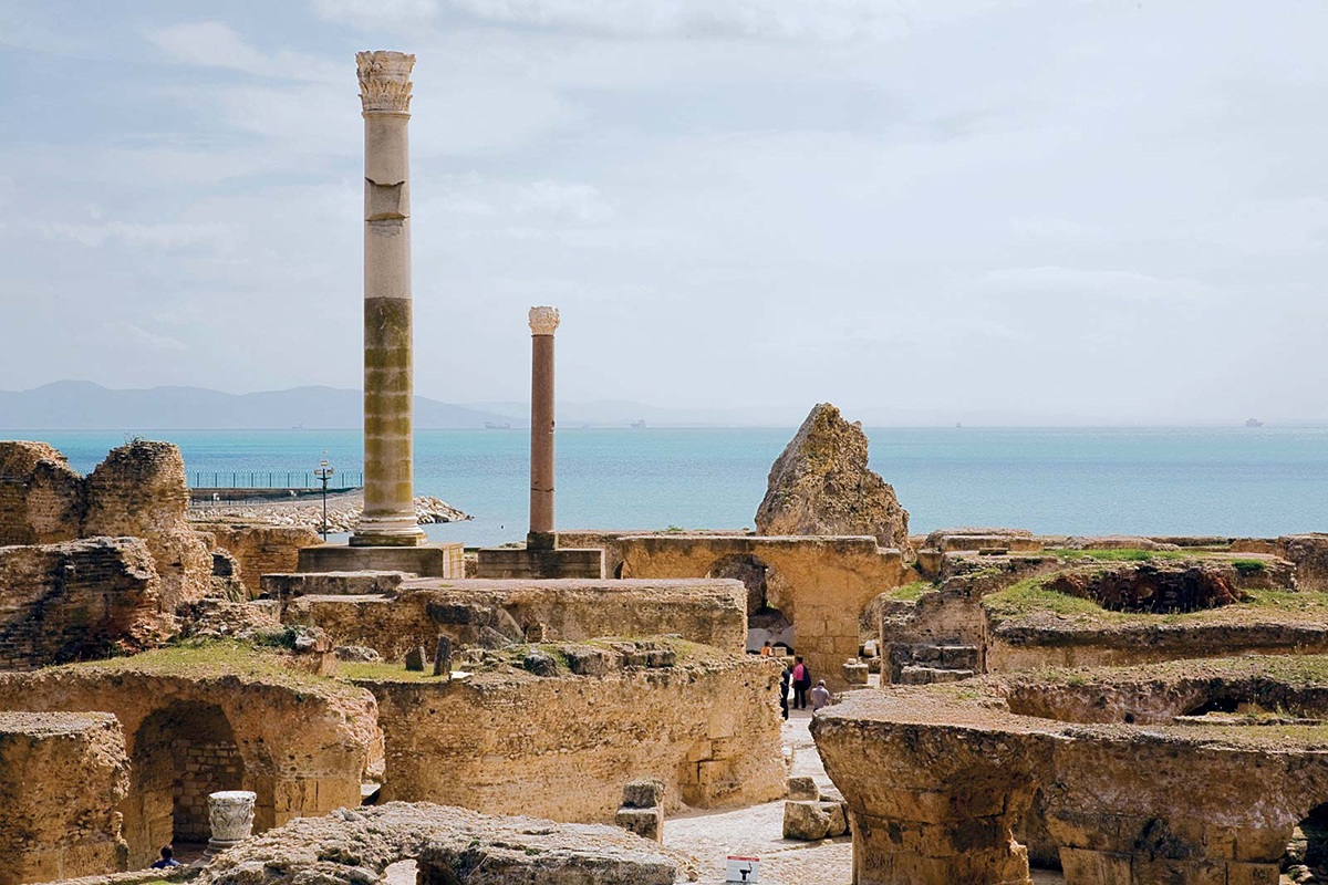
Rome fought three wars against the Carthaginians. During the last one, the Third Punic War (149-146), the Romans besieged Carthage for three years and finally defeated it. The city was demolished until a ruin remained and its territory was incorporated into the Roman Empire.
However, after the death of Julius Caesar in 44 BC, the Emperor Augustus had a new city built which was also named Carthage and which, partly due to the fact that many "Punics" settled there again, soon became a city of considerable importance.
In the course of the first century AD, the city even grew to be the second city in the western half of the Roman Empire with approximately 500,000 inhabitants11. Only Rome itself was larger, with around 800,000 inhabitants.
Around the year 100 AD, the Roman amphitheatre of Carthage was built; one of the most impressive theatres in the Roman world.
The City
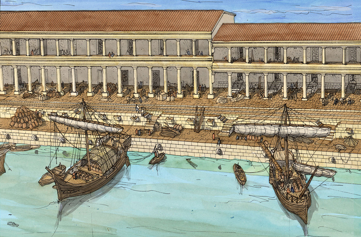
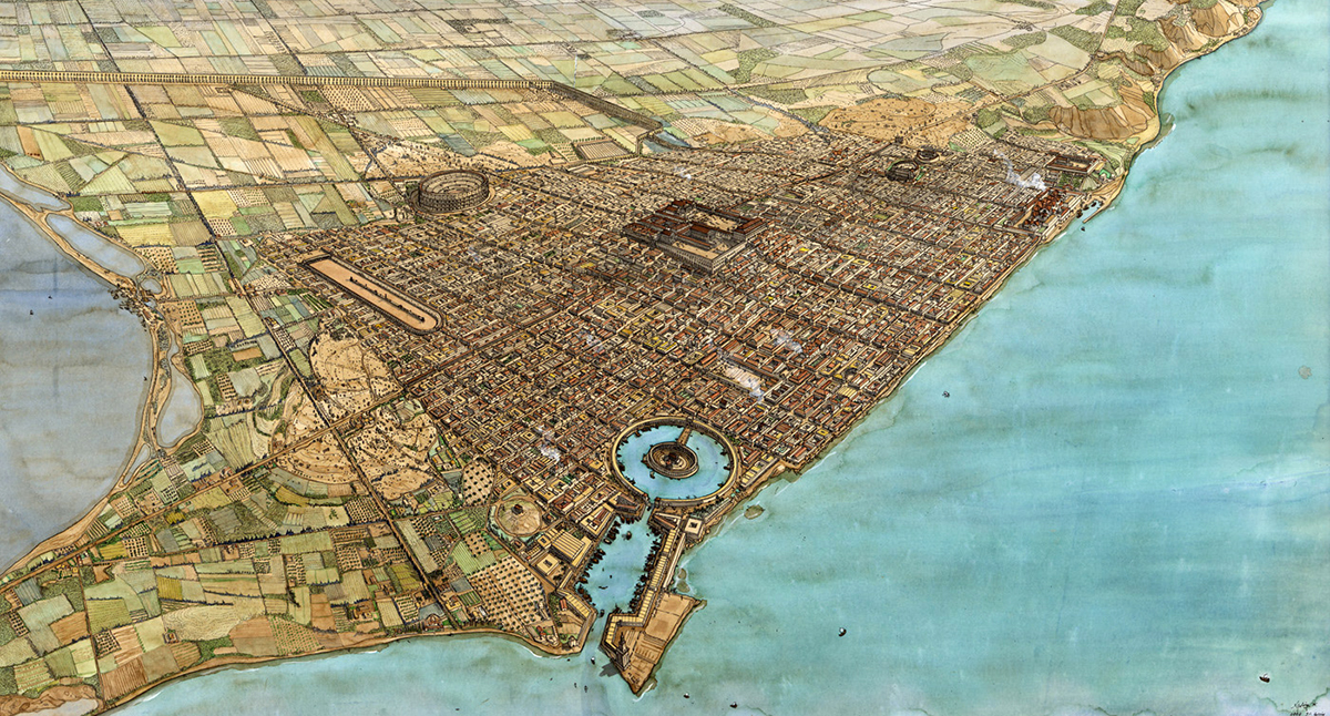 Figure 5: Artist impression of Roman Carthage13
Carthage is situated on a peninsula in the Gulf of Tunis. According to the Greek historian Appianus14, the city had a triple wall, each 45 feet high and 30 feet wide, with barracks for 24,000 men and stables for 4,000 horses and 300 elephants.
Carthage had, as we shall see, several small harbours or anchorages, two large artificial harbours between the peninsula and the mainland, a commercial harbour with a military one behind it. The mouth of the Carthaginian harbour, situated north of the later Roman entrance, was, according to Appianus, 20 metres wide and could be closed with a large iron chain, so that nobody could enter or leave the harbour.
Ships came and went from all over the Mediterranean and the Atlantic coasts of Africa, Spain, France and even England.
The entrance to the Roman harbour (see figure 5) was narrow with a large watchtower that kept an eye on the harbour and the sea. Appianus writes that 220 ships could moor there at the same time.
They traded in the royal purple and blue dye from Tyre, tin for making bronze, silver, gold, wood, wine, clothes, pottery, carpets, jewellery, lamps and many other goods.
The Harbours
Almost all Roman ports in the Mediterranean, with the exception of Portus, developed into centres for regional overseas trade to which the Roman annona15 was added.
Research into Carthage was already being carried out in the 19th century, although with varying success.
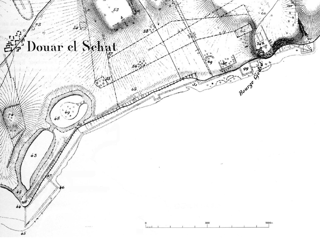
The first detailed map of Carthage (see figure 6) appeared in 1833 by the Danish archaeologist C.T. Falbe16.
Although there was a large lagoon of about 40 km2 (today's Lake Tunis) 1 km south of the city with a low-lying sandy shore protecting it from wind and sea currents, it seems that it was rarely used as a natural harbour in ancient times.
The proof is again found with Appianus in his account of the 3rd Punic War based on Polybius17, where he speaks of the lake and the sandy beach: 'One of the Roman consuls, Censorinus18, had camped by the lake at the foot of the enemy city wall when his men became ill from the unhealthy environment. He moved his encampment to the seashore'19.
Later, Scipio Aemilianus20 built a dam south of the mouth of the harbour to block access to it. The Carthaginians responded by making an opening on the other side of the harbour that led directly out to open sea21.
When they could not get all the ships into the harbour through this opening, they tied them to a wide quay built for unloading merchant ships22. This shows that the main port was directly connected to the open sea and the lake therefore played no role.
Almost seven centuries later, in 533 AD, the Greek historian Procopius of Caesarea23 reports that the harbour within the walls of the city (called Mandrakion) was considered too small to accommodate the fleet of General Belisarius24 , consisting of 592 ships. Therefore they chose another port, called Stagnum, some 40 stades (about 7.4 km) from Carthage where there was abundant space25. Stagnum was also the word used by Latin authors for the lake and the harbour of this name was probably situated at the site of the natural opening in the sand bank.
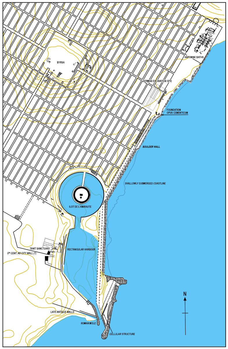
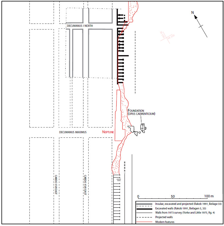
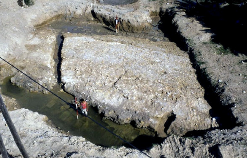
The well-documented evidence from the German excavation site on the city's coast (see 'German excavation site' on Figure 8) points to an extension of the land above the sea of several tens of metres between approximately the 7th century BC and the 2nd century AD27. These excavations, around an insula (residential block) north of the Decumanus Maximus, were close to the central part of the Roman city and, given the uniformity of the levels from the Antonine baths towards the harbours, it seems likely that this pattern of growth south-eastwards was generalised.
The two man-made harbours are the result of the excavation of coastal deposits, which probably date from a time close to the end of Carthage's independent existence, in the middle of the 2nd century B.C. We know these harbours from literary sources28 and from the archaeology of their Punic - Byzantine development.
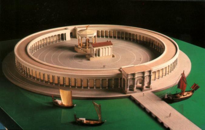
At the time of the Third Punic War (149 - 146 B.C.) the inner circular harbour, the so-called Ilot de l'Amiauté (the Admiralty Island) was a naval arsenal29, while the outer 'rectangular' harbour, according to Appianus, was intended for merchant shipping. Archaeological research shows that this was a considerable basin with quays enclosed between the city wall on the seaward side (east) and the Tophet (sanctuary of Tanit) on the west. It was connected to the circular harbour on the north side and its entrance was on the south side. During the Carthaginian period this entrance was situated north of the later Roman entrance. The latter was demarcated by two stone piers in opus caementicium (see Figure 14).
A new function for the Ilot.
During Roman rule, the Ilot de l'Amirauté changed into a square surrounded by a colonnade with a temple and an octagonal building in the middle. This probably happened in the second or third century A.D. Later, office-like spaces were added to the colonnade, as was the case behind the theatre in Ostia.
In a trench in the central part, thirty ostraka (described potsherds) were found, on which the transport of olive oil by the mensor olei (official in charge of the transport of oil) was mentioned30:
POS(T) CONS(ULATU)S
MODESTO ET ARINTHEI
XIIII K(A)L(ENDAS) MART(IAS) FELIX MENSOR OLEI FOEI
KARTHAG(INIENSIS) SUSCEPIMUS PER NAV(I)C(U)LA(M)
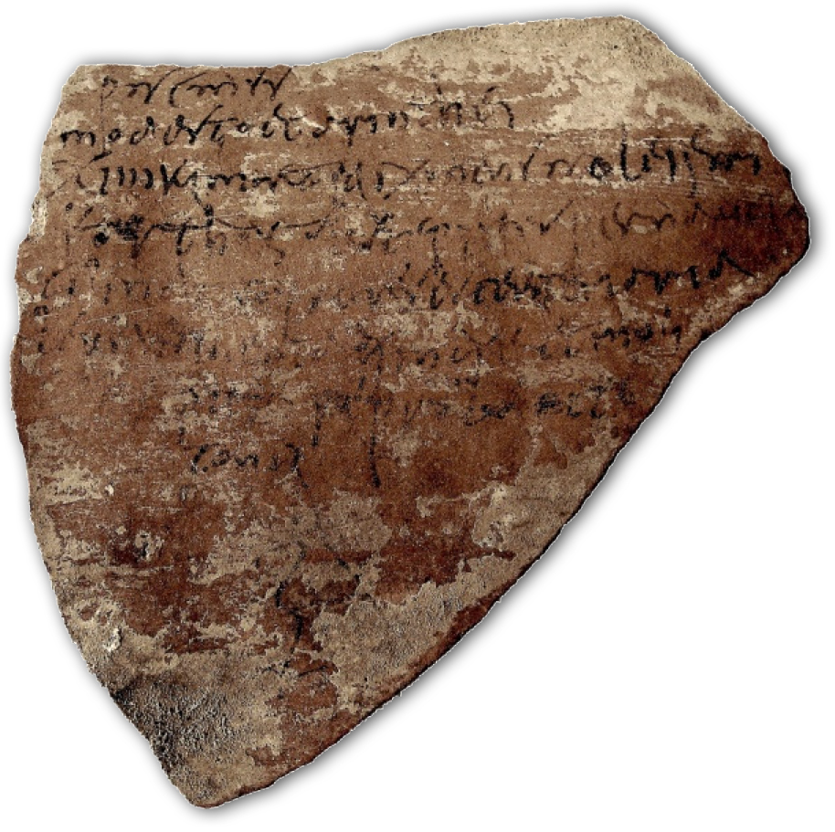
So his name was Felix and the date 372-3 AD. This may indicate an annonatory role for the port, in which documentation and perhaps shipping of oil destined for Rome took place.
An excavation on the northern side of the harbour, close to the quays, has uncovered a succession of workshops dating from the 1st to the 7th century AD. These seem to be partly related to a cloth industry, and from the remains one can conclude that there was an integrated set of different crafts with ever stronger central control in the later imperial period 31. It is possible that the conversion of the Ilot coincided with Emperor Commodo's establishment of the African grain fleet, the Classis Commodiana, and the renaming of Carthage as Colonia Commodiana Togata in 186 AD.
Another scenario suggests that the Ilot was used as a commercial harbour market place where annona-related goods were traded and that craft production on the harbour site was also primarily intended for commercial purposes32.
The rectangular harbour basin retained its shape from the Punic period but was modified in the south with a Roman entrance to the harbour. The new Roman breakwaters provided more quay capacity and the southernmost pier extended into the sea to provide even more space for ships to moor on that side. Already during the Punic phase, there was a 15 m wide quay area on the west side which led to a street parallel to the harbour basin. To the west of this was a large temple complex, probably dedicated in Roman times to Saturn, Venus and Caelestis, replacing the original Punic Tanit sanctuary.
Falbe's map (Figure 6) shows the presence of regular cellular structures on the east side, running in a narrow strip along the entire length of the coast from the Antonine bathhouse to the harbour entrance in the south. These structures, which are also found in other Roman harbours such as Leptis Magna, are normally interpreted as warehouses/commercial offices.
Although the buildings and the space in front of them were also seen as Roman quays on ancient maps of Carthage33 , it raises a problem which was already noted in 1899 by Henri de Roquefeuil34 who found a seawall of boulders between the sea and the aforementioned quay, which led him to believe that this could never have been a landing quay: ‘The hewn stones formed a simple barrier filled in with rubble (blocages), which was still visible, and the various ornaments I saw all around (carved stones, marble parts of columns, etc.) prove that this quay was built more for pleasure than for utilitarian purposes' 35. This view is rejected by other scholars.
Another researcher, Charles Saumage36, therefore argued, with a mental picture of the street plan of Carthage that he had discovered, for a seafront promenade with a colonnade on the outer edge of the supposed insulae. However, this last view is also subject to criticism. In any case, the seawall makes access to the quays from the sea impossible.
Another chronological point are the remains of the foundations of a massive monument measuring 18 x 9 m, which was probably a triumphal arch at the end of the Decumanus Maximus. This is just opposite the Byrsa hill and may have been the very first landing place of the Phoenicians. An archaic Phoenician quay would be appropriate here. The Romans would then have made this concrete block there much later as a foundation for a monument/arch. The type of concrete suggests a date from the height of the empire. This is also supported by the fact that traces of a wooden formwork were found in the foundation of the monument, which leads to the assumption that the monument was built in the sea according to the method of Vitruvius37.
The sea wall lies on both sides of the monument and seem to curve around it (see Figure 9). The sea wall must therefore have been built later to protect the land from the sea. The monument and the cell-like structures associated with it were built earlier and originally overlooked the sea.
If we consider the cell-like structures as seawalls, we run into another problem. The most common wind direction at Carthage is north-west (see Ancient Ports Antique). The quays run from northeast to southwest and therefore offered a limited protection for ships. Nevertheless, we have both written and archaeological sources that tell the contrary.
The written source comes again from Appianus of Alexandria in the account of the Roman victory during the 3rd Punic War. He describes here the wide quay situated in front of the city wall where merchants unloaded their goods. The Carthaginians built an outer work to protect it. Since this outer quay could be attacked by the NE waves, it may have been undermined by erosion, so that eventually it had to be protected or replaced by the rampart.
The second line of defences made of rubble stones, the boulder seawall shown in Figure 8, was added later by the Romans. The result was that no ship could reach the outer quay and the inner harbour must have taken over all traffic.
The quay was fought over in 146 BC and was taken by Scipio's soldiers. The latter placed 4,000 men along it and built his own fortification38.
So this unloading point was not a jetty but clearly something very substantial. Given the 4,000 men stationed there and two fortifications, it is difficult to see it as anything other than the long seawall where the Roman cell-like buildings were later built. Moreover, the rapid expansion of this seawall, documented in the German excavations, makes the existence of an unloading point in front of the city wall plausible39.The likelihood of Carthaginian unloading points on the main seawall then supports the interpretation of Roman quays and buildings on the same stretch.
The harbour entrance
Such an open quay raises the question of whether there was protection for ships unloading there.
For the northern part of the coast, this must have been a major problem. There were no natural harbours there. Ships had to moor along the quay or anchor further from the coast after which smaller boats had to unload and/or load the goods. The sea depth along the coast was very shallow and one had to sail at least 50 metres from the coast to reach 3 metres of water depth.
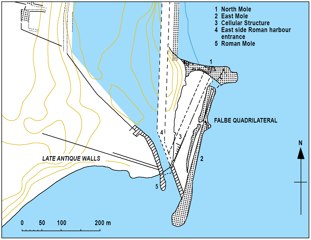
The Phoenicians probably built jetties from the quay into sea in order to reach a depth of 2 to 3 metres. The protection of the access to the artificial harbours has been seen as the function of a so-called 'quadrilateral' at the southernmost point of the city's seawall. This was first defined by Falbe in 1833 (see figures 6 and 13).
It used to be thought that the various parts of 'Falbe's quadrilateral' consisted of a single construction. Research in recent years has shown that it is composed of elements of different date which must be considered separately.
The earliest surviving element, and the only one of possible Punic date, is the northern mole, which extends perpendicular to the coastline into the sea for about 75 m (Figure 13-1). This appears to have been built before the Roman coastal extension and, if the mole extended inland as Falbe's plan suggests, it may have been there earlier than both the cell-like buildings on Falbe's plan and the further, possibly contemporary, 'cellular structure' to its south. This North mole was clearly earlier than the East mole (Figure 13-2) and may have served as a breakwater. According to Henri Hurst, ships unloading on the open coast in the north would have moved to the leeward side of this mole in bad weather. Arthur de Graauw believes that the distance was too large and that there was only room for five ships at the most. He therefore agrees more with Hurst's second hypothesis that if this breakwater, as it now appears, was of Punic origin, its location could also indicate the entrance to the artificial harbours.
Augustine's account of his departure from Carthage with a ship that lay ready near the church of St. Cyprian of St. Cyprian leaves little doubt that there was at least an anchorage on the north side of the city in the 4th century AD.41. The French researcher Louis Carton42 suggested that there may have been a small harbour south of present-day Borj DJedid (Bourge Gjedid on Figure 6) on the site later occupied by the Antonine baths and the insulae to its south. He also believed that this was the original Punic trading port whose inner waterline was marked by finds of shell-inlaid Punic stelae.
So there seems to have been protection for ships at both ends of the open sea embankment of Carthage, possibly in both the Punic and Roman periods. Cicero already described Carthage as succincta portibus ('surrounded by harbours'). Further research could confirm this.
South of the North mole a 90 metre long, cell-like structure runs from northeast to southwest. This runs at an angle to all other structures in the square, but on almost exactly the same line as the general sea front north of the harbours. Yorke and Little in 1970 described this structure as a concrete structure, "clad with finely worked masonry blocks and fronted by a platform 2.50 m wide." Further investigation in 1977 noted that formwork had been used in the foundation43. It was also suggested that this structure was interrupted at the south end by the pier which formed the east side of the Roman harbour entrance.
The last structure in the square was probably the eastern pier, a double wall of boulders (almost everywhere), which ran south for about 400 m from the end of the northern mole and diagonally bordered the opus caementicium mole on the eastern side of the Roman docks.
Epilogue
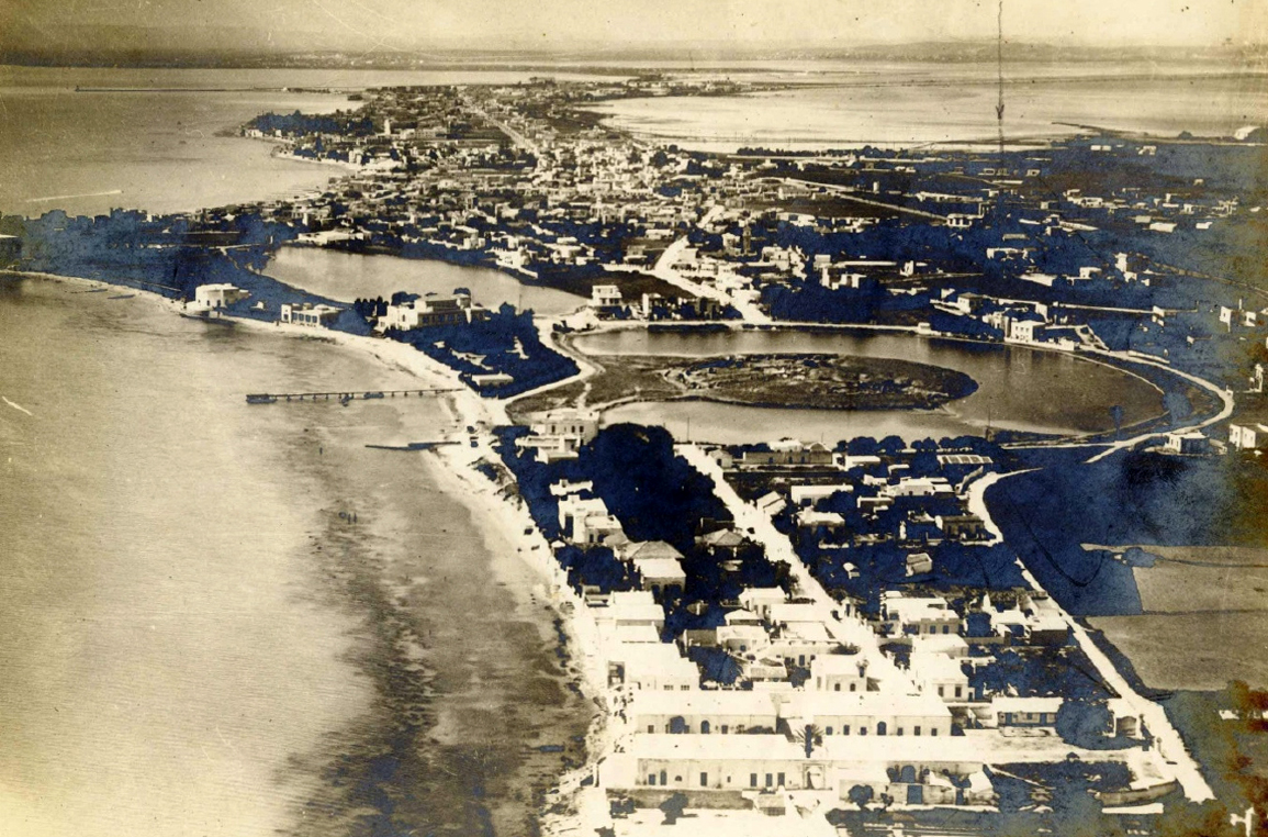
The fact that Carthage was ultimately important to Rome as a trading partner is evidenced by the fact that the city had its own representation in statio 18 on Piazzale delle Corporazioni in Ostia. Even today, Carthage has many places to visit that can testify to its rich past: the remains of the double artificial harbours, the amphitheatre, the aqueduct, the cisterns, the bathhouse of Antonius Pius, streets, villas and much more (click here for a video).
Despite the Roman destruction, some traces of the Phoenician city can still be found, such as the Tophet from the 8th century B.C., the Magon district from the 5th to 4th centuries B.C. and the Hannibal district near the St Louis Cathedral from the 3rd to 2nd centuries B.C.
The city is now on the UNESCO World Heritage List and hopefully funds will soon be released to further uncover this important port city.
- Sources
- - Henry Hurst: Understanding Carthage as a Roman Port
- - Encyclopædia_Britannica
- - Arthur de Graauw - www.AncientPortsAntiques.com
Notes- 1: Translation: Do you see that city which, after being forced by me to obey the Roman people, resumes old wars and cannot keep the peace?
- 2: Marcus Tullius Cicero 106 – 43 voor Chr. : De re publica 6.11
- 3: Photo- Wikipedia
- 4: Aeneis from Vergilius
- 5: Read article: Tyre, Birthplace of Europe!
- 6: María Eugenia Aubet, The Phoenicians and the West: Politics, Colonies, and Trade
- 7: Werner Huss, ‘Der Name der Byrsa von Karthago’, Klio, 1982, nr. LXIV, 1982, pp. 403–406
- 8: Giambattista Pittoni (1687–1767)
- 9: Not to be confused with present-day Mauretania. In ancient times it was situated on the north coast of Africa, roughly the area of today's Morocco and Algeria.
- 10: Photo: Pascal Radigue (Wikipedia)
- 11: Time Magazine - Servanda Est Carthago!
- 12: Photo: Collection personnelle Bertrand Bouret (Wikipedia)
- 13: Photo: Vividmaps.com
- 14: Appianus Alexandrinus; 95-165 AD) ancient Greek historian from Alexandria. Wrote Roman history from the republic to the middle of the second century in order of regions.
- 15: Annual supply of foodstuffs (mainly cereals) for the population of Rome.
- 16: Falbe C.T., Danish archaeologist: 1833. Recherches sur l’emplacement de Carthage. Paris.
- 17: Polybius- Greek historian (203 - 120 B.C.), held military and political posts and witnessed the destruction of Carthage as a friend of Scipio Aemilianus.
- 18: Lucius Marcius Censorinus, consul in 149 B.C.
- 19: Appianus Libyca 97, 99
- 20: Scipio Aemilianus: Roman military officer and politician. Brought down Carthage in the Third Punic War.
- 21: Where this entrance was located is not known. Probably on the south side of the northern mole or a passage from the round harbour to the sea.
- 22: Appianus Libyca 121-23
- 23: Procopius of Caesarea (500-565 AD) accompanied General Belisarius during the wars of the Emperor Justinian.
- 24: Flavius Belisarius (505-565 AD) One of the greatest generals of the Eastern Roman Empire. In the name of Justinian I of Byzantium he reconquered a large part of the lost Western Roman Empire.
- 25: Which city is involved is still uncertain.
- 26: Drawing from Yorke and Little 1975, Figures 4 and 8, Rakob 1991, Appendix 36, and Hurst 1999, Figure 2
- 27: Rakob F. 1991. Karthago, Band I. Die Deutschen Ausgrabungen in Karthago. Mainz. Beilagen 37-40
- 28: Appianus- Libyca 96
- 29: According to the report by Appianus, there were boxes for 220 ships; no fewer than 170 can be deduced from the archaeological remains (Hurst 1994, 39).
- 30: Pena 1998, 123, no 2: "After the consulship of Modestus and Arintheus [AD 373], 14 days before the calendar of March [16 February], we received Felix, weigher of olive oil at the Forum of Carthage, with the boat of ...."
- 31: Hurst 1994, 64-70
- 32: The Ilot as a "maritime agora" under Justinian: Procopius, De Aedifciis VI, v, 10 (see Hurst 1994, 114-115)
- 33: Bordy’s map of Carthago from 1897
- 34: De Roquefeuil Henri (1869 – 1928) French researcher
- 35: De Roquefeuil 1899, 36
- 36: Charles Saumage 1960, Le lungomare de Carthage romaine.
- 37: See 'Pompeiopolis, roman port in Turkey'
- 38: Appianus- Lybica 123-25
- 39: Rakob 1991. Annexes 37-40 give an overview of coastal development from the 5th century BC.
- 40: Photo: Henry Hurst
- 41: Confessions V, 8, 15,
- 42: Carton L., 1911. Le port marchand et le mur de mer de la Carthage punique. Revue
- 43: ‘Wall C’: Yorke and Davidson 1985, 161-162
- 44: Photo: Marcella Miriello/stock.adobe.com


 We are committed to providing versions of our articles and interviews in several languages, but our first language is English.