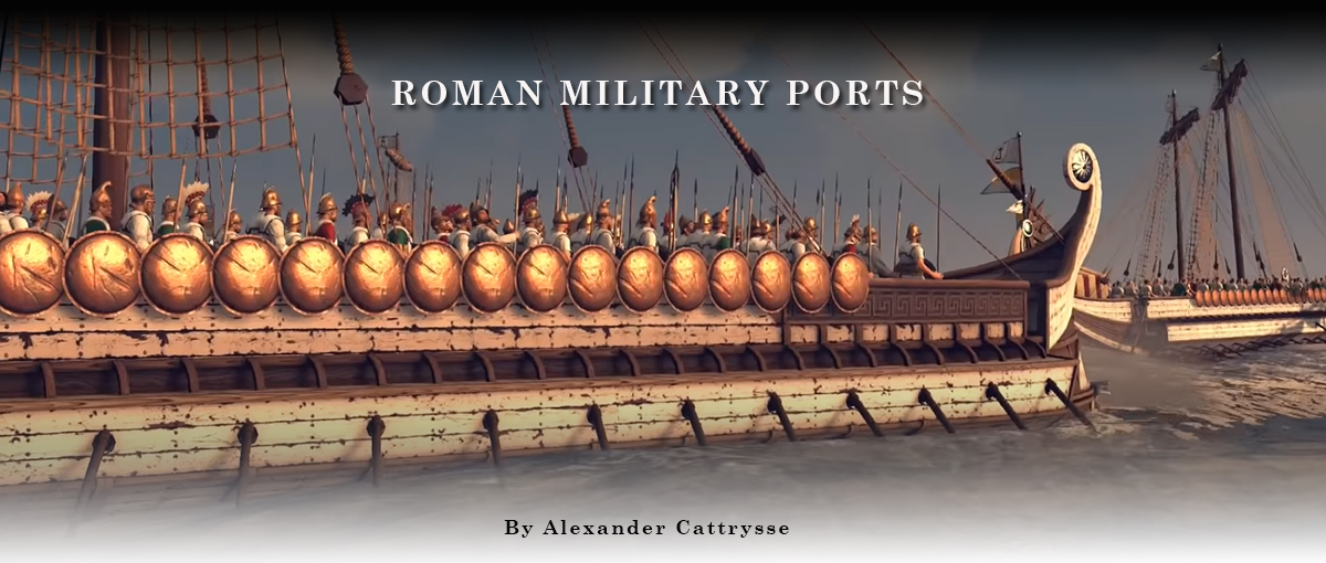
Preface
Until now, when we discussed Roman ports, we have always talked about civilian ports. Ports that mainly focused on trade. In addition, there were of course also ports built as military harbours, serving as home to the various war fleets of the Romans, the classis. In addition to ports specially constructed for the maintenance of a fleet, there were also civilian ports that had facilities to maintain warships on a regular base. Just like the land army, the fleet made use of temporary wooden ports that were demolished after they were abandoned.
The Romans also built harbours along rivers. These river ports often had a dual purpose in military terms. Firstly, they were used for military organization, and they also controlled the neighborhood.
What are Roman military ports?
A real definition of the Roman military port is difficult to give. There are, however, some characteristics that are expected to be found in a military port: berths are needed that are preferably out of sight, storage areas for the material and the boats. In addition, there was often a camp nearby or free spaces that could be used to supply the ships; where the crew could rest and wait for new orders; where ships were protected from the weather and where any damage could be repaired. In addition to these buildings, just as with civil ports, there were also horrea (warehouses), thermal baths, quays, lighthouses and temples. A good example of this is the port of Tarraco (todays Tarragona) on the east side of the Iberian peninsula (read also "Tarragona"). During the second Punic war in 218 BC. the Romans chose this city as a base to defeat the Carthaginians. They built, besides an artificial harbour for their ships, an army camp next to the existing village.
Finally, one should always keep in mind that not only the discovery of remains of military ships indicates a possible military port. TheRoman navy also had various ships at their disposal that carried out tasks such as the transport of men and / or goods for the maintenance of the fleet and its crew.
Evolution of the Roman port network from the late republic to the late imperial period.
At the end of the republican period, a maritime arms race took place. The Mediterranean became an important medium for the rapid movement of troops from point A to point B. Efforts started to build up a military fleet to transport and protect these troops. In addition, enemy troop transports had to be able to be stopped before they reached their destination.
During this period, the Romans in the west of the Mediterranean had only a limited infrastructure for their ships. They relied mainly on the ports and naval fleets of their allies in the eastern Mediterranean. A big exception to this was Brundisium. This port was located at a strategic point that guarded the passage to the Adriatic Sea, towards Greece and the Eastern world. Ownership of this port was therefore of great importance during the civil wars at the end of the republican period.
For the rest, the fleets mainly used temporary harbours and harbours that were actually built for commercial use.
A completely different situation arose in the east. Here several large cities had their own port infrastructure too and even the option of equipping and deploying their own naval fleet. As a result, whoever possessed the eastern part of the sea automatically had significant maritime power.
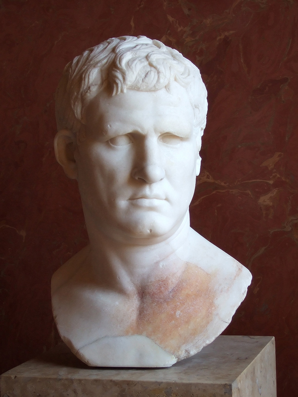
However, this situation would be changed by an important name in Roman maritime history, Agrippa2. In 38 BC. the triumvirate loses a naval battle against Pompey and lost its fleet. This called on Admiral Agrippa to work out a new fleet and port infrastructure. In 37 BC. Agrippa gave order to build the, for that period, important port of Portus Iulius by the architect Lucius Cocceius Auctus. (read: 'The ports of Campi Flegrei').
Already in 12 BC. Portus Iulius fell into disuse due to silting up and was replaced by new military ports on Italian territory. Towards the end of the reign of the Emperor Augustus, a military harbour was located in Ravenna on the east side of Italy and Misenum on the west side, close to the former military harbour of Portus Iulius. The latter was now a commercial port. Furthermore, the Romans started to build a network of ports both on the Italian peninsula and beyond. Partly made up of ports where ships could be built, repaired and maintained and partly of several “intermediate ports” located along the sea routes, that had the possibility to resupply ships on their voyages.
In the east of the Mediterranean, the former seaports were still used by military ships, but few will have had a permanent military fleet. There was an important fleet in Alexandria, the classis Alexandrina. Occasionally military naval units would also have been located at Athens and Cyzicus.
In addition, in Rhodes, Caesarea and Perinthos, there were some military allies who still had their own fleet.
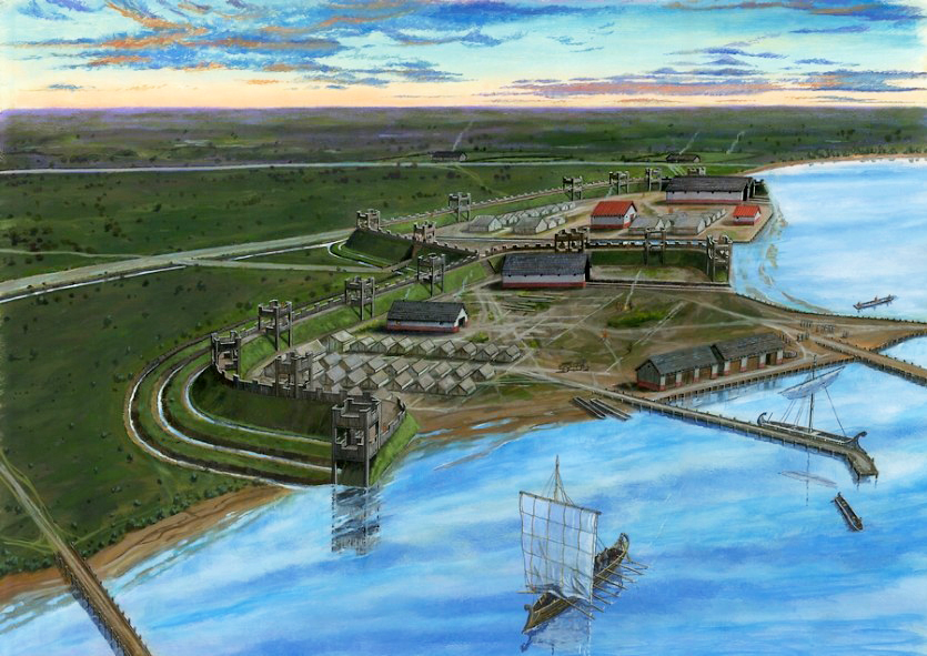
Finally, as a result of the conquests towards the north, ports will also manifest themselves along the river network of the new area with Cologne as the capital. In this context, several camps will be built along the various rivers that flow through the Germanic tribal areas and ended into the Lower Rhine. These rivers could be used as roads for the Romans but also as roads for the Germans. This made these rivers had to be extra secure. We will talk about these river ports later in a follow-up article. In this article we focus on some of the most famous sea ports that were used completely or partly for military purposes.
Towards the end of the first century or the beginning of the second century, a change occurred in the port infrastructure. Ravenna and Misenum still had an important fleet to protect Italy, but several of the smaller ports no longer played a military role. The emphasis shifted to guarding the borders. The establishment of the classis Britannica 4, the classis Pontica 5 and the classis Syriaca 6 must be placed in this context.
The late Roman period is less well known as far as port infrastructures are concerned. In Italy, both Misenum and Ravenna were still important ports. According to the Notitia Digitatum7 there would also have been a military port in Aquileia. In the east of the Mediterranean there were important naval fleets at Constantinople, Seleucia, Alexandria and Thesaloniki. The Notitia mentioned several military ports along the rivers in Gaul and along the Danube. So we see a disappearance of the large sea fleets that, through their great mobility, could defend a large territory. These were replaced by smaller units that operated only over a limited area. This meant that some border areas were no longer controlled by the military fleet and were therefore ravaged by pirates, such as along the Gallic, British and even the Spanish coast. In the East, however, people still worked with large sea fleets, such as the fleet of Constantinople. From this too you can deduce the greater power of the Eastern Roman Empire compared to the declining Western Roman Empire.
To begin with, let's take a closer look at various ports.
Roman military ports.
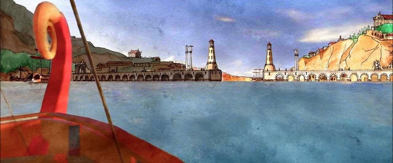
Alexandria
Alexandria already had a port with its own Ptolemaic fleet (see "Alexandria, the largest of all ports"). Although the first texts that speak about a Roman fleet in this port did not appear until the time of Caligula, it is quite possible that immediately after the defeat of the Egyptian fleet at the Battle of Actium, a Roman fleet was brought to Alexandria.
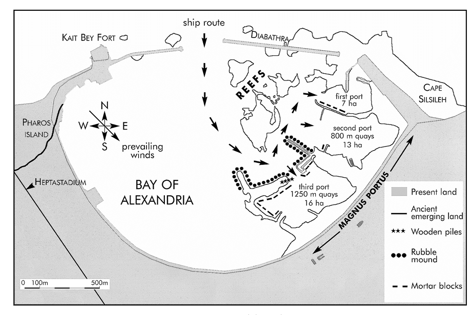
Alexandria port was dominated by the island of Pharos, which was connected to the mainland by an artificial road called Heptastadium. This road turned Pharos into a peninsula dividing the bay into a western basin, Eusnostos (old harbour), and an eastern basin, Portus Magnus (great harbour). The two basins were connected by two passageways in the Heptastadium, which were provided with a bridge8.
The eastern basin was divided into three inland basins. The most northerly consisted of the Royal Basin. To the south of this was a basin that was used as a temporary military port in Caesar's time. It had a peninsula on the south side, followed by a breakwater and two piers.
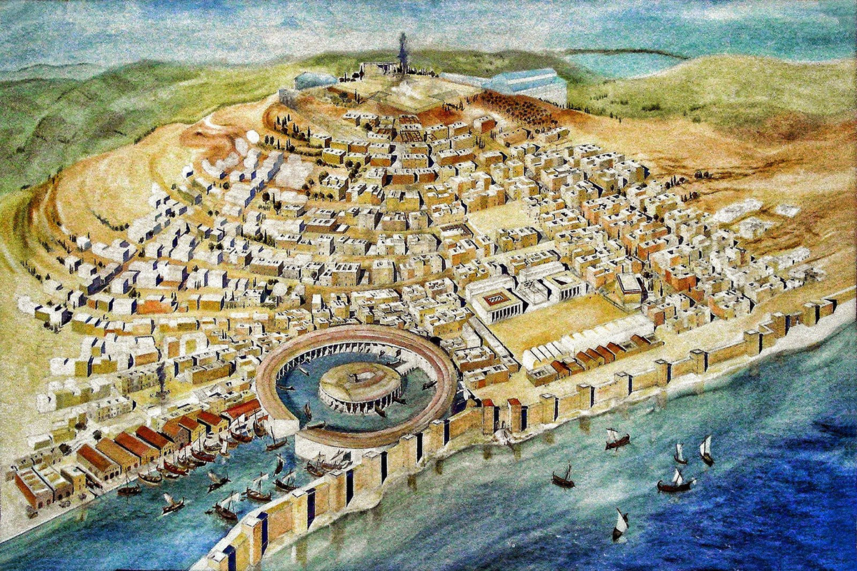
Sebastos (Caesarea)
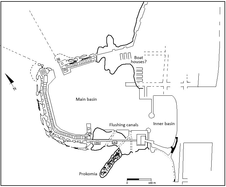
The question is whether Sebastos was a military port or not. If Herod, the builder of the port of Sebastos (see "A Jewish port for the emperor"), had his own fleet, it might have been stationed in Sebastos. The Jewish writer Josephus points out that Herod intended to build a harbour that could receive large armadas. It is therefore suspected that this port was built with the idea that the fleets that were on their way from Alexandria to Rome could shelter here from possible storms and other dangers. However, there have been found several structures that may indicate a military port. For example, three rectangular, parallel structures made of ashlar (a local building material) were found. They descended towards the middle basin of the harbour and are interpreted as ship sheds.
On the west side of the temple platform, four vaulted chambers were found on either side of the stairs. These were all interpreted as Horrea (warehouses). However, no closing wall has been found on the west side, so it is suspected that this may be a boathouse. It is possible that a wooden construction was used as a slope between these vaulted rooms and the harbour basin. What contradicts this interpretation is the size of the rooms. These are not large enough to store biremes9. They are large enough to hold small galleys. However, there is no hard evidence, neither in historical nor archaeological sources, to show whether the port was of a commercial or military nature.
Portus and Ostia
Ostia was an important military port during the republican period. As we can read in our article "A harbour for Rome", according to Quintus Ennius11, Ostia was initially founded as a naval base against attacks from sea. In the imperial period, however, commercial activity in the port began to play a major role. This does not mean that there were no more military ships at Ostia at the time. This port played an important role in the defense of the capital of the Roman Empire.
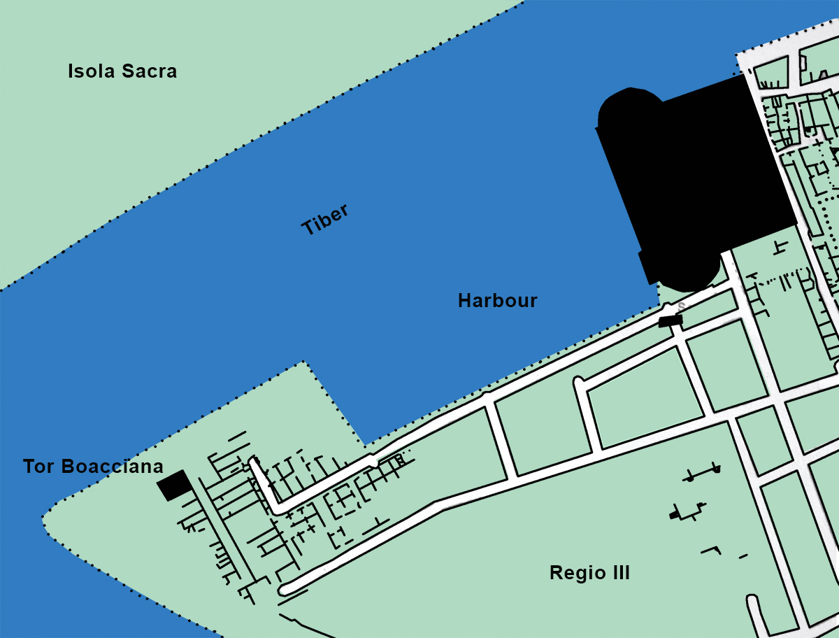
Recent research has shown that, in addition to the possible presence of warships in the nearby Portus, there may also have been military ships at the river port in Ostia12. from the year 50 AD onwards. The question now is: where were the structures needed to support the presence of these ships?
The river port of Ostia was an artificial inlet in the Tiber of some 100 meters with a length of 160-180 meters. On the east side of this basin was a large terrace built on vaulted spaces. There was a temple on the terrace. The rooms on the west side opened onto the Tiber and had a width of five meters and a height of 4.5 meters. With these dimensions, these rooms were not suitable for servicing seagoing vessels. These twelve chambers were probably used to maintain smaller warships intended to protect the mouth of the Tiber.
Further clues to the interpretation as ship houses can be found in the second room on the west side, as seen from the south side. In this space they found the start of a slipway that descended in a westerly direction and stopped at the water.
It is almost certain that warships lay in Portus, but there is currently nothing to say with certainty about the location of that military naval unit13.
Ancona
Ancona is an artificially constructed port along the Adriatic coast, possibly also used by the Roman navy (read: "The elbow that rules the Adriatic"). According to various researchers, Trajan would have sailed from this port on his second campaign against Dacia. This hypothesis is based on a scene from Trajan's column. Other researchers think that this is the port of Brundisium14.
According to Livius, Ancona had a naval base at her disposal during the Illyrian war of 178 BC.: ”profectus ab Aquileia consul castra ad lacum Timaui posuit; imminet mari is lacus. eodem decem nauibus C. Furius duumuir naualis uenit. aduersus Illyriorum classem creati duumuiri nauales erant, qui tuendae uiginti nauibus maris superi orae Anconam uelut cardinem haberent.”15
The port of Ancona was probably used by the Ravenna fleet.
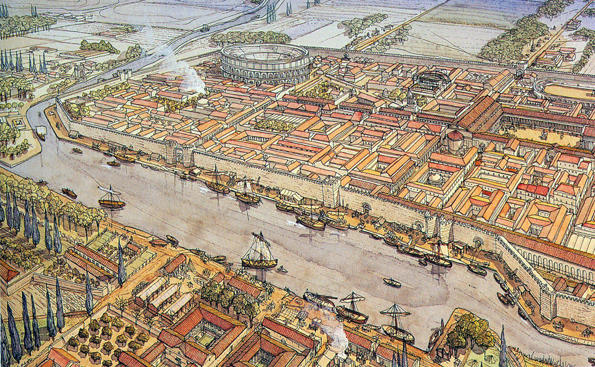
Ravenna
Two sources from the end of the twelfth century tell us that harbour works were already carried out at Ravenna under Julius Caesar. Ravenna was the headquarters where Caesar gathered his legions during his negotiations with the Roman Senate before crossing the Rubicon.
After the murder of Caesar, his successor Augustus also made use of this port. Here he built a part of its fleet between 39 and 38 BC. Augustus then stationed one of his two fleets responsible for the defense of the Italian peninsula in Ravenna.
The nearby forests made this port extremely suitable for the construction of shipyards for both the construction and the repair of ships. The city therefore became well-known for its shipbuilding. The choice for Ravenna to build a military port is not surprising. In addition to its location on the sea, it was also located in a swamp area. Only one road ran through this swamp, making the harbour very well defendable against possible attacks over land.
A canal, the Fossa Augusta, connected the River Po with Ravenna. This was supposed to be dug in the early 20s BC. to avoid the mouth of the river as it was difficult to navigate and dangerous.
The area looked a bit like a lagoon with inhabited islands. Between these islands were small lakes that could be used as harbour basins. In the early imperial period, the lagoon consisted of at least two important basins. The first was located southwest of the ancient city. To the east of it was the second basin which, through a natural channel, gave access to the sea. Here, excavations have found traces of the harbour from the time of Augustus. The harbour is completely surrounded by burial fields. The inscriptions on the graves show that there was a military fleet at Ravenna. Between the sea and the harbour basin was also the classe (the name of the district where the harbour was located) itself. It may have been surrounded by a wall.
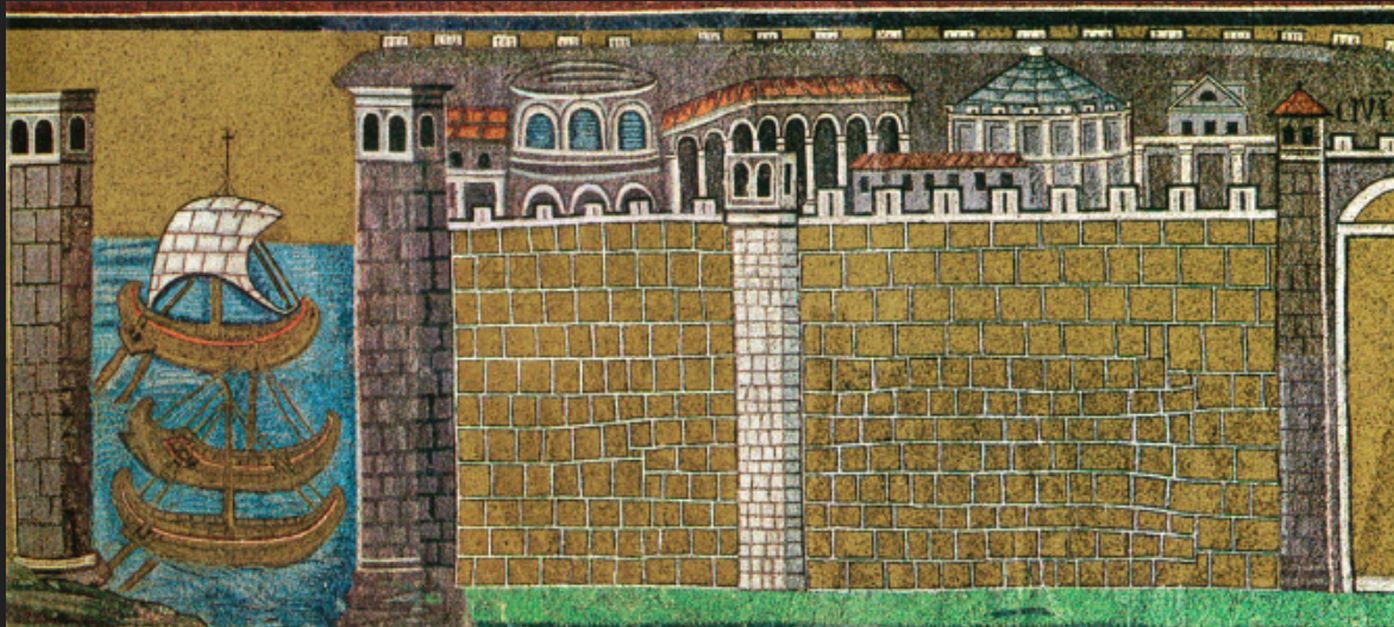
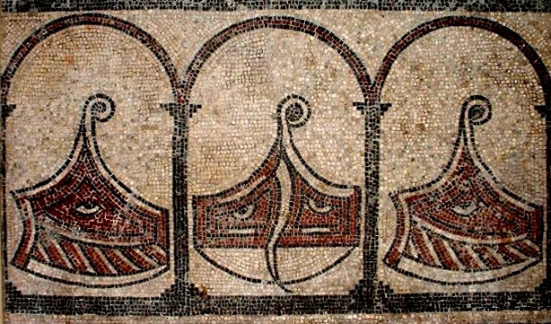
On one of the larger islands, a building with perpendicular walls measuring one hundred by fifty-six meters was found. This construction was interpreted by many as the possible naval base. However, the plan of the above camp rather resembles the plan of a Horreum (warehouse). This does not exclude the possibility that it would still be a building with a military function. But the dimensions of the building rule out that it would be a castrum (an inscription at Populonia and a papyrus found at Fayoum show that there was a camp of the castrum type at Ravenna). With this port, just like many ports, it is not certain whether it was only a military port. It is quite possible that the port was also used for economic purposes. The classis itself also remains in use throughout Roman times. Evidence for this is provided by a mosaic found in the San Apollinare Nuovo. Here we see the port entrance guarded by two square watchtowers with space provided for placing guns. However, there are cargo boats in the harbour. This shows that by this period the port was thus used for both military and commercial purposes.
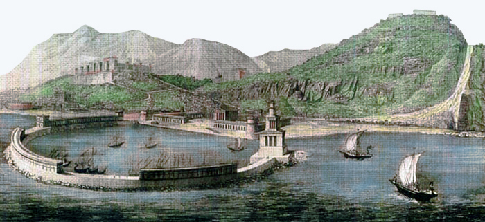
Portus Iulius
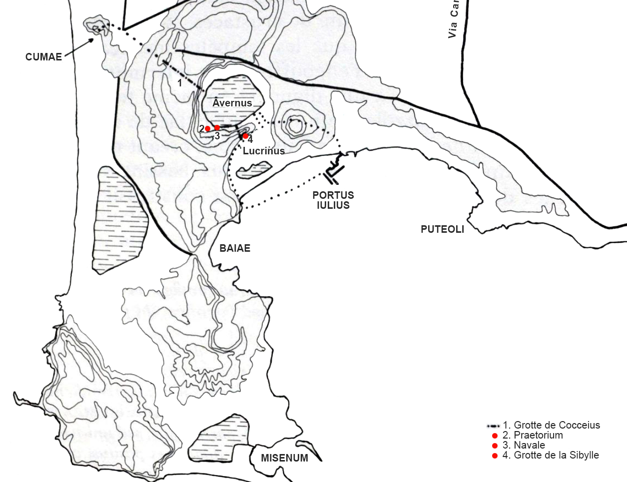
In the spring of the year 38 BC. Octavian's fleet was in danger of wrecking, because they did not have a proper home port where the fleet could withdraw after the naval battle against Sextus Pompeius18. There was a need for a port in the fleet's operational zone.
Octavian had entrusted Agrippa to fight the pirates in the Mediterranean. He chose the region of lakes Lucrinus and Avernus to build a harbour, the Portus Iulius. Lake Lucrinus was separated from the sea by a narrow storm-ravaged coastline. Agrippa built a dam on this coastal strip and opened the lake to the bay of Puteoli. On the other side of the lake he made an opening to Lake Avernus. This dam was named Opus Iulium. He created a harbour with two basins that, by means of this dam, offered good protection against storms.
Nowadays the lake seems quite small and therefore not suitable for the construction of a fleet harbour. However, the lake has shrunk significantly as a result of a volcanic eruption in 1538.
The passage between the open sea and Lake Lucrinus was ensured by three bridged passages. Two tunnels found were probably built by Agrippa. The first would have been a connecting tunnel between Portus Iulius and the nearby port of Cumae. We’re talking about “la cave de Coceius”. It is a tunnel of one kilometer long that was wide enough to allow passage for a cart. It was probably built to be able to resupply the fleet through the Misenum peninsula without having to round the dangerous promontory of Misenum, exposing itself to Pompey's fleet on the island of Ischia.
The “cave de la Sibylle” must also be considered in the same light. It is a 203 meter long and 3.60 to 3.80 meter wide tunnel that would have provided communication between the two harbour basins. However, these theories have yet to be archaeologically confirmed.
Aerial photography discovered at the bottom of Lake Lucrinus into the water harbour structures. There was an external dike, an entrance channel and various shops on the edge of the harbour basins. In addition, the photos show that many of the buildings are made of brick. These could be from the time of Augustus or perhaps a little bit older, but none of the buildings found can be attributed to the Portus Iulius of Agrippa.
According to Strabo19 , the Lucrinus basin was no longer be suitable for large, heavy ships by the year 18 AD and it was once again used as an oyster farm, as was the case before the construction of the harbour by Agrippa. The lake suffered greatly from silting up and, according to Pliny the elder under Claudius, the lake was even closed off from the sea by means of dams.
It is likely that the design of the port as a military base was only temporary and the structures related to it were therefore made of wood.
Forum Iulii
Forum Iulii, today's Frejus on the French south coast, played an important role as a naval port in the early Roman Empire. Forum Iulii, built between 31 and 27 BC, was a veteran colony called ‘Octavanorum colonia quae paceensis appellatur et classica’.
In 31 BC, Octavian moved part of the fleet to Forum Iulii. During the second triumvirate, this port mainly played a role as a basis for actions against Sextus Pompeius18. Even after the victory of Ocatvianus over Antonius, there should have been military units in Fréjus. They are said to have played a logistical role in supplying the legions that were located in Gaul. From inscriptions we know names of two soldiers who should have come from this port. Strabo also mentions the presence of a fleet at Fréjus in his time. Even in the troubled times after Nero's death, it appears that, when Forum Iulii falls into Flavian hands, it still had a fleet. After this period it was probably moved. In 69 the port would have lost its right to exist.
Misenum
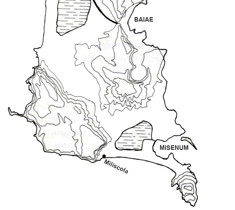
Misenum is considered Italy's most important military port. However, there is no certainty about the foundation date of this port. The texts of the Roman historians Suetonius and Tacitus assume that the port was founded by the Emperor Augustus. As terminus post quem (lower limit) we take the year 31 BC. Before the battle of Actium, the main port was that of Forum Iulii. Therefore there are no indications that the port would have been founded before this date. As terminus ante quem (upper limit) 12 BC. has been pushed forward. This is the year in which Agrippa died. It is believed that Agrippa was responsible for the construction of Misenum because the harbour, like Portus Iulius, consisted of an inland lake with a natural outer harbour, which gave access to the open sea. Although these ports are similar, there is no hard evidence that Agrippa actually built Misenum. From written sources we know that there was both a military base and a civilian settlement at Misenum. It cannot be ruled out that both types of settlements overlapped.
During excavations a theater was found that showed that the civil part of the city was located on the cape of Misenum. However, the location of the fleet is still under discussion. Among other places, Miliscola is mentioned as a possible location, as the name of this place is interpreted as a contraction of the Latin words Militum and Schola, which seems to confirm the military function of the zone.
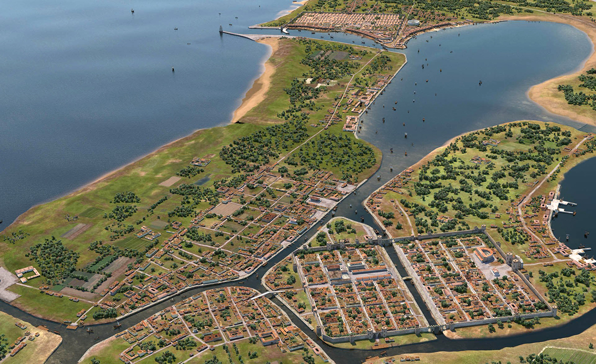
Aquileia
Aquileia is located at the head of Adriatic Sea behind the lagoons and connected to the sea by the river Natiso. Around 181 BC, built as a border fortress, it quickly became an important trading port, partly because many roads were running from here to the south and west of Italy as well as to the northeast. It may therefore be assumed that there was also a military detachment in the port. Clues are various funeral inscriptions referring to the fleet and the Notititia Dignitatum. This shows that in late Roman times the port had its own fleet, the classis Venetum, which operated in the north of the Adriatic and provided communication with the imperial capitals in the Po Valley (Ravenna and Milan) and with Dalmatia.
The question now is to what extent the harbour was used for military purposes in the period between Augustus and the late Roman period. Inscriptions found reveal a wide variety of military ranks, from the milites (ground troops) to the trierarchia (commander of a trireme22). In terms of dating, they can all be placed in the first century AD. According to some researchers, these graves should be more likely associated with those who died on patrol and then buried in Aquileia. There are also three graves of veterans of the Ravenna fleet. In any case, the dating does not proof that after the first century AD, and certainly not after the Julio-Claudius period, a naval unit could be found in Aquileia.
Where could this possible port of Aquileia have been located? It has been suggested that Grado would have served as a sea harbour.
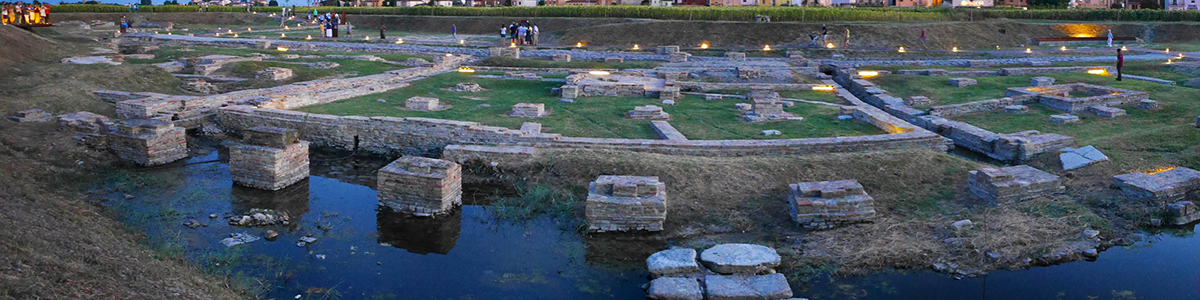
The only port we know, however, is the river port of Aquileia. It consists of a 48 meters wide and 330 meters long canal, which was supplied with water from the Natiso River. This was east of the city and, according to Strabo, about eleven kilometers from the sea. However, this port channel seems to have had a mainly commercial function. No indications have been found at the spot that this port would have been used for military purposes.
Centumcellae
Centumcellae, now Civitavecchia, was probably a second base of both the fleet ofMisenum and of Ravenna. This is evidenced by about twenty inscriptions that have been found here.
The port is said to have been founded by Trajan (read: "Centumcellae, the port of Trajan").
To the south of the 16th century fortress Michelangelo, excavations have found walls that were placed perpendicular to the basin. Remains of mosaics, paintings and marble were found there. The hypothesis of this structure is that one is dealing here with the navalia (yards) and the quarters for the officers who in command over the ships situated in Centumcellae.
Tarracina
This port on the Tyrrhenian coast south of Rome was built under the Emperor Trajan on the site of probably a small local harbour. Antonius Pius renovated this harbour to create an intermediate station for the fleet from Misenum.
The basin of this artificial harbour was formed by two dikes that protruded into the sea from the coast (read also "Tarracina, the fourth harbour of Trajan").
Other Mediterranean Military Ports..
The ports mentioned above are just a selection of the main military ports. Of course there were many more ports with a military function such as Puteoli, Trapezus, Antium and Pompeiopolis. Brundisium was an important military port during the republican period and the civil wars. However, its military importance diminished with the establishment of a military port at Ravenna.
Marseille and Carthage also played a role as military ports for the period discussed here. The fleet of Marseilles was defeated by Caesar in the year 49 BC. The harbour, located at La Bourse, was given a commercial function under Roman rule.
There were two ports in Carthage. A circular and rectangular harbour connected to each other. During the Punic period, the port had 140 boathouses and room for 220 ships. The port was put back into use when the Romans built a new city on the same spot after the destruction of Carthago. The harbour was dredged under the Emperor Augustus. However, it seems that in Roman times the port had more a commercial function.
General characteristics
Military ports were an exception in the Roman Empire until the beginning of the civil wars prior to the Roman Empire. As a result of these civil wars, however, they were forced to expand their own military fleet and as a result to build several military ports. The urgent need for these ports can be deduced from the construction of the ports Forum Iulii and Portus Iulius. Both harbours were used for a short time, the military infrastructure at Portus Iulius was probably even made of wood, which clearly indicates the temporary useful life of the harbour. Forum Iulii seems to have been built for a slightly longer useful life, which is noticeable in the different types of stone used for this harbour that are still visible in the landscape today. Before the year 69 BC could begin, this port was already abandoned, probably for the benefit of the newly built military ports of Ravenna and Misenum. These ports became the main military ports of the Roman Empire.
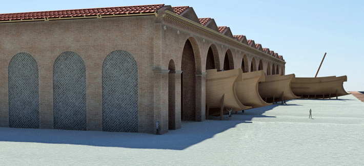
The associated military camps are certainly not well known at all ports. However, it is known that the navy also had army camps. They had a wall with towers, two main roads, communal buildings and barracks. Logically, these ports were also located near the port itself. In Latin texts the terms Textrinum (weaving mills for, among other, rope) are used, which refers to buildings for the composition and equipment of boats, in addition, one also speaks of Navalia, (boathouses). Usually the word Navalia refers also to the complete infrastructure and these navalia are even used sometimes to refer to non-military port infrastructure.
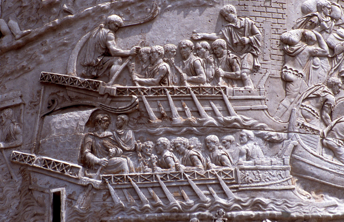
We can probably consider the battle of Actium (September 2, 31 BC) as the last naval battle where heavy vessels were used to ram each other. These were kept in large storage houses where they remained dry until they had to be used for a naval battle(see video). They were replaced in the Roman Empire by light, movable vessels with soldiers on board. When close enough to the enemy ship wooden bridges were placed between the own and the enemy ship to board the boat.
The use of smaller, lighter craft also had an impact on the construction of the ports. For example, according to Raban, due to the use of smaller vessels, navalia would no longer be used in Roman ports.
Reddé also wondered whether these navalia / textrinum occurred in the imperial period. As the main evidence he cites iconographic evidence such as a mosaic found at Via Ardeatina, another found at Pompei and the “La Grange du Bief” mosaic from a villa north of Lyon, which is said to depict these buildings. These depictions, however, are all from the republican period, with the exception of the La Grange du Bief mosaic, which was dated by Guey J. (French historian) in the early second century AD, but others dated the mosaic to the late republican, early Augustinian period.
We have already talked about ports outside the Mediterranean and along the various rivers. As mentioned earlier, we will discuss these later in a subsequent article on military ports.
- Sources
- - Masterproef Alexander Cattrysse: Vergelijkende studie van de Romeinse militaire haveninfrastructuren (eerste eeuw voor Chr. tot de tweede eeuw na Chr.) Gent 2009/2010
- - Reddé M. 1986. Mare Nostrum. Les infrastructures, le dispositive, et l’histoire de la marine militaire sou l’empire Romain, Ecole Française de Rome, Palais Farnèse: Rome.
- - Van Daele B. 2006. De Romeinse marine. Davidsfonds: Leuven.
- - Van Tent W.J. . 1994. Vechten – Fectio in Van Es W.A. & Hessing W.A.M. 1994. Romeinen, Friezen en Franken in het hat van Nederland, van Traiectum tot Dorestad 50 voor Chr. tot 900 n.c. Rijksdienst voor het Oudheidkundig Bodemonderzoek: Amersfoort
- - Konen H.C. 2000. Classis Germanica: die römische Rheinflotte im 1.-3. Jahrhundert n.Chr.,Pharos: Studien zur griechisch-römischen Antike Band XV. Scripta Mercaturae Verlag: St. Katharinen.
- - Oleson J.P. & Branton G. 1992. The technology of king Herod’s harbour in Vann R.L. (ed.). Caesarea papers: Straton‟s tower, herod‟s harbour, and Roman and Byzantine Caesarea, Journal of Roman Archaeology, supplementary series number 5: 49-67
- - Viereck H.D.L. 1975. Die römische flotte: Classis Romana. Koehlers Verlagsgesellschaft mbH: Herford.
- - Rivet. A.L.F. 1988. Gallia Narbonensis: Southern France in Roman Times. B.T. Batsford Ltd: London
- - Raban A. 2009. The harbor of Sebastos (Caesarea Maritima) in its Roman Mediterranean Context, BAR International Series 1930. Hadrian Books Ltd: Oxford.
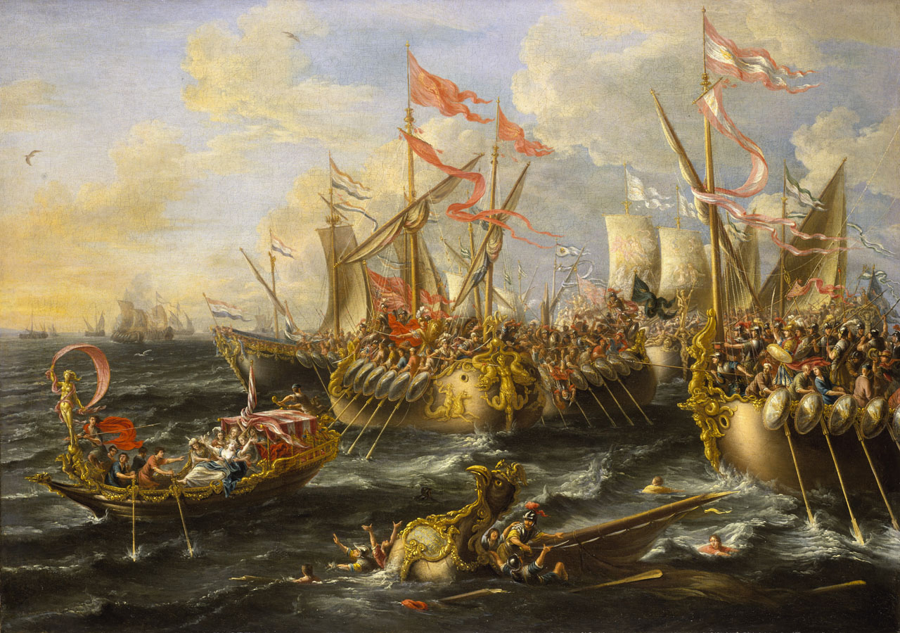
Notes- 1:Battle at Actium van Lorenzo A. Castro (1664 -1700); National Maritime Museum
- 2: Marcus Vipsanius Agrippa (63 BC – 12 BC). Roman general
- 3: Photo Agrippa: Louvre. Copyright-Wikipedia (Shawn Lipowski)
- 4:The Classis Britannica was the Roman military fleet on the Channel, mainly intended to protect the waterways between the province of Britannia and the European mainland. The main bases of the fleet were at Gesoriacum (Boulogne-sur-Mer), the fleet's headquarters, and Portus Dubris (Dover).
- 5:The Classis Pontica was a provincial fleet, initially established by Augustus and then permanently stationed in the Black Sea by Nero (around 57).
- 6:The Classis Syriaca was a provincial fleet founded by Tiberius or Vespasian. She was tasked with guarding the northeastern Mediterranean along the coasts of Syria, Judea and South Asia Minor.
- 7:The Notitia dignitatum, the "List of Dignitaries", is an overview of all administrative and administrative functions and their weapons in the Roman Empire from the early fifth century AD.
- 8:Strabo 17, I: 6-9 & 10 en Raban, 2009: 153-154.
- 9:Bireme - warship that was propelled by oarsmen on two levels
- 10: Read also:'The first harbour of ancient Rome'.
- 11: Quintus Ennius (239-169 v.Chr.); a Latin poet.
- 12: Heinzelmann & Martin, 2002: 16.
- 13: Read also: 'Portus, the imperial harbour of Rome’.
- 14: Reddé, 1986: 218
- 15: Livius xli.i - Translation: The consul, departed from Aquileia, camped at the Lake of Timavus; this lake is located by the sea. Gaius Furius, the captain of the ships, came there with ten ships. In order to attack the fleet of the Illyrians, two naval supervisors had been appointed for the ships, whose center was Ancona, to guard the coast of the Adriatic with twenty ships.
- 16: Photo: www.ravennantica.it
- 17: Photo: https://www.foodandsoon.com
- 18:Sextus Pompeius Magnus Pius, in short, Sextus Pompeius (c. 68 BC - Miletus, 35 BC) was a Roman general. He resisted the murder of his father, Gnaeus Pompeius Magnus, in 48 BC. against Gaius Julius Caesar and later against the Second Triumvirate. With him the resistance against the Triumvirate died.
- 19: Strabo (64 BC. – 24 AD.)- Grieks historicus, geograaf en filosoof
- 20: Forum Iulii artist impression : The French History Podcast
- 21: Photo: A. Ocram (Wikipedia)
- 22: Trireme - warship propelled by rowers on three levels
- 23: Photo: www.reddit.com
- 24: Photo: Albert Samuy and Arsène Perez


 We are committed to providing versions of our articles and interviews in several languages, but our first language is English.