14 Aug 2018

Finalement, il s’agit de personnes(anglais)

Photo 1: Visitors at the maritime museum of Santa Severa (Italy)1

Report: Gerard Huissen

History, and, of course, archaeology, enjoys an increasing interest nowadays. Throughout the year hundreds of thousands of people visit archaeological excavations, ancient cities and museums. Also organizations that pay attention to these topics, such as Roman Ports, got out there and make some noise. What motivates all those people to look at the past? Of course the art, architecture, etc., but ultimately, we look mainly at the way people lived in the past, what they did, how they set up their lifes and tried to solve their problems. In short: how much did our ancestors differ from us?

Photo 2: Floor mosaic in which a personal name is mentioned.2

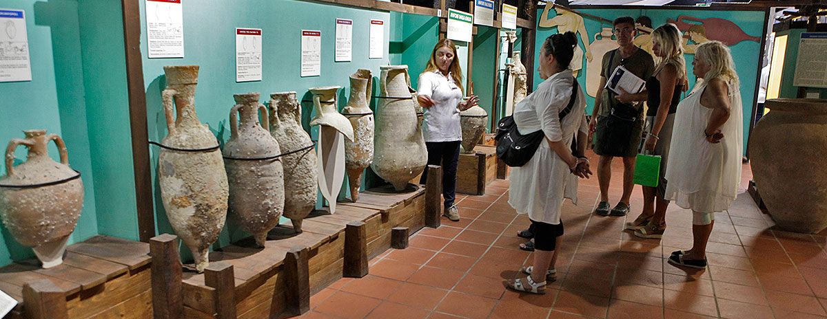
Everyday life of the common man

Photo 3: close up of Photo 2 3
Of course, nowadays we know many about the upper class, those in authority, emperors, senators and other important figures on which much has been handed down. About the common man not much is known. Sometimes we find names mentioned on mosaics, inscriptions or as donor of a statue or monument. But nothing more.
However, we do have still a source of some citizens. A resource that brings us even closer to a person than we ever imagined and sometimes even shares a personal side of what once was ruling his life. I’m talking about the many ancient cemeteries that survived the test of time.
The Roman Cemetery of Portus on the Isola Sacra.
There have been found many cemeteries around the world. One more spectacular than the other. Because we are concerning with Roman ports, I would like to take you to my favourite cemetery, the necropolis of Isola Sacra.
Photo 4: Tombs on the necropolis of Isola Sacra.
Some years ago I described this cemetery for the website www.ostia-antica.org and visualized the most important 100 tombs4
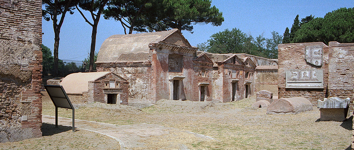
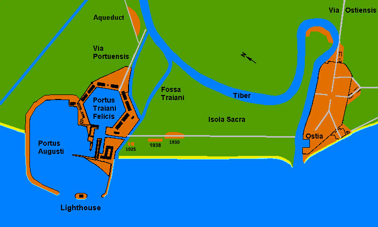
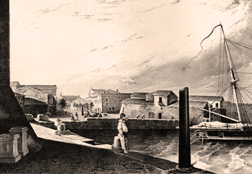
IIsola Sacra is an artificial island formed on the west side by the sea, on the south and East side by the River Tiber (which bends) and the canal, dug by Trajan, to connect the Portus Harbour with the river Tiber on the north side. From Ostia the island was reachable by a ferry across the Tiber and from Portus via a bridge over the Canal of Trajan. The ' inhabitants ' of this Cemetery (as far as we know) all came from Portus.
Photo 5: Small tomb on the so called ' field of the poor'
on the cemetery from Isola Sacra. 8
In an earlier articleI wrote extensively about this official necropolis that was excavated in 1930 by professor Guido Calza. In 1938, a second part of this necropolis was excavated. This last part is covered again and lies, invisible, under a farmyard.
All found texts on sarcophagi, tomb inscriptions etc. are classified in 1952, described and interpreted by the Swedish Classicist Hilding Thylander6.
In 2007 a new research, with improved insights, was published under the direction of the head of the Finnish Institute in Rome Anne Helttula7. On these texts many tragedies can be read. Because these are the only personal data of the people who lived and worked in that place at that time, any tangible evidence must be nurtured. This brings us to the topic I actually would like to talk about
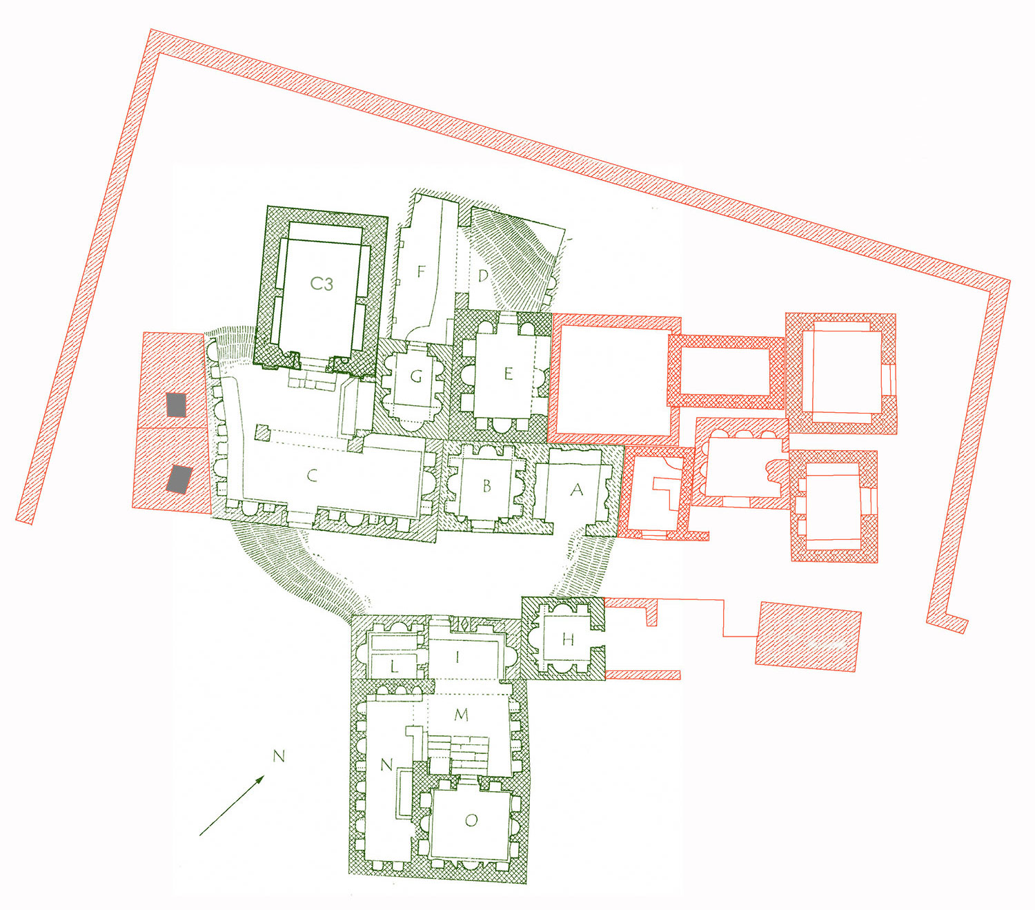
plan1a


The Canal Tombs.

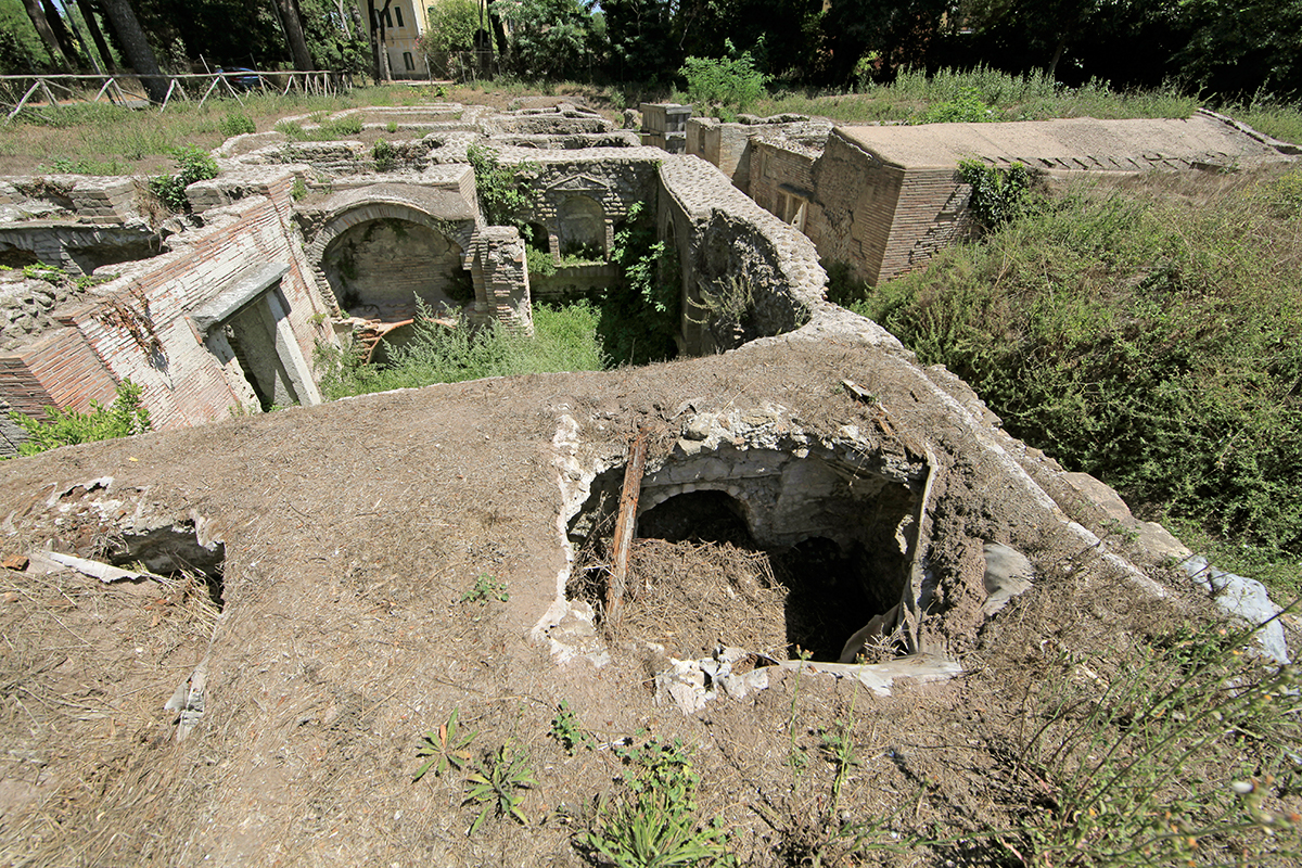
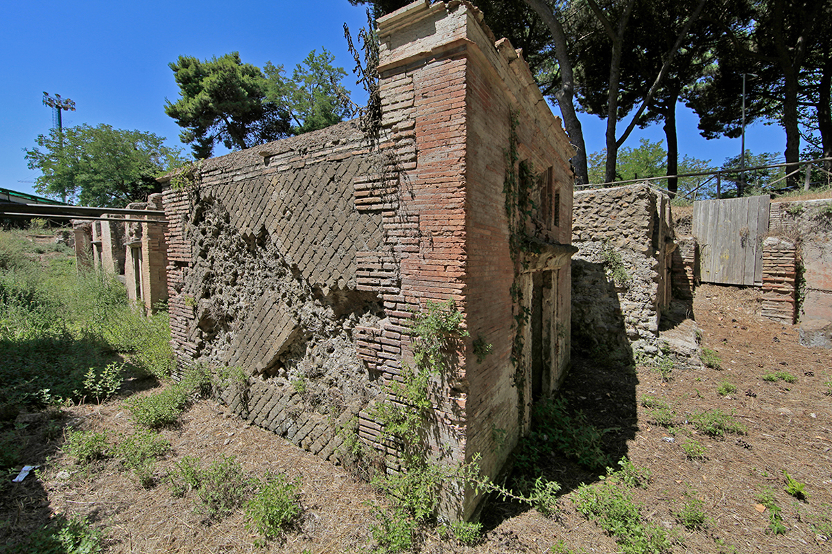
In 2005 I drove along the official necropolis of Isola Sacra towards the Via Redipuglia, the road that leads to Fiumicino Sud. Along this street, in line with the large cemetery, I saw a small, bad railed excavation with a number of tombs. A large sign, which was completely faded, stood desolated at an unreadable distance away from the fence.
Photo 7: the cluster tombs along the road to Fiumicino Sud
Because that time I was working on the description of the great cemetery, I asked various archaeologists what they could tell me about this small cluster of tombs. The big silence started. It seemed like these graves had come forth from the ground yesterday and nobody had taken notice. After a lot of searching I got a photocopy with the description of a part of these tombs. They should have been excavated already in 1925 by Guido Calza, five years before for the well-known part of the necropolis was unearthed (1930). Because the location of this cluster of tombs is close to the former Canal of Trajan we called them the "Canal Tombs ', a name you will definitely not find in official documents, as far as there are documents anyway. On the photocopy was a floor plan with the description of the corresponding tombs with the following indications: Tomb A till I, L, M, N, and O. Later on I found a separate description of a Tomb C3 (see the plan at the bottom of this article)
Photo 9: Interior of Tomb C3
Photo 8: View from the NW. On the foreground Tomb C3


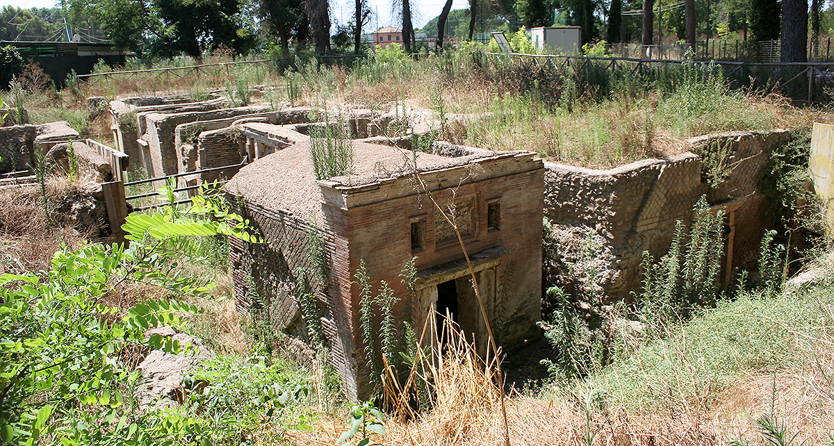
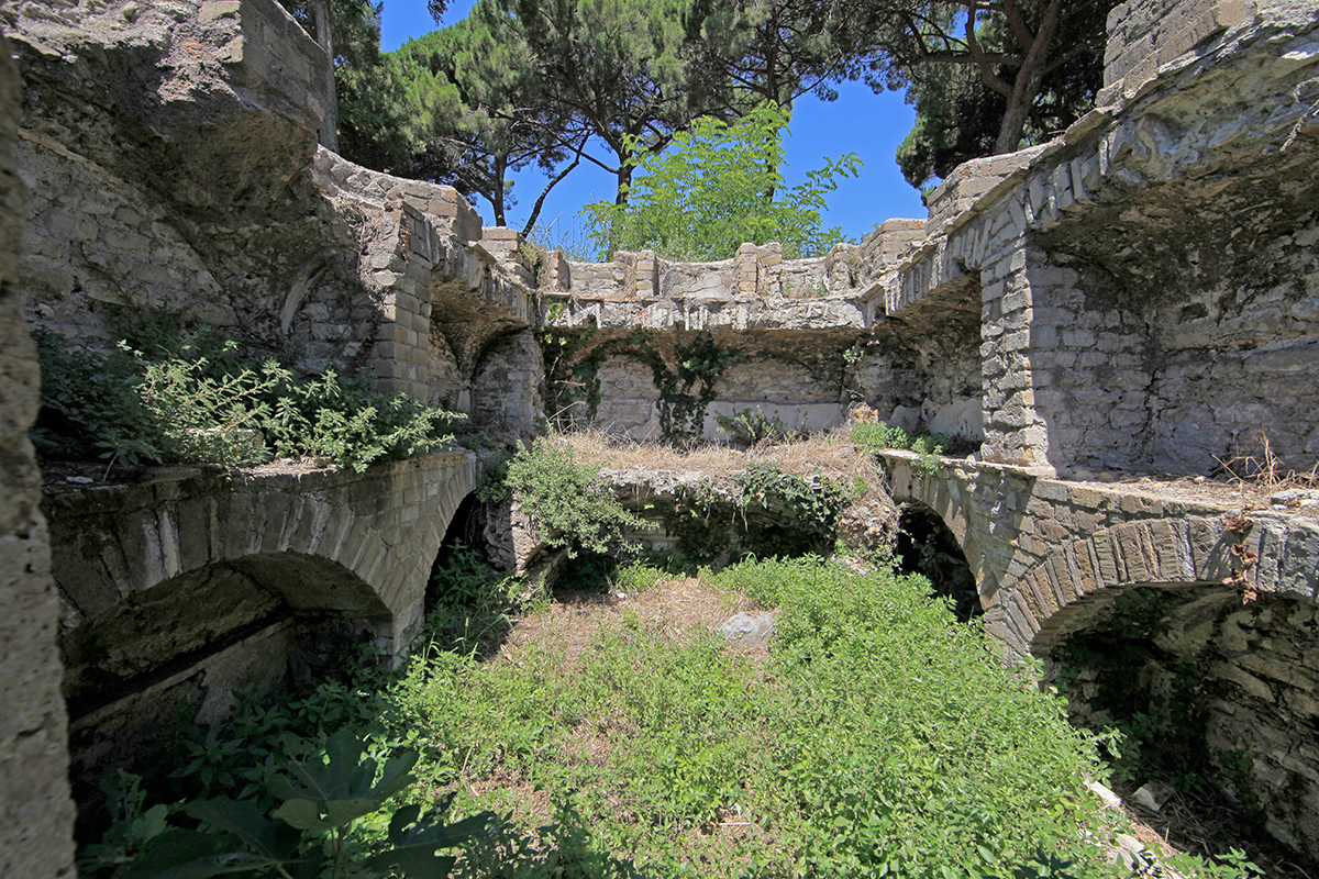
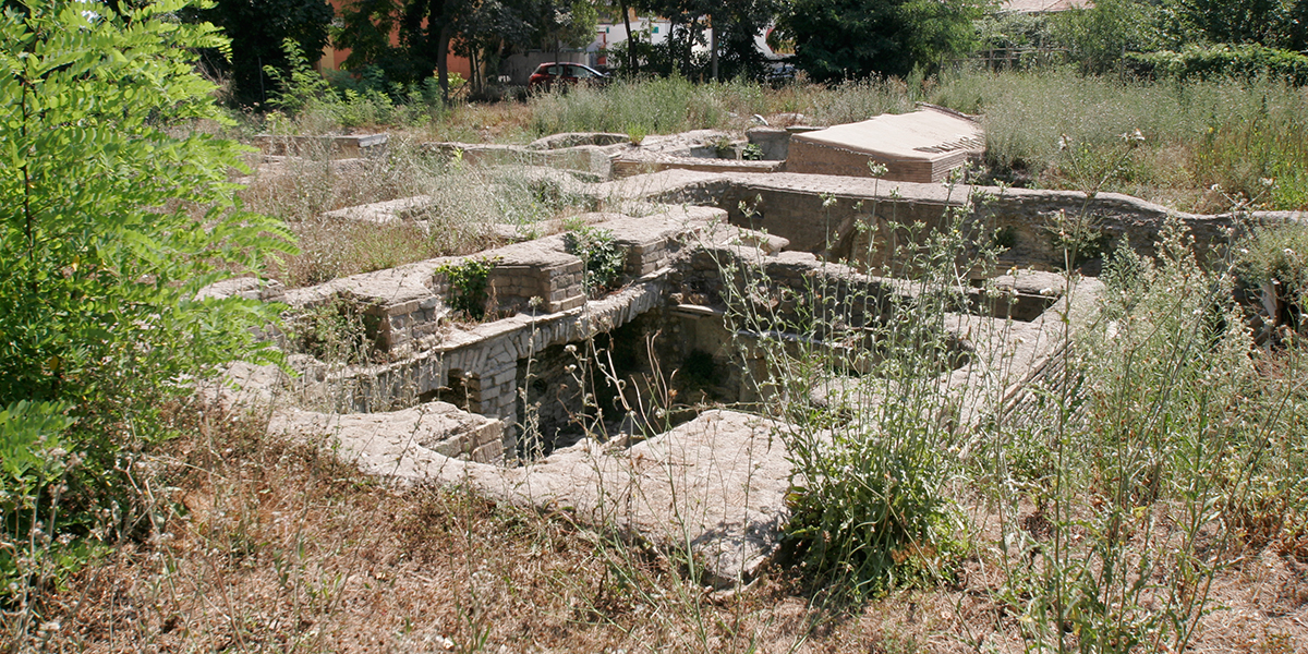
Time to check it out myself. The adjacent football field was to be renovated and the fence was partially removed. As a true explorer I went down into the great pit with the tombs which I shot with my camera from every possible angle9. From above I noticed that there were more tombs to excavate, and some had already been entered by a hole in the ceiling. On the east side of the cluster of tombs the walls were propped up.
Photo 10: The group of graves with partially opened (not described) tombs in the foreground. Behind them we see tomb C with the door to C3 on the left side.
Home again with my photos I compared them with the available map. I immediately noticed that something strange was going on. There were clearly more tombs than listed on the map. On the basis of the Struts I could see exactly which tombs were subscribed and which were not. Thylander’s map from 1928 shows the already mentioned graves with the exception of C3. Maybe C3 and the undescribed tombs were not excavated and/or described yet. But then I looked in the book of Anne Helttula from 2007. Unfortunately it seems that Helttula apparently leans on Thylander because he shows exactly the same map, even without C3, which was already described in 2007 too.
Photo 11: The two most Eastern, undocumented, tombs (see also photo 7). Behind them a part of the Struts.
Up to this day inquiring didn’t achieve anything. Because these graves were apparently the closest to Portus we may assume that we have to deal with the oldest graves at, what used to be, one big cemetery. It seems to me so incredibly important, partly because the available data of the antique fellow humans is already so scarce, to save this piece of heritage very well. On the basis of my own data, photos and Google earth, I took the liberty to make a reconstruction of the currently visible part of the Canal Tombs. Now let's hope that someone will reply to tell me more about this unique tombs, so that they don’t, literally and figuratively speaking, disappear into oblivion.
plan scavi 1925C3
Map Canal Tombs. Green: the existing card (with later added Tomb C3). Red: my own additions. 

  • notes:
  • 1:Read our article 'Santa Severa, a town behind a bathing resort'
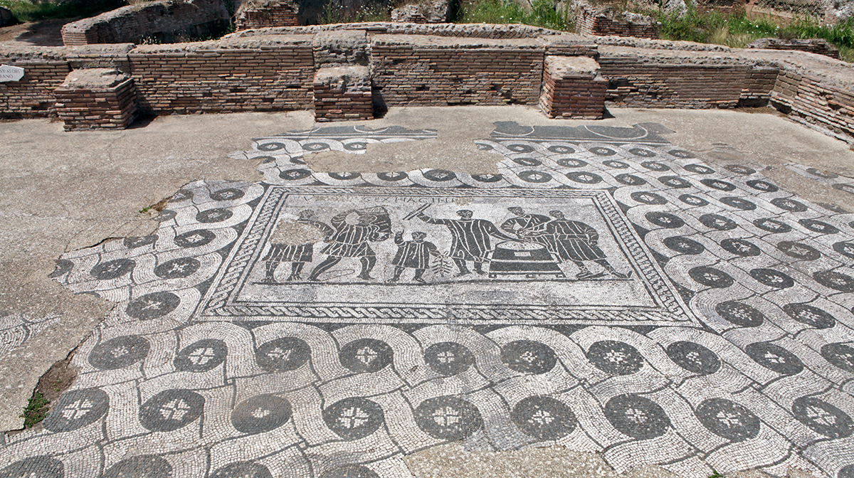
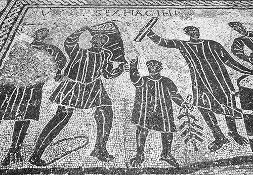
  • 2:Floor mosaic in the Aula dei Mensores (hall of the grain measurers) at Ostia.
  • 3:The text says: V[...]SEXHAGIHI[...] Becatti interpreted this as v[ilici] sex h(orreorum) Agi(lianorum) hi[c], "Here are six employees of the horrea of Agilianis"
  • 4:http://ostia-antica.org/valkvisuals/index.htm
  • 5: Read our article 'A place without fear'
  • 6: Hilding Thylander: Inscriptions du Port D'Ostie: Lund-CWK Gleerup: 1952
  • 7:Le iscrizioni sepolcrali latine nell'Isola Sacra. Sotto la direzione di Anne Helttula-edizione a cura di Anne Helltula, Tryggve Gestrin, Maijastina Kahlos, Reija Pentti-Tuomisto, Pekka Tuomisto, Raija Vainio en Risto Valjus. Roma 2007
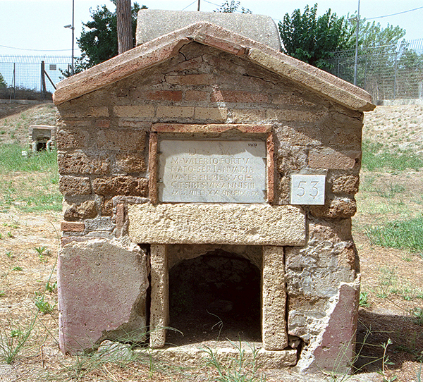
  • 8: The text on the tomb tells us that it had been made for Marcus Valerius Fortunatus by his mother Sergia Ianuaria, but also for herself. Marcus Valerius died at the age of three years, eight months and twentyfive days.
  • 9:See http://ostia-antica.org/valkvisuals/html/canaltomb_01.htm

Si vous appréciez notre travail?

Soutenez-nous avec une donation.

Devenez membre et soutenez-nous
articles & projets récents

Colonia Julia ad Turrem Libisonis (Anglais)

Colonia Julia ad Turrem Libisonis  (Anglais)

.....probably founded by Julius Ceasar around 46 BC, was located in the north-west of Sardinia.

Lire la suite...

Ariminum (Anglais)

Ariminum (Anglais)

.....And Ariminum has a port and a river of the same name.

Lire la suite...

Tous les fleuves mènent à Rome (Anglais)

Tous les fleuves mènent à Rome (Anglais)

.....rivers were the arteries of the Roman Empire...........

Lire la suite...

Le Servus romain (Anglais)

Le Servus romain (Anglais)

Let deserving slaves sit down so that they may stand up free...........

Lire la suite...

Massilia, “La Cité Phocéenne" (Anglais)

Massilia, “La Cité Phocéenne

There are several legends about the origins of Massalia (Roman Marseille) ...........

Lire la suite...
Actualités

About Roman Ports

Amor and PsycheWe are committed to providing versions of our articles and interviews in several languages, but our first language is English.

Please become a member of the Facebook group, which is our main communication platform. There you can learn about upcoming events and items of interest, post your own photos, or share any stories or general questions you may have.

If you have specific questions about our organisation, questions about financial issues, if you would like to assist in the production of our online magazine, or if you have specific requests or ideas for content, use our contactform below. You can contact us in any language!