As I have told you before, the coasts of the Roman Empire were teeming with ports. From small fishing ports to large trading ports. Every hamlet or village located on the waterside did have its own port1. In Roman Ports, we try to highlight and describe the most important and interesting ones. Nobody will blame us if we do not know all the ports either. In fact, with clock-like regularity, it is pointed out to us that a certain port at a favourite holiday destination of this or that person, wherever it may be, should definitely not be skipped. We always take these comments seriously and look at what is known about the port in question and then determine whether, in our opinion, it could make an interesting story. If it does, we will dive on it and make every effort, partly through our organisation, to snatch that port from oblivion.
Not long ago, it was the Turkish-based port of Patara where, among other things, all the loose building blocks of a collapsed Roman lighthouse were recovered and rebuilt.
This time it was the turn of another Roman port in Turkey near Patara. Friends of our chairman André Smedinga had apparently been on holiday there and.... you get the picture, it was almost ridiculous that we had not yet written about this port. I am talking here about Kaunos (Caunus in Roman times).
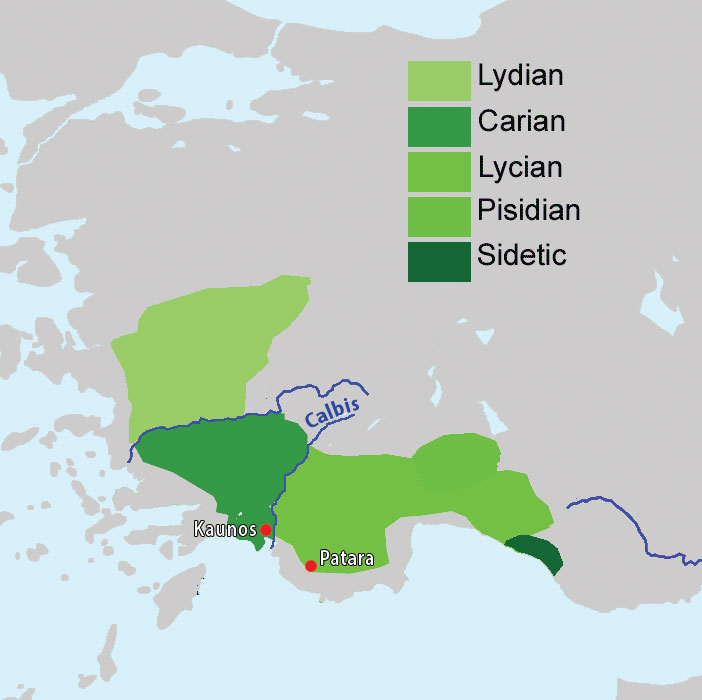
Friendly and willing as we are, we decided to throw ourselves into this port in order to find out a little more about this, to us unknown port city, which, by the way, was already known to Mr Strabo2: …..than to Caunus and to the Calbis, a river near Caunus, which is deep and provides passage for trading ships; .... the city has docks and a harbour that can be closed.
CAUNUS /KAUNOS
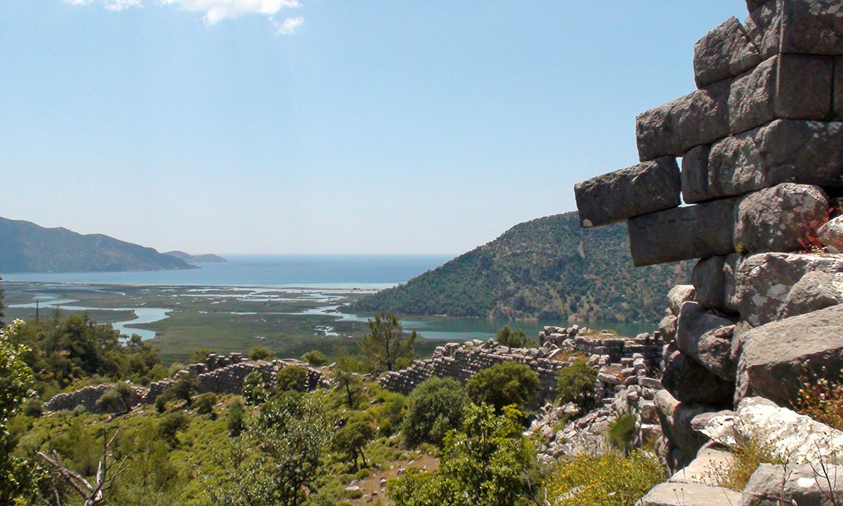
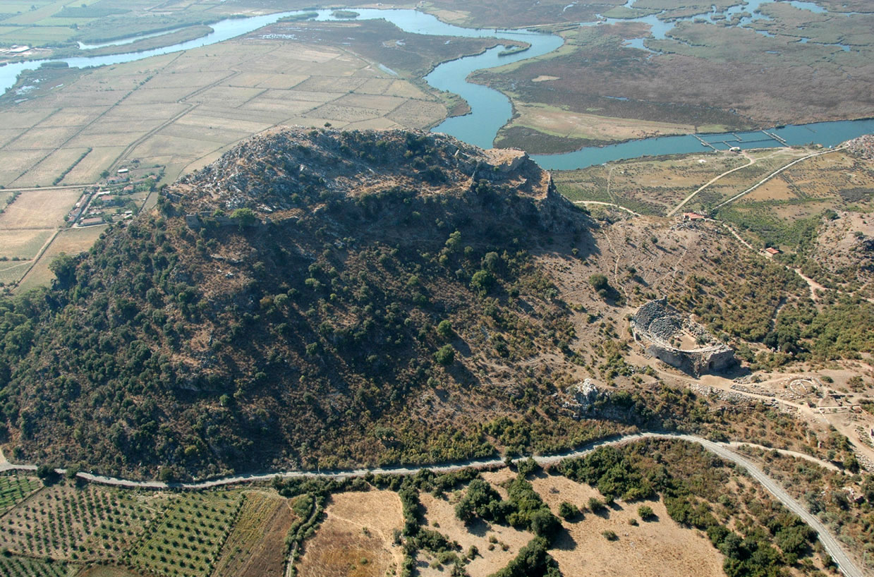
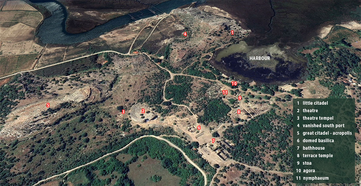
The city was built on a peninsula that stretched like a tongue towards the sea, formed among others by the 'great citadel' with the Acropolis, which rose 152 m above the sea, and the 'little citadel'. Kaunos was located on the right bank of the Calbis (today's Daylan River).
According to archaeological documents, Kaunos dates back to at least the 10th century BC and there was probably already a settlement long before that. Its original name was Kbid.
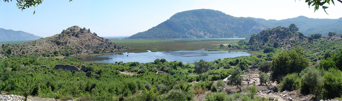
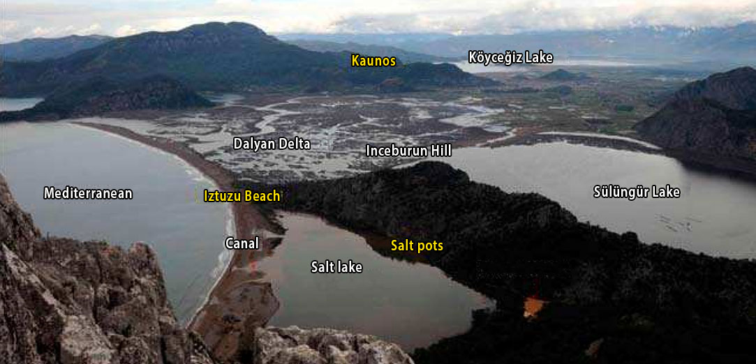
Kaunos became an important seaport city with two ports; one in the south southeast of Küçük Kale (Little citadel) and the inner port in the northwest, today's Sülüklü Göl (Lake of the Leeches). The southern port was used from the foundation of the city until about the end of the Hellenistic era, after which it became inaccessible due to desiccation. The latter was used until its final days. When, due to the silting up of the delta and thus the port, Kaunos lost its important function as a trading port, it also lost its prosperity.
In its heyday, Kaunos traded, among other things, in dried fish, salt, dried figs, agricultural products, materials for building and repairing ships and slaves. After the conquest of Caria by Turkish tribes and the severe malaria epidemic in the 15th century AD, Kaunos was completely abandoned. The port (Liman) is currently some 8 km off the coast and has degenerated into an inland lake.
History of Kaunos
Anatolia, and thus Kaunos, have been part of many empires throughout history. Kaunos was an independent state until 540 BC but, despite fierce resistance, was taken by Cyrus the Great of Persia and had to pay high taxes to maintain its independence as a port city. Less than a hundred years later, in 480 BC, the Persians, at the battle of Salamis, were defeated by the Greeks in the 2nd Persian War. Kaunos came under Greek influence.
In the fourth century BC, Persia seizes power again and the region comes under the rule of the satraps7 Hecatomnus and his son Maussolus. On the north side of the Acropolis of Kaunos, the remains of the Persian defensive ramparts from that period are still clearly visible, at 8 metres high.
In 333 BC, Alexander the Great conquered the region. Afterwards, there were numerous other rulers such as the Ptolemaeans, the Seleucids and the Rhodians until finally, from 166 BC onwards, the Romans took over.
During Rome's colonisation process, there was an immigrant population of nearly a hundred thousand who settled in Anatolia. The Roman (Romani) and Italic (Italici) populations8 had both wealth and, as natural supporters of Rome, great influence. Italic citizens who came to Anatolia as peregrinus (foreigners) and settled in the cities and countryside included negotiator/mercetor (merchant), veteranus (retired soldier), publicanus (tax collector) and colonus (farmer). They had marriage and trade relations with the local nobility, a voice in the society in which they lived and, as prominent members of the city councils, acted in Rome's interests. This also applied to Kaunos.
Mithridates Eupator VI of Pontos, one of the most formidable and determined opponents of the Roman Republic, knew very well that this was the case in Anatolia. When he wanted to seize power, he instructed all his followers to "first kill all Romans on the same day and at the same time" because these people posed the greatest danger to him in his fight against Rome. The massacre took place in a very bloody fashion in 88 BC at many locations, including Kaunos. All Roman inhabitants, including women and children, were massacred.
The Romans in turn defeated Mithridates and punished Kaunos by giving the city in 81 BC to another people who were also greatly hated in Kaunos, the Rhodians, which was the status quo well into the first century BC.
In 78-74 BC, a Roman commander, Publius Serviliuss9, appointed by the Roman dictator Sulla, launched a major campaign (military operation) to cleanse the whole of Caria, Lycia, Pamphylia and Cilicia of rebels and pirates. With a mighty armada equipped with heavy weapons and five legions of soldiers, he purged the region of rebels within five years and expanded the Roman provincial borders to include the mountainous areas of Cilicia.
As a port city, Kaunos was also constantly harassed by pirates. Even blocking the port with chains was not enough to prevent harassment. The work was completed by Cnaeus Pompeius Magnus, the great, in 67 BC.
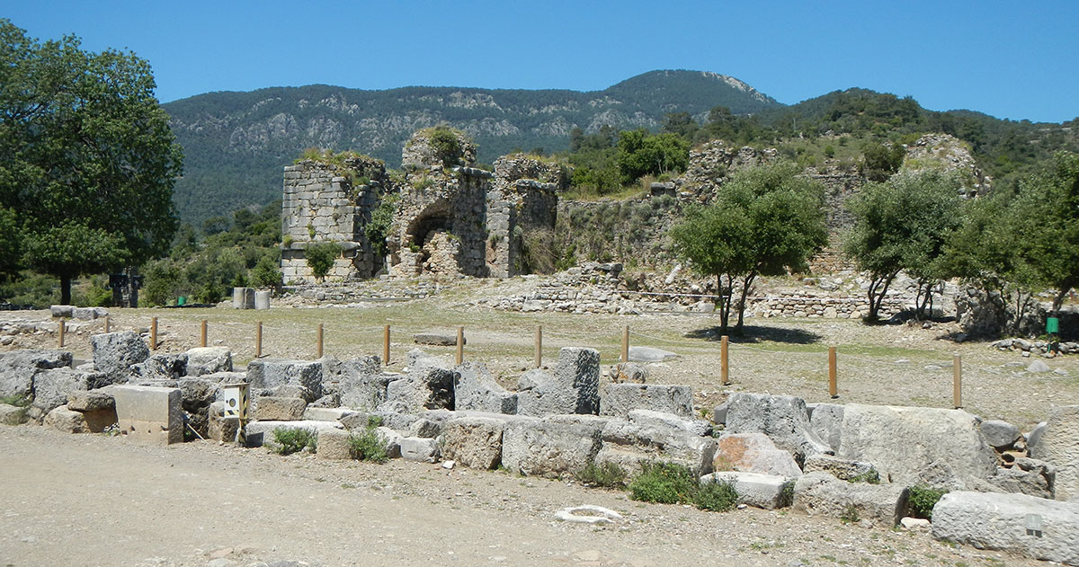
What remains of the once-important port city?
The existence of Kaunos was well known to classical scholars, but its location was a mystery until English archaeologist Hoskyn discovered it in 1842.
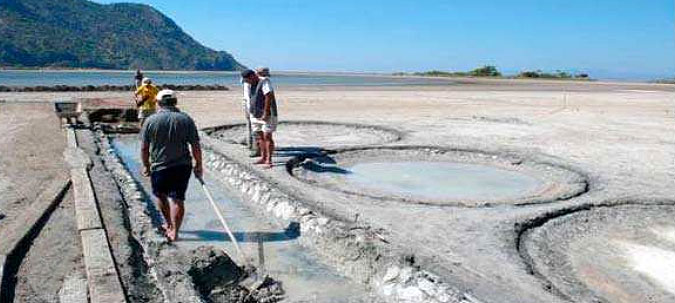
Hoskyn10 found a tablet of a public assembly in the ruins in Dalyan and deciphering the text on this tablet revealed that this place was Kaunos. However, archaeological excavations in the city were first started in 1966 by a Turkish team led by Turkish classical archaeologist Baki Öğün (1922-2001). An account by Turkish researcher and writer Yayuz Çekirge:"One spring morning, we sailed by boat through the waters of an emerald sea. The delta of the ancient Calbis river is visible in the distance. The boat where we embarked early in the morning from the fishing port in Ekincik Bay first called at the West Iztuzu beach. The site of the old main port and salt factory. The Kaunos salt mine, which I had read about in books and seen pictures of, we couldn't see. Nobody has heard of the old salt plants and nobody knows where it is." 11
Yayuz Çekirge:"We travel through the thick reeds while listening to different bird sounds. The reeds almost formed a labyrinth. Passages and trenches were probably kept open by the boat owners so the boats could pass through the reeds. On the southern cliffs of Mount Balıklar, rising on our left, beautiful mausoleums gaze at us. They have stood there for twenty-five hundred years. On the right side of the rocks, six temple-like tombs are carved into the rocks with the intricacy of a sculptor. The tomb on the far right looks unfinished. These are clearly king's tombs."
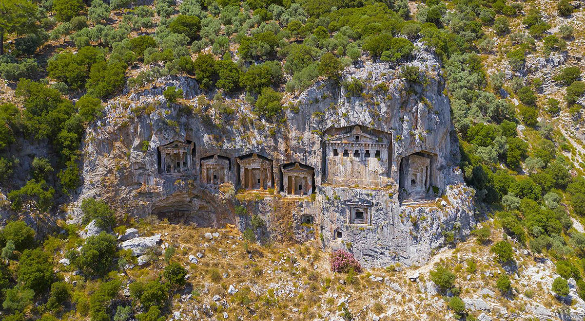
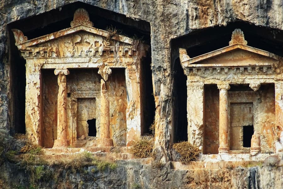
The Lycian rock tombs of Kaunos date back to the mid-fourth century BC and were indeed originally intended for the Lycian kings but later probably also used in the Roman period.
Carved into the rock, the tombs have the appearance of a Greek temple with two Ionic and Doric columns, friezes and cornices. On one of the friezes are lion reliefs.
Inside the Lycian tombs are three stone beds on which the dead were laid. The rightmost of the tombs was never completed. According to Herodotus13, the Persian general Harpagus left for Kaunos in Lycia after taking Ionia and Caria in west - Anatolia. After long resistance, Kaunos had to surrender. At that time, the construction of the last tomb is also said to have stopped14.
The Kaunos city wall is the most gigantic monument in the city and, with its well-preserved, rich masonry techniques and different types of gates, immediately attracts attention. Professional research did not take off in Kaunos until late. So did the investigation of the defensive walls. The first excavation-supported research of the walls of Kaunos were carried out between 1988 and 1991 by German researcher Bernhard Schmaltz.
The walls of the Great Citadel (Acropolis) were surveyed by Soner Özen and B. Özen-Kleine between 2012 and 2013.
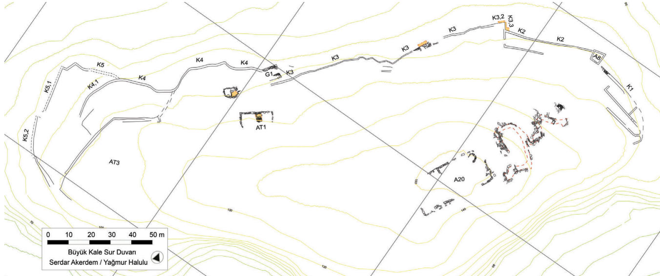
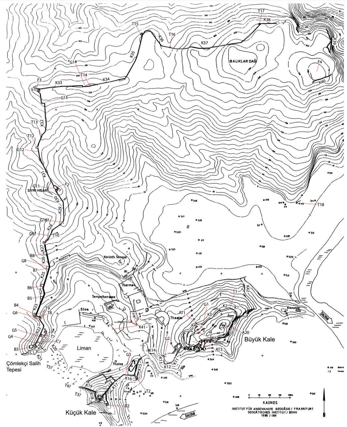
The wall of the Acropolis (Figure 12: K1-K5) was built about 30 metres below the top. The entrance was probably gate G1. The first phase of this wall dates back to the 6th century BC. During this survey, the remains of temple A20 were discovered on the Acropolis. Incidentally, few traces of habitation have been found there. This suggests that the Acropolis had both a religious function and was a "fortress of refuge" where the inhabitants of Kaunos sought refuge in case of danger.
Several phases of repair can be recognised in the Acropolis wall. The last phase of the Acropolis wall is related to the Eastern Roman Period which, due to the material used, is easily distinguishable from the older wall it was built on top of.
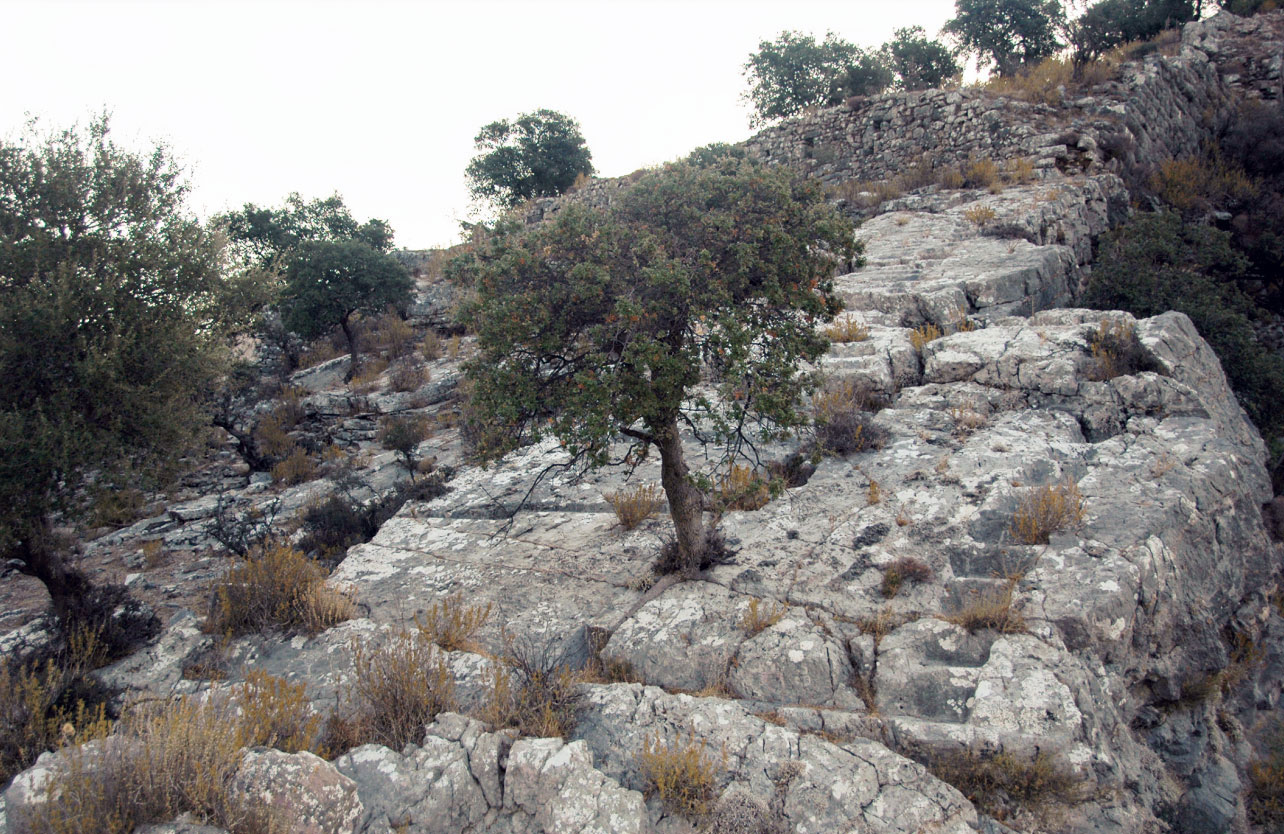
On the west side of the Great Citadel (figure 6), wall segments K11-K14 run downwards to segments K15-K19 which connect the Great Citadel with the Little Citadel and the harbour. Port gate G3 is the only gate (excavated so far) giving access to the Little Citadel. In a later period, walls K15-K17 were reinforced with a tower (T2) and a bastion (B2). According to B. Schmaltz, that part had to be reinforced because, due to the silting up of the 'southern harbour', which was located southeast of the Little Citadel, attacks from that region could thus be better prevented (see Figure 14).
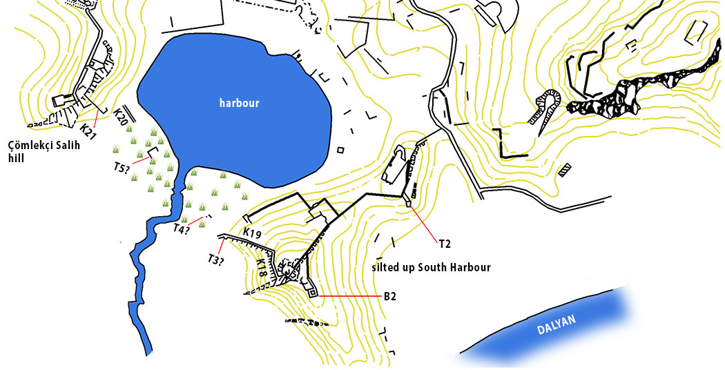
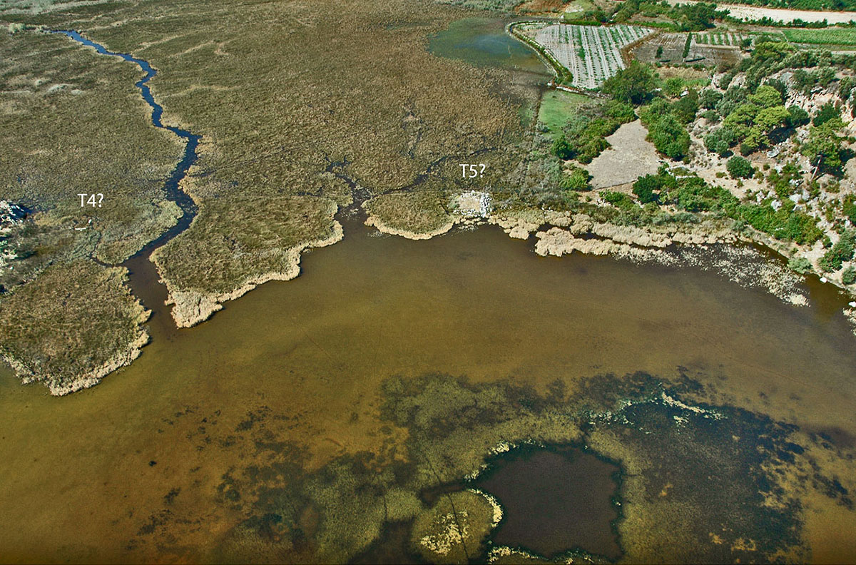
Surveys up to 2016 conducted in the harbour basin and south of the Çömlekçi Salih hill show that walls K19, K20 and K21 as well as towers T4 and T5 were of great importance. The latter part of K19 was later expanded as can be clearly seen by the beds carved into the rock (Figure 13). Although no longer visible, it is obvious that there was also a wall between the two towers T3 and T4, which stood in the water at the time.
It is possible that towers T4 and T5, located about 100 m apart, belonged to two separate walls. In this case, we can think of Strabo's information about the port of Kaunos: "Kaunos has a port that can be closed". These words of Strabo suggest a harbour complex that could be closed, if necessary, by a chain that could block the entrance to the harbour, and it makes sense that in such a complex the two towers between which the chain was attached were built in the harbour water, as was the case at T4 and T5.
The rest of the great wall around the city of Kaunos (see Figure 6) is described in detail in the pdf 'Kaunos_Suru'. We do want to take a quick look at the east side of the city.
In the northeast, the city was surrounded by steep slopes of Mount Baliklar and therefore no defensive wall was needed.
In the flat part, between the Great Citadel (Büyük Kale) and Mount Baliklar, was a bay that later became enclosed (North Bay). Research conducted between 1990 and 1992 by geographer H. Riedel suggests that there were human activities in this area in the period between the 4th century BC and 100 AD.
In the ancient port area known as Sülüklü Göl, lies the port agora and stoa15 of the old port. Some years ago, research was conducted in the agora16 to find possible remains of the harbour structures such as quays, warehouses, etc. Soil investigations revealed that new structures could be expected at several places in the agora. The researchers therefore strongly advocated initiating new targeted excavations at the site. Whether this has already been done is not known to us.
The city and her inhabitants
The inhabitants of Kaunos lived on the terraces along the various heights, but mainly close to the port.
According to Strabo, the land was fertile, but everyone agrees that the air in the city was dirty in summer and also in autumn, because of the heat and the abundance of fruits. It is mentioned that the reeds in the delta created by the Calbis current in the region harboured a very large mosquito population and that is why people suffered from malaria and their faces turned green. It would take two thousand years before the region was free of the malaria germ.
The Acropolis
Kaunos' Acropolis hill is a about hundred and fifty metres high. A path leads up from the rocks on which the theatre is built. On the Acropolis, there is no trace of the Acropolis temple. However, the defensive walls of the citadel are visible here and there.
Het Theatre
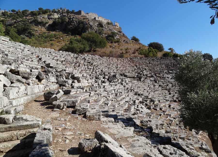
One of the most striking ruins is that of the theatre (Fig. 16/2) built in the 2nd century BC. The theatre had a diameter of 75 m and was built at an ascending angle of 27o divided into nine seating areas by eight staircases. Each seating area had 33 rows of seats. The theatre could accommodate about 5,000 spectators.
The orchestra is accessed from the northwest by a straight staircase and from the southeast by side passageways with steps carved into the rock. In addition, there are two more passageways with barrel vaults opening directly onto the corridor, which is characteristic of the Roman period.
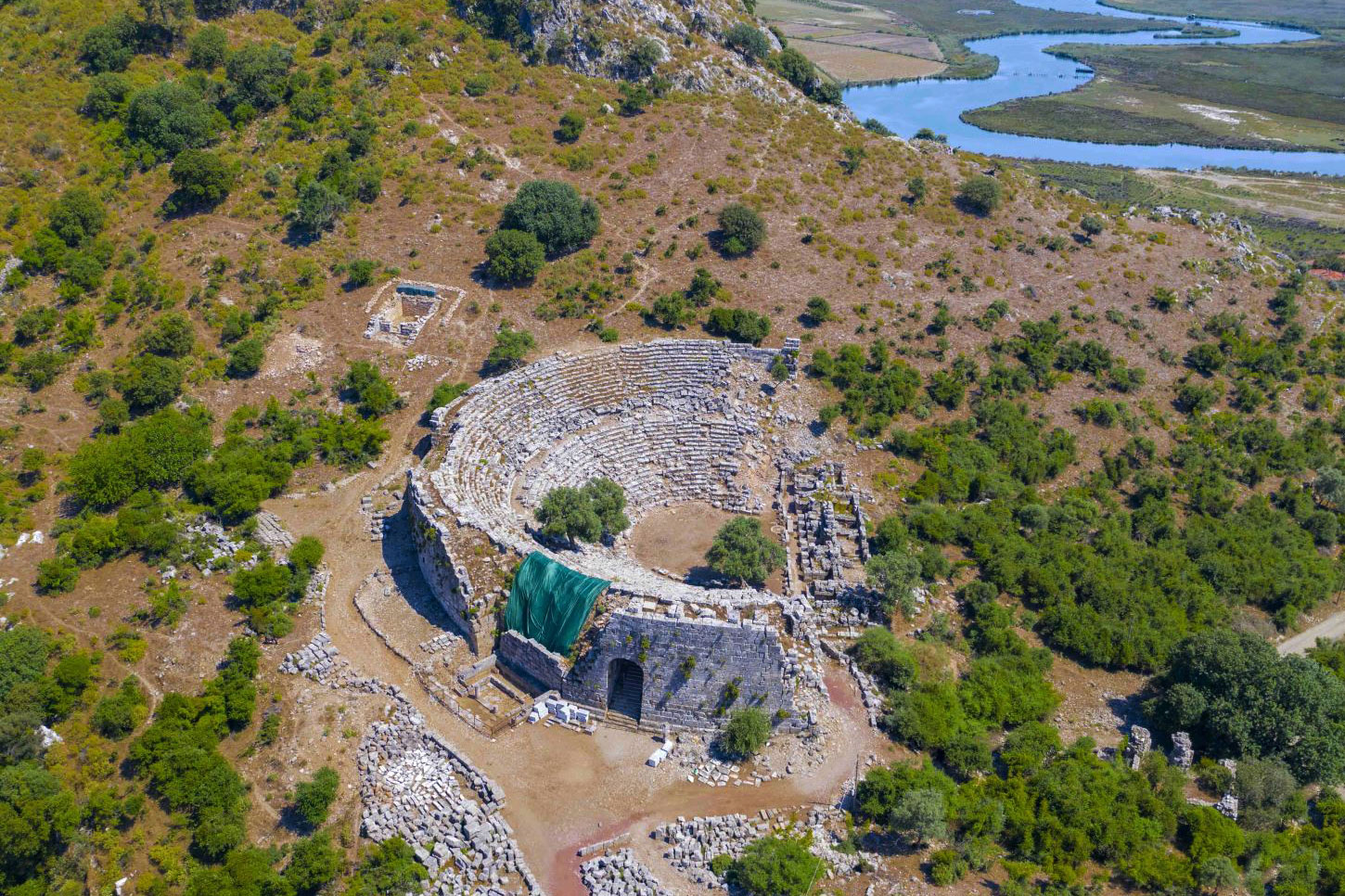
Behind the theatre was the theatre temple (fig. 16-3).
Within walking distance of the theatre is the palaestra18 which, according to archaeological research, was probably built over part of the ancient city.
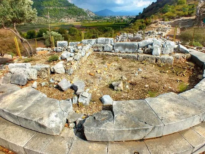
Wind measurement platform
This palaestra included a wind measurement platform dating from 150 BC that was used in city planning. It consisted of a circular building with a diameter of 15.80 m. However, the building collapsed, probably due to an earthquake. There is quite some debate about how it worked. Roman architect Vitruvius19 stated in his standard work, De architectura, that wind measuring platforms were used to plan streets in accordance with the prevailing wind direction, to keep the air in cities clean.
Byzantine Basilica
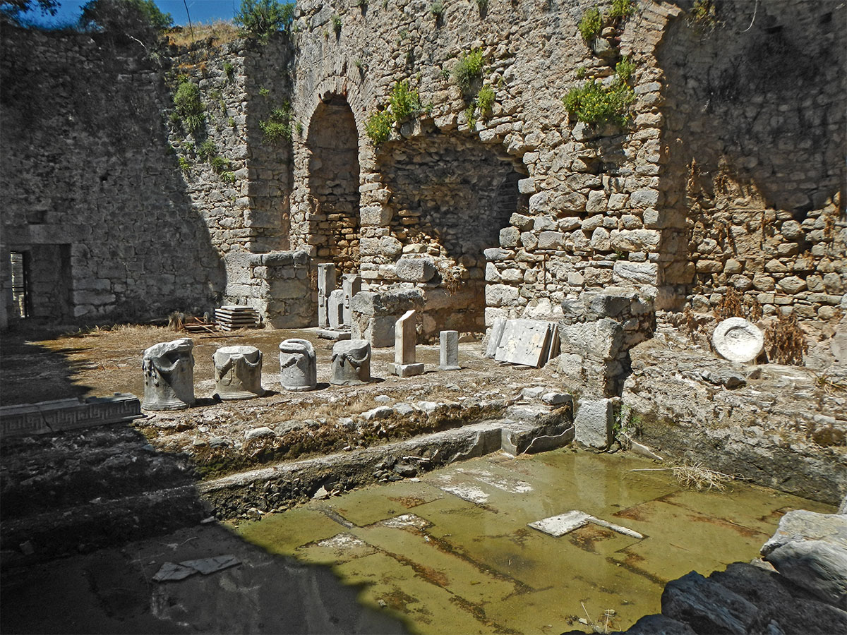
Roman bathhouse
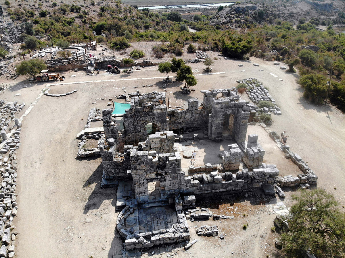
Beyond the basilica, we see an imperial-era Roman bathhouse complex consisting of a courtyard columned on three sides on the same palaestra and the bathhouse. Of the courtyard (56.80 x 31.40 m), only the foundations are preserved. The actual bathing complex (58.20 x2 8.29 m) consisted of large halls. There were two lukewarm baths (tepidarium) and two exercise halls (ambulacrum) on either side of the cold-water bath (frigidarium) and the sweat hall (laconicum) that formed the central axis. To the southwest was the large hot-water bathd (caldarium). Each of these halls originally had a marble floor.
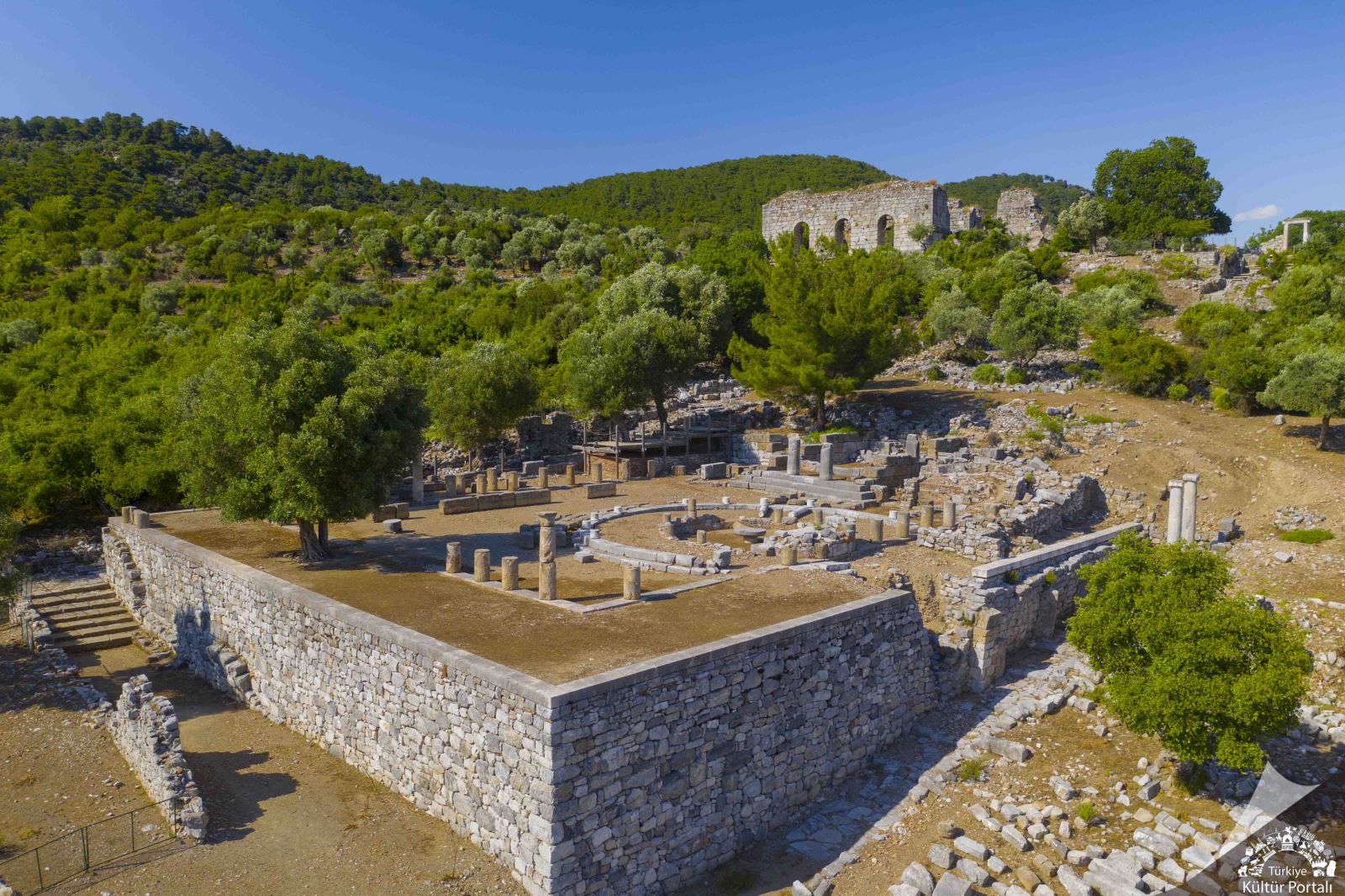
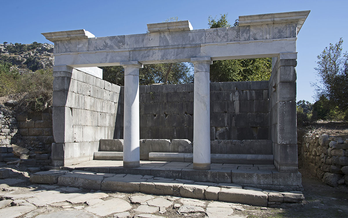
The Terrace Temple
The Terrace Temple consists of a square courtyard enclosed by a colonnade of Doric columns. A small classical temple had been built on one side and along another a nearly circular sanctuary.
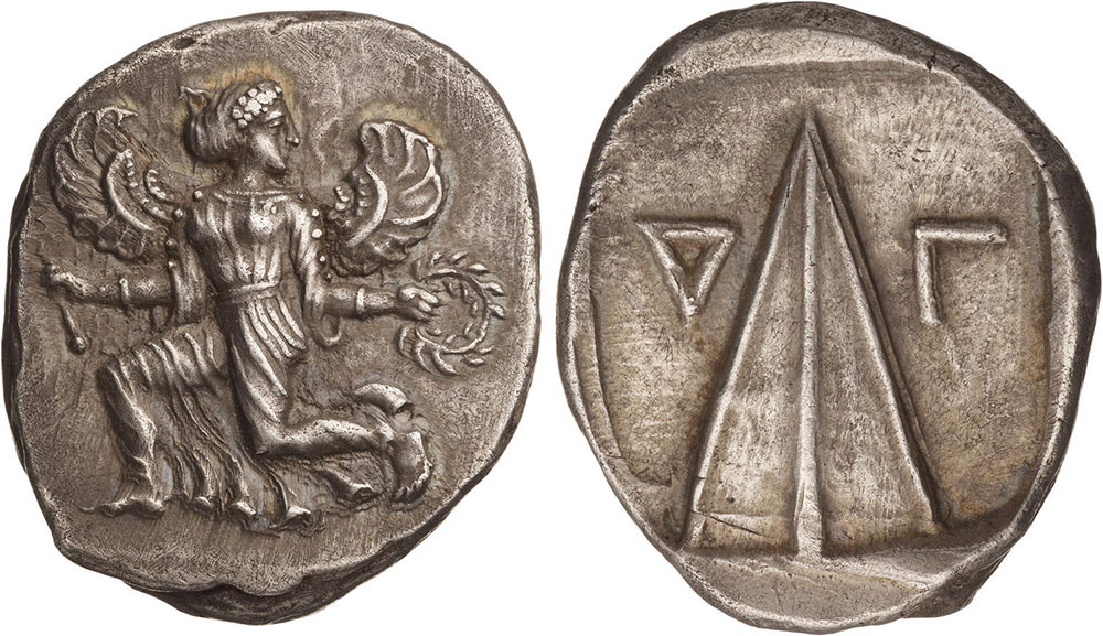
Six metres below the sanctuary, a three-and-a-half-metre-high, pyramid-shaped sacred stone was found. This stone, which is also depicted on coins minted in Kaunos, was the symbol of the city.
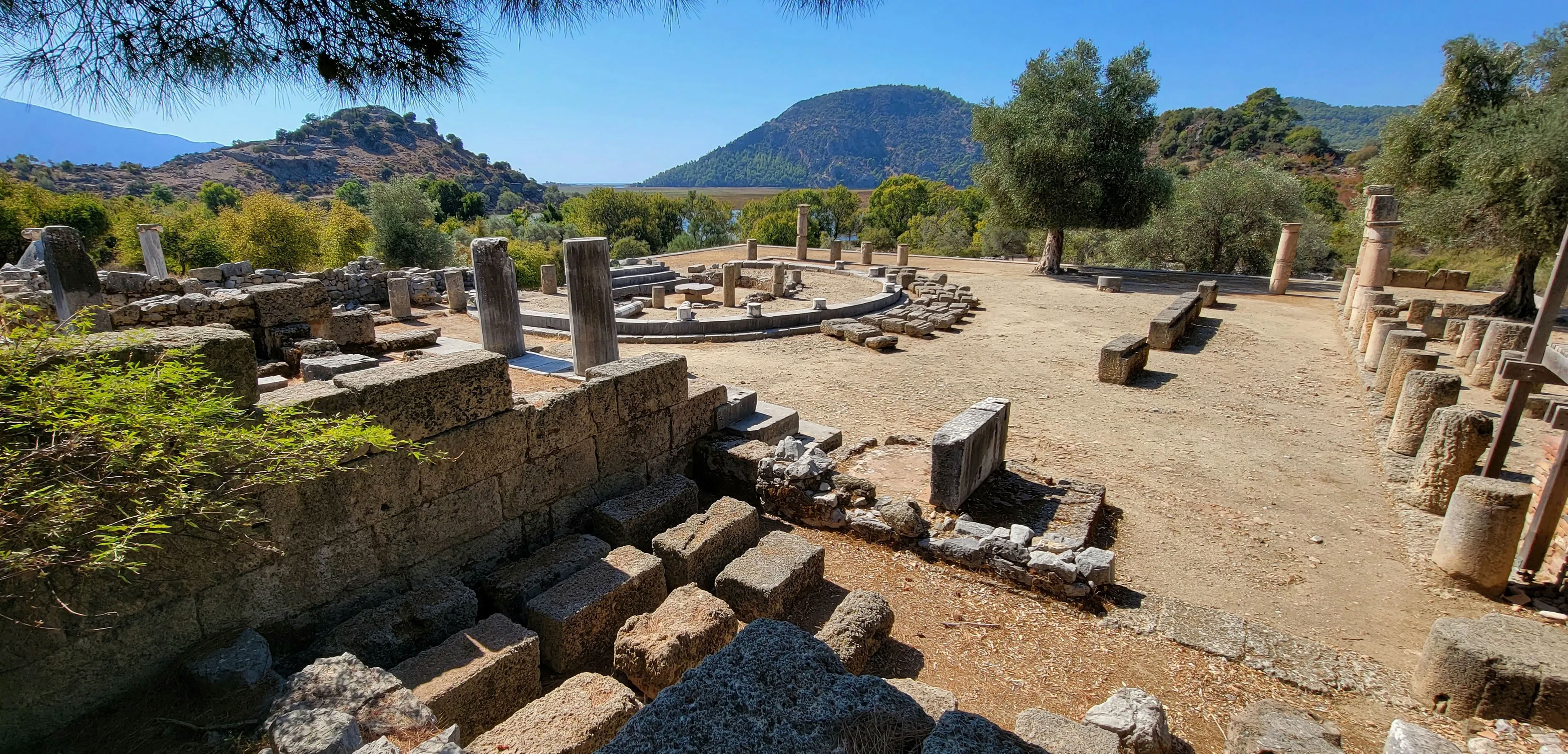
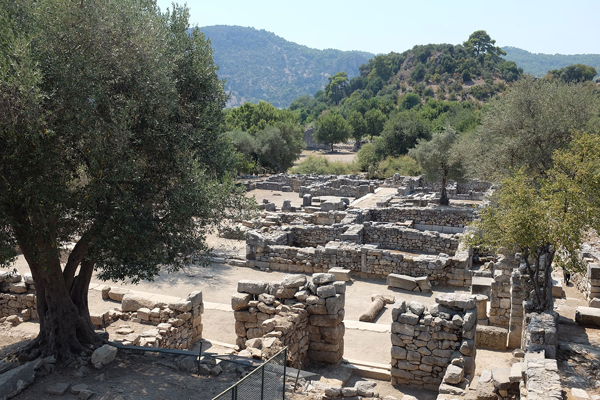
Agora and stoa
The port agora on the flat area in front of Lake Sülüklü must have been the city's most active area and dates back to the 4th century BC. The agora retained its function as an economic, political and social meeting place until the end of Roman times. The remains of pedestals found here indicate that statues (perhaps made of bronze) of influential Romans must have stood there. These have not been recovered. They were probably melted down during the Byzantine era, as archaeologists found a smelter from that period near the pedestal of a bronze equestrian statue of the Roman governor of Asia, Lucius Licinius Murena.
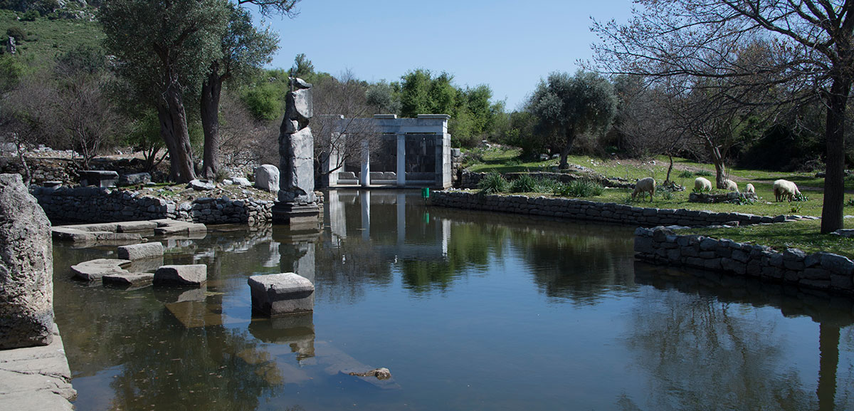
Nymphaeon
On the northwest side of the agora, one found a nymphaeum with a long customs inscription on the outside of the wall facing the harbour. This inscription from Hadrian's time tells that the toll for merchants and boat owners was relaxed to compensate for the gradually silting up of the harbour. Therefore, it was initially thought to be a customs building.
The building has been fully restored with the original blocks and is also called the Fountain House. The building measures about 8 m by 5 m and was accessible on the west side by three steps.
Although Kaunos was discovered as early as the 19th century and systematic excavations have been taking place since the 1960s, the city is only partially uncovered and many questions remain unanswered for the time being. For example, it is still not clear where the various public institutions needed to run such a port city and typical of cities in antiquity were housed. Where were the unloading and loading bays, the warehouses, the various port services?
In many ways, Kaunos still remains a mysterious place, a place that continues to raise many questions. Questions that perhaps one day by further research will be answered.
The questions actually started back in ancient times. In his time, the 'Father of History', Herodotus of Halikarnassos, a place not so far from Kaunos, clearly found the identity of the Kaunians to be a moot point. He refers to the fact that the inhabitants of Kaunos themselves thought they came from Crete but were considered Carians by him, and all their neighbours. He also calls their religious beliefs unusual 24. Perhaps it was and Herodotus was also right about the origin. Recent finds at least point in that direction.
Several inscriptions refer to an entity named“Basileus Kaunion” (Lord of the people of Kaunos). Rather than an actual ruler, this seems to have been the main deity of the city, a male god whose exact nature remains unclear, although he may have eventually merged with the more conventional cult of Zeus. More research in the future will hopefully teach us more. Meanwhile, we are convinced that a visit to this ancient port city is more than worthwhile.
- Sources
- - Yavuz Çekirge: Kaunos
- - The historical marker database HMdb.org
- - Burhan VARKIVANÇ - Kaunos Tiyatrosu’nda Deneysel Arkeoloji: Kuzeydoğu Tonozu Kapısı
- - www.livius.org/articles/place/kaunos/
- - Heinrich Hall: Seven reasons to visit Ancient Kaunos in Turkey – Peter Sommer Travel (13 August 2014)
- - https://artofwayfaring.com/destinations/dalyan-ancient-kaunos-and-iztuzu-beach/
- - https://whc.unesco.org/en/tentativelists/5906/
- - en.wikipedia.org/wiki/Kaunos
- - www.kulturportali.gov.tr/turkiye/mugla/gezilecekyer/kaunos
- - www.dalyaninfo.com/Dalyan/dalyan_kaunos.html
- - Kimberly Lin – An ancient city of ruins and rock cut tombs (March 17 2017)
- - Soner Özen - Kaunos Surlarɪ (2016)
- - İsmail ERGÜDER, Ezel BABAYİğİ, Prof. Dr. M. Cengiz IşIK, Doç. Dr. Sema Atik KORKMAZ: Antik Kenti Liman Agoras
- - www.ancientportsantiques.com/ancient-port-structures/defensive-chains/
notes- 1: See ‘THE catalogue of Ancient ports - Ports antiques’ of Arthur de Graauw.
- 2: Strabo, Geogr, 14.2.2 – (Geographica). Besides Strabo, the city was also mentioned by: Thucydides, Pelop, 8, 39 ; Scylax, Peripl ; Plutarch, Nicias, 40 ; EA 14, Lex Portorii Asiae ; SEG 14,639 ; Stephanus, Ethnica ; Stadiasmus, 265 & 272. This is also a sign of the great importance of this port, both for Greeks and Romans.
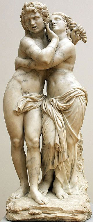
- 3: Publius Ovvidus Naso, Roman poet during the reign of Augustus, wrote mainly on Greek and Roman mythology.
- 4: Ovidius, Metamorphoses 9.446-665
- 5: Sculptuur of Laurent-Delvaux-1734 (Bode Museum)
- 6: To picture of Davius (Wikipedia)
- 7: In the Old Persian Empire of the Achaemenids, satraps were a kind of governors who administered a particular province (satrapy) in the service of the actual ruler.
- 8: Romani were original inhabitants from Rome, italici the inhabitants from Italy (outside Rome). Both groups had different civil rights.
- 9: Roman senator in 48 BC along with Julius Caesar consul.
- 10: Richard Hoskyn (1811-1873) : Royal Navy officer and hydrographic surveyor
- 11: From 'Kaunos' by Turkish researcher and writer Yayuz Çekirge.
- 12: Photo - Official Turkish Museums
- 13: Greek historian and writer of history from Halicarnassus (485-452 BC), also called the 'Father of historiography'.
- 14: Herodotus 1.171
- 15: Covered walkway
- 16: Agora is the Greek equivalent of the Roman forum, centre of the city and meeting/ trading place.
- 17: Photo – www.tuerkei-antik.de
- 18: Originally a practice, training and competition facility for sports.
- 19: Vetruvius - Military engineer (70 - 15 BC)
- 20: Photo - www.turkeysforlife.com/
- 21: Photo – www.dailysabah.com
- 22: Kaunoscoin with winged Iris (messenger of the gods) and the pyramid.
- 23: Photo – Dosseman (Wikimedia)
- 24: Herodotus: Historiën – book I
- 25: Photo – Alexander van Loon


 We are committed to providing versions of our articles and interviews in several languages, but our first language is English.