Previous history
"The Romans of that time (late second century BC) and even to the days of our own memory (during the time of Julius Caesar) believed that fighting others was a matter of bravery, but against the Gauls it was a struggle for survival." 1
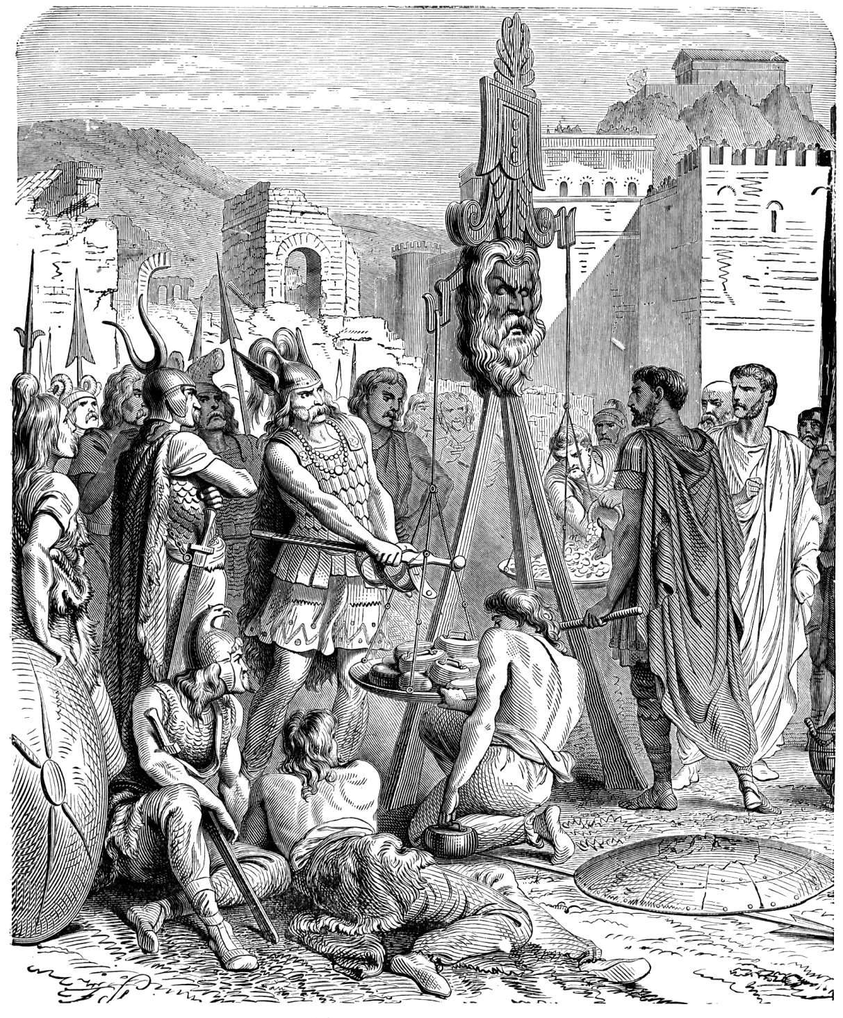
Roman historian and writer Gaius Sallustius Crispus (86-38 BC) gives us the reason why, after the victory over Carthage in 146 BC, the Romans' attention was focused on northern Italy populated by Celtic tribes.
Besides the metus Punicus (fear of the Punics), there was also the so-called metus Gallicus ('fear of the Gauls'), dating back to the legendary plundering of Rome by the Gauls in the early 4th century BC.3
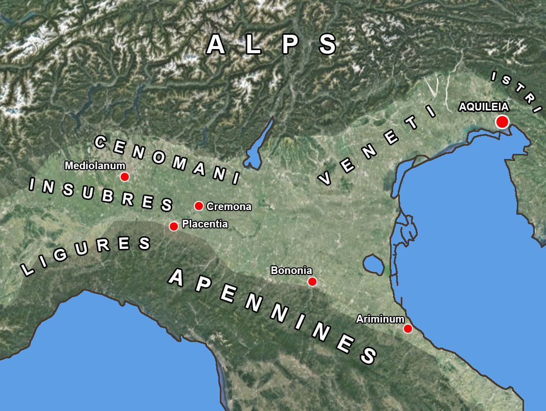
The Gaulish tribes had inhabited the northern part of present-day Italy for several centuries and sometimes tried to invade the Italian peninsula. One such attempt was foiled by the Romans in 225 BC in the battle of Telamon. They entered Cisalpine Gaul (Gaul this side of the Alps4) and captured and destroyed Mediolanum (Milan). That was the first time the Romans crossed the River Po. To safeguard their territory from these attacks, the Romans established colonies south of the River Po at Placentia (Piacenza) and Cremona in 218 BC.
The battle with the Gauls was finally decided only in 191 BC, in which the towns of Placentia and Cremona were fortified and a new Latin colony, Bononia (Bologna), was founded in 189 BC. Two years later, the via Aemilia was constructed, connecting Placentia to Ariminum (Rimini) on the Adriatic coast.
AQUILEIA
In 186 BC, 12,000 Gauls once again crossed the Alps. This time with the intention of building a city on a piece of land in the Veneto region. Livius speaks of "a place not far from where Aquileia is today."5
Despite the fact that the Venetians were not under Roman control and the Gauls had no aggressive intentions, this was still so worrying for Rome that they gathered troops to prevent the building of a new city. However, the Gauls surrendered immediately and informed Rome that they were overpopulated on the other side of the Alps and that poverty and infertility of the land had forced them into this immigration. The senate, however, was not to be swayed and sent them back, incidentally retaining their goods brought with them. The part of city the Gauls had already built on the spot was razed to the ground. Nothing was asked of the Venetians.
The Istri ('Histriërs') in the immediate east were not at all happy with Rome's tacit possession of the Venetians' territory. A new war soon loomed. For this reason, the Romans decided to build a new colony nearby, Aquileia, intended as an advance post against the Istri.
Through a new "law", the nature of the colony, how many colonists would be recruited with what status and how large the size of the colony should be, would be formally decided. The commissioners to establish colonies, invariably triumviri 6, were then elected (for a set period of three years) by the comitia tributa (committee of tribes). This three-member committee determined the boundaries of the colony's territory, allocated land to its settlers, assessed any disputes that broke out between them, or between the settlers and the natives, presented the constitution for the new community and appointed the first office-bearers and priests. To enable them to carry out these duties efficiently, the commissioners were given imperium (authority) to act at their discretion on behalf of the Roman people. They were also provided with support staff, equipment, transport, clothing and funds.
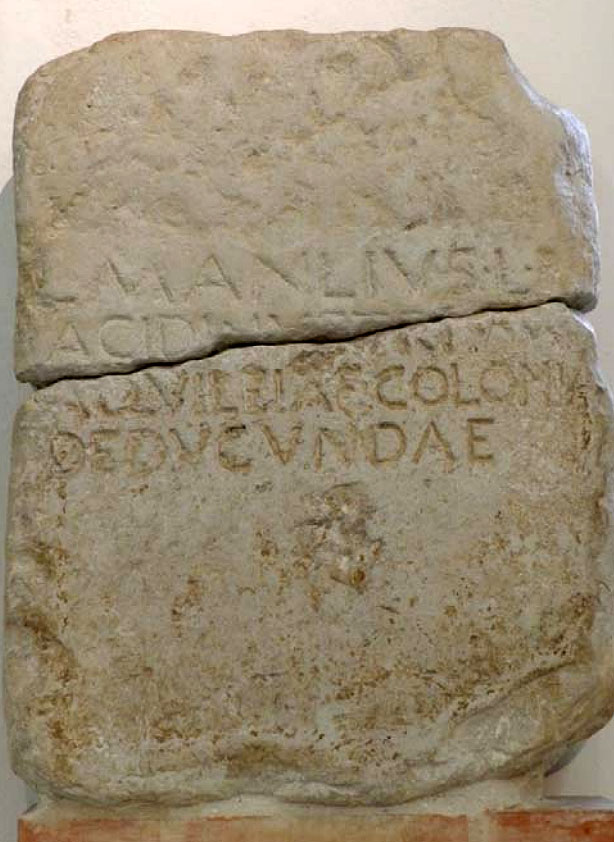
Figure 3: Limestone Cippus with the name Manlius from
the second half of the second century BC 11
The 'Founding Fathers'
According to Livius, the elder was Publius Cornelius Scipo. As senator he had been a member of a colonial commission earlier in his career as one of the triumvir coloniae deducendae (council of three for founding a colony) to lead the colony Venusia (Venosa)7. In 191 BC, as consul, he had defeated the Gallic tribe the 'Boii'8.
The second committee member, Gaius Flaminius, had been a successful commander in Hispania Citerior9, first as praetor (magistrate)10 and then as propraetor between 193 and 190 BC. More significant, however, was the fact that in 187 BC, together with M. Aemilius Lepidus, he ravaged Liguria and defeated the Friniates and Apuani (tribes from Liguria). Furthermore, he had a road built from Bononia (Bologna) to Arretium (Arezzo).
The third member was L. Manlius Acidinus Fulvianus, or Acidinus for short. This Acidinus had just before been sent by Rome as ambassador to the region to forbid the trans-Alpine Gauls to build a new city and send them back across the Alps. Acidinus had been a general during the Punic Wars, was held in high esteem and, according to Cicero at the time, was considered a 'vir bonus' and 'egregius civis' (a good man and an excellent citizen). He had been praetor in 188 BC and would become consul in 179, almost 10 years later.
Of these three, only one could be the actual leader and thus, during the annual celebration of the city's birth, be designated as its founder.
No written evidence has survived of the first two, but Manlius did. A relatively thin limestone cippus (memorial stone), 73 cm high and 56 cm wide, bears the following text:
L . MANLIUS . L . F
ACIDINUS.TRIV.VIR
AQUILEIAE.COLONIAE
DEDUCUNDAE
L(ucius) Manlius, son of L(ucius) Acidinus, triu(m)vir for the foundation of the colony of Aquileia
Incidentally, he is not specifically mentioned here as the colony's founder, but remembered as one of the three. What is strange is the failure to mention the other two members.
The foundation of the colony
The triumviri could start recruiting inhabitants. It had already been decided to set up a colonia juris latini (Latin colony) and not a colonia ciuium Romanorum (Roman colony)12. The colonists were not granted all the privileges that citizens of Rome did, and Romans who voluntarily left for the colony thus lost their birthright. The reason for this lay in the fact that the senate in Rome considered Aquileia practically too far from Rome.
How Aquileia got its name is not entirely undisputed. When Livius spoke of "a place not far from where Aquileia now lies." (see above), no Aquileia existed at all. A late tradition does say that at its foundation an eagle flew by and gave its name to the city. Today, however, people hold it to be a Latinised version of the name of the Venetian Akylis, with a nod to the favourable-sounding original city that once stood on this location.
Eventually, thousands of brave souls came forward, no doubt attracted by the material benefits on offer.
The Latin colony of Aquileia was founded in 181 BC on the in agrum Gallorum (territory of the Gauls). Three thousand infantry soldiers were given fifty iugera each (1 iugerum is ¼ hectare), centurions one hundred, equites (cavalry) one hundred and forty. A war with the Istri was not long in coming. The Romans argued as justification that the Istri interfered with the foundation of the colony.
The military character of the colony was established from the beginning. With the difference that Aquileia would simultaneously be a working community. Those at the level of centurion13 and above would have the opportunity to become landlords, and for everyone there was the possibility of producing a comfortable surplus from the rich Friulan plain.
The city was officially consecrated according to a complicated religious ceremony after which it was assigned its name. All this was done, as told above, by just one of the three triumviri (modelled on the foundation of Rome):
"With the priestly trumpet (salpinx), which the Romans called lituus in their language, after the word lite (prayer), [Romulus] pronounced the name of the city (polis) ... A city was called by three names, a secret (or mystical) one (telestikon), a priestly one (hieratikon) and a public one (politikon)"15.
Aquileia
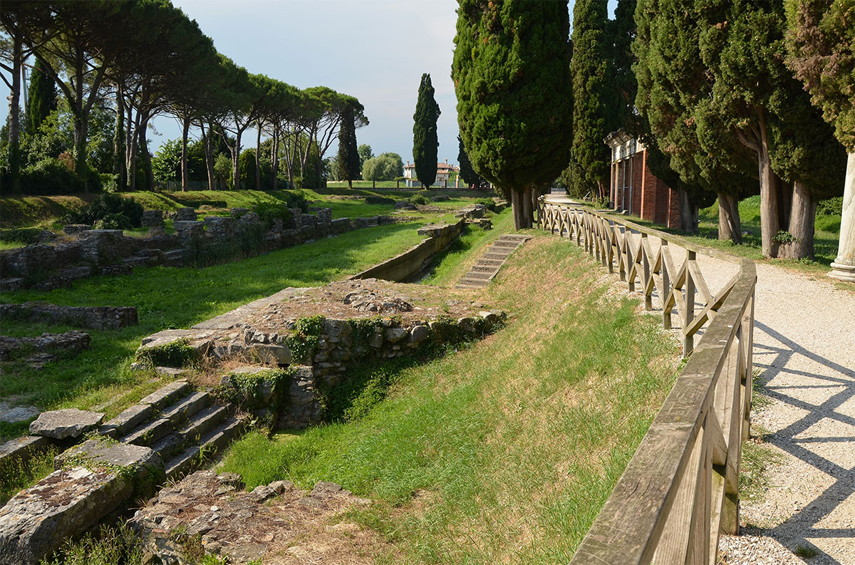
After allocating the promised land to the new settlers and determining the size of the new fortress, a wall had to be built around it; the republican wall.
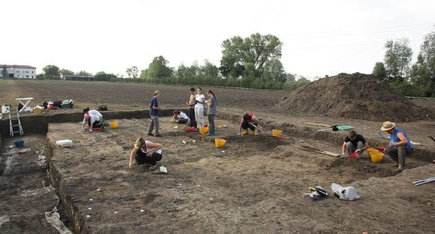
Excavations between the 1920s and 1930s showed that this was probably a bossed double-headed construction16. After reconstructing the excavation results, the early fort was found to have been rectangular (elongated in a north-south direction) with a perimeter of just over 3,000 metres and an area of about 40 hectares. The fort would have overlooked the bend in the Natiso River. The question, of course, is whether this fort was built all at once or in several phases. Archaeological evidence and literary evidence contradict each other here regarding the original size of the city centre.
Livius suggests an original, much smaller perimeter that, after the expansion of the settler population in 169 BC, was enlarged northwards.
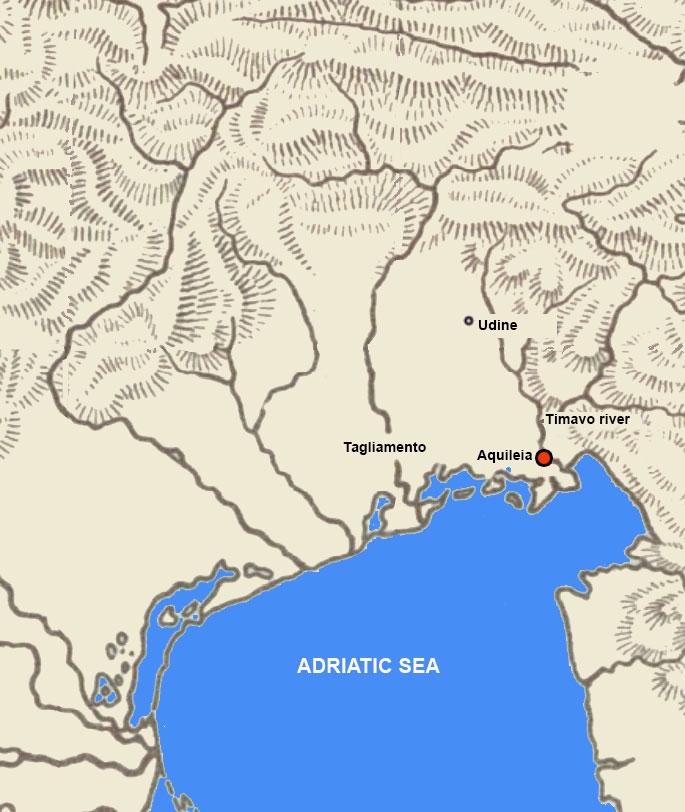
The entire territory of Aquileia is calculated at some 400 km2 taking into account the various lagoons present. The area probably covered the entire Friuli plain from Tagliamento in the west to the Timavo river in the east and from the coastline in the south to the hills of Udine in the north.
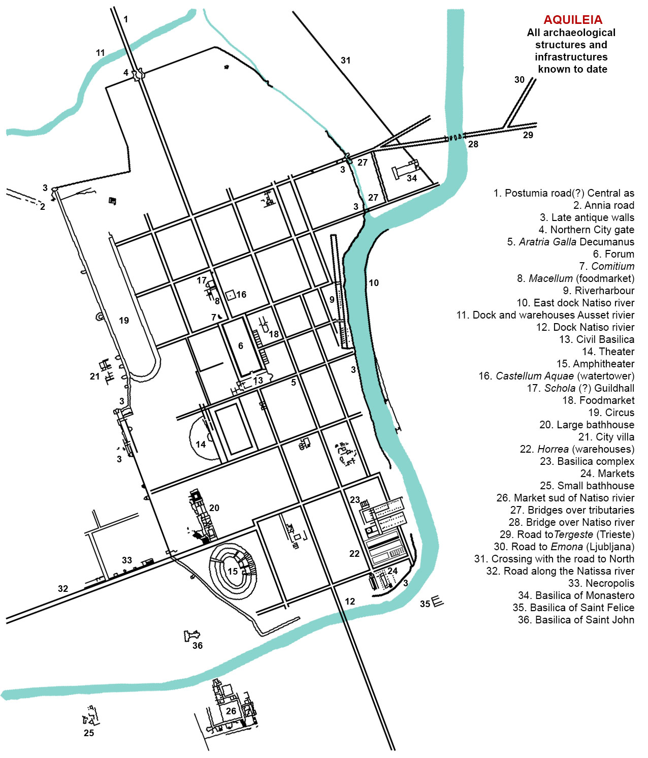
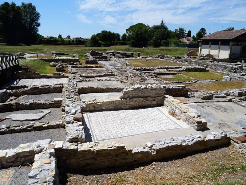
The civic centre was relatively modest. The forum (6), the city's main square, covered only 1.87% of the urban space (by comparison, Luca's forum covered 3.5%). In a sense, it was not the urban centre that was the heart of the community, but the land around it. The city itself was not big enough to accommodate all the settlers. The traces of domestic architecture seem to show that Aquileia conformed to the pattern of other settlements in northern Italy.
So far no insulae (apartment buildings) have been found as in Ostia. Nevertheless, there was a clear civil structure - to some extent a copy of the republics of Rome and central Italy. A comitium (place of political assembly) has been found (7). We find magistrates on inscriptions and also a senate.
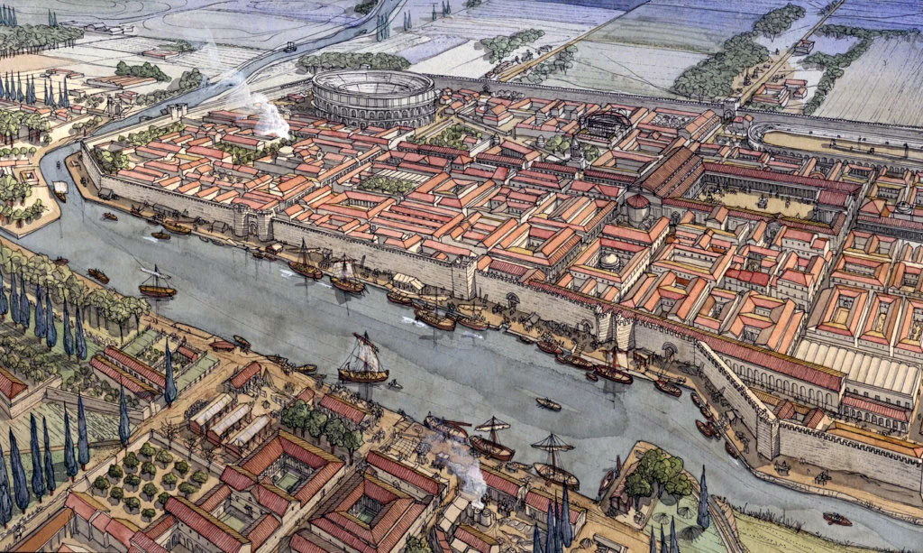
In the 1st century AD, Aquileia was a thriving city, located at a crossroads of trade between the Mediterranean and mainland Europe. Several monumental works, including the river port on the Natiso River, testify to that wealth. In ancient times, the river ran east of the city.
The Greek geographer Strabo reported about Aquileia: "There is an inland route for merchant ships, via the river Natiso, for a distance of more than sixty stadia. Aquileia is a trading place for the Illyrian tribes living near the Ister; the latter load their wagons and transport the products of the sea, wine in wooden jars and olive oil to the interior, in exchange for slaves, cattle and hides."
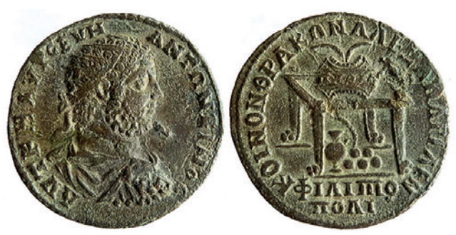
Coin from Aquileia 198-217 na Chr.17
The in all respects very favourably located settlement quickly developed into a strong military outpost and an important industrial and commercial centre (including amber from the Baltic countries). Partly because of this, Aquileia became the capital of Italy's Region X (Venice and Histria) in the imperial period and, outside Rome, the only city with its own currency.
Many emperors and their relatives visited Aquileia including Marcus Aurelius who stayed there for a long time which brought great prosperity to the city.
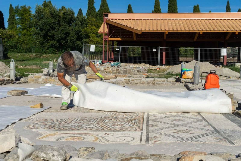
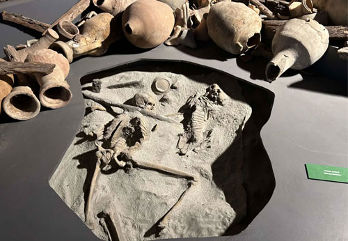
Excavations brought to light several houses, wells, temples, baths and a Roman cemetery. Various floor mosaics, columns and ornaments can still be admired.
The harbour
(Photo Fondazione Aquileia)
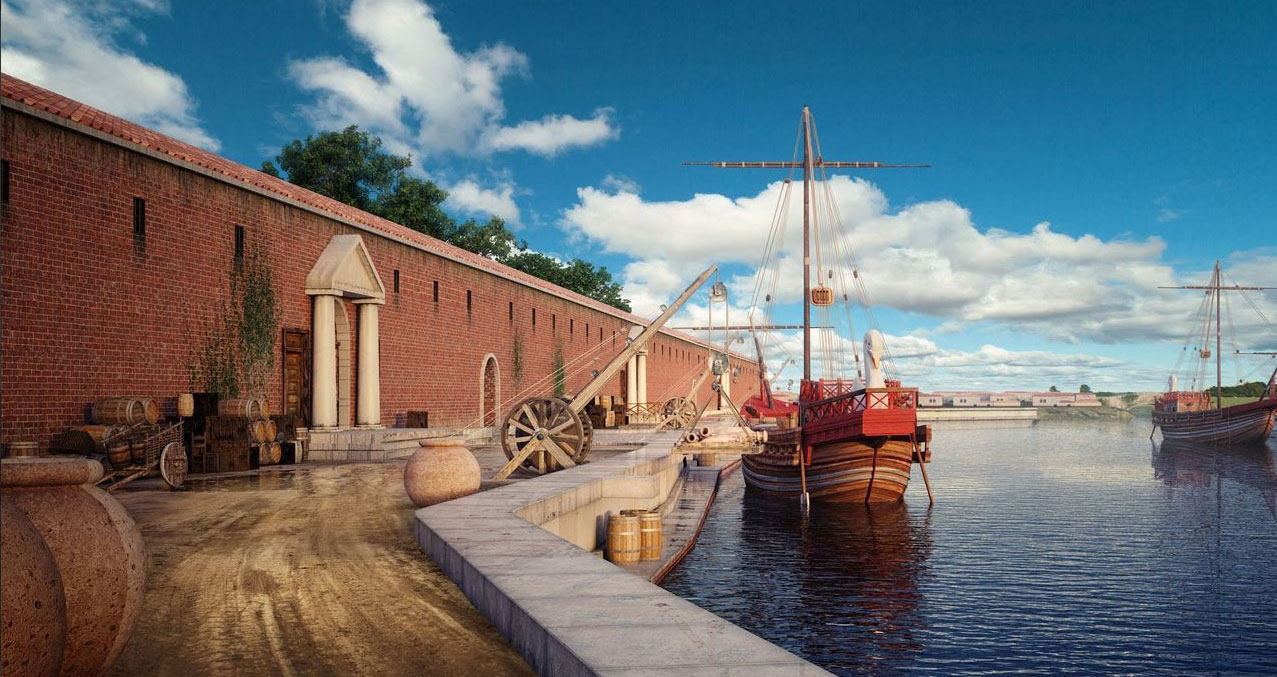
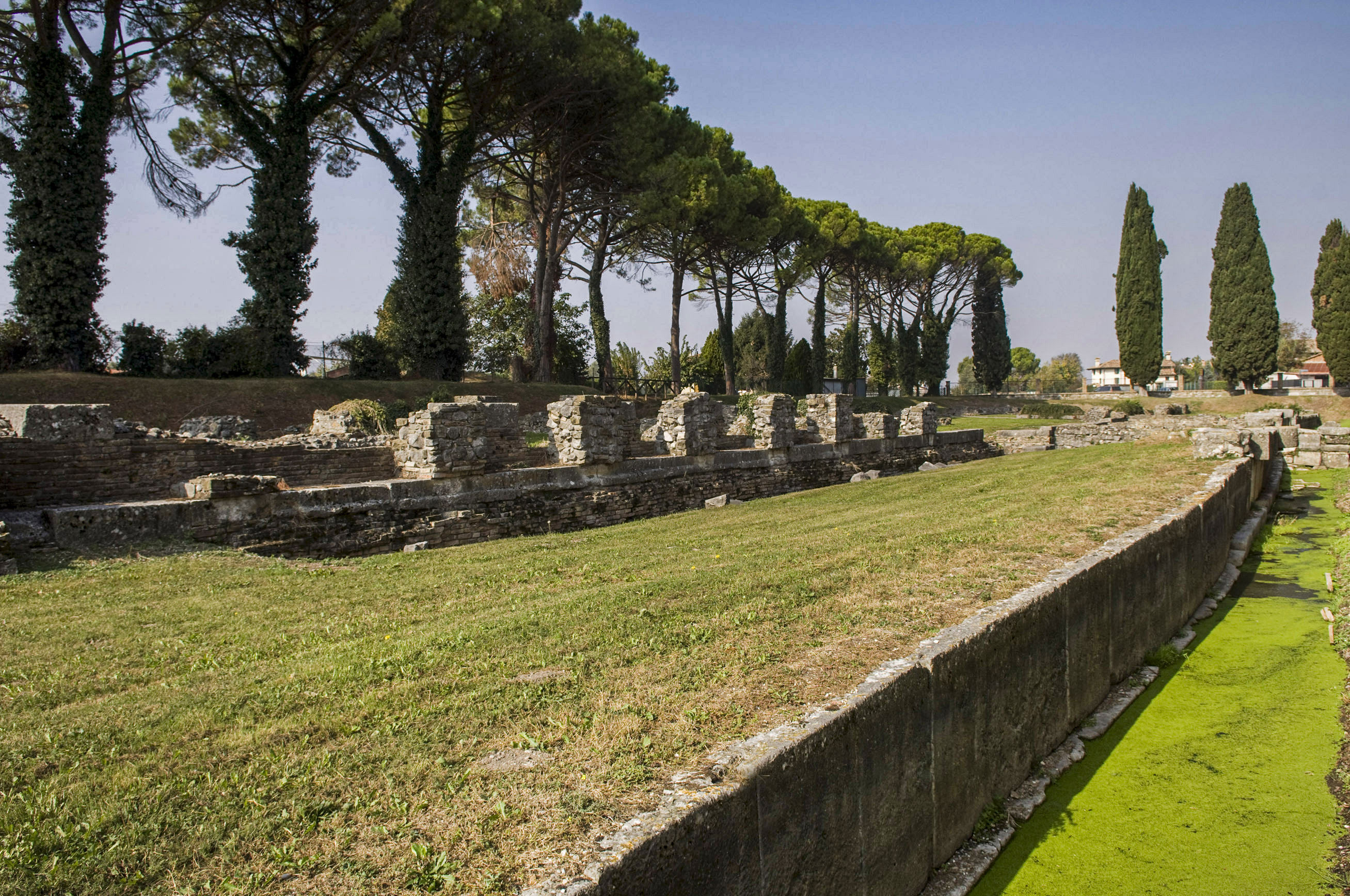
Aquileia was already very early equipped with a harbour. Admittedly a river port, but one of the best-preserved examples of port structures from Roman times. It was located in a branch of the river Natisone on the eastern side of the ancient city. The river was almost 50 metres wide at that location.
The port facilities, excavated in the 1930s, extend for 100 metres and run right along the republican city walls on the right bank of the river. The excavated structures date back to the early first century AD and had been built on top of much older harbour installations. During that first century, many architectural projects were completed in Aquileia, including thus special attention to the improvement of the port system. Quay walls of Istrian stone, piers and warehouses over a length of three hundred metres were built, of which the brick walls of the long sides have been partially preserved (see Figure 13). Despite its length, the structure was quite narrow, being no more than thirteen metres wide. The complex was possibly used as storage for goods and for offices. The building could be entered through at least two gates, preceded by a staircase. Probably the ramps of the connection to the city roads ran under the building.
Later, in Constantine's time, the large building was further extended: witness to this are the foundations of the pilasters now visible inside and outside the original perimeter.
The port system was also connected to small docks on secondary waterways and navigable canals north and west of the city centre.
The Anfora Canal was also part of the system: an extraordinary artificial project on the western edge of the city that stretched in a straight line of six kilometres and run into the present-day Marano Lagoon.
The quays consisted of a powerful system of upright limestone slabs topped with interlocking parallelepiped-shaped blocks, which were used as loading and unloading floors.
About two metres below the quay, a long walkway helped dock workers load and unload smaller boats.
From the lower level, transverse ramps connected the quays to the city roads. These were also used for the wide ramps that gave access to the warehouses.
On top of the quays, the ruins of a sturdy structure about three metres thick are still visible. The structure was added to the river installations in late antiquity (4th century). The river, which by then had already become much narrower due to siltation, hardly functioned as a harbour anymore but provided an additional defence for the new wall ring, which was equipped with towers.
At a later date (probably in the 5th century), an entirely new city wall was added to reinforce the older one. This emerged a little further into what was left of the riverbed.
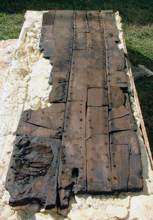
During excavation work in 1988 as well as in 2005, fragments of two Roman ships were found in the Anfora Canal. These ships were built using the 'sewn' plank system23 as opposed to the more common mortise-and-tenon system.
Aquileia's crucial role as a rich commercial crossroads between the Mediterranean and continental Balkan Europe has been documented by thousands of finds and confirmed in the words of the geographer Strabo: "Aquileia [...] can be reached by sailing up the river Natisone with trade boats of more than sixty stadia".
- Sources
- - The literary, archaeological, epigraphic and topographical evidence for the foundation of Aquileia. Tom Hillard and J. Lea Beness. Macquarie University
- - Aquileia a border city. Fondazione Aquileia
- - https://www.fondazioneaquileia.it/it
- - Stilus.nl
- - ciaotutti.nl
- - Fragments of Boats from the Canale Anfora of Aquileia, Italy. Carlo Beltrame and Dario Gaddi- The International Journal of Nautical Archaeology (2013)
Notes- 1: Sallustius, The Jugurthine War 114.2
- 2: Gravure "Histoire de France en cent tableaux" by Paul Lehugeur, Paris, 1886
- 3: Battle of the Allia in 390 BC in which the Senones, a Gallic tribe, drove the Romans to flee and plundered the city.
- 4: The Po Valley and Venice to the east.
- 5: Liv. 39.22.6; cf. 39.45.6; and 39.54.3
- 6: A member of a triumvirate (college of three with specific responsibilities)
- 7: Livy 31.49.6
- 8: Boii – tribe from northern Italy involved in the conquest of Rome in the 4th century BC.
- 9: Spain was then divided into two provinces Hispania Citerior (The Near Spain) and Hispania Ulterior (The Far Spain)
- 10: Literally 'predecessor'
- 11: CIL V, 873 [= CIL 12, 621] = Inscrip. Aqu. I, 27 = ILLRP 324 = IEAquil. 1 (Museo Archeologico Nazionale di Aquileia)
- 12: A Roman colony consisted only of Roman citizens with all the rights of a Roman; a Latin colony was a community of Latins and Romans with fewer rights.
- 13: Centurion was a social class first used here.
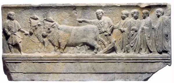
- 14: Relief (National Archaeological Museum of Aquileia). A ploughshare symbolically marks the boundaries of a city (after the rite of Romulus at the foundation of Rome)
- 15: Joannus Laurentius Lydus, 6th-century Byzantine administrator and writer. Mensibus 4.73, pp. 124-25
- 16: Cladding the masonry with rough-hewn blocks of natural stone at the front to suggest a substantial, resilient or elitist character.
- 17: Aquileia, National Museum. The Archaeological Heritage Office of Friuli-Venezia Giulia
- 18: Photo www.corvinus.nl /
- 19: Photo www.timetravelturtle.com
- 20: Photo Carole Raddato
- 21: Photo Gianluca Baronchelli
- 22: Photo www.fondazioneaquileia.it
- 23: Type of wooden boat whose planks are sewn, stitched, tied or bound together with sinews or flexible wood, such as roots and willow branches.


 We are committed to providing versions of our articles and interviews in several languages, but our first language is English.