
By Ahmed Fergiani
As a Libyan born, I have always been in love with this little port ever since I walked on its soil about twenty years ago. Although I spent more years of my life abroad, trying to survive in a rainy Glasgow, working hard to quickly master Newcastle's fascinating Geordie accent and coping with the overwhelming history of Rome which has become my home, I felt however the need to reveal this site of Ptolemais.
In this article I’ll tell you something about the city, the harbour and like to share my point of view about one of its most controversial figures of the early age of Christianity.
Historical background
Ptolemais, Tolemaide in Italian (after all I’m an Italian now) or طلميثة in Arabic is located in eastern Libya historically known as Cyrenaica, roughly two hour’s drive from Benghazi, covering a narrow strip of land nearly two kilometers between the Mediterranean Sea and the low foothills of the Jebel el-Akhdar (Green Mountain).
It was founded as a port in the sixth century BC by the Greeks of Cyrene1 and got her name from Ptolemy III (246-221 BC), a descendant of one of the generals of Alexander the great (Ptolemy I), to commemorate his dynasty of the Ptolemys in 252 BC2.
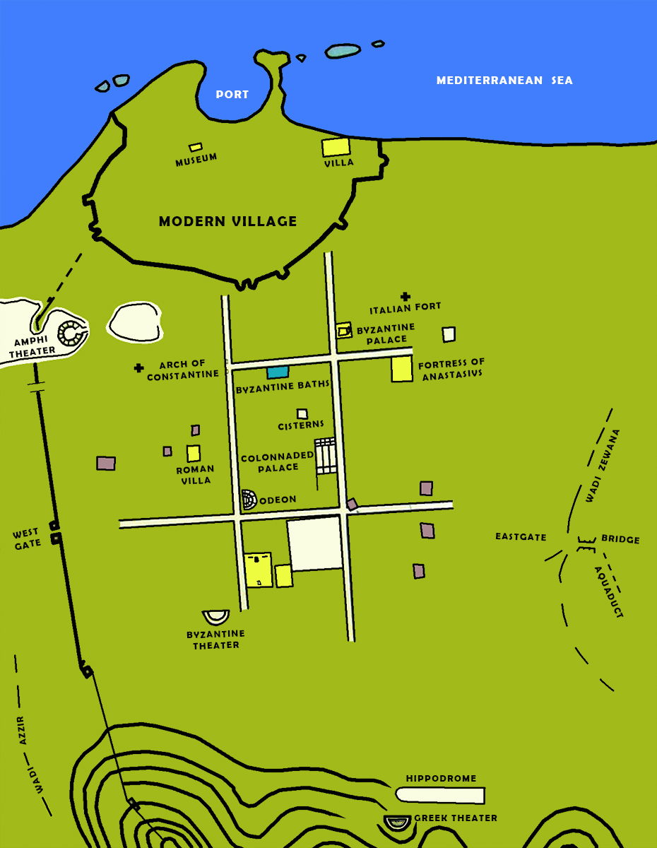
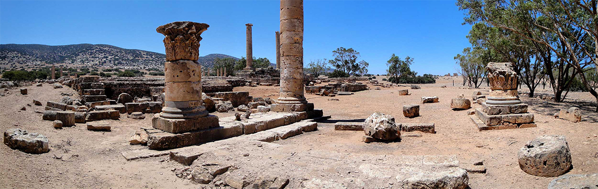
The Hellenistic city had a regular layout in the shape of a rectangle of about 1650 x 1400 meters and had an imposing Decumanus Maximus (long main street), Via Monumentale, with a triumphal arch and a colonnade from the beginning of the 4th century AD. Little has been preserved of the city wall from the Hellenistic period, although remains of square towers have been found as well as a part of the city gate, the Taucheira Gate.
Pieces of a wall were found parallel to the sea. This may have been a Byzantine wall to protect the harbour.
Ptolemais flourished thanks to goods arriving from the nearby ports, such as Alexandria, as well as to export of the main products of the region, like the aphrodisiac plant of silphium, honey, butter, horses, grains and above all fish and fishproducts.
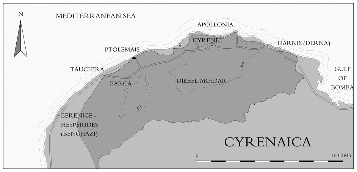
In 70 BC. Ptolemais became part of the Roman Empire. Diocletian made Ptolemais in 194 AD the capital of the five eastern cities of Libya known by the Greek name Pentapolis3. This glory did not last long. During the Byzantine period it lost that title again because the Emperor Justinian4 preferred the city of Apollonia as its capital rather than the quite insecure Ptolemais. Unfortunately by the time of the Arab invasion in the 7th century AD, Ptolemais lost its importance and begun to be a memory from the past.
Constantine and bishops7
Arius and his version of Chrstianity
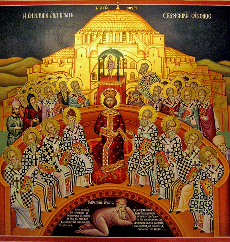
In 312 AD, Christianity finally became a recognised religion after its acceptance by the Emperor Constantine. Not long after, a dispute broke out over the religion initiated by a man from Ptolemais, a certain Arius! This Arius studied under Lucian, the revered teacher and martyr of Antioch5. He was pastor of the Alexandrian church of Baucalis, where he won many supporters by his preaching. He may have been aspired to the episcopacy of Alexandria, which went instead to his fellow presbyter Alexander6. Years later these two, I mean Arius and Alexander, had to decide the shape of Christianity!
Just to make things clear, my duty here, as a writer, is not to consider Arius neither a hero nor a heretic but to reveal his move in a nutshell and to understand his intellectual position as provocative and inspiring to many other ancient Christians. The man must have been full of himself, as he was about to shake the newly recognised Christian religion with his ideas!
Arius discussed the nature of Jesus and its relevance to the father or in other words the doctrine of Trinity established by Tertullian of Carthage (160-230 AD). Constantine was not ready to allow such a division in his empire, so a council was called in 325 AD in Nicaea in today's Turkey. Somewhere between 250 and 318 bishops from across the Roman empire attended. The conflict at the heart of the First Council of Nicaea involved the nature of jesus in relation to God the Father. On one side of the conflict were those of Arius who held that Jesus Christ was created by the Father (not equal but more or less a demigod) and on the other side were those of Alexander of Alexandria who held that Jesus Christ was begotten by the Father (equal and the same person). After nearly a month of debates, discussions and disputes Constantine had enough of it. A decade and a half earlier, he had also faced a similar scenario with his strong rival Maxentius8. He must have thought: once bitten, twice shy! ….. and not wanting to divide his empire into two camps again, he ended it. There would be a vote.
Arius was confident to triumph in Nicaea but the result was against his wish. The verdict hit him on the head; all but two bishops of Marmarica (region east of Cyrenaica) and Ptolemais, voted against his idea. The three bishops of eastern Libya who refused the creed of Nicaea, were excommunicated. Arianism was banned as heresy.
Ptolemais was not just the homeland of disputed figures in the history of Christianity, it was as well the place where one of the greatest Christian philosophers of the 5th century was brought up: the Bishop Synesius of Cyrene. His letters (Synesius, 413) and publications tell us so much about life in the late Roman epoch.
The port
Until now we have talked about the history and religious perils that arose from Ptolemais. However, Ptolemais was above all a port city on the south coast of the Mediterranean. So let's see what we know about that port.
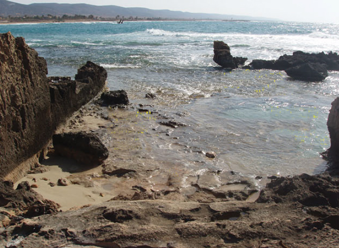
Today, the archaeological evidence for the port is mainly found about two meters below sea level. The port's rather complex history is due to changes in the sea level and shifting of the coastline following an earthquake that hit the Mediterranean in 365 AD.
In the summer of 1972, John H. Little, under the auspices of the Society for Libyan Studies, undertook an underwater survey of the remains of the old harbour. The publications on this research prompted a new visit to the site in 2009 to re-map all the data from the 1972 field study, supplemented with new discoveries of the coast and submerged blocks that had been made visible by recent sand shifts.
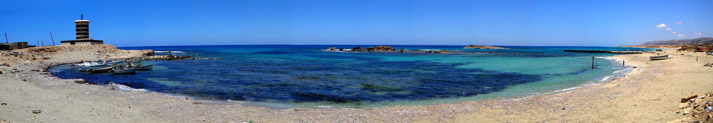
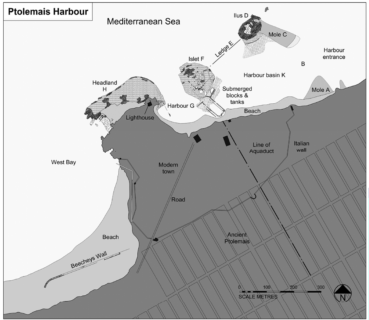
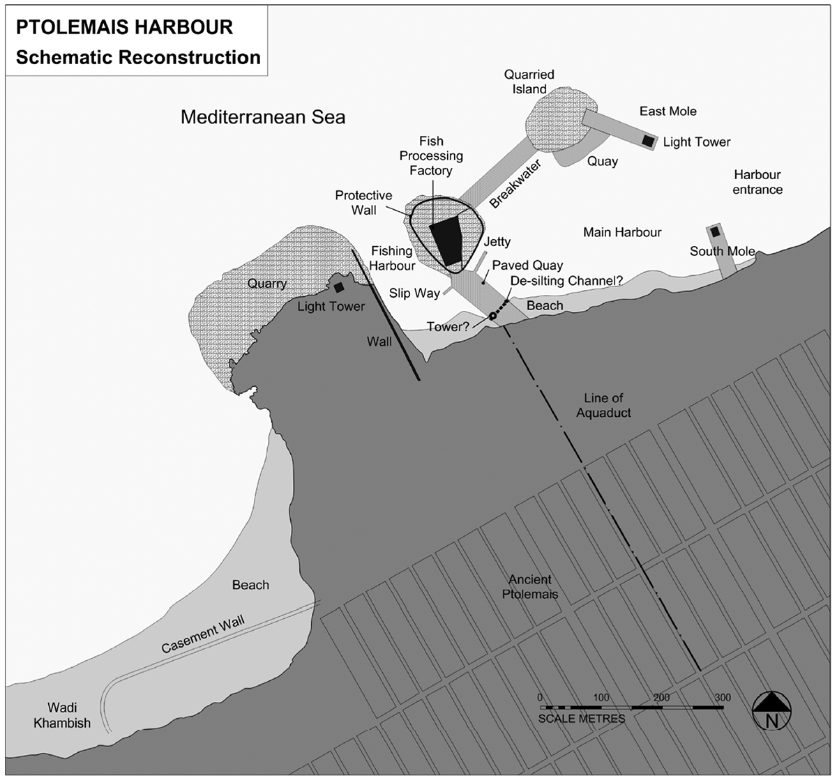
It turned out to be a harbour with two basins. The size of the port installations is comparable to that of the nearby, better known port, Apollonia, but not the same level in complexity (see: "Apollonia, the port of African Athens"). The harbour can be recognized by a headland on which the modern lighthouse stands with two small islands in the east and a long open sandy bay in the west (see figure 7).
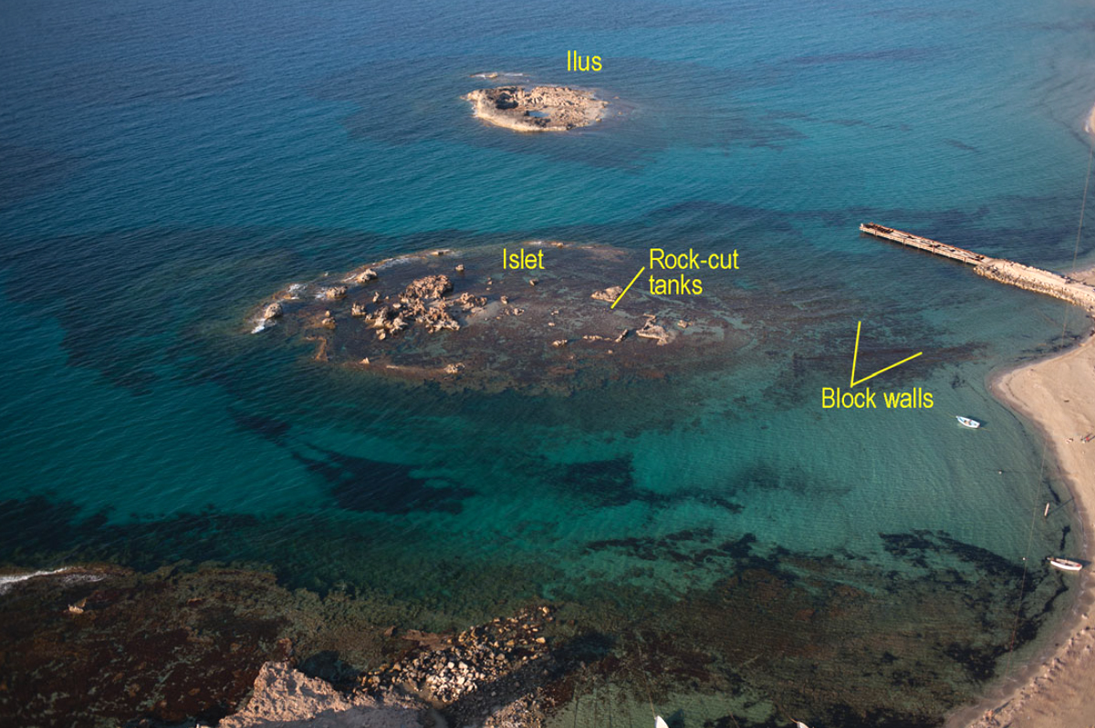
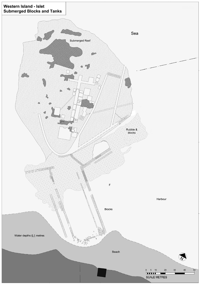
The easternmost island (D) was called Ilus, the other island (F) had no modern name and was simply indicated by "Islet" (island). The islands were connected by an artificial breakwater (E).
There was a small natural harbour (G) in a bay east of headland (H) used by local fishing boats. In ancient times, island F was actually a promontory, which meant that the small basin G was even better protected originally.
To the east of Island F was the large harbour basin formed by the aforementioned breakwater E, the island of Ilus (D) supplemented by artificial stone breakwaters from Ilus and artificial quays between Island F and the coast.
Early travelers believed there must have been a huge artificial harbour basin west of the headland (H). Incidentally, this has been refuted by the 1972 study.
Since an antique foundation has been found at the foot of the modern lighthouse on headland H, it is assumed that there was already some form of warning regarding the navigation of ships in the form of a lighthouse.
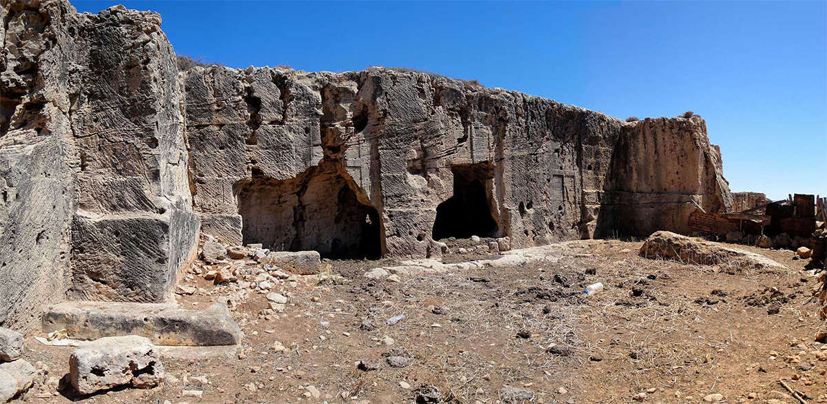
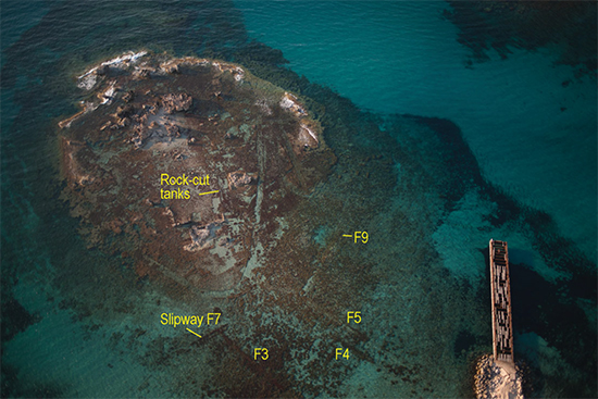
Incidentally, no traces of buildings have been found on the headland. However, a number of round silos cut into the rock have been found on the highest part. These can be used as a water reservoir or for storing moisture-containing products such as salted fish or garum (fish sauce).
On the west side of the headland, facilities have been found that should indicate boat ramps as well as supposed fixings for the roof of a ship's shed12. However, further investigation has shown that, partly due to the breaking seas driven by the prevailing northwest wind, launching boats would have been very dangerous and therefore unlikely. Therefore they can never have been slipways13.
No man-made structures have been found on the island of Ilus except two small cisterns containing opus signinum mortar14, indicating that they were watertight and therefore intended for the storage of liquids or liquid-containing products. Probably the base of these tanks was above sea level in ancient times.
An artificial mole (C) with a length of 130 meters ran southeast from the east side of Ilus. The mole was about 6 meters deep and served as a breakwater on the east side of the harbour basin. Where the mole reaches the entrance to the harbour (B), carved out stone blocks found on the bottom of the sea indicate that there may have been a building at this end of the mole.
Mole A juts out from the coast into the sea. On top of this mole an abundance of blocks, monumental stonework, columns etc. have been found confirming that it was a man-made structure.
Between the two moles C and A was clearly the entrance to the harbour basin K. It therefore seems likely that the stones found at the end of mole C could have been a lighthouse on the east side of mole C.
Between the two islands is a rocky ledge (E) covered with sand at a depth of 2 meters below sea level. Echo pilot research has shown that this was a breakwater connecting the two islands. This breakwater and the two islands together created a large 7 hectare safe harbour.
From the western island F one could reach the island of Ilus, where the lighthouse stood and ships were moored too, via a road on the breakwater. Both the islands and the headland were also used as quarries for the building materials in the city as well as in the harbour. Also for the transport of these stone blocks the road had presumably an important function.
D. P. Davidson)
From the west island to the coast, some 200 meters, there were many structures in the form of walls built with blocks of stone, chambers cut into the rock and foundation trenches, which connected the island with the coast. In 1972 they were still visible for 60%.
During the construction of the harbour, the western island was accessible from the coast and so was the other island via the road on breakwater E. The wall construction formed also the separation between the two harbour basins and was equipped with a paved road between the coast and the island.
In ancient times in such a case it was common to build a lock system between the two harbours to create a flow of water from one basin to the other, thus preventing silting. The only logical place for such a De-silting channel was on the south side of the quay (see figure 17).
submerged line of block walls and a slibway 17.
Conclusion
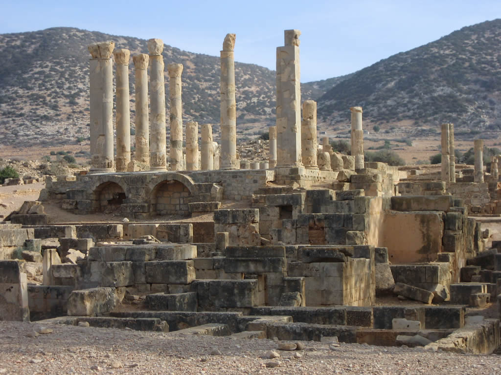
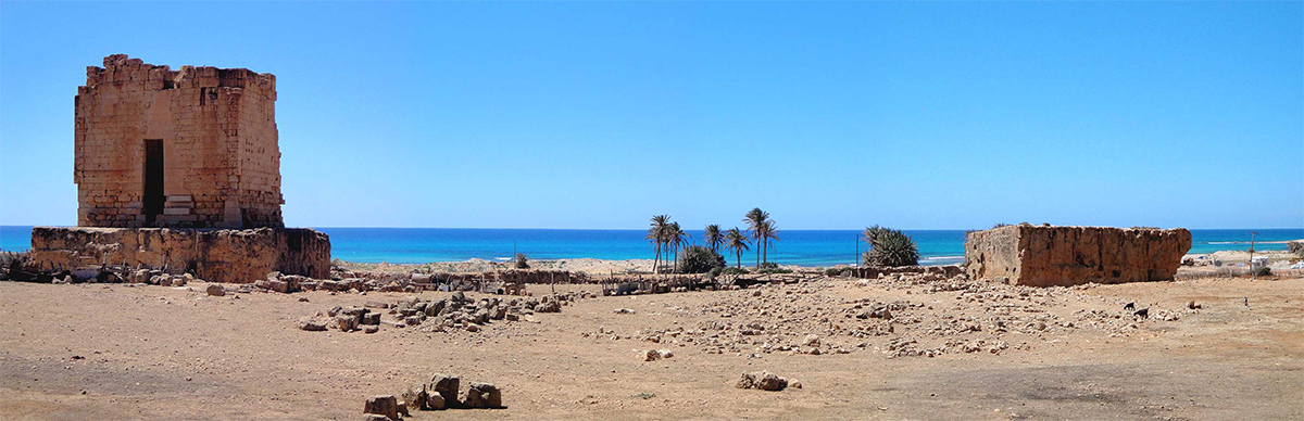
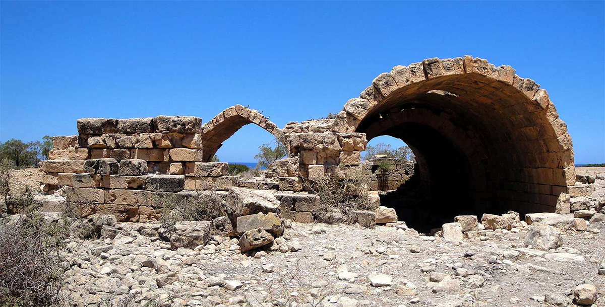
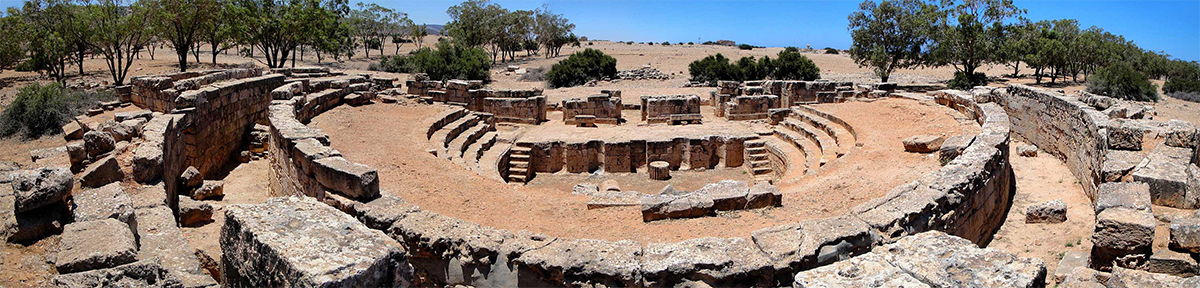
Ptolemais is now a quiet town at the foot of the Green Mountain, famous for its ruins such as the majestic Palace with the Pillars richly decorated with mosaics, the Forum, 17 water cisterns, the Byzantine fortified church, a hippodrome, an Odeon, an theater and amphitheater. The odeon was made suitable for water spectacles in the 4th century AD. The orchestra18 and the stage walls were covered with a layer of waterproof cement, making it possible to change it into a swimming pool. A Roman aqueduct from Hadrian's time, with a length of 20 km, provided water to the city.
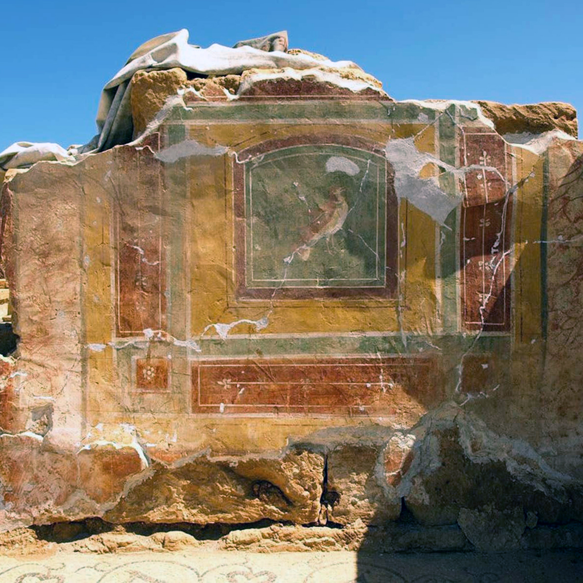
Only recently, a Polish expedition uncovered one of the largest Roman villas with frescoes and mosaics of an exceptionally high quality20.
Research has shown that the harbour consisted of two basins to the east of the headland. The small basin next to the headland had an area to 2.5 hectares and was also used in ancient times by local fishermen and coasters. The main port, some 7 acres, provided shelter and anchorage for a large number of ships waiting to be loaded or unloaded. Incidentally, the port was never part of the Roman Annona system21 according to Rougé22.
The entrance to the great harbour basin, which had the same size as the harbour at Apollonia, was between two moles on the east side; one mole runned from the island of Ilus, about which is spoken in the Stadiasmus Maris Magna23 in the second century AD and the second one runned over a short distance to the coast. There was probably a lighthouse or beacon on the southern tip of the Ilus mole.
On the north side the basin was, as we saw, closed with a breakwater between the two islands. The western island was connected to the mainland by a wide quay, paved in the same way as the streets in Ptolemais. Ships in the western part of the large basin moored against this quay and were loaded or unloaded there.
The small basin was directly accessible from the sea on the northside.
Remains have been found of what may have been a small slip way for the maintenance of small ships on the northwest side of the quay.
The island itself was surrounded by a two-meter-high wall as protection against the sea and unwanted visitors. Within this wall was a fish processing factory. The fish processed here was probably tuna fish for local consumption as well as for export and could therefore be shipped immediately.
The aqueduct ran through the city in the direction of the island and the water will therefore also have been used for supplying ships and for fish processing.
Due to the unstable situation of the country, Ptolemais port is not yet fully revealed. Nevertheless, I’m proud of Ptolemais, of its past, of its present and it feels safe and sound, because today it is protected by the mountains, the Mediterranean and…..Unesco.
- Sources
- - Bogacki, M., 2012, Archaeological kite aerial photography in Ptolemais in years 2006–2008, in J. Żelazowski (ed.), Ptolemais in Cyrenaica. Studies in memory of Tomasz Mikocki, Ptolemais 1, 77– 91. Warsaw: Institute of Archaeology University of Warsaw.
- - Beltrame, C., 2012, New Evidence for the Submerged Ancient Harbour Structures at Tolmetha and Leptis Magna, Libya.
- -Laronde, A., 1996, Apollonia de Cyrénaïque: Archéologie et Histoire. Journal des savants, 1996
- -The Harbour at Ptolemais: Hellenistic City of the Libyan Pentapolis, Robert A Yorke, David P.Davidson
- -Robert A. Yorke and David P. Davidson: The Harbour at Ptolemais: Hellenistic City of the Libyan Pentapolis; The International Journal of Nautical Archaeology (2017)
Notes- 1:Herodotus - iv 151-160
- 2: Mueller, 2004: 1ff
- 3: Pentapolis of Cyrenaica in eastern Libië (Cyrene with the port of Apollonia, Barca, Berenike (present Benghazi), Ptolemais and Taucheira)
- 4:Flavius Petrus Sabbatius Iustinianus, Justinianus I – the Great (482 - 565)
- 5:The holy Lucianus of Antioch, better known as Lucian the Martyr, was a christian priest, theologian and martyr (240 - 312).
- 6:Alexander I of Alexandria, 9e pope.
- 7:Icon from the Mégalo Metéoron-convent in Greece, which represents the First Ecumenical Council of Nikea 325 AD, with the condemned Arius at the bottom of the icon. Photo Jjensen (Wikimedia commens)
- 8:Marcus Aurelius Valerius Maxentius (ca. 278 - 28 oktober 312) was a Roman emperor from 28 oktober 306 till 28 october 312. He is called a usurper, as he was not entitled to the title and was not recognized by the other emperors.
- 9:Photo-www.fayeandsteve.com
- 10: Polish Mission to Ptolemais, Institute of Archaeology, Warsaw University, author: Miron Bogacki)
- 11: Photo-www.fayeandsteve.com
- 12: Baika, 2014
- 13: Beltrame 2012:317
- 14: Roman building material made of tiles broken into very small pieces, mixed with mortar and then knocked down with a pestle.
- 15: PHoto-www.fayeandsteve.com
- 16: Photo-www.fayeandsteve.com
- 17: Polish Mission to Ptolemais, Institute of Archaeology, Warsaw University, author: Miron Bogacki
- 18: Space for the stage in a theater.
- 19: Photo-www.fayeandsteve.com
- 20: https://most-interestingthings.com/archaeologists-uncover-1700-year-old-roman-villa-with-stunning-mosaics-in-libya/?fbclid=IwAR2R-OW5atjNNX-g8n2SkUMHH_8rIHGQH2KAVTGcEiMAQC778cLyLLl5YOE
- 21: Anona system: in this case the imperial food (grain) system for the people of Rome. (see "Roman Shipowners".)
- 22: Rougé, 1966
- 23: Stadiasmus Maris Magna: part of Hippolytus Chronicon geographic and navigators handbook from 235 AD.
- 24: Photo-www.fayeandsteve.com


 We are committed to providing versions of our articles and interviews in several languages, but our first language is English.