
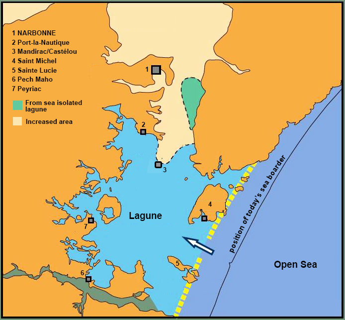
In June 2019 we published an article about one of the most important Roman port cities outside Italy under the title ‘Narbonne, gate to the Celtic world’. In this article, we showed how a city located on the edge of a lagoon usually had a complex port system instead of one large port. One of the reasons for this was the changeable situation regarding wind and water in a lagoon area.
In the mentioned article, various ports and mooring places belonging to this port complex of the Roman colony Narbo Martius were described. Today we add another port, that is to say: a port whose structures have brought to light, but where every trace of the actual harbour is still missing.
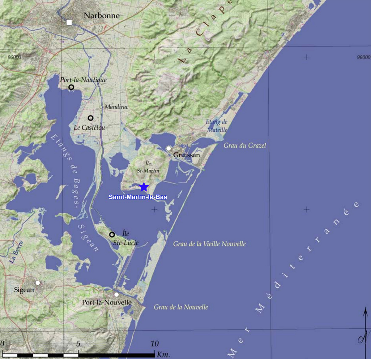
Searching for the harbour of Saint Martin le Bas
In the municipality of Gruissan, the island of Saint Martin is located a few tens of kilometres from Narbonne. Excavations have been carried out on the south side of this island since 2011 as part of the Collective Research Program “Les ports antiques de Narbonne”. The excavation site covers approximately 4 ha, of which more than 2,000 m2 is currently uncovered, spread over two plots. The most northern plot is divided into 4 zones, the southern part includes zone 5.
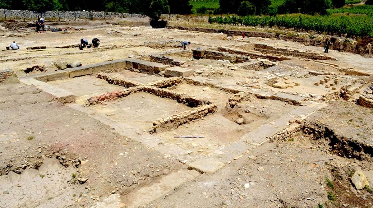
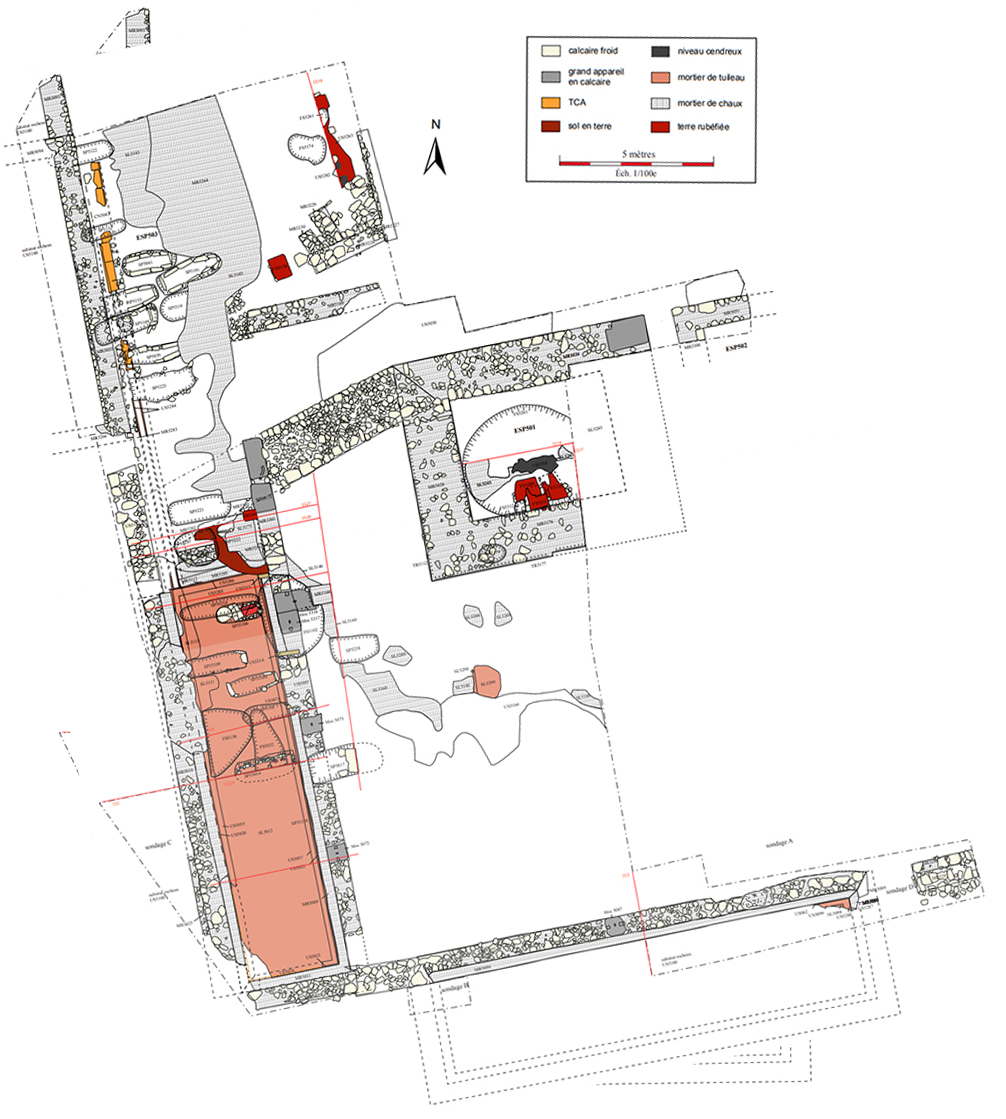
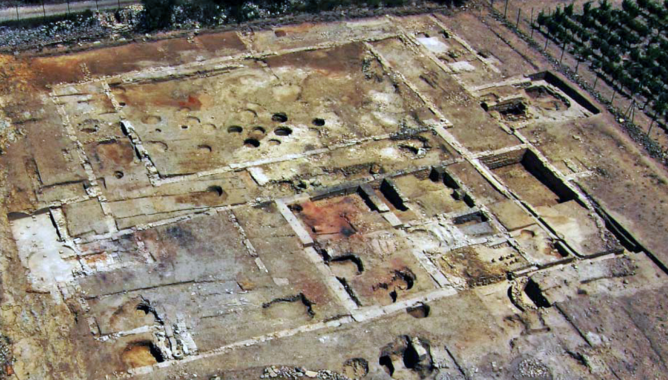
On the northern site a team, led by the French archaeologist Corinne Sanchez, has uncovered a large complex of buildings. This complex was situated around a large central courtyard (ESP 201) of 380 m2 which was equipped with a 4-meter wide gallery on three sides (see photo 3).
On the east side, several small spaces open onto the gallery, including two 18 m2 rooms with a lime floor and intended for commercial or administrative purposes.
Most of the space surrounding the main central square remains difficult to interpret because unfortunately previous excavations have disrupted or destroyed many levels. With the exception of a small, square-shaped room of 8 m2 on the east side (ESP 216). This seems to be the only entrance to the complex. Due to its small width of 2 meters, it is suspected that this was not the main entrance, which could then, for example, lie on the part that has not yet been excavated.
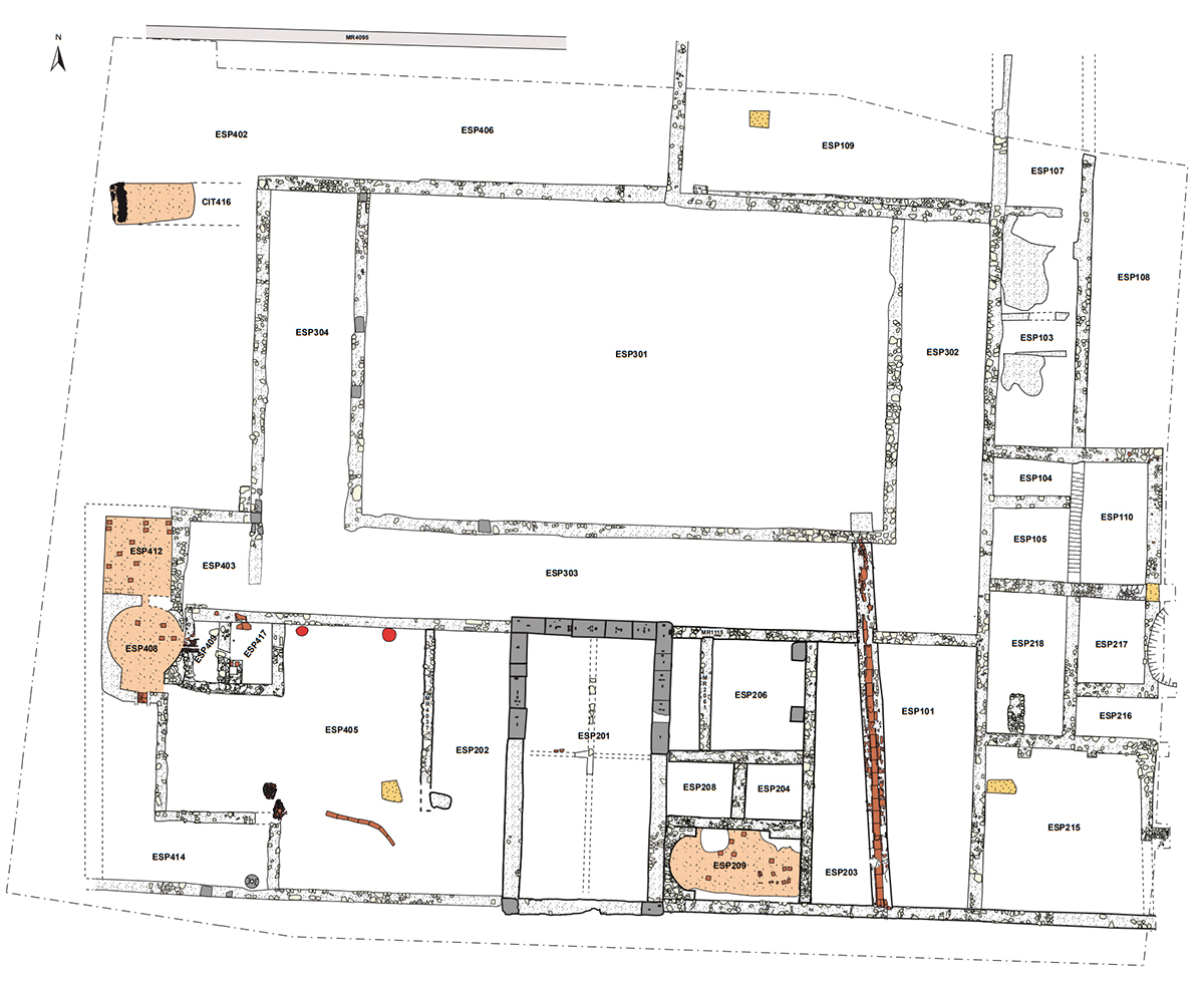
The whole complex was anchored so deep in the ground that we can assume that the building consisted of several floors.
Also in this area was a large space of 91 m2, constructed from monolithic limestone blocks with a length of more than one meter, including a basement (ESP 201). This rectangular building has an area of 14 x 7.5 meters and a considerable height, which gave it a monumental appearance and was undoubtedly a good landmark for the ships entering the lagoon to reach the ports of the city.
The ground floor, consisting of 4 rooms from 15 to 21 m2, is reminiscent of a storage space like the cryptoporticus we know from other Roman cities, such as in Narbonne. (see article 'Narbonne, gate to the Celtic world'). The rooms had an earth floor and were separated by walls of mud, mixed with chopped straw and covered with a layer of lime.
In one of the rooms a series of objects was found, including a scales, a leg ruler, bronze balm bottles, a number of bone and glass chips and bronze needles. The findings suggest that the spaces were used for economic and commercial purposes. The objects that probably lie there from the 3rd century AD. mainly originate from the 2nd century AD.
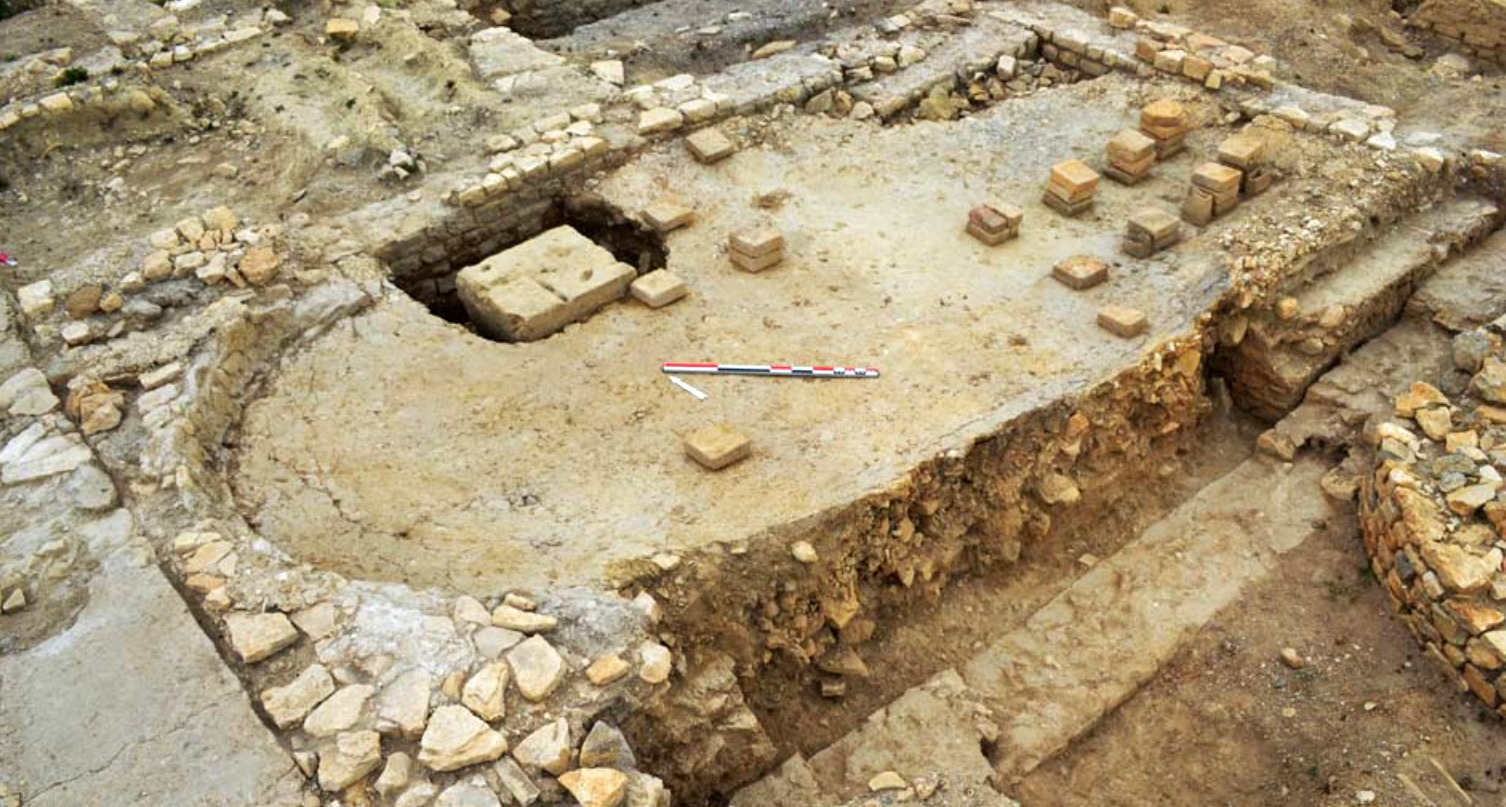
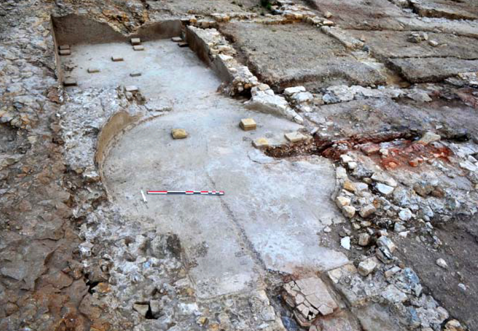
The complex also had two small thermae (public baths) without much luxury. The first is located against the eastern wall of construction 201. The entire bathing house measures 50 m2, of which only the apse-shaped caldarium (hot water bath) of 19 m2 has been reasonably well preserved (209).
North of the caldarium were two rooms (204 and 208). The ground layer of these two rooms from the imperial period has been completely obliterated by medieval excavations. However, it is suspected that these two spaces of 7 and 8 m2 respectively were used as tepidarium (lukewarm water bath) and frigidarium (cold water bath). Finally, room 206, which has not yet been excavated, may well have been the apodyterium (dressing room) through which one entered the baths from the southern portico.
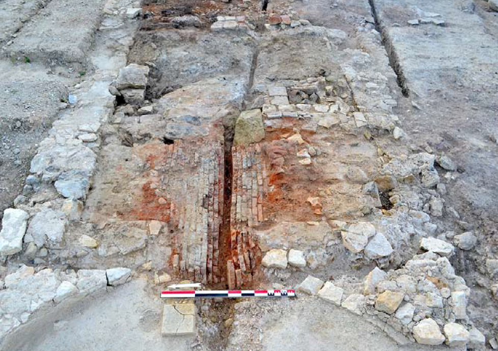
The second bathing house is located west of tower 201. These baths probably date from the Augustus-Tiberius era. This bathing house is also relatively small and sober. Only two heated rooms of this baths, connected to a praefurnium (heating room-409), have been preserved. The warm air was transported from the praefurnium in a special way via hypocaust stones (hollow red clay stones) horizontal laid in the clay of the floor.
The caldarium (408) measures 13 m2 and has a circular outline with a rectangular south-facing exedra (extension). The tepidarium (412) is rectangular in design and measures 12 m2. No trace of the frigidarium has been found, but this was probably located between the tepidarium 412 and the cisterna (water reservoir) 416.
The baths could be reached via a vestibule (403).
These simple bathing houses were probably used by sailors who, after a long period at sea, could use a proper bath.
A small workroom of 5 m2 next to the vestibule of the western bath house led to a courtyard (405) of 100 m2 which was located between the tower construction and the bath house. Various activities appeared to have taken place in this courtyard. For example, a blacksmith shop witnessed by the large amount of presented iron slag. Oil amphorae were also placed in the floor. These were probably filled with water to extinguish the forgings, as we see in many of these installations1. In addition, four cooking areas have been found in the southern part of the courtyard and part of a mill (catillus) for grinding flour. Apparently in this part food was prepared and bread was baked.
Zone 5
In addition to the complex described above, divided into four zones (see numbering of the spaces), a second plot has been partly excavated, zone 5, as already mentioned. This plot is located on an elevation, 100 meters southwest of the first excavation and another 100 meters from the current coastline. The sector is surrounded by a rural path and was known as "Vieux Château" (Old Castle)2.
In 1955, based on aerial photographs and soil research, a large building measuring 35 x 20 meters divided by various walls was already noticed.
In 1999 the site was cleaned and measured by the team led by C. Sanchez after which the function of the structures could be specified.
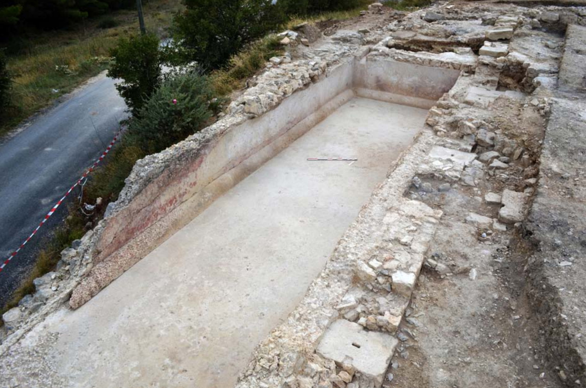
The complex included two basins placed perpendicular to each other. Basin 1, of which only the north wall is visible over a length of 7.20 m, was oriented east/west. Basin 2 is oriented south/north. Three walls of the latter basin are still standing, over a length of 7.20 meter and a width of 3.60 meter. The south/west corner of the basin has been sacrificed on the road that passes it. Both basins had a volume of about 40 m3. The walls and floor were provided with a water-resistant tile mortar3, which allows the basins to be identified as cisterns (water tanks) 4, probably intended to provide ships with fresh water. This water was supplied via an aqueduct from the north.
North of basin 2 a pipeline has been discovered that may have been used as a water supply or overflow.
Basin 2 has a length of 13 meter and is 3 meter wide. Based on the coating and the Gallic and Spanish amphora present, both basins are dated no later than between 10 and 50 AD.
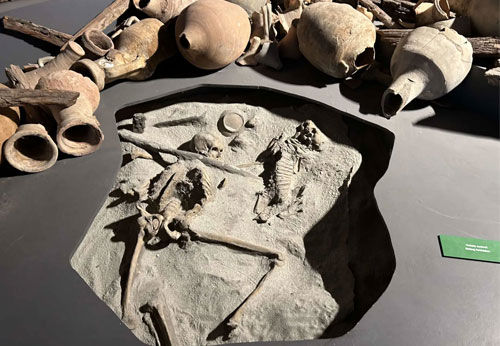
On the north side of the plot, the foundations of other buildings have been found. Further investigation will be necessary to determine their function. In a later period (5th to 7th century) this ground was also used as a cemetery. Many tombs and skeletons have been brought to daylight.
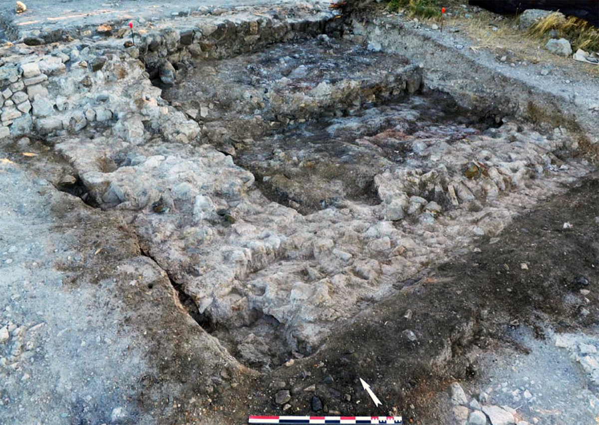
At the end of the 2015 excavation, four walls were discovered that border space 501. They enclose a rectangular space with an outside dimension of 8.30 meter (east/west) by 7 meter (north/south) and an interior of 5.30 meter by 3.90 meter. Thus an inner surface of 21.06 m2. All walls are anchored together and have an average thickness of 1.55 meter. The deep and heavy foundation of this building strongly suggests that we are dealing here with a tower. Perhaps a lighthouse.
CONCLUSION
According to the research, Saint Martin le Bas is said to have been founded by the Romans at the end of the second century BC, just after the establishment of the colony of Narbonne (see 'Narbonne, gate to the celtic world').
The excavated settlement of Saint Martin le Bas dates from the time of Emperor Augustus, probably around 20/10 BC. and would have remained in use until the mid-5th century.
The current exposed construction can be seen as closely associated with the port complex of Narbonne which, as we know, was of enormous economic importance in ancient times.
Although such a large-scale building in combination with a courtyard with a covered gallery on three sides was customary, in this case it indicates something special, in a remote area far from the city. This can only be explained by the important role it apparently played within the port system. The intensity of commercial traffic in this area necessarily implied the existence of these types of specific buildings. The arrangement around the central courtyard with underground storage areas and shops or offices appears to be particularly favorable for commercial transactions and for the storage of traded goods.
This complex also had a number of service activities witnessed by the two modest bathing houses that have been uncovered and the activities in courtyard 405. The forge there seems to suggest that ship repairs could also be carried out.
Finally, the large reservoirs of zone 5 had to be near the coast in order to supply the boats with water, while the tower (201) was a beacon to direct the ships to the entrance of the lagoon.
The strategic position of this site was also important. Located at the entrance to the lagoon, this was the first mooring possibility ships encountered on their way to the ports of Narbonne. We can therefore assume that this place was part of the administrative and customs infrastructure of the city. We know that taxes were levied on all goods that passed through the port. If further research confirms this hypothesis, the Saint Martin site may prove to have been a key position within Narbonne's port system.
Where are the moorings, quays etc?
The only weak spot in our argument is the lack of a harbour. Where was this?
Navigating the various ponds of the lagoon is just as difficult today as it was in ancient times. Knowing the different shipping channels was necessary to achieve unobstructed access to the River Aude or to one of the various berths around the lagoon..
For some reasons, not least salinization, the lagoon is no longer the same one from 2000 years ago. The alleged port complex of Saint Martin le Bas is also no longer accessible for ships due to salinization.
However, we would like to know how ships could reach this mooring place in ancient times. A lot of research has been done on this in recent years. Various geophysical samples have been taken, with the main focus on the area around the two cisterns that are believed to have been used to supply ships with fresh water. Because in order to take-in water a ship had to be able to moor at one of the two tanks.
Also the research done in 2015 mainly focused on studying the environment close to the archaeological site to find out how to reach the coast of Saint Martin le Bas from the lagoon, and thus from the sea.
After studying the geological5 and topographic map, the researchers came to the idea that the valley of the Stream of Saint Martin may have been an old estuary that could give a boat access to the lagoon in the immediate vicinity of the site.
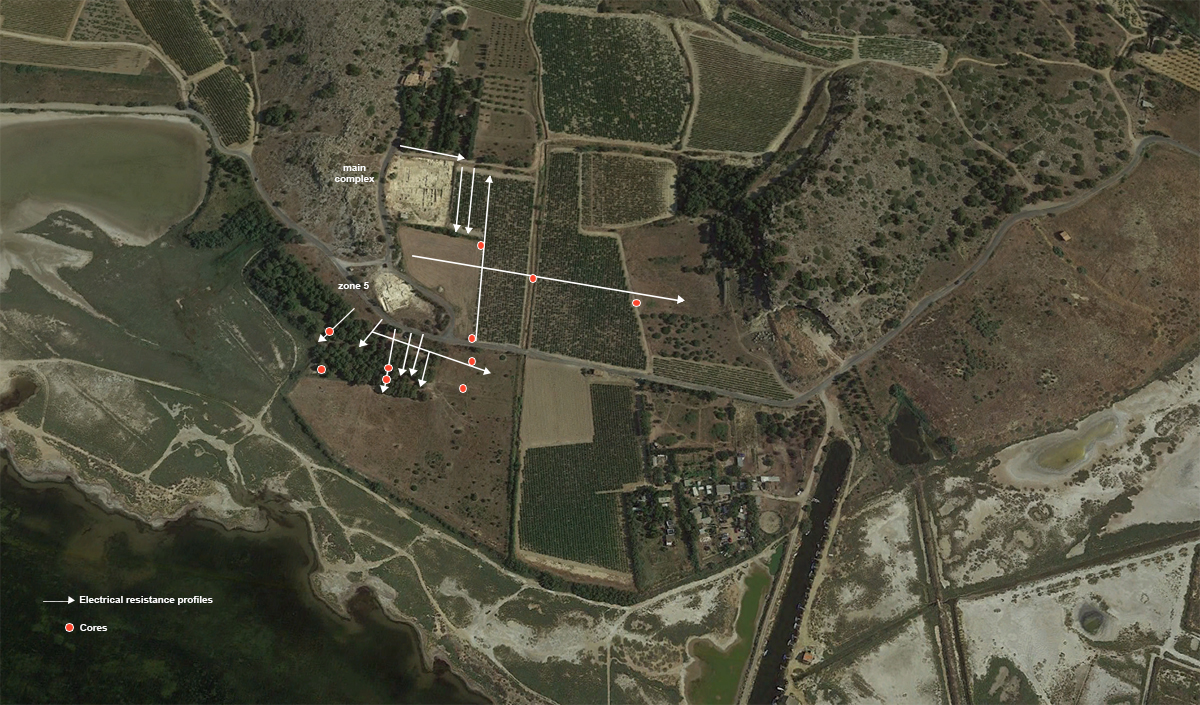
To test these hypotheses, an electrical resistance tomography campaign was launched in April 2015. Tomographic profiles provide in-depth insight into the geometry of the sediment deposits. Twelve profiles were set out at crucial places in the area to be studied. In addition, 10 core samples were taken. The cores (drills) were installed on the main profiles in consultation with geophysicists.
The results of this soil investigation, which incidentally have not yet yielded any positive results concerning the location of the harbour, can be read in detail in the report by Camille FAÏSSE (from page 498).
For the accessibility of this port, we will therefore have to wait for what subsequent investigations will reveal.
Sources- - Guillaume DuPerron-L'Etablissement Antique de Saint Martin le Bas à Gruissan (Aude)
- - Arthur de Graauw www.ancientportsantique.com
- - Florens Aqvilivs Narbonensis
- Noten
- 1:See (Dieudonné-Glad, Parisot 1999; Martin-Kilcher 2003, p. 235; Reymond et al. 2009, p. 73).
- 2: Guy 1955; Sanchez et al. 2000, 312
- 3: Mortar consisting of, in addition to the usual components (water, lime, sand and gravel aggregates), the residue of grinding bricks or tiles. This mortar has hydraulic properties and can then be cured in a damp environment or in the absence of air. It was therefore already used in ancient times in hydraulic structures (thermal baths, water management and routing, crossing rivers, etc.).
- 4: Sanchez et al. 2000, 336
- 5: Lespinasse et al. 1982


 We are committed to providing versions of our articles and interviews in several languages, but our first language is English.