Introduction
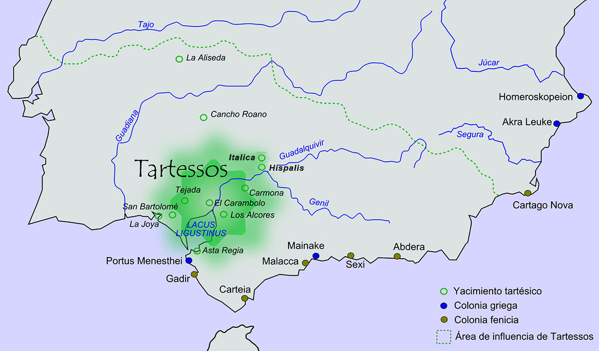
Besides the several Roman Sea Ports we already described, we also like to focus sometimes on river ports used or built by the Romans and especially those river ports which were tremendous important for the overseas trade. As we saw at Narbonne, cities laying on a river were often equipped with a network of harbours (see ‘Narbonne, gate to the Celtic world’) Today we like to tell something about one of the ports connected with the legendary kingdom of Tartessos in the western province of Spain, Hispania Baetica, which was very important among others for the trade with Britannia.
A report by Eric Tayler
ITALICA
Italica in Roman era4
Italica was the first city to be founded in Spain by the Romans being situated about six miles to the north of Hispalis (modern Seville) in the Guadalquivir valley. Geograhically, Italica lies close to the routes running from the mining zone in the Sierra Norte mountains.
The area which became the city of Italica from 206 BC can be traced back to the 8th Century BC and the Kingdom of Tartessos2 which covered an area of the middle and lower Guadalquivir Valley. The city of Tartessos was situated on the Atlantic coast at the mouth of the river Guadalquivir3. Trade flourished at those times with the Phoenicians and Greeks who operated prosperous factories smelting ores and manufacturing pottery.
Africanus6
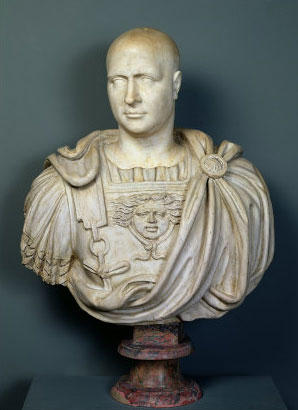
Italica5 was founded in 206 BC by Publius Cornelius Scipio (Africanus) specially for the veterans and invalids from the Battle of Ilipa in the 2nd Punic War against the Carthaginians, who settled there in 206/205 BC.
In due course, three Roman tribes moved into the city, the Gens Ulpia, the Aelii and the Tirahii. The Aelia were the ancestors of Hadrian and possible Trajan, both of whom were probably born in the city. It has been suggested that Theodosius (346-395 AD) was also born in Italica, but it is more likely that he was born at Coca, Segovia.
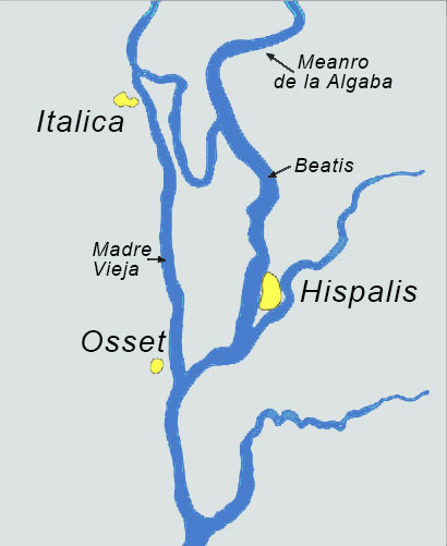
Particularly under the influence of Hadrian and Trajan, the city became quite prosperous and was linked to a busy river port. According to “The Catalogue of Ancient Ports” (nr 317), the port of Italica was situated at what is now the town of Santiponce. The catalogue states that the port could be found on an “affluent” of the Guadalquivir river, namely the Madre Viega (see photo 2).
Italica was an important centre for the redistribution of metals mined at Rio Tinto and Aznalcollar in the Sierra Morena. At what is now Santiponce, there is evidence that there was a large lake that was both wide and deep on the edge of Italica. This would have made it easy for big boats to turn and take advantage of the deep connection to the sea via the Guadalquivir.
THE CITY
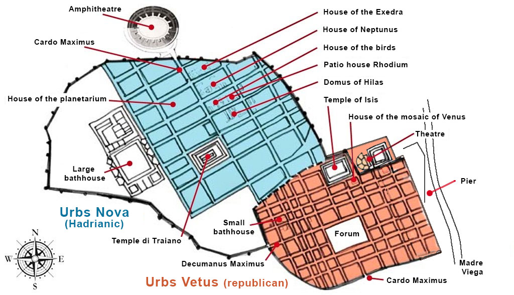
The vetus urbs (original or "old" city), founded in the second century BC, developed into a prosperous city, built on a Hippodamian street plan (i.e. wide avenues with smaller streets between, at right angles to the main avenues) with public buildings and a forum at the centre. At the eastside the old town was linked to a busy river port connected with the Atlantic Ocean via the rivers Madre Viega and Beatis (modern Guadalquivir).
Many improvements were made by the emperor Augustus, including the building of a 3000 seat theatre.
As we already mentioned, the forbears of both Trajan and Hadrian originally came from Italica and it is likely that both emperors were born there. Under Trajan, but especially under Hadrian, Italica flourished, its area increasing fourfold. He expanded the city northwards as the nova urbs (new city) and in the 2nd Century AD, upon its request, elevated it to the status of colonia as
COLONIA AELIA AUGUSTA ITALICENSIUM
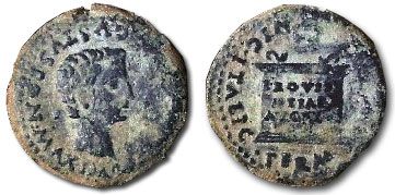
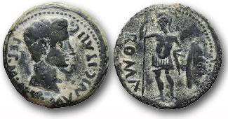
When Italica was awarded municipal status, a short-lived mint was set up producing the low value As. These are just three examples of the coins produced:
Roman As minted after 14 AD.
Obverse: TI CAESAR AVGUSTVS PON MAX IMP
Reverse: MVNIC ITALIC PERM DIVI AVG
Roman As minted after 27 AD.
Obverse: PERM AVG MVNIC ITALIC
Reverse: ROMA (holding a spear and shield)
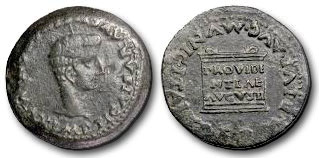
Roman As minted during reign of Tiberius.
Obverse: IMP TI CAESAR AVGVSTVS PON MAX
Reverse: PERM DIVI AVGMVNIC ITALIC
Hadrian also added temples, including the enormous and unique Trajaneum8 in the centre of the city to venerate his predecessor and adopted father, and rebuilt public buildings. Today the republican town lies beneath the modern city of Santiponce.
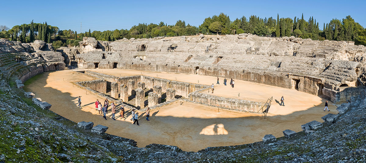
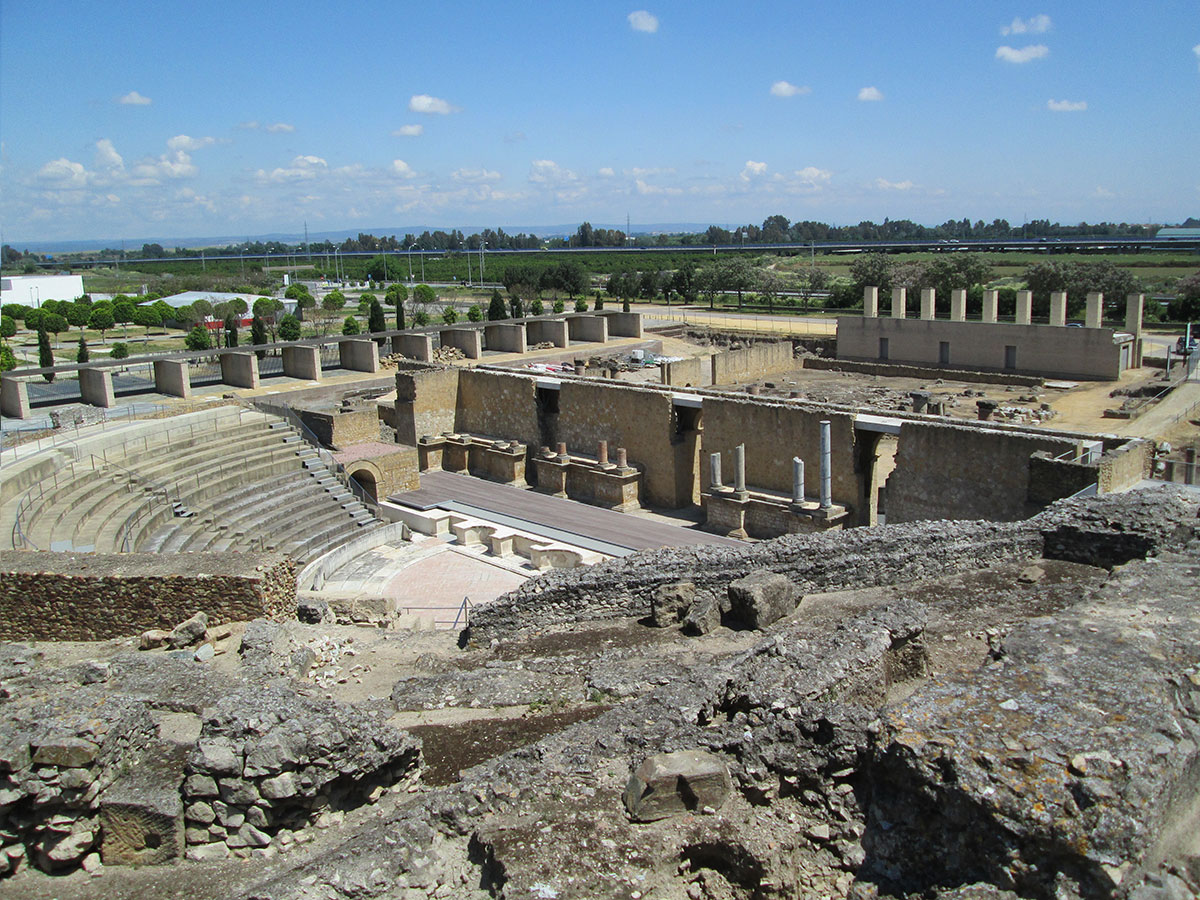
When you arrive at Italica, the first thing that you see is the remains of the Amphitheatre. The seating capacity was 25,000 and it was built in a city with a population of just 8,000. It is the third largest Roman amphitheatre and by far the biggest building in the city, having survived despite much pillaging over the years. Most of the first level of seating remains along with some of the second and third rows.
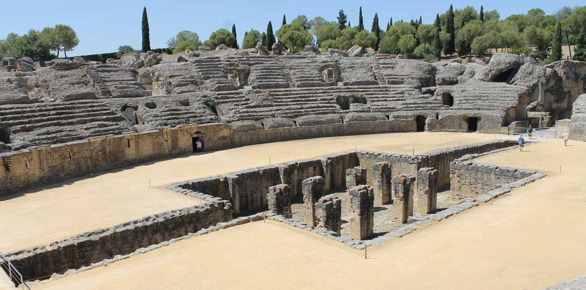
In the centre of the arena is a pit where the animals were kept, which was covered by decking during the performances. Underneath the seating, corridors (or Vaults) ran all the way round the amphitheatre and these are still accessible today.
In 2016 the amphitheatre was used as a filming location for the international famous TV show ‘Game of Thrones’.
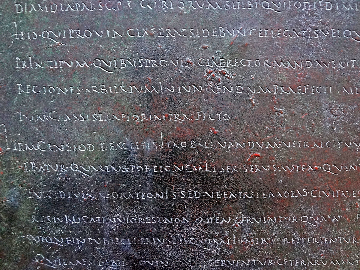
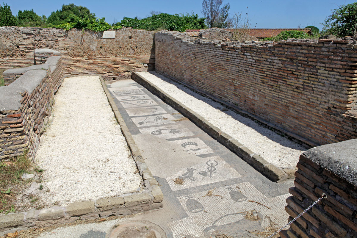
There were many side rooms off these corridors, and in one of the rooms hangs the copy of a lead plaque. The plaque is called the Tabula Gladiatoria which tells how elated the priests were that the costs of putting on gladiator fights was going to be reduced. The original Tabula Gladiatoria can be seen in Madrid.
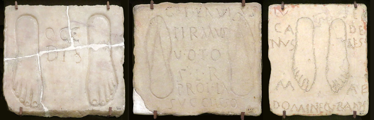
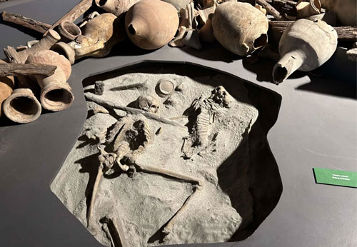
When you enter the amphitheatre, a number of interesting features can be seen at floor level, namely some ‘boards’ for the game of Rota11 and a reproduction of a votive offering.
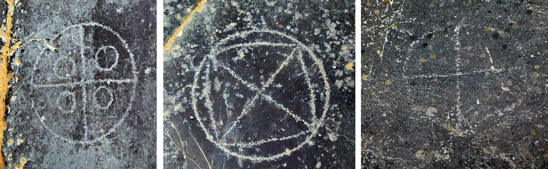
During the reign of Tiberius, a small shrine to Isis was built in the theatre and it was there that four ex voto marble inscriptions were found showing the characteristic foot prints. The votive offerings came originally from a find in one of the rooms in the amphitheatre.
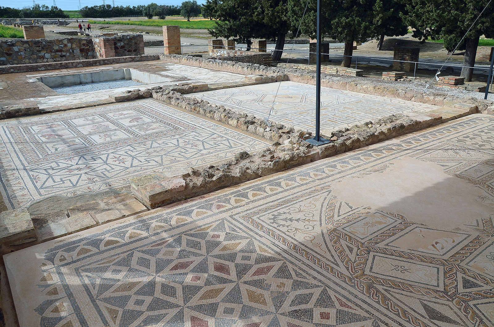
The remainder of what else still can be seen in Italica is in the urbs nova (new town). The urbs nova follows, like the old city, also a Hippodamian street plan. On, or near the main avenue, the Cardus Maximus, several large houses have been excavated (see photo 4).
The house of the Exedra (semi circular niche)
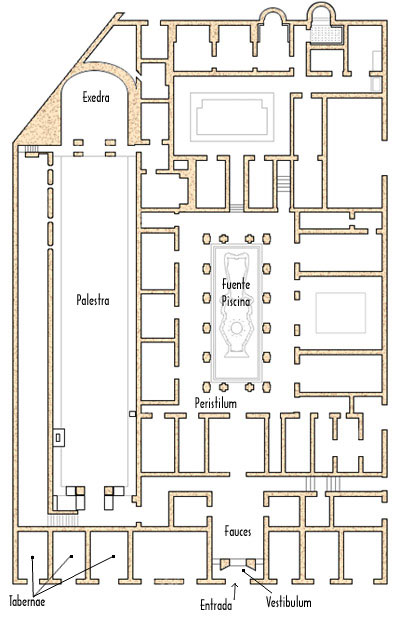
This house is the first you meet when you by-pass the amphitheatre. Because of its size, it is thought to have had a dual function – residential and business or socialising. The business or socialising part may have housed a school or have been the headquarters of some organisation.
In the residential section was a central pond and several latrines with decorated mosaic floors. (Compare this house with the ‘Schola di Traiano’ in Ostia).
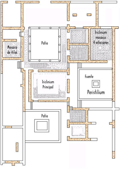
The house of the Planetarium
Close by, to the south-west, is another impressive building, the House of the Planetarium.
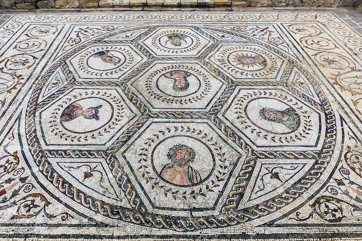
The house was built in the 2nd Century AD but was later split into smaller units. The mosaic represents the seven celestial bodies that were closest to the earth. In similar mosaics Sol ("Deus Sol Invictus") was found at the centre, but here it is Venus. It has been suggested that the mosaic is a calendar, as the days of the week are named after the Gods; Sol (Sunday), Luna (Monday), Mars (Tuesday), Mercury (Wednesday), Jupiter (Friday) and Saturn (Saterday). These seven Gods are also associated with the seven grades of the Mithras cult that can be seen also in the mosaic of the Mitreo di Felicissimus at Ostia (see our article:’The last ecavated Mithras Sanctuary’).
Apart from the mosaic and description provided, several other mosaics could be found in the house including the Mosaic of the Animals. As you enter the house, an oven is immediately visible.
House of Neptune
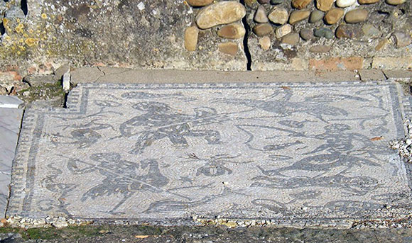
Built in Hadrian’s time, the house had its own thermal baths and caldarium (hot room). Several mosaics have been found there, but the main one suggests that the owners had Egyptian interests.
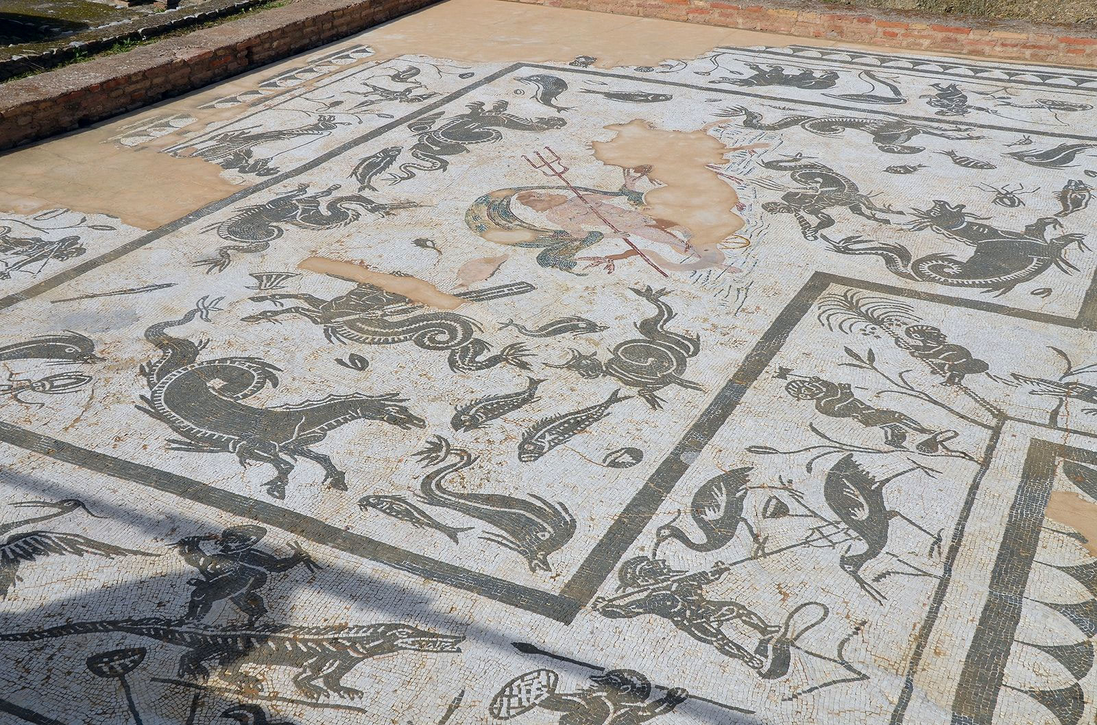
Neptune can be seen in a chariot being drawn by a hippocampus surrounded by crocodiles, hippopotami and pygmies fighting ibises. The mosaic is very similar to the mosaic found in the Baths of Neptune at Ostia and the labyrinth maze is similar to the one at Knossus.
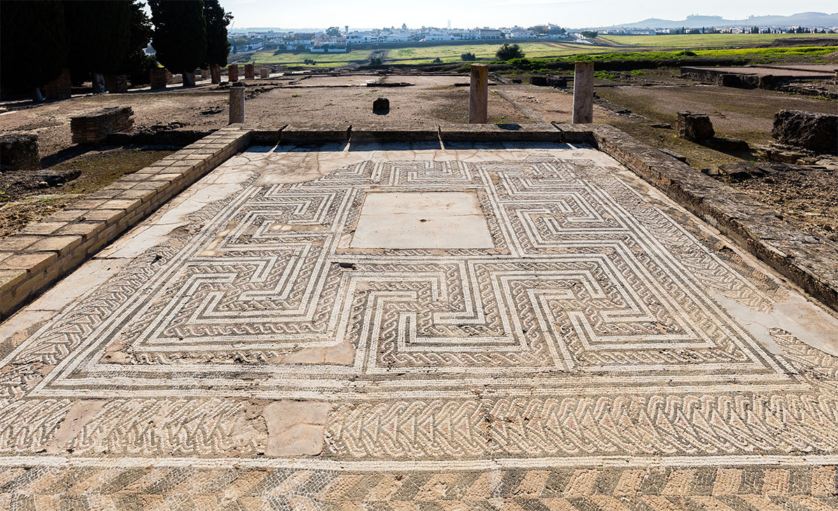
House of the Birds
The house of the Birds was the first house of Italica that was completely excavated.
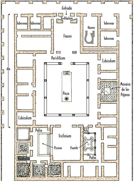
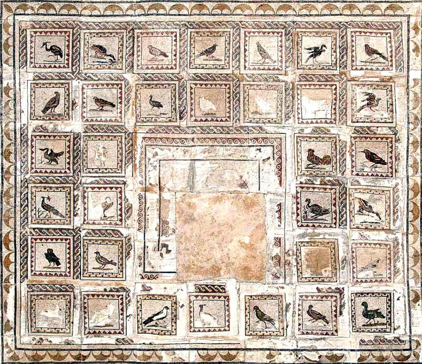
The house was built in the time of Hadrian, obviously for a member of the upper classes. Like all these houses it was connected to the water system of Italica and had a water cistern in the basement. The main mosaic in the house consisted of 35 small squares, each showing different species of birds. Unfortunately, the sqare in the middle is damage and cannot be interpreted. At the entry end to the house were several tabernae (taverns). In one of them was a large bread-making oven. Also a small private altar to the Lares (house gods) has been found.
House of Hilas
Like all the houses mentioned, this was of traditional structure and obviously luxurious. The mosaic that gives the name to the house can now be seen in the Sevilla Museum.
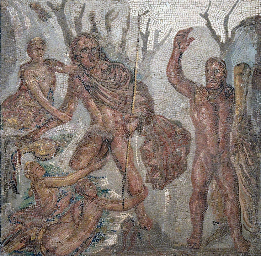
What is happening in the mosaic, follows the verses of Apollonius of Rhodes describing the voyage of the Argonauts in the search for the golden fleece. Hercules and Hilas disembark in Bithynia looking for a source of water. Hilas is trapped by some nymphs and despite looking for help from Hercules, he cannot be rescued.
The Port
For details of the port at Italica, we rely on the reports of historians who visited the site in the past centuries. In the 16th Century, Italica was visited by Ambrosio de Morales18 and others. In their writings they describe ‘a powerful wharf that lies in the ruins of the city amongst layers of sand’. The Spanish local writer, Fernandez Prieto Sotelo, wrote in the 18th Century of a large wall at Italica, locally known as the pier. Apparently, not many years before he visited the site, large bronze rings (argallones) were still attached to the pier and it was here that the boats could be loaded/unloaded and tied to the pier for storage purposes.
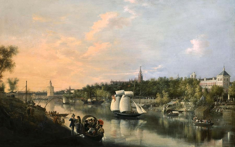 Photo 22: The Guadalquivir near Seville 17.
Downstream from Italica was the larger port of Hispalis which was probably situated near the Puerta Jerez in the modern city of Seville.
The port at Italica went into decline as a result of silting up of the Madre Viega in the 3rd Century due probably to deforestation in the immediate area whereas the port at Hispalis continued to flourish.
Italica simply became a quarry supplying artefacts and building materials for growing Hispalis (Seville).
Spanish Oil
Besides the already mentioned mining and metal industry, the whole of the Guadalquivir Valley and its surroundings (Roman Baetica) was involved in the growing of olive trees and the export of olive oil. This required the production of large numbers of amphorae to carry the oil and there were scores of pottery works in the Guadalquivir Valley between the mouth of the river and Corduba (modern Cordoba).
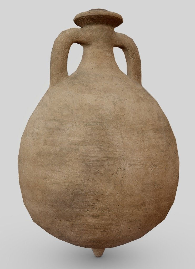
It is likely that production was continued from pre-Roman days in Italica as several pottery kilns have been found in the area.
It has been estimated that 80% of the amphorae produced, as llustrated, were the Dressel 20 type The evidence for this comes from the Monte Testaccio in Rome, a man-made mountain of broken (mainly Dressel 20) amphorae. Calculations similarly have been carried out to show how much olive oil each Roman soldier would need for personal hygiene, food preparation and lighting purposes. Without going through each stage of this calculation, it has been worked out that each Roman soldier would require 6.5 gallons or almost 30 litres of olive oil each year. Bearing in mind that there were 6000 soldiers at the garrison at York for example, that adds up to rather a lot of olive oil!
Britannica and the Spanish oil
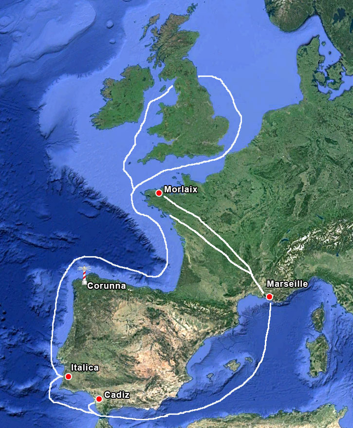
So, the main destination of olive oil from the Guadalquivir valley was Rome itself and the Roman military camps scattered about Europe, thus also Britain. As to know how the olive oil actually got to Britain, there have been several routes suggested.
The cheapest form of transport was by sea so the boats could have sailed along the west and north coasts of the Iberian peninsula, along the west coast of France into the Oceanus Britannicus20. This route could obviously be quite hazardous, but the Romans did build the lighthouse at Corunna in an attempt to make sea transport safer.
The most expensive way to transport goods was by land. There was a land route to Morlaix, in what is now Brittany, from Marseilles but this would also have taken longer than the sea route.
A third possibility was from Cadiz to the mouth of the Rhone, then via the Rhone and Loire valleys to the mouth of the Loire river towards the north of the Bay of Biscay. These three routes are only suggestions, but as they have also been suggested as possible routes for the export of tin from Cornwall for example, it would seem to make sense that goods were being carried in both directions, keeping the boats “full” all the time21.
The above picture shows some of the routes that could have taken olive oil to the north of Britain.
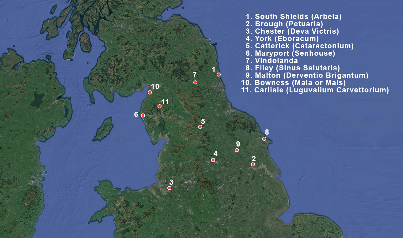
South Shields was a busy port at the eastern end of Hadrian’s Wall and from here there were Roman roads that ran along the southern side of the Wall.
Brough was a crossing point of the River Humber and was positioned on Ermine Street which continued on to York. So again, road transport would be used to transport the olive oil to its final destination.
York itself was a busy port with wharves and warehouses and olive oil was passed from there to Catterick via Aldborough (Isurium Brigantum.)
There is also evidence of trade between Catterick and Vindolanda via Dere Street. Filey was a safe harbour used as a dropping-off point for the olive oil, and Roman roads ran from there to Malton and then onto York where there was a large garrison.
The two ports on the west side of the country in Cumbria, where olive oil would be delivered to the Wall were most likely Maryport and Bowness. Maryport was the larger of the two but both had roads leading to Carlisle at the western end of the Wall.
Further south was the city and port of Chester on the navigable stretch of the River Dee, again a military stronghold.
In this way Spanish oliveoil was sent also to all the places where Roman soldiers were encamped. So, there wasn't only trade between a province and Rome but also between all the different areas of the total Roman Empire.
Notes- 1: Photo Wikipedia-Té y kriptonita based on Image:Iberian Peninsula base map.svg-created by Redtony
- 2: The location of Tartessos is uncertain. The Greek traveller and geographer Pausanias wrote in the 2nd century AD: “They say that Tartessus is a river in the land of the Iberians, running down into the sea by two mouths and that between these two mouths lies a city of the same name. The river, which is the largest in Iberia and tidal, those of a later day called Baetis and there are some who think that Tartessus was the ancient name of Carpia, a city of the Iberians”.- Pausa-nias Description of Greece 6.XIX.3.
- 3:The river Quadalquivir was called in Roman times ‘Beatis’.
- 4:Hypothetical reconstruction by Rodríguez Hidalgo (2010: 47-59)
- 5: The name Italica reflected the veterans' Italian origins, i.e from auxiliary Italic units.
- 6:Publius Cornelius Scipio ‘Africanus’ (236-183 BC) was a Roman general and politicus. (Bust in le Chateau de Versailles)
- 7:Photo Tyk-Wikipedia
- 8:The Traianeum was a large, imposing temple in honour of the Emperor Trajan, built by his adopted son and successor, Hadrian. It occupies a central double insula at the highest point of nova urbs. It measures 108 x 80 m and is surrounded by a large porticoed square with al-ternating rectangular and semicircular exedra around its exterior housing sculptures.
- 9:Photo: Diego Delso-Wikipedia
- 10:Photo: www.nattivus.com
- 11:The original Roman name is unknown. The name Rota, which in Latin means “wheel”, was given to it by Elmer Truesdell Merrill, in his article about the game, published in 1916, where he brought it to the world’s attention for the first time.
- 12:This type of votive offering was located on the ground at the entrance to the amphitheatre and symbolised the footprints of a deity.
- 13:Photo: Civitatis
- 14:Photo: Carole Raddato
- 15:Photo: Carole Raddato
- 16:Photo: Diego Delso
- 17:The Guadalquivir: Painting, 1851 by Manuel Barron y Carrillo, 1814-1884
- 18:Ambrosio de Molrales was a Spanish historian - Cordoba, Spain, 1513 – September, 1591
- 19:See also 'the-largest-roman-pottery-industry-found-in-malaga-spain'
- 20:Oceanus Britannicus or Mare Britannicum are latin names for the English Channel.
- 21:Read also: “ICTIS”


 We are committed to providing versions of our articles and interviews in several languages, but our first language is English.