……… of Tauroentium, Olbia, Antipolis, Nicaea, and the sea-port of Augustus Caesar, called Forum Julium . which is situated between Olbia and Antipolis, and distant from Marseilles ……
Strabo Geography §4.1.9
…… the veterans discharged by Vitellius who now freely re-armed, and had garrisoned Forum Julii, where Paulinus held the greater authority since it was his native …….
Tacitus Histories §3.34
Many quotations have been handed down from antiquity that refer to the ancient name of Fréjus; Forum Iulii (market of the Iulii family). The first quotation from Strabo1 says something about its location and the second from Tacitus2 about the reason for its foundation as we shall see later.
That the city is mentioned so often is not surprising. In its heyday Forum Iulii was the city with one of the three most important naval bases of the Roman fleet in the western Mediterranean3. But let's start at the beginning.
The origine
The area in the south of France where our story is set this time is situated between the massifs of Esterel and Maures. The area that was crossed by the river Argens was inhabited by Celtic-Ligurian tribes.
In 122 B.C. these tribes were overrun by the Roman legions led by Sextius Calvinius4 and the latter founded a new city Aquae Sextiae (today's Aix-en-Provence). Initially, the Romans settled further inland, leaving only a narrow coastal strip to the Massaliotes. the inhabitants of Massalia, (today's Marseille).
In 118 B.C., the Romans founded Colonia Narbo Martius (today's Narbonne) in the first province of Gaul, Provincia Romana 5.
Massalia, originally a port founded by the Greeks, has existed already for about 600 years. Nevertheless, Julius Caesar (probably in 49 BC) decided to build a second port next to Massalia, partly because the old port of Massalia had sided with Pompey in the battle against Julius Caesar7. Massalia was besieged and lost its fleet and its treasury.
A second reason was the need for a new port at a strategic junction of roads; the Via Iulia Augusta (between the Rhône and Italy) and the Via Domitia (between Spain and Italy).
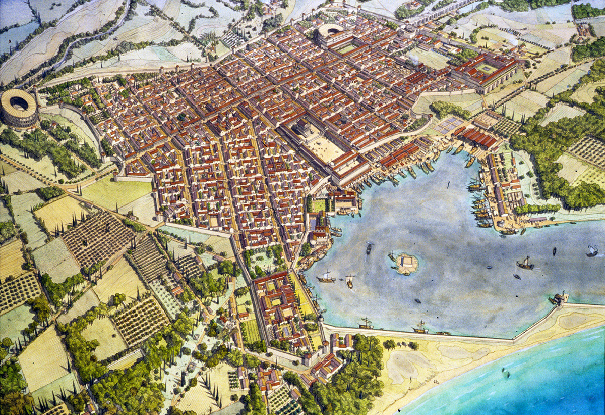
The site for this new port, Forum Iulii, became a small rocky promontory overlooking the Argens Valley.
In 31 BC Julius Caesar stationed a large part of the ships of Antony and Cleopatra's fleet, which had been defeated at the battle of Actium, in the harbour of Forum Iulii. The port was called "claustra maris" (gateway to the sea) by the Roman historian Tacitus.
Between 29 and 27 B.C. Octavian, the later Emperor Augustus, made Forum Iulii into a colony for the veterans of the 8th Legion and gave it the addition Octavanorum Colonia 8. Some years later he even made the city the capital of the province ofNarbonensis.
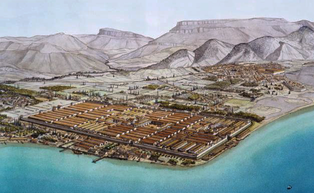
The rapid development of Forum Iulii soon made the city one of the most important ports in the Mediterranean and, certainly until the time of Nero, the second most important port in the Empire after Ostia.
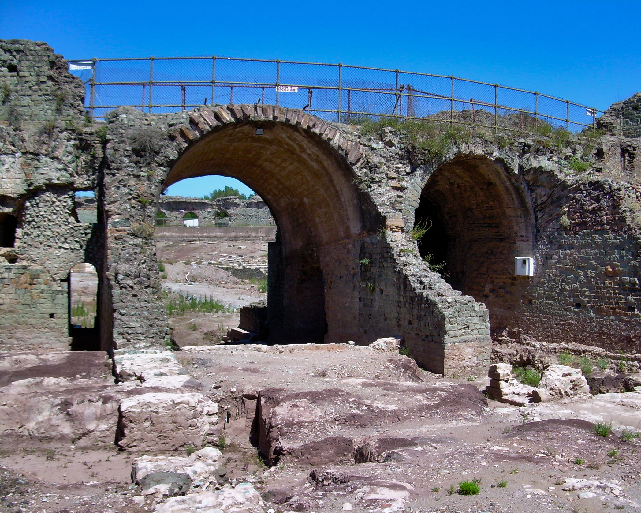
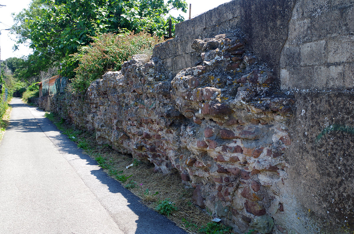
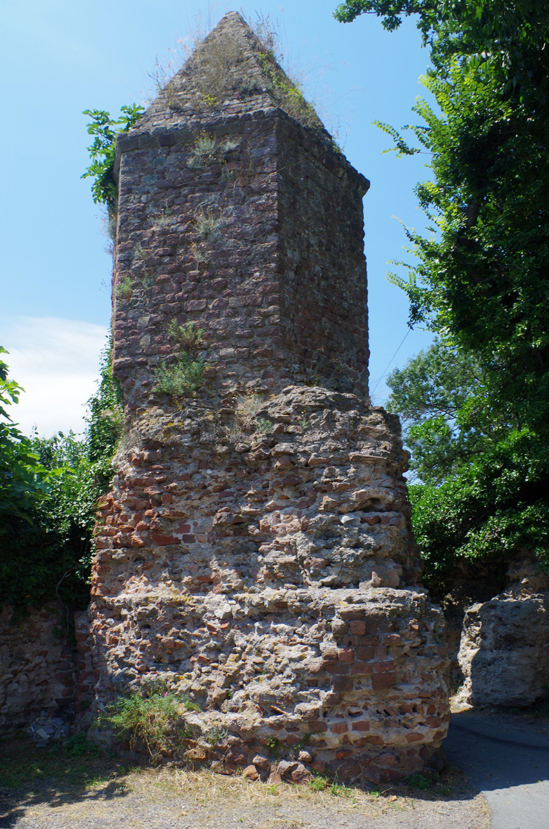
Under Tiberius most of the monuments that are still visible today were built; the amphitheatre, the aqueduct, the lighthouse, the baths and the theatre. In its heyday, the city covered an area of 35 hectares and had an impressive wall of 3.7 km. Forum Iullii grew into an important commercial port from which crafts, agricultural and fish products as well as green sandstone were shipped to all corners of the Roman Empire.
The navy camp
In the 1980s, the structures of a Roman camp were found one kilometre south-east of Fréjus. They are probably the remains of the "camp de la flotte", the camp of the fleet of the Roman general Agrippa (friend of Emperor Augustus). The oldest elements date from the beginning of our era11. The camp was about 24 hectares in size, but only part of it has been given permission to study; in particular the barracks, a warehouse and the bathhouse.
Between the end of the first century B.C. and the middle of the first century A.D., a legion of soldiers (about 5,000 to 6,000 men) stayed in the camp.
The coastline and the harbour
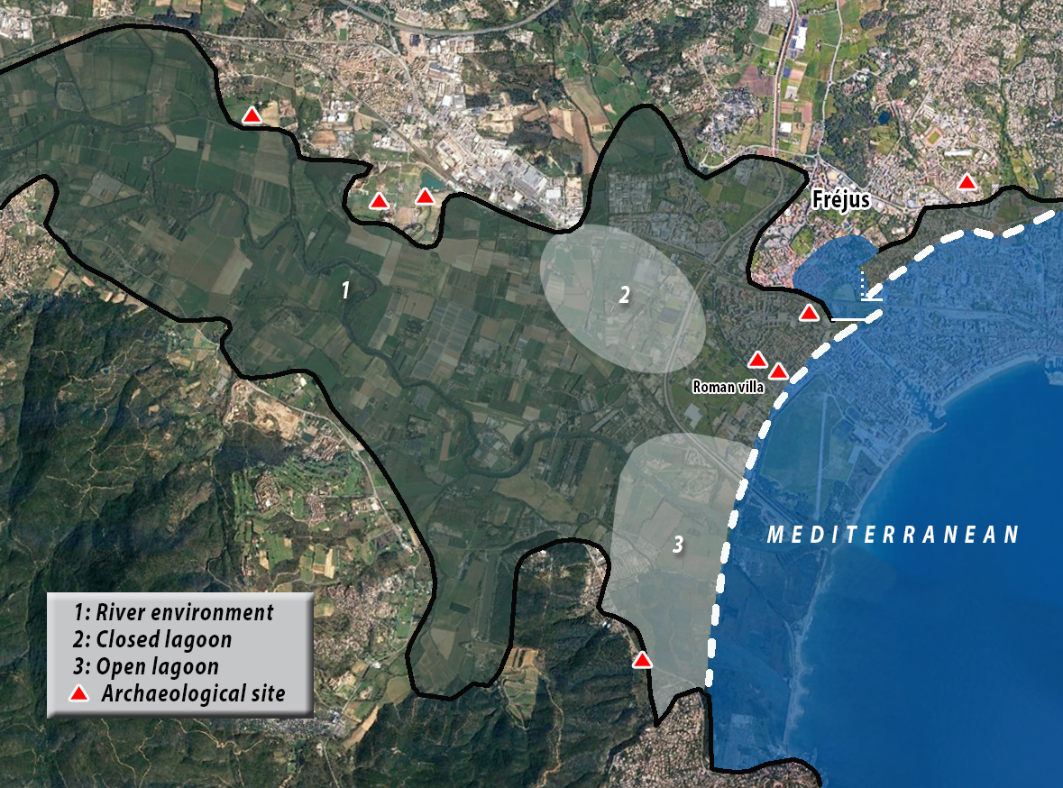
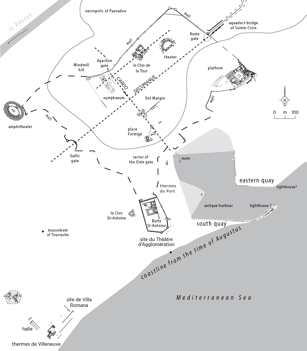
Soil research at archaeological sites such as the Théâtre d'Agglomération and the Villa Romana made it possible to reconstruct with precision the position of the coastline in the early days of the Roman occupation (Fig. 5). On the rocks, clear traces of sea erosion were found which predate the construction of the theatre, as well as remains of sea molluscs which testify to the beating of the waves on the rocks12. Behind this rocky coastline was a beach embankment, marked by a storage area of the Roman villa in the form of a pile of petrified tegulae (roof tiles). This beach was developed around the middle of the first century BC and was bordered by an alignment of oak posts running parallel to the beach, the ends of which were found during excavations. Behind these posts, large sandstone blocks were placed for stability and to hold the sand.
A few decades later, towards the end of the first century BC, the area was converted into a garden and pits for plants were dug directly into the sand, some of which were lined with half amphorae. The regular spacing and the alternation of large and small pits suggest a pleasure garden, which may be related to a building that predates the baths at Villeneuve13. This bathhouse complex, located in the plot adjacent to the garden, is partly built on top of another building that probably dates from the same period as the garden was created.
All these remains bear witness to the early occupation of the northern flank of the lower valley, behind the beach ridge. At a time when urban development was beginning to take place on the Fréjus promontory, the land was probably still fairly water-rich, as evidenced by the persistence of a body of water in the closed lagoon (2) in Figure 5.
On the other hand, on the southern side of the valley, there is still a lagoon (3) with an open connection to the sea.
The determination of the correct position of the coastline also sheds a different light on the development of the ancient port of Forum Iulii, which is now completely filled in and lay more than a kilometre from the present coastline.
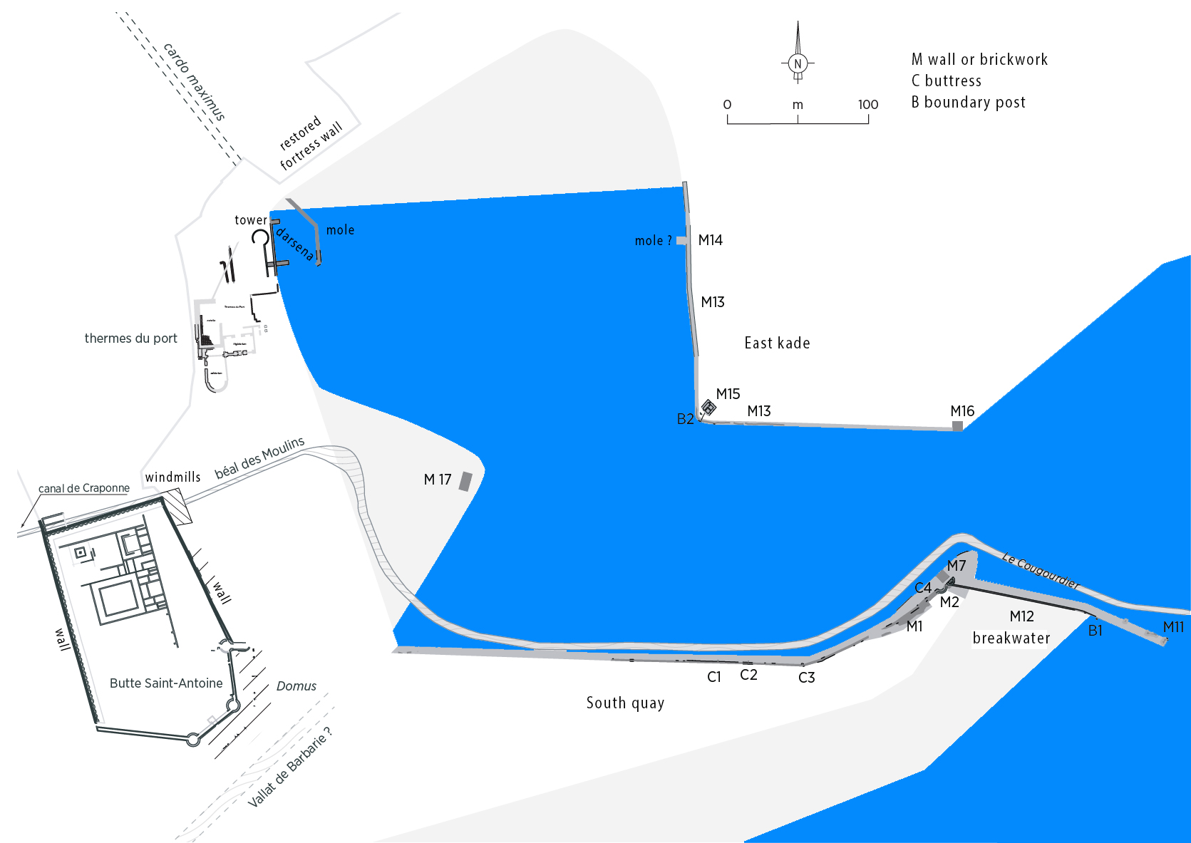
On the basis of earlier research, it was assumed that the harbour was built in a lagoon or a more or less excavated marsh 16. The main argument for this was the irregular shape of the harbour basin. In the south and east, the boundaries can be easily traced, due to parts of the quays still intact. In the north, the boundary proved more difficult to determine.
At the end of the southern quay a 100-metre wall was found, which probably served as a breakwater (Figure 6 M11 and M12). It was long thought that the entrance to the harbour was on the west side and that the sea could be reached via a 1.5 km long canal, the "Canal de Craponne" and "Béal des Moulins" north of the Butte St. Antoine. At the end of that canal would have been an outer harbour protected from the western waves and wind by that breakwater.
The recently obtained research results show that the canal dates from the 16th century and the bottom of the harbour consists of sea sand and not lagoonal silt. Therefore, we can conclude that the entrance to the harbour has always been on the east side (M11) and was freely accessible from the sea. The original breakwater consisted of the whole southern quay up to M7 and had to keep out not only wind and waves but also, in Augustan times, the sand brought in by the Argens and Reyran rivers.
. In the 1st century AD, the breakwater was extended (M12) to stop the sanding of the entrance to the port.
The canal from the 16th century probably has nothing to do with the harbour and, judging by its name, served as a supply of water to the local mills.
The original harbour from the end of the 1st century BC was therefore situated in a small protected bay on the east side of the Butte St Antoine.
Archaeology is of little help in dating the port's establishment: the scarcity of excavations in its vicinity explains why none of the remains visible today can be archaeologically dated.
However, after detailed re-examination, Chérine Gébara suggests that the oldest structures, the southern and eastern quay and the masonry structure that borders the western side (Figure 6 M17), can be dated to the time of Augustus17.
The harbour basin was in direct connection with the sea, without any access channel or outer harbour, as demonstrated by a sample taken west of the harbour.
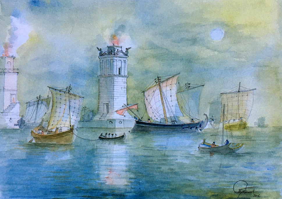
The wide entrance to the basin was probably equipped with two lighthouses, at the ends of the southern and eastern quays19.
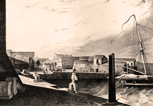
At the end of the original breakwater M11, the "Lantern of Augusts" would have served as a beacon. With the Roman peace, Forum-Julii lost its military function and became a commercial port, but it never reached the grandeur of Arles or Nîmes. The port has always had to fight against silting up. In the 12th century there was still heavy traffic. In the 16th century the port had almost completely disappeared and in the 18th century it was replaced by an agricultural area.
- Sources
- - Topostext.org
- - Frédérique Bertoncello et alii - Fréjus Romaine La ville et son Territoire
- - Ballade Historique sur les traces de Fréjus la Romaine
- - Arthur de Graauw
- - Wikipedia
Notes- 1: Strabo-Greek geographer, historian and philosopher (63 B.C. - 23 A.D.)
- 2: Publius, Cornelius Tacitus- Roman consul, historian, writer and orator. (56 - 117 AD)
- 3: Gascou and Janon, 1985: p. 18-21
- 4: Gaius Sextius Calvinius – Consul of the Roman republic
- 5: Read also: 'Narbonne, gate to the Celtic world'
- 6: Photo: J-M Gassend (2006) in Gébara (2010)
- 7: Roman Civil War 49 - 45 B.C.
- 8: Plinius the Elder, Histories, III, 35
- 9: Photo: Patricia.fidi (Wikipedia)
- 10: Photo: J.C. Golvin
- 11: Excavations from the 1980s by Christian Goudineau and Daniel Brentchaloff
- 12: Excoffon, Devillers, 2006; Devillers et alii, 2007
- 13: Excoffon, 2011
- 14: After F. Bertoncello
- 15: Mao after F. Laurier and C. Gébara
- 16: Lentheric, 1880
- 17: Gebara, Morhange, 2010 : p. 81, 113-116
- 18: Photo: Roamin’ The Empire
- 19: Photo: Gassend et alii, 2010


 We are committed to providing versions of our articles and interviews in several languages, but our first language is English.