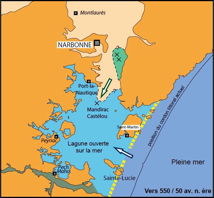
Narbonne, gateway to the Celtic world1, has been frequently described by geographers and historians in ancient times. Strabo2 places the city at the rear of a lake and at the mouth of the Atax (River Aude). Pomponius Mela3 specifies the location on a large lake, called Lacus Rubraesus, which, through a narrow passage, is connected to the sea. Pliny the elder4 indicates that the city was 18 km away from the sea
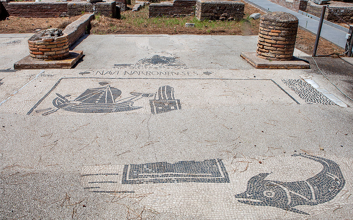
Narbo Martius, as the city was called in ancient times, was not directly on the sea, but on a lagoon formed by many islands. It must have been a thriving port city, as witnessed by the trade office of the port of Narbonne on the Square of the Corporations (Piazzale delle Corporazioni) in Ostia (statio, office 32). But what do we know about the city and what happened with the harbour?
![]()
In 125 BC the port city of Massilia (nowadays Marseille) was attacked by the Salluvii, a Celtic tribe from southeastern Gaul. Because Massilia was an ally of Rome, the Roman consul Fulvius Flaccus4 was sent over the Alps with an army to defeat the Salluvii, which was temporarily successful. The following year his place was taken by the consul Sextius Calvinus, who defeated the Salluvii forever and destroyed their capital. Near this place he founded Aquae Sextiae (Aix), known for its hot springs.
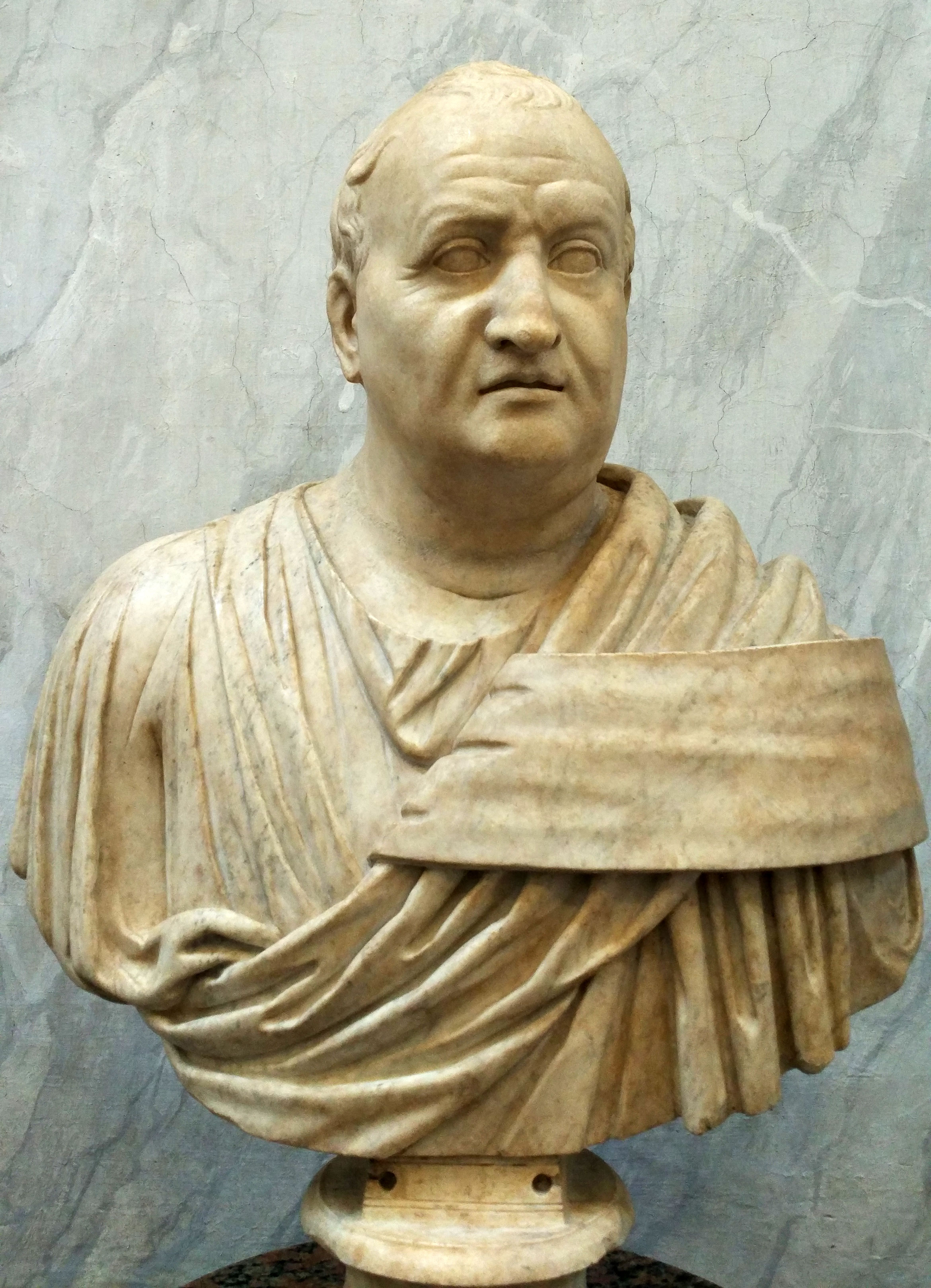
In 121 BC the great war between Bituit, king of the Averni5, and the Romans started. The reason was the separation of another Celtic tribe, the Aedui, from the Gallic kingdom, controlled by the Averni. King Bituit then plundered the area of the Aedui. In turn the Aedui demanded support from the Romans, upon which again a large army, led by Gnaeus Domitius Ahenobarbus6, was sent over the Alps. This army was, following Hannibal's example, equipped with elephants. To be on the safe side, Rome sent a second army under the supervision of the consul Quintus Fabius Maximus Allobrogicus. According to tradition, Domitius Ahenobarbus triumphantly rode an elephant through the region after the victory7. Domitius pacified the area, which took him four years, from 120 to 117 BC. At the same time he ordered the construction of the Via Domitia. This road ran as an extension of the via Aurelia in Italy from the Alps to the Iberian Peninsula.
In 118 BC Domitius instructed his son together with Licinius Crassus to found the colony9 of Narbonne (Colonia Narbo Martius) at the intersection of the via Domitia and the via Aquitania (the road to the Atlantic coast in northern Gaul). Thus the first Roman colonia in Gaul was founded. Shortly thereafter the name of the province also changed from Gallia Transalpina to Gallia Narbonensis, with the Narbo Martius colony as the new capital. Both Domitius and Julius Caesar donated plots of land in and around Narbo Martius to many former legionaries. From Julius Caesar's Legio X Equestris, in particular, many old-timers settled down in this area. In total there were around 2,000 settlers, most of them from Umbria, Picenum, Latium and Campania.
Narbo Martius as a trade center
Due to the construction of the via Domitia and the via Aquitania (among others important for the metal trade with England12) the northern European countries and the Iberian peninsula were also accessible via land instead of only via the risky journey by sea. In addition, the new provincial capital was also easily accessible via the sea. Narbo Martius was not directly positioned on open water, but was easily accessible via the lagoon and the river Atax (modern Aude).
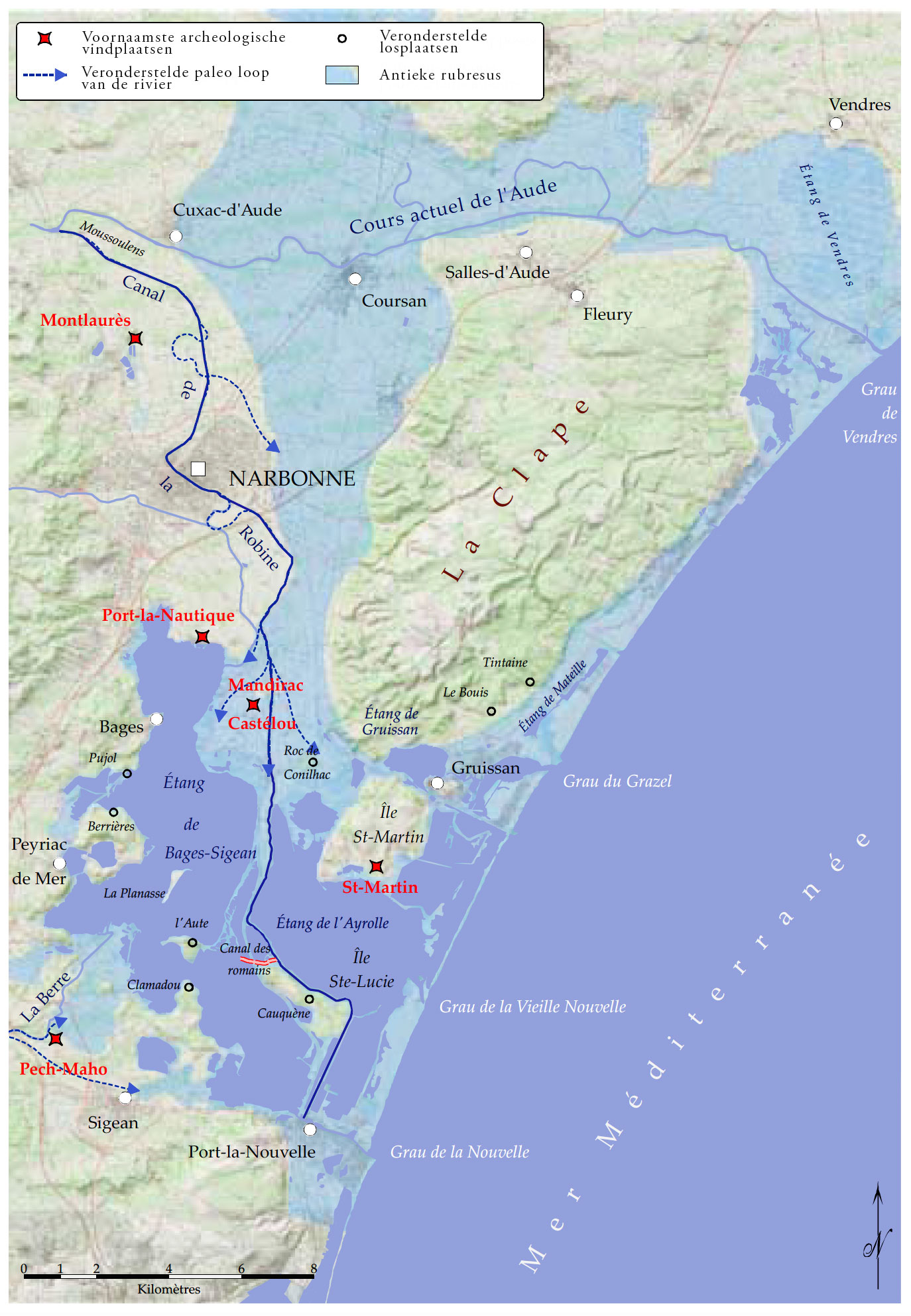
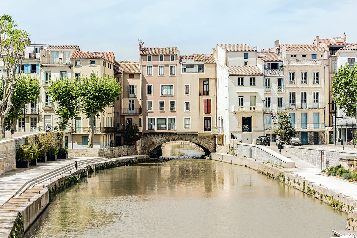
The Atax split into two branches. One went straight through Narbonne to the south, the other ran to the east. Both ended up in the Mediterranean. To make this river more navigable, the Romans built a dam where the river split and the river itself was canalized. In Roman times too it was called the Robine, just like the modern channel. The frequent high water level in the river did not make communication between the city and the port always possible. Therefore, various other loading and unloading places where the ships could moor were built. The locations of these ports and the port-related places have been the goal of research for several years. However, this investigation is complicated by the catastrophic flooding of the city in 1316. This flood caused the course of the Aude to lie north of Narbonne. In addition, the Lacus Rubraesus has been totally changed over the years to the current Étang de Bages-Sigean through silting and erosion.
During the Roman republic Narbonne was at the heart of the transalpine trade in Italian products. Narbonne also played an important military role, because the city was in charge of controlling the provincial arteries. The city also served as a base for the various military campaigns in Spain and Gaul. During the Roman civil war between Caesar and Pompey, as many as three legions spent the winter in Narbonne at the same time. In 46/45 BC. a new delegation of settlers was sent to Narbo Martius. These were veterans of the tenth legion, nicknamed Decumani. The city was given a new name: Iulia Paterna Narbo Martius Decumanorum. The title was completed under Claudius by adding the name "Claudia".
The development of the city
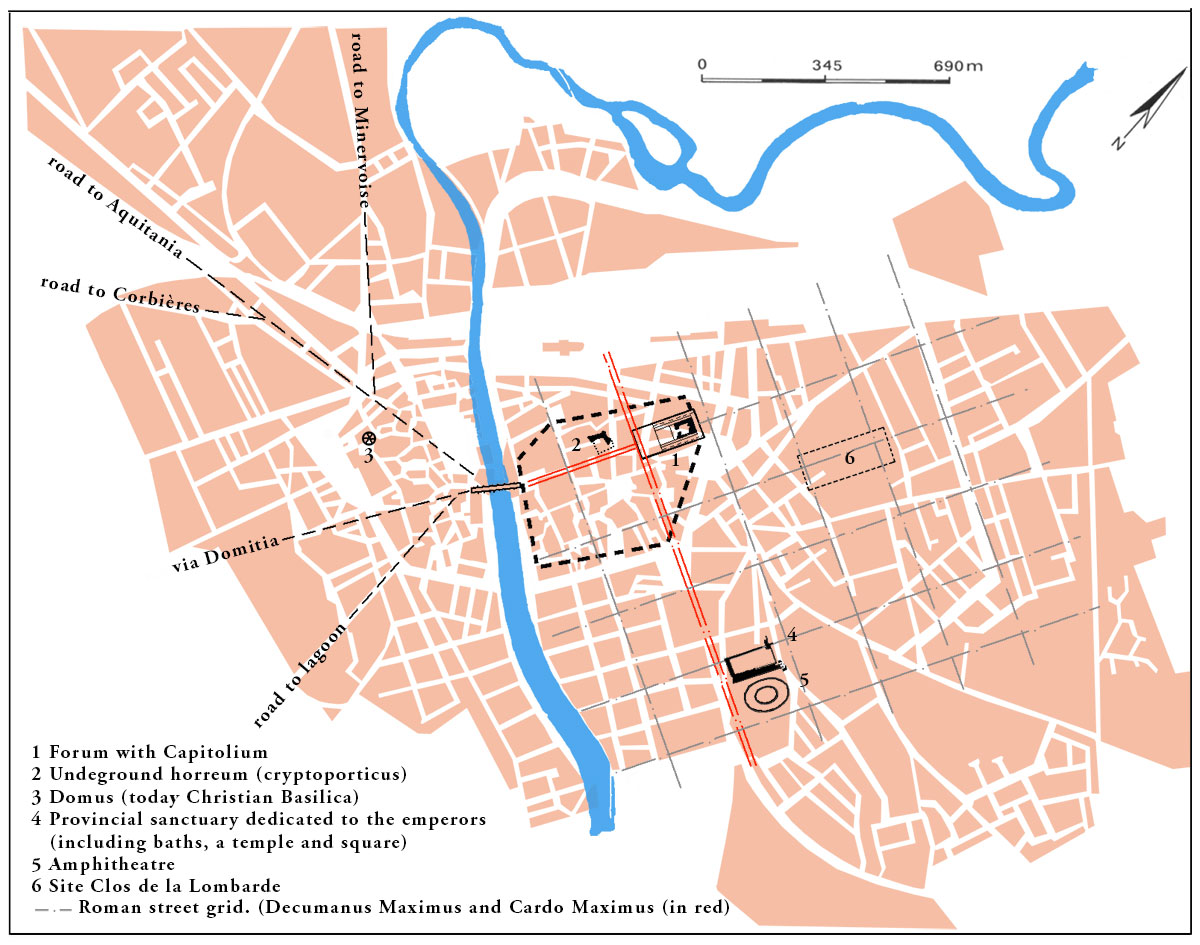
During the imperial period the city could count on the generosity of the emperors. Especially by Antoninus Pius (138-161) who, after a major city fire around 145 AD. had renovations carried out on a large scale14. The city had an amphitheatre that was excavated in 1838. Not much later, in the centre of the city, horrea (warehouses) were discovered. The temple complex on the forum was also dug up, between 1877 and 1898. Apart from the 19th-century publications about the excavation, none of this has been preserved. Excavations were also carried out outside the city in the 20th century, such as on the nearby oppidum (fortified hill) Montlaurès, the various cemeteries and Port-la-Nautique.
During the last years of the twentieth century research has mainly been done on residences. The best known is the excavation of the Clos de la Lombarde in the 1970s. It was long thought that the Robine canal, that runs through the city, took the place of an old branch of the Aude. Recent research has shown that this is a Roman canal that was already dug at the foundation of the first colony. This channel led to Lake Sigean-Gruissan, which then, together with many other lakes, formed a much larger water surface (see photo 5). This lake was largely navigable and was the outer port of the Roman city. Here goods could be transferred to river boats and transported to the city. Because the area of Narbonne is rich in minerals, gold, silver, copper and iron were already extracted and processed since the first century BC.
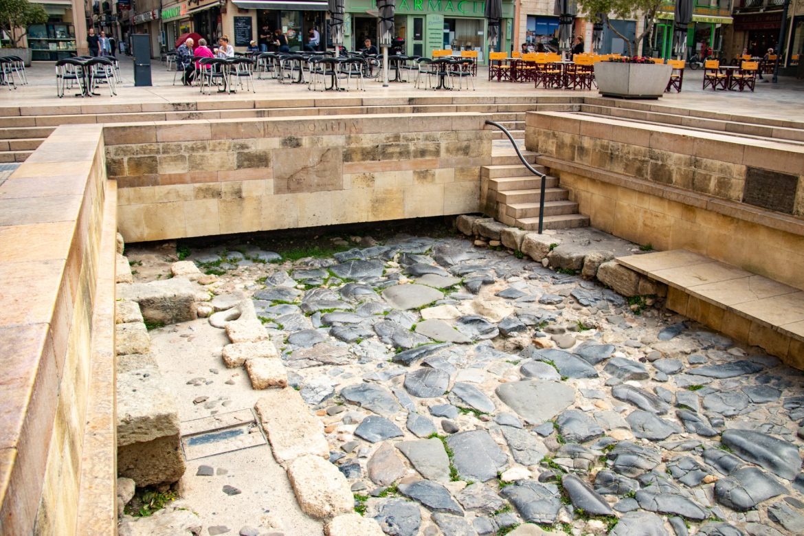
Although not much is known about the street plan of the city, it is still known from research that the western part was already inhabited in the first half of the first century BC. The street network follows a grid with insulae (apartment blocks) of approximately 90x90 to 100x100 meters. The Cardo Maximus runs from the bridge to the forum with the Capitol temple having the same size as the Capitol temple in Rome.
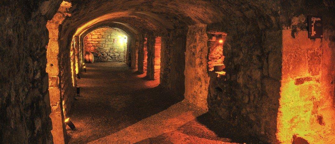
Only fragments of the Roman city have been preserved. The most prominent is the underground horreum in the form of a cryptoporticus and the excavations in Clos de la Lombarde (see video). The cryptoporticus was discovered in 1838, but only thoroughly investigated in the middle of the last century. The vaulted galleries are approximately 7.30 meters wide and consist of a corridor flanked by small spaces of 3.30 - 5.50 m2. Presumably there were about 126 rooms along the 177 meter corridor, all without a door. The whole dates from the end of the republican period.
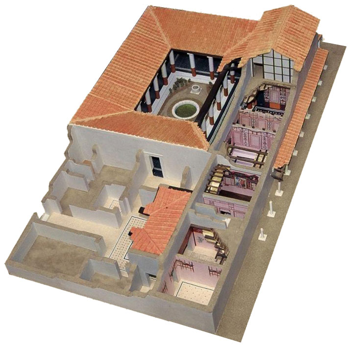
During the excavations of the Clos de la Lombarde an entire block of houses, originally built in the first century BC, was excavated. Among the houses that have been excavated are a house with an atrium and a peristyle, and a house that was built in a U-shape around a peristyle. As little tangible evidence remains, the greater the epigraphic and literary source material. The theatre was described by Sidonius Apollinaris17 (c. 431 - 489 AD). There are inscriptions that mention the existence of a forum with an altar for the Numen Augusti at the time of the Emperor Augustus, a macellum (market building) and a sanctuary for Vulcanus. Later in the first century AD, according to the sources, there would have been an aqueduct, baths and at least one fountain. Before the second century there is talk of a mercatus (market) and a templum novum (new temple). One of the most important sources about what was still visible in the fifth century is once again Sidonius Apollinaris18.
The harbour
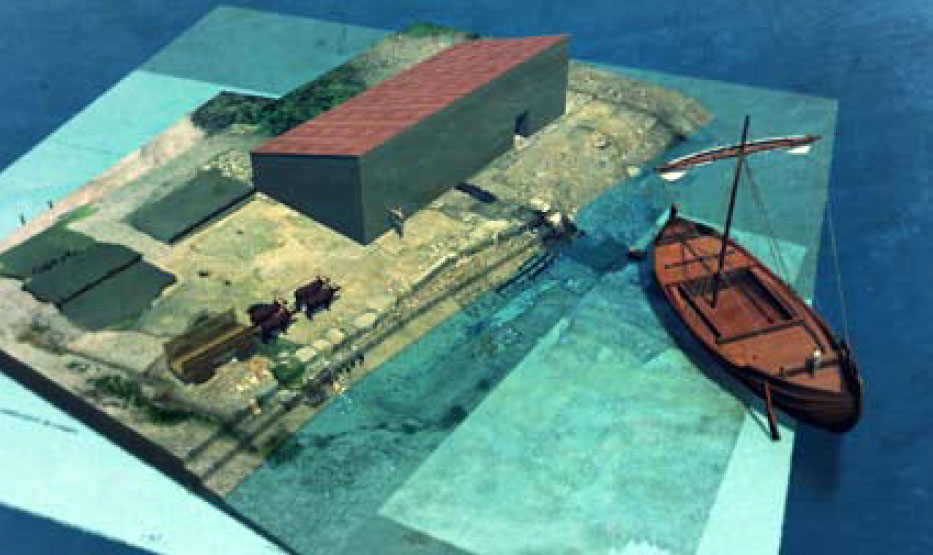
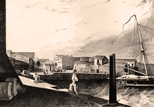
The location of the "city harbour" of Narbonne is unknown, but it is probably located under the banks of La Robine. A little further, near La Médiathèque and Saint Loup Ouest, remains of a quay wall from the first century AD were found. The port of Narbonne can best be described as a river-lagoon-maritime port system. One of the suspected outer ports has been found at Port-la-Nautique (see photo 5).
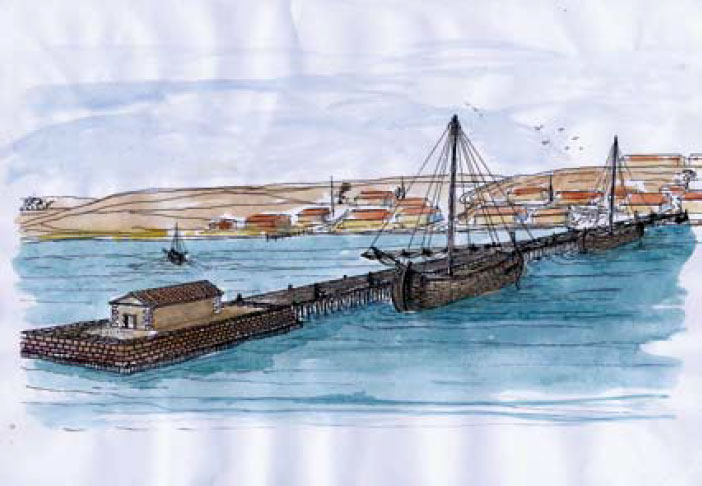
Here, during excavations, traces have been found of harbour structures that must have served since the second century BC, so before the foundation of the colonia. The discovery of a large anchor indicates that this port was also accessible to large sea vessels (see video) . The harbour seems to have been abandoned in the last years of the first century AD.20
Castélou - Mandirac
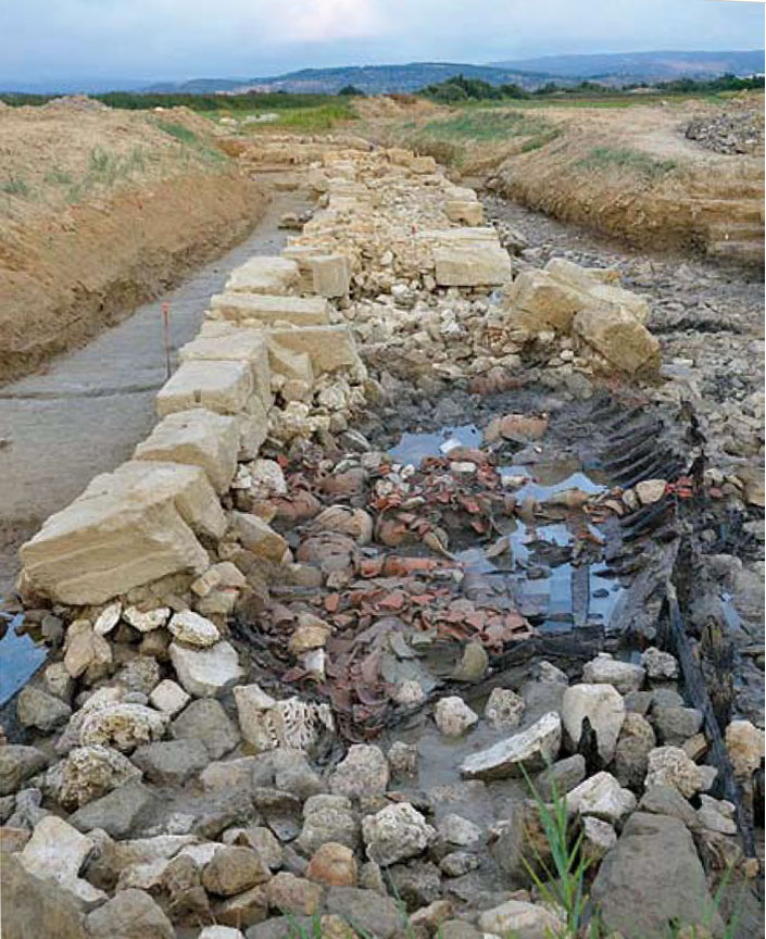
Already in 1914 the French archaeologist Henri-Pierre Rouzaud (1855-1935) noticed that the pavement of Mandirac, 6 kilometers south of Narbonne, consisted of large carved stone blocks with many shards of pottery. He suggested that the quays of the old port could be involved here. Aerial photos from 1945 showed the former outflow of the river due to the difference in vegetation in the Mandirac-Castélou region. In ancient times this area was completely occupied by water. Research after the antique port from 2007 has given for the first time a good impression of the underlying terrain. The research showed several parallel structures and the densely sanded river. Two parallel dams were then discovered to channel the river.
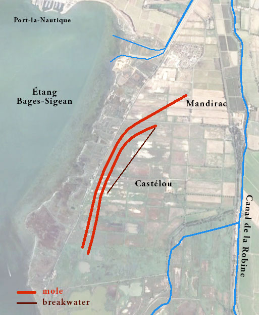
Both dams, about 50 meters apart, started near Mandirac and ran south past Le Castélou. Recent research by the French archaeologist Corinne Sanchez and her team has shown that the antique port of Narbonne should most likely be placed at Le Castélou. This location was within a series of coastal lakes, the Etang de Bages-Sigean, which was reasonably accessible from the Mediterranean at the time of the Romans.
The Narbo Bay, as the Romans called the lagoon, could be reached between the islands of Sainte Lucie and Saint Martin. Although the prevailing wind from the northwest made it difficult to enter, no shipwrecks have been found to date. The port at Le Castélou was close to the ancient mouth of the Aude, which caused another problem. The sediment that was brought in by the river had to be kept out of the canal port with the aim of sufficient water flow. That is why both dikes were constructed to create a strong river current. Both dikes probably had to be extended periodically, so that there was sufficient draft for the ships. The eastern dike was 50 meters longer, and perhaps both were equipped with lighthouses on the ends.
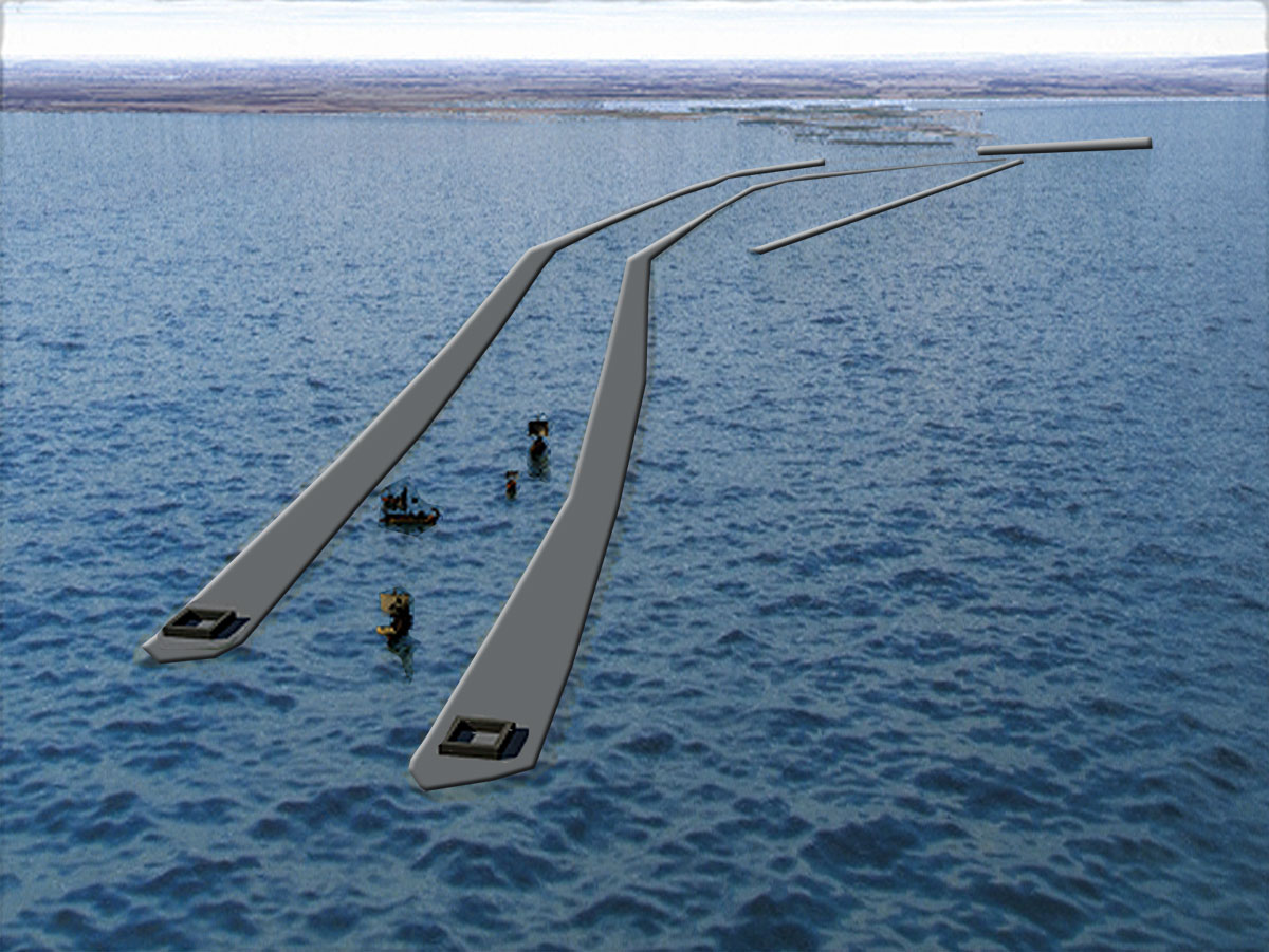
Port-la-Nautique was, as we saw, only briefly in use. The port of Mandirac-Castélou, on the other hand, served from the first till the fifth century AD. The construction of the river mouth at Mandirac-Castélou must have lasted from the middle of the first century AD up to the silting up of Port-la-Nautique. During the works, the water flowed from the river into a shallow lagoon. The Romans made use of natural shallows that were raised with wooden posts and embankment added with the aid of a pile driver mounted on a raft. After that slopes were built against it, so that the course of the river could no longer move and room was created for maintenance, including dredging. So, for the different phases wood was used that was recovered exceptionally well preserved, buried under wet sediment, free from air and light.
river mouth in Mandirac22
On these dikes of about 17 meters wide, roads, quays and warehouses were built over a length of 1.9 kilometers for the handling of goods. The right bank was used as a towpath for the towing vessels and as a country road to the city. The recent research (the final results are unfortunately not yet published) makes it possible to reconstruct the right bank as a place with a lot of activity, where countless flat-bottomed boats came to load and unload large tonnage boats, boats that were pulled and carts transporting goods to the city. The left bank, on the other hand, seems to have been less crowded and remained a simple dam. Also a third structure was discovered during the investigation; a stone 800 meters long breakwater. The lack of such a construction to the north was compensated for by wooden caissons filled with stones that prevented the sand from being carried away. A written-off ship was even used to reinforce the dike in the fourth century.
For five centuries the Mandirac-Castélou region has taken care of the harbor mouth, facing the floods, erosion and sanding up. Repairs can still be seen at various places. In Le Castélou an area has been identified that can be associated with the loading and unloading of ships. This was a building of 7.60 meters by 18 meters. In the 4th and 5th century AD the streets around the harbour were redesigned with the help of demolished monuments from the city. The warehouse was demolished and small artisan workshops were built instead, probably for repairing boats.
On the river side a loose block has been found with parallel traces of friction, which indicates a gangway and thus a use as a discharging-berth. On the side of the lagoon a beach was built where, on the west side, small boats could be brought ashore, while larger ships could moor on the east side of the dike. We may therefore speak of a pier used on both sides. Many objects were found. Many lost coins and fragments of Eastern and African amphoras lay on a piece of flat-stepped quay. Unprocessed glass and iron ore show that in ancient times there was a large trade in these raw materials. Workshops in Egypt and the Near East produced large sheets of glass in antiquity, which were then cut into pieces and transported to all parts of the Roman Empire.
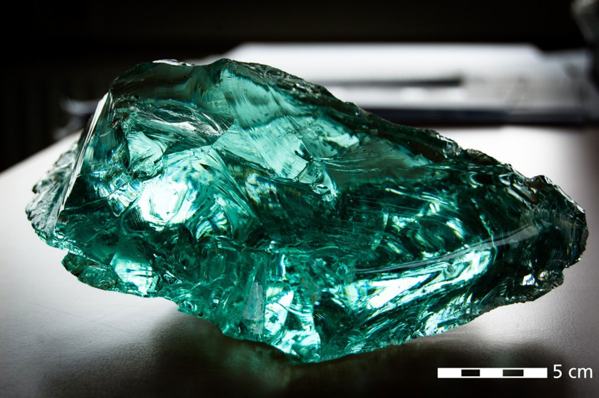
In local workshops vases, windows and other objects were then made. Some of these objects were found during excavations in Le Castélou. The trade in iron also flourished in ancient times. Important for this were the mountains near Narbonne (Montagne Noire, Corbière, Canigou). The iron was forged in bars of 2 to 33 kg, placed on the market in Narbonne and transported in ships that could possibly carry 150 tons25. On the quay of Le Castélou a load of 140 kg of iron ore from the third century AD was found, probably from Elba. From Narbonne a lot of waste has been dumped in Le Castélou and Mandirac to strengthen the port facilities. Many remnants of daily life in the city were uncovered in that way and saved for the future.
- Sources
- - Corinne Sanchez et son équipe: L’aménagement d’une embouchure du fleuve: Mandirac-Castélou.
- - Arthur de Graauw: http://www.ancientportsantiques.com/a-few-ports/narbonne/.
- - Alfonso Medinilla: Urbanisme en de koloniesteden van Gallia Narbonensis - Gent 2006/2007.
- -Carayon et al.: The harbour system of Narbo Martius (Narbonne/F) and its facilities during antiquity.
- Notes
- 1:The area where Celtic was spoken: Europe north of the Alps, Iberian peninsula, Great Britain.
- 2:Strabo, Geographica IV.
- 3:Pomponius Mela.
- 4:Livius, Periochae 60. - According to Livius he was the first Roman to enter Gaul over the Alps.
- 5:The Arverni were a Gallic tribe in modern-day Auvergne in central France. The famous Gaul Vercingetorix, who was defeated by Julius Caesar, was a later leader of the Averni.
- 6:Gnaeus Domitius Ahenobarbus - Roman consul (129 BC) and general.
- 7:Livius, Epitoma 61; Florus, Historia Romanorum III, 2; Strabo, Geographica IV, 2, § 3; Cicero, Oratio pro Fonteio 12; Brutus 26; Velleius Paterculus, II, 10, 39,
- 8: Photo Wikipedia, bust in the Vatican Museum in Rome.
- 9: A Roman colonia was not a colony as we know it, but a civic unit consisting of a city and a territory with a specific legal status. Since Marius and Sulla it was customary to establish veterans there.
- 10:Photo Cette adresse e-mail est protégée contre les robots spammeurs. Vous devez activer le JavaScript pour la visualiser..
- 11:Photo Fagairolles 34 at the French Wikipedia.
- 12:See article ‘ICTIS’.
- 13:Photo IGN-2006, J. Cavero.
- 14:Solier 1986, 14-15.
- 15:Photo Didier Descouens.
- 16:Photo Les amies du Clos de la Lombarde - http://www.amiscloslombarde.fr/en_maison%20a%20portiques.htm.
- 17:Sidonius Apollinaris (Lugdunum, 431 - Clermont-Ferrand, 489) was a late Roman writer and politician.
- 18:Sidonius Apollinaris, Carmina XXIII, v. 39-44: summary of Narbo in the fifth century “Salve, Narbo, (…) muris, civibis, ambitu, tabernis, portis, porticibus, foro, theatre, delubris, capitoliis, monetis, thermos, arcubus, horreis, macellis, pratis, fontibus, insulis, salinis, stagnis, flumine, merce, ponte, ponto”.
- 19:Artist's impression: la Société Marseillaise de Crédit © J.-M. Falguéra.
- 20:Sabrié M. & Sabrié R. 2003, p. 279.
- 21: Photo after P. Cervellin.
- 22: Photo C. Sanchez.
- 23:Photo P. Cervellin.
- 24:Photo www.baac.nl.
- 25:Such as the ship whose wreckage was discovered by the DRASSM (submarine and underwater archaeological research department), that was stranded at Saintes-Maries-de-la-Mer, at one of the old arms of the Rhone.


 We are committed to providing versions of our articles and interviews in several languages, but our first language is English.