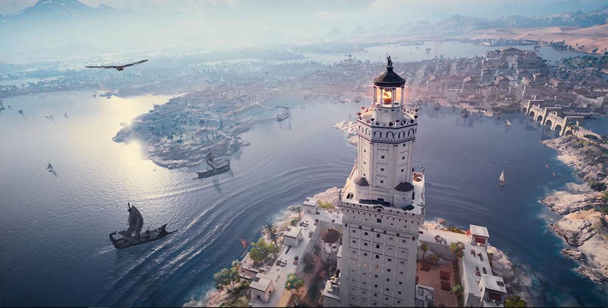
We know that the city of Alexandria in Egypt was built by Alexander the Great, but he did not build the first port at that location. Already in 1900 BC port facilities were built in the village of Rhacotis, to service coastal shipping and supply the island of Pharos 2. According to Homer the isle of Pharos, also had a port, which is still there, underwater, on the north side of today’s Ras el-Tin. Nevertheless the reason that Alexandria is widely known even today is due to Alexander the Great, who founded Alexandria, and to his successor, Ptolemy I Soter (saviour), who built the harbour. To get a clear idea of what happened we have to go back to the year 332 BC when Alexander was forced to attack the island of Tyrus (in English: Tyre) 3, which he captured after a long and difficult siege.
Choice of the site
In a hurry to conquer the world, Alexander the Great cannot have enjoyed the fact that the Phoenician city of Tyre resisted for eight months (January-August 332 BC) before he was able to take it. As Alexander could not attack the city from the sea, he built a kilometre-long causeway stretching out to the island on a natural land bridge no more than two meters deep 4.
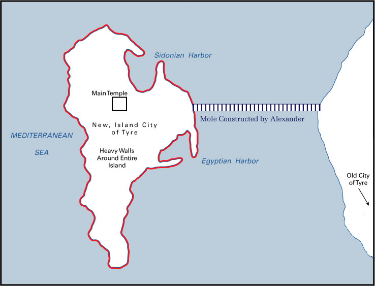
The similarity between the island of Tyre and the island of Pharos is striking, especially when one adds that Alexander built a causeway between the island and the mainland at both sites, Tyre and Pharos, and that they both have a double harbour. It is plausible that Alexander copied the situation at Tyre when he decided to build a port in Egypt. But why exactly on that spot? Soon after conquering Egypt, Alexander had a dream in which Homer visited him and spoke lines from The Odyssey. Among these was a reference to the Egyptian island of Pharos in the Mediterranean, and so the next morning Alexander travelled to Pharos and stood upon its rocks, staring out at a scrappy, forgotten stretch of coastline where the archaic port had now vanished into the sea. He recognized the similarity with Tyre, noticed the position on the western verge of the Nile between the Mediterranean Sea and Lake Maryut 6 in connection with the hinterland and at that moment the most remarkable city the ancient world had ever seen was about to rise.
The rise of a city
The lighthouse and the museum with the famous library are the best remembered and admired ancient buildings of the old city of Alexander the Great. Building a city however starts with its overall design. Alexander’s chief architect, Dinocrates 7, envisaged a grid that would knit together public and private space, spectacle and function, as well as land and sea. Dinocrates’ masterpiece disappeared without a trace before the first slab had ever been placed in the sand. In the absence of chalk to mark out the shape of the new city’s future roads, houses and water channels, Dinocrates used barley flour instead. But as quick as his surveyors could calculate the relevant angles and his labourers could draw the requisite lines with flour, flocks of seabirds swooped down and snaffled this life size blueprint for themselves. Many on the ground considered it a terrible omen for the settlement that was to bear Alexander’s name, but the general’s personal soothsayer took a different view: the birds’ feeding frenzy, he explained, was a sign that Alexandria would one day provide sustenance for the whole planet.
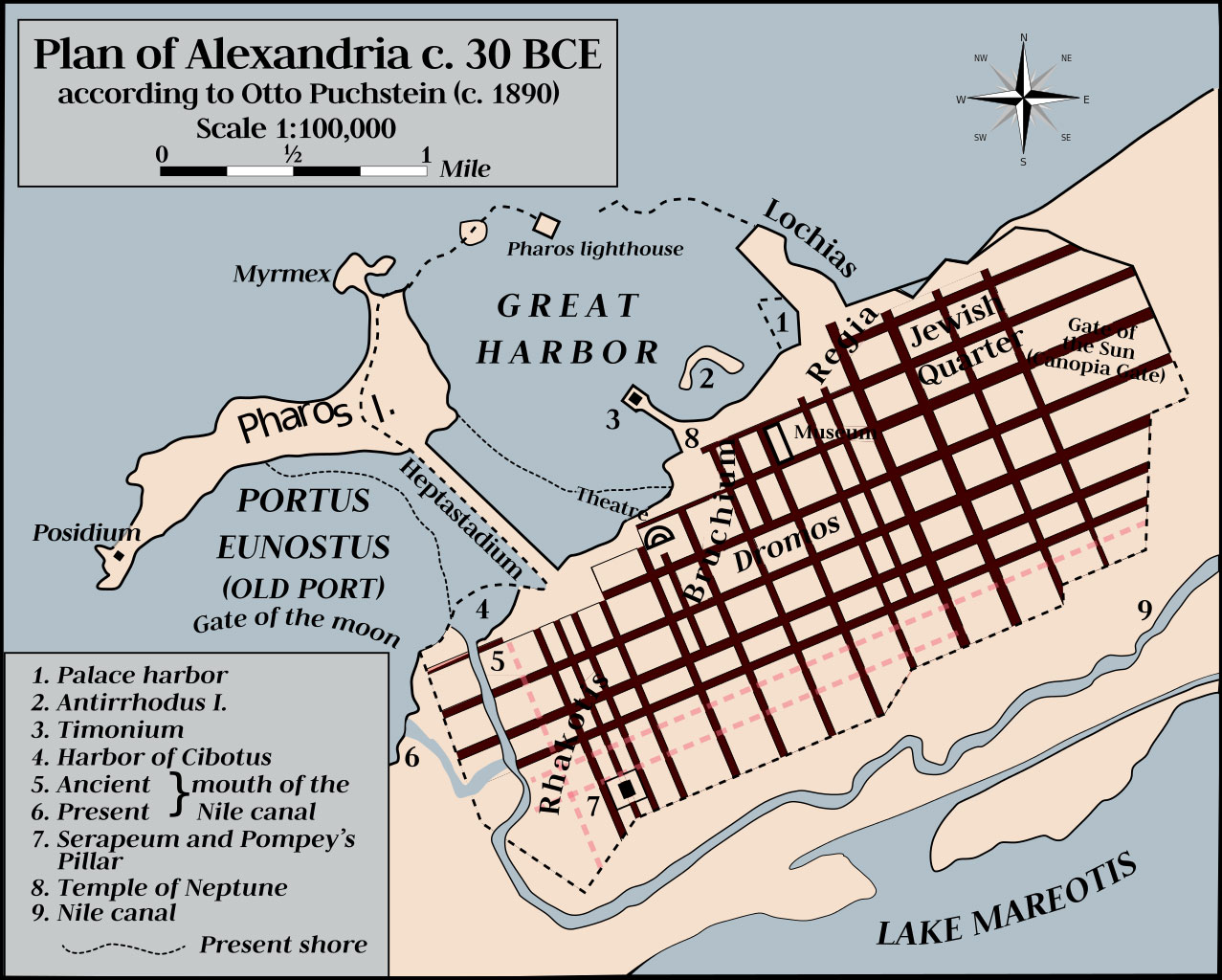
Among others Dinocrates built a royal palace, temples for both Greek and Egyptian gods, an agora (market place) for commercial activities as well as communal gathering, residential dwellings and walls. Canals were cut from the Nile with rivulets diverted under the main streets to supply the homes with fresh water.
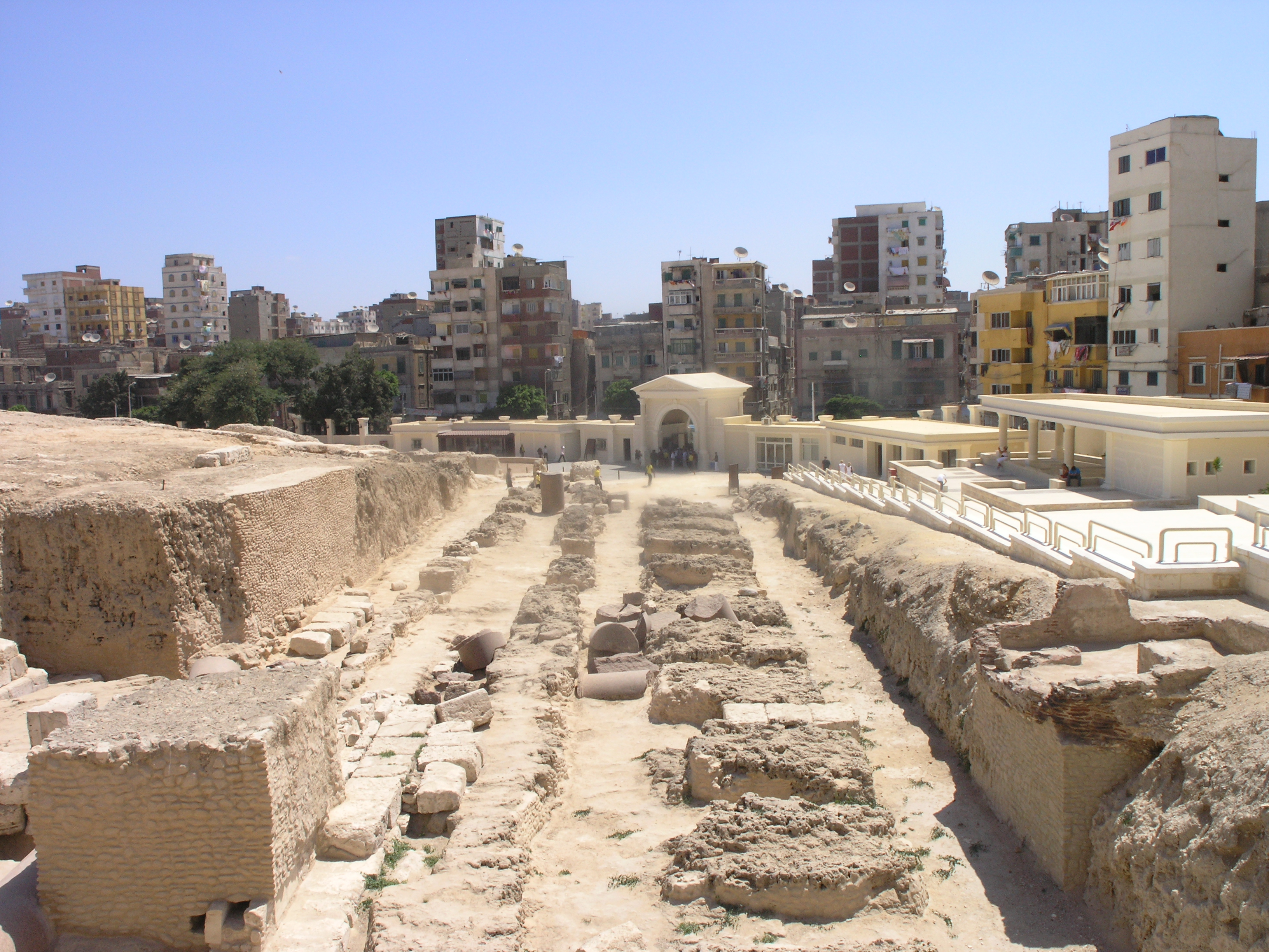
where part of the library was stored 10
He built the Mouseion (a temple for the Muses) with the famous library, the largest on earth. Finally he extended the line of his grid out over the water by building a 600 ft wide land bridge from the mainland to the island of Pharos, called the Heptastadium 9. By building this connection he created two harbours, just like the situation in Tyre.
Use of the harbours
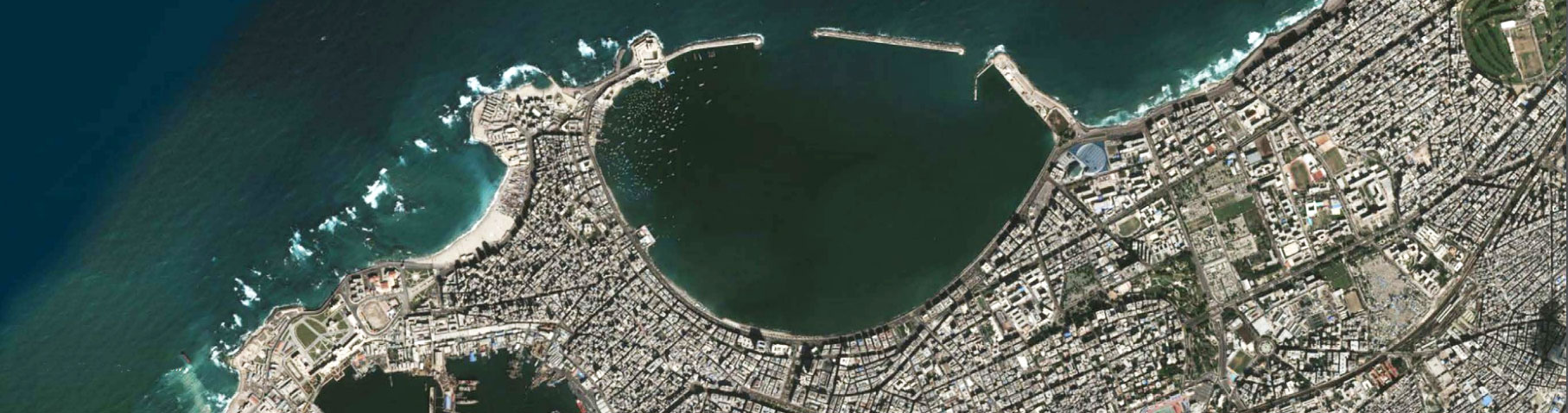
The idea of building a double harbour was motivated by the fact that there are two main wind and offshore wave directions. In this case, which is quite frequent, it is useful to be able to move ships from one harbour to the other in order to obtain the best protection against wave disturbance in all circumstances. After the construction of the Heptastadium the island of Pharos became a peninsula that perfectly fulfilled this criterion: to the west was built the Port of Eunostos was buit (which became the commercial harbour), to the east Portus Magnus (the royal harbour)
Ships could be transferred from one to the other without going out to sea, via canals cutting through the Heptastadium. Bridges were built over the canals. Nevertheless, both sides of the Heptastadium must have begun to silt up progressively resulting in the curved shorelines that exists today on both sides. This natural feature creating an isthmus is called ‘tombolo’. The reason is its proximity to one of the main mouths of the Nile near Rosetta. Sediment carried down by the Nile is transported along the coast by waves.
Alexander was definitely not a sailor. He symbolically burned his boats on disembarking in Asia after crossing the Hellespont (The Dardanelles) with 300 triremes (galleys with three rows of oars). After founding Alexandria on 20 January 331 BC he remained in Egypt for only a few months.
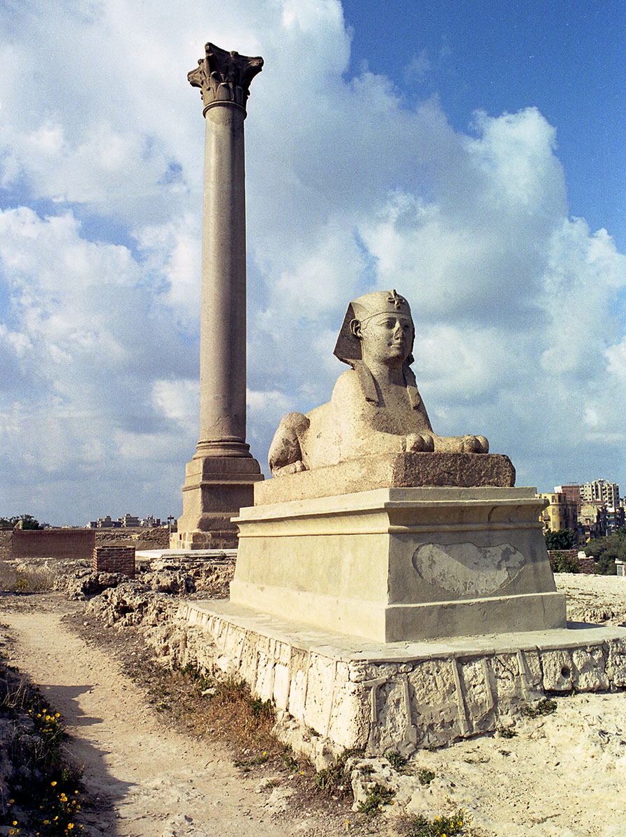
the spinx of Pharao Horemheb
He therefore did not choose this site as a base for his fleet of warships, though his successors (in particular Ptolemy II Philadelphus) did base their fleets there. He must nevertheless have learned the lesson from his master Aristotle, who advised him, eleven years earlier, to create an access to the sea to be “easily supported on two fronts at the same time, from the land and from the sea” in the event of an enemy offensive, and also to “import products that are not found in your own lands, and export your own surplus products”.
The city is indeed situated on a strip of land between the sea and lake Mariotis (the present lake Maryut), on which a river port was built. The river port is connected directly with the Nile and the Red Sea by means of a canal built by Ramses II and restored by Ptolemy II.
Three centuries later, at the time Strabo 12 visited Alexandria (around 25 BC), the pirates had disappeared due to the efforts of Pompey’s fleets a few decades earlier and trade was booming thanks to the peaceful conditions created by the Romans. Alexandria had almost a million inhabitants of various origins. It imported cedar wood from Lebanon, wine, oil etc. It exported wheat to Rome and papyrus throughout the Mediterranean. At the beginning of the Christian era the city was exporting up to 150.000 tons of wheat per year to Rome.
In this article we will focus on the port east of the Heptastadium, Portus Magnus, the Great Harbour.
PORTUS MAGNUS
Overall layout
Archaeological investigations carried out in Alexandria Bay by Franck Goddio 13 of the European Institute for Underwater Archaeology have revealed the harbour complex from the time of the first Ptolemies. These royal ports sheltered the Ptolemies’ fleets of warships consisting of several hundred galleys, some of which were extraordinarily large. The complex consists of three ports, probably built between 300 and 250 BC during the Hellenistic period, more than 200 years before the arrival of Julius Caesar in 48 BC. They are thus more than 200 years older than the nearby harbours that have been studied so far, such as that at Caesarea (Israel). Unfortunately there are no extant documents from the period concerning the design of these ports, and we are now forced to make assumptions on the basis of present knowledge and on the only ancient text concerning maritime structures, by the Roman architect Vitruvius 14.
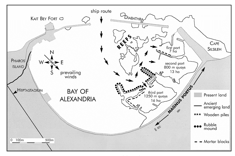
Let us begin with what concerns all shipping, namely wind and waves. It may reasonably be assumed that the wind and wave conditions have hardly altered if at all since ancient times. Present statistics show that the winds and waves prevailing off Alexandria come from the W-N sector during the summer months and N-E during the winter months 16. This latter sector has had a considerable importance for the development of the port, as it is the reason for the double harbour arrangement, as pointed out above.
The first logical reaction would be to locate the port against the Heptastadium, in the shelter of Pharos Island, at the place where today’s fishermen shelter their boats from prevailing winds from the W-N sector. Yet this argument does not appear to have carried weight, as the three ports discovered to date are located at the opposite end, below Cape Lochias (modern Cape Silsileh), where the royal palace used to be. This eastern part of Alexandria Bay is relatively more exposed to offshore NW waves and this meant that it was necessary to build a protective breakwater (“Diabathra”) to supplement the natural protection offered by the reefs that emerged above sea level at the time.
One explanation of why the ports were located on the eastern side of Alexandria Bay could be the siltation that occurred against the Heptastadium. If it is assumed that the construction of the harbour began only during the reign of Ptolemy I Soter at the earliest (he acceded to the throne in 304 BC), then almost 25 years had elapsed since the construction of the Heptastadium. This is quite long enough to reveal siltation against the Heptastadium and incite the planners to locate the ports elsewhere.
Access to the ports could therefore only be achieved by skirting the reefs to the west and south. The three ports had a different capacity: first port, about 7 ha; second port, about 13 ha with probably around 800 m of quays; third port, about 16 ha with probably around 1250 m of quays. The majority of the Great Harbour was taken up by the Heptastadium Bay (between the third port and the island of Pharos): about 100 ha with 1000 to 2000 m of beach.
Harbour structures
The third port is the largest and uses the island of Antirhodos (see photo 4) as a natural protection against wave disturbance. The island was entirely developed as the site for a royal palace and quays consisting of large blocks of mortar cast in situ. The remains of wooden structures have been used for carbon-14 dating and reveal the existence of an archaic structure in the form of a double row of piles. The two principal types of harbour structure found in Alexandria are protective breakwaters and quays. The inner breakwaters protecting each of the three ports consist of a sloping mound on the seaward side and in most cases a quay made of mortar blocks on the leeward side. The quays were made of timber platforms, resting on piles or on pillars made of blocks of stone. From a general point of view they may be classified as follows, depending on the material used:
- without mortar: dressed stone blocks with a possible filling between two facings;
- with mortar, without pozzolana: massive blocks cast in the dry in wooden formworks;
- with mortar, with pozzolana: massive blocks cast under water in wooden formworks 17.
The early Alexandrians did not have the advantage of pozzolana when they first built Portus Magnus. It may therefore be assumed that each large block of concrete could have been built in the dry in a caisson that would be floated into position directly above the future quay, and ballasted until it sank to the bed on to a previously prepared foundation surface. The caisson must have been sufficiently watertight and buoyant in order to act as a barge capable of carrying the block of mortar (it should be recalled that the Egyptians had for centuries transported all kinds of dressed stones, columns and obelisks weighing up to several hundred tons by river) 18.
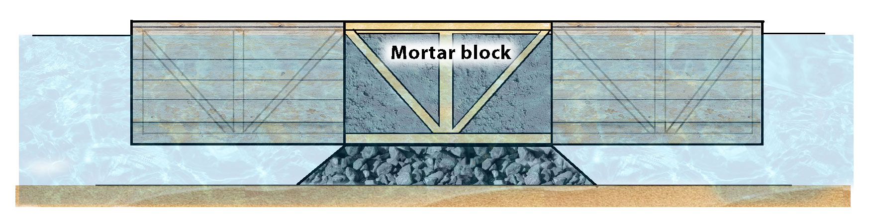
It would be enough for the caisson to be about 2.5-3 times larger than the mortar block, which has a relative density of about 2.5, as in this case the draught of the caisson with its block would be about the same as the height of the block to be lowered into position. This explains the presence of timber beams and planks under the block, as well as the existence of vertical and inclined beams held in the mortar, giving the caisson its rigidity during the floating and sinking stages. This also explains the absence of vertical timber walls, as they must have been dismantled and recovered after the mortar block had descended to the bed. However, the large mortar blocks discovered in the third port at Alexandria do contain pozzolana and must therefore be of a later date. The block consists of alternating layers of mortar and flat pieces of limestone. The existence of planks of pine wood 3-4 cm thick under the block indicates that the form certainly consisted of a timber floating caisson.
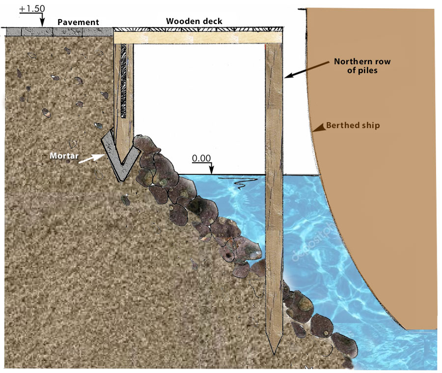
The double row of elm piles discovered at the eastern end of the island of Antirhodos is older than the large blocks mentioned above (around 400 BC). Moreover, it disappears under more recent fill material and large blocks. The presence of mortar at the lower end of the piles indicates that these rows must have been built in the dry, i.e. that they sank under the sea after construction. The following hypothesis could be put forward, whereby this double row of piles could be the remains of an ancient timber quay. The southern row consists of grooved piles (0.14 x 0.14 m section), spaced 0.4-0.5 m apart, into which pine planks 4 cm thick were introduced to form a small wooden screen capable of holding quarry run fill. The northern row consists of simple piles spaced 0.2-0.4 m apart. These could have supported wooden planks and have been set in water about a metre deep. The northern row is 1.5-1.8 m from the southern row.
It is hoped that these investigations will be just the first in a long series, which will give us further information on ancient port engineering techniques, and that this part of Alexandria Bay will soon be declared off limits for construction or, even better, transformed into an underwater museum.
Sources
- The Guardian: The story of cities, part 1: How Alexandria laid foundations for the modern world, by Jack Shenker (14-3-2016).
- Franck Goddio: Alexandria - The Submerged Royal Quarters, Publ. Périplus Ltd, London 1998.
- Arthur de Graauw, http://www.ancientportsantiques.com/a-few-ports/alexandria/.
- Notes
- 1: The city of Alexandria as depicted in Assassin's Creed: Ubisoft.
- 2: Mark Depauw, "Alexandria, the Building Yard", Chronique d'Egypte 75 (149), pp. 64–65.
- 3: Tyre, the largest and most important city-state of Phoenicia, was located both on the Mediterranean coast and on a nearby island with two natural harbours on the landward side. The island lay about a kilometre from the coast in Alexander’s days, its high walls reaching 46 m (150 ft) above the sea on the eastern, landward facing, side of the island.
- 4: N. Stafford, "How geology came to help Alexander the Great", Nature News, retrieved 2007-05-17.
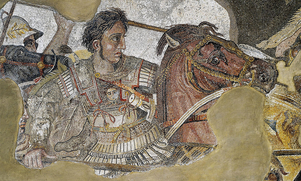
- 5: Floor mosaic (first century AD) from the House of the Faun in Pompeii. Now in the museum of Naples. Alexander defeats Darius III in the Battle of Issus.
- 6: Lake Maryut: a lake just behind the city of Alexandria. The famous Rosetta Stone has been found in a temple.
- 7: Greek archtitect. The name Dinocrates means ‘master of miracles’.
- 8: Otto Puchstein (6 July 1856, Labes – 9 March 1911, Berlin) was a German classical archaeologist.
- 9: Heptastadium because the length was seven times the length of a Greek stadium (about 185 meters).
- 10: The original Mouseion with the library was completely destroyed, not in the last place due to upcoming Christianity. The Serapeum was an extra depot.
- 11: Photo: Matthias Kabel.
- 12: Around the years 30-25 BC the historian and geographer Strabo visited Alexandria, together with the Roman prefect of Egypt Aelius Gallus. Read here what Strabo tells about the city and the harbour (Strabo, Geographia XVII 1) http://www.alexandrianlibrary.org/?page_id=252.
- 13: Franck Goddio is a pioneer of modern maritime archaeology. See http://www.franckgoddio.org/.
- 14: See http://www.ancientportsantiques.com/ancient-port-structures/vitruvius/.
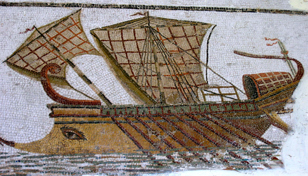
- 15: Roman trireme on a mosaic in Tunisia: photo taken by Maciej Szczepańczyk (Wikimedia Commons).
- 16: Read also our article about Winter Shipping.
- 17: Read also our article about Pompeiopolis.
- 18: An obelisk meant for the circus of Nero (now at the Vatican) built for the Egyptian ‘Pharaoh’ Hatshepsut was transported from Karnak (Egypt) to Rome on a ship by Caligula. Afterwards the boat was used as a caisson on which the lighthouse of Ostia-Portus was built.


 We are committed to providing versions of our articles and interviews in several languages, but our first language is English.