HOW TO RECONSTRUCT A FIFTH CENTURY ROMAN CITY-CENTRE IN SPITE OF THE DAMAGE OF THREE HUNDRED YEARS?
Also in 2018 year the Ostia Forum Project continues with their excavation program. At this very moment, while we are editing this article, the archaeologists and their students are in the middle of this year’s campaign, which started on the 16th of August and will be ended on the 28th of September.
The Ostia Forum Project, part 2 - A report by Daniel Martin Beurze Damgaard 1
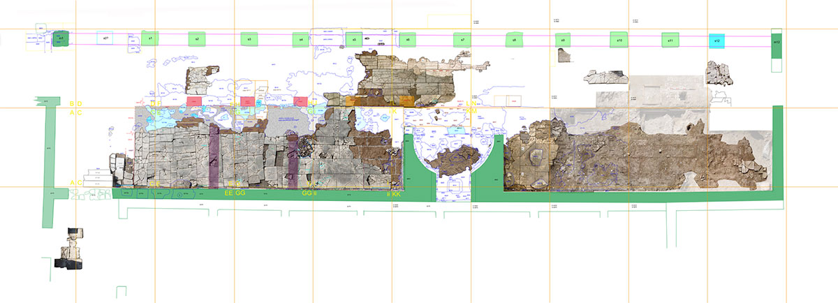
As we saw in our first report about the Ostia Forum Project the city was excavated on a large scale until 1941, but many areas were never scientifically documented. Pavements were rarely recorded, even though there are relatively adequate plans of walls.
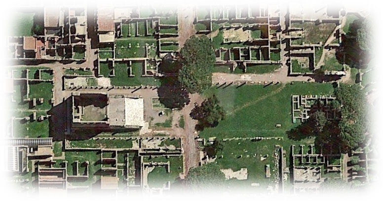
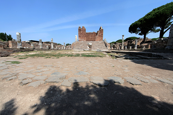
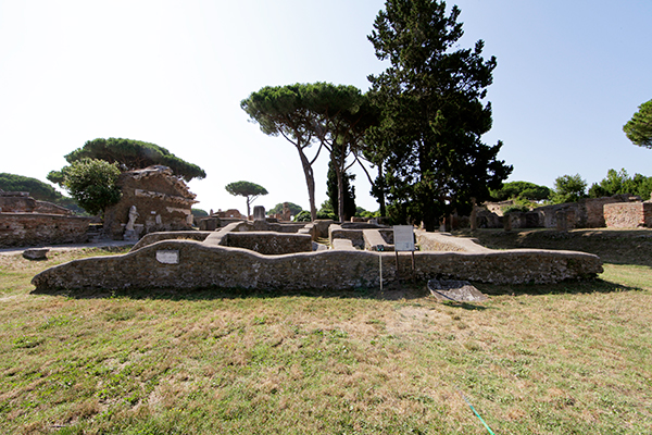
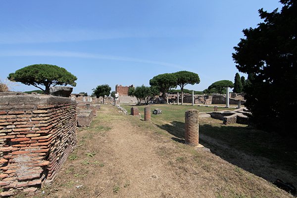
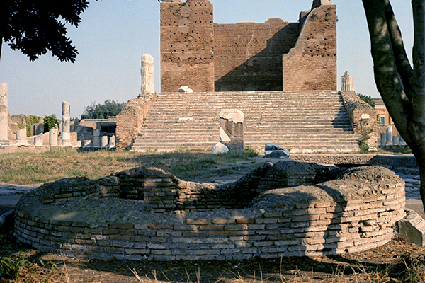
Detailed plans exist only regarding high value floors, like figured mosaics, not for ordinary floors like simple mosaics, mortar beds, travertine and even marble pavements. The situation is even worse regarding piazzas (squares), with prominent examples like the Forum (see photo 2), which were never documented in detailed plans showing individual pavement slabs and the various traces of use and reuse. Therefore we started from the first project in 2002 – and continue until today – with a systematical approach of the area in several steps:
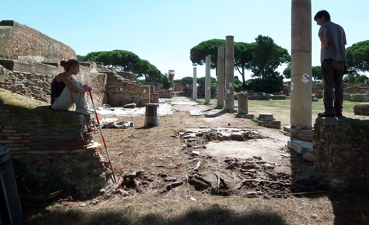
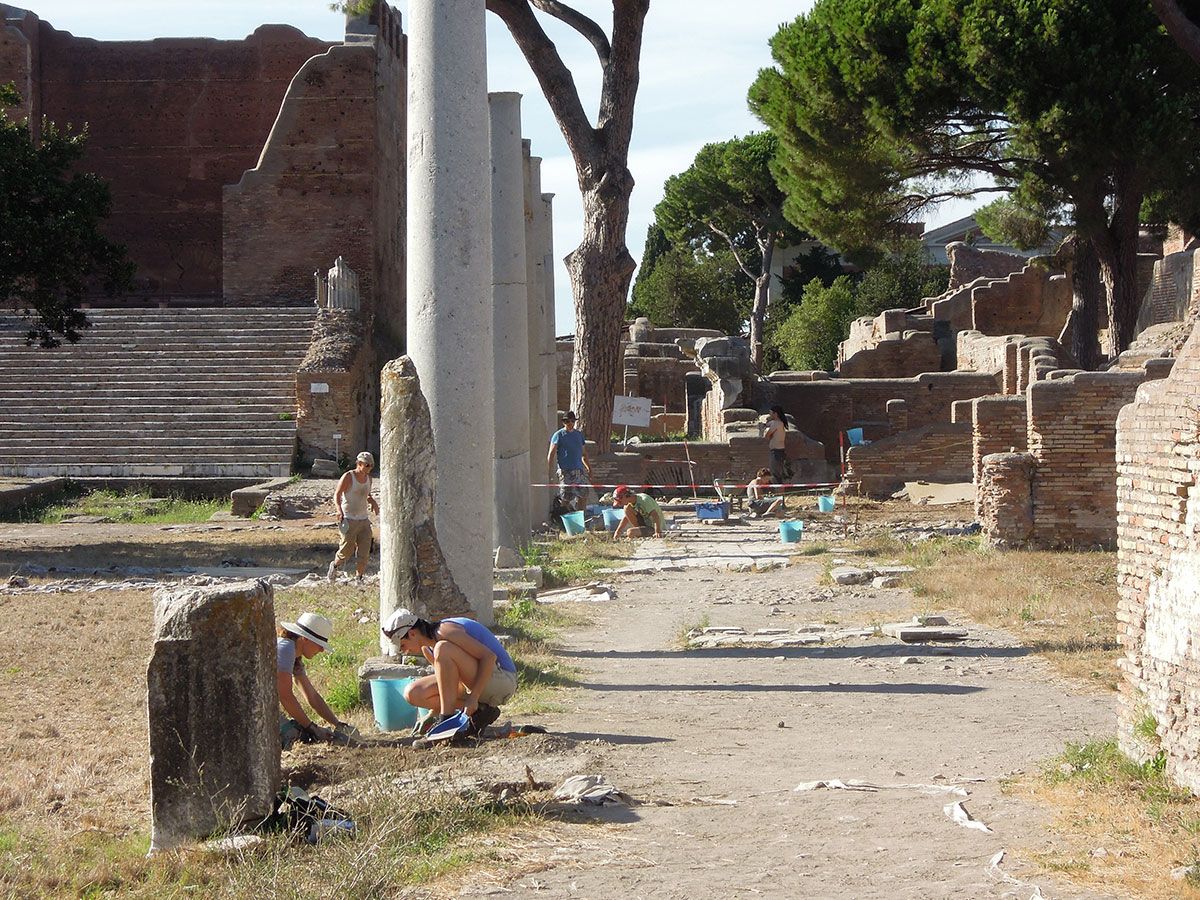
The first step: archaeological surface cleaning
The idea is to clean the micro-stratigraphy inside and underneath the modern vegetation layers with maximum care. This allowed us to gain a similar situation like it appeared to previous excavators in order to do the documentation, which was not done in detail from the early 19th century until the mid-20th century. After removing the recent vegetation and touristic occupation layers, we found a partly very uneven antique surface, which was a product of centuries of robbing activities and the almost pre-scientific excavation methods used in the 1930’s. Fortunately in some areas we can rely on the excellent plans of Italo Gismondi 2 drawn before 1938, and the diaries of Raffaele Finelli until 1924 3.
The second step: geophysical analysis
Our second aim was to do large scale geophysical analysis from 20 cm depth until 160 cm depth to find out where substantial remains of buildings can be detected and where areas of refill and previously undocumented excavations were situated.
The third step: strategical stratigraphical sondages
Based on geophysical analysis, our aim was to plan strategical fundamental sondages. By defining the limits of the previously undocumented excavation work until the 1950’s, with help from old photographs, diaries, and the geophysical plans, it was possible to do minimal invasive excavation work. Trenches deeper than 30 cm were executed in previously excavated refill areas, with the purpose of cleaning and drawing profiles of the status quo of the excavations from the late 19th and early 20th centuries.
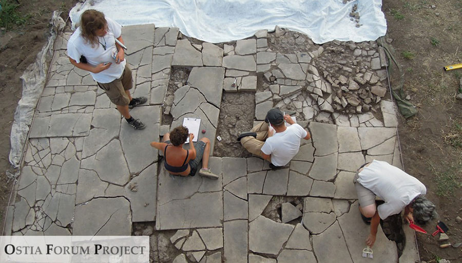
The fourth step: documentation of all antique surfaces
Based on surface cleaning we tried to document all surface evidence of surviving late antique stratigraphy and pavements. Considering the irreversible erosion by weather and mass-tourism, it can be defined as an active help for conservation to record the status quo of all exposed antique surfaces, using new documentation methods with the highest technical standards available today:
- Two-dimensional photo mosaics with highest resolution digital photography
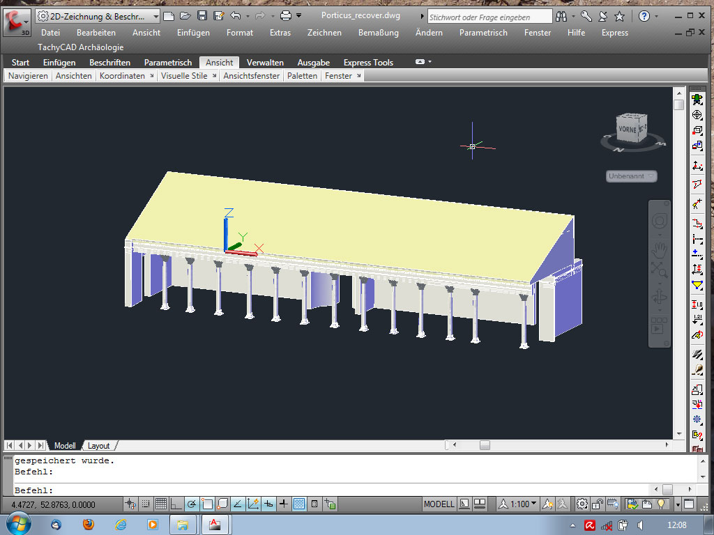
- 3-D laserscans with colour information
- 3-D orthophotography 4
With special computerprograms pictures can be created from laserscans, which give an impression similar to normal photos (see picture below), but the viewer can move inside a 3-dimensional model.
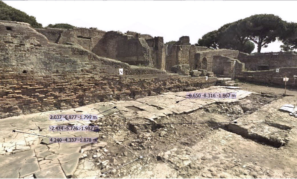
leading to world-coordinates in special computerprograms
In order to document large areas in limited time we developed a complete digital recording system based on aerial photography with quadro- and octo-copters (drones) and supplementary high resolution photography from the ground. Besides that, we also put all the records into a grid system and gave them coordinates. Because all these 3-D-model plans had to be put into a broader framework, a basic grid had to be established for the entire centre of the city.
The fifth step: 3-D reconstructions
Based on the newly obtained documentation and all available stratigraphical information, the final aim of the project is to create 3-D reconstructions of all building phases of the city centre from the 3rd century BC to the 6th century AD. In comparison to existing 3-D models we aim to develop a more precise differentiation between the original antique remains, modern conservation efforts and actual damage by erosion, and the hypothetical full reconstruction of its supposed antique shape 5.
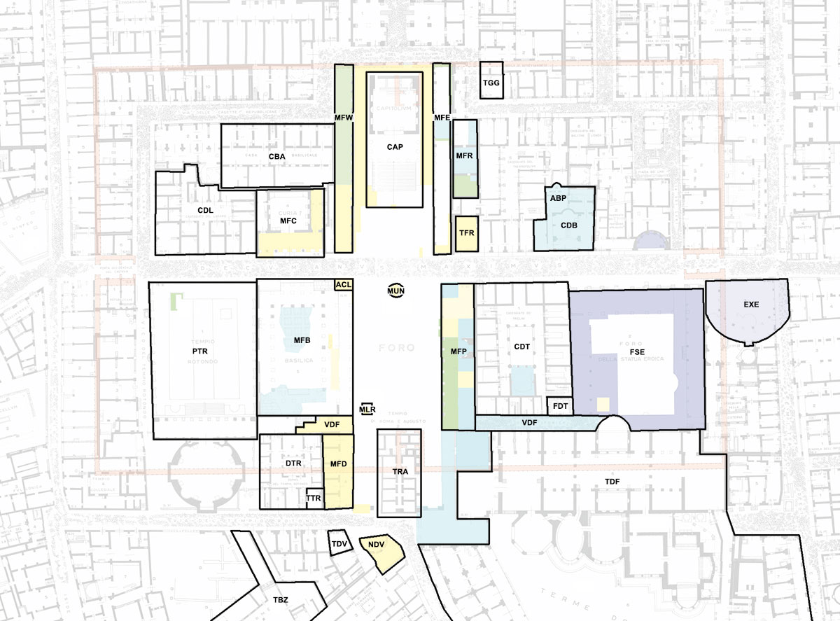
This method of surface cleaning and excavation work, conducted by Axel Gering of the German Archaeological Institute of Berlin, was started at Ostia already in 2002. The actual Ostia Forum Project is a continuation of the Berlin team’s activities in 2013 with its focus area being the Forum and the adjoining buildings. The following areas have already been treated and investigated since 2008 or will be investigated in the years to come:
 |
 |
MFP - Main Forum Portico MFR - Main Forum Rooms MFW - Main Forum West MFE - Main Forum East EXE - Exedra FSE - Foro delle Statua Eroica VDF - Via delle Forica ABP - Aula del Buon Pastore CDB - Casa della Basilica TFR - Taberna Forum Rooms TGG - Taberna Giove e Ganimede CDT - Caseggiato dei Triclini FDT - Forica dei Triclini TDF - Terme del Foro MFC - Main Forum ‘Curia’ MFB - Main Forum ‘Basilica’ MFD - Main Forum Domus Portico DTR - Domus del Tempio Rotondo TTR - Taberna Tempio Rotondo MUN - Mundus TRA - Tempio di Roma e Augusto CAP - Capitolium ACL - Attius Clementinus MLR - Manilius Rusticianus PTR - Piazzale del Tempio Rotondo TBZ - Terme Bizantine NDV - Ninfeo delle Venere TDV - Taberna delle Venere CBA - Casa Basilicale CDL - Caseggiato del Larario |
|
 |
 |
||
 |
 |
||
 |
 |
||
 |
 |
Source
- http://ostiaforumproject.com/.
- Notes
- 1: Daniel is site manager and supervisor of the Danish sub-team and research assistant of the Ostia Forum Project (see also http://ostiaforumproject.com/daniel-damgaard-ph-d-student).
- 2: Italo Gismondo entered the Amministrazione delle Antichità e Belle Arti in 1910 and was named director of the Ostia excavations, where he remained for 44 years.
- 3: See 'The last stage of Roman Ostia back to life'.
- 4: Orthophotography is a technique by which an aerial photograph is geometrically corrected ("orthorectified"), so that the scale is uniform (the photo has the same lack of distortion as a map). An orthophotograph can be used to measure true distances, because it is an accurate representation of the earth's surface, having been adjusted for topographic relief, lens distortion, and camera angle.
- 5: For a short introduction into the methodology of refined excavation- and survey-techniques in large-scale excavated sites like Ostia see: Axel Gering. Ruins, Rubbish dumps and encroachment: Resurveying Late Antique Ostia. In: L. Lavan and M. Mulryan (Eds.). Fieldmethods and Post-Excavation Techniques in Late Antique Archaeology, LAA 9, 2012 (Leiden 2013). Page 249-288.


 We are committed to providing versions of our articles and interviews in several languages, but our first language is English.