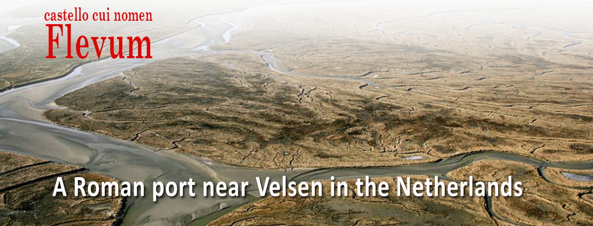
On 27 July 2021, Unesco's World Heritage Committee placed the Lower Germanic Limes on the World Heritage List. The Lower Germanic Limes was the border of the Roman Empire in the Roman province of Lower Germany. About two thousand years ago, the Limes protected the Empire against invasions by Germanic tribes for centuries. Along this border, which is roughly the course of the Old Rhine, you will find many Roman traces such as the remains of forts, legion bases and watchtowers.
Around 55 BC, Julius Caesar had his eye on this region. According to him, he extended the Roman Empire to the Rhine. However, this was not realized before the reign of his successor, the Emperor Augustus who had built several outposts in the Lower Rhine area and sometimes with a harbour. It was not until 47 AD that the Emperor Claudius decided that further outbreaks to the north were not worthwhile and decided that the Rhine should become the definitive northern border. The outposts above the border became superfluous and were soon abandoned. This article1 describes the origin, decline and rediscovery of one of these northern bases with harbour, Fort Flevum:
“…..castello cui nomen Flevum”
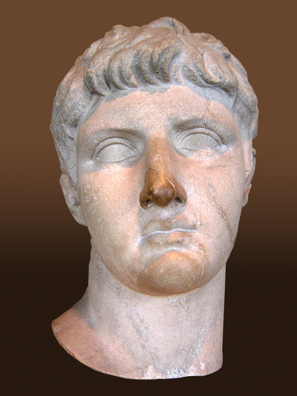
The region in the north of the Roman Empire was inhabited by a people called Frisii (Frisians) by the Romans. In 12 B.C. the Frisii were incorporated into the Roman Empire by the Roman army commander Drusus3.
In 28 AD these Frisians revolted against the Romans because of excessive taxes. The Roman historian Tacitus4 reports about this revolt in his Annales5 in which fort Flevum also played an important role:
“That same year the Frisii, a nation beyond the Rhine, cast off peace, more because of our rapacity than from their impatience of subjection. Drusus had imposed on them a moderate tribute, suitable to their limited resources, the furnishing of ox hides for military purposes. No one ever severely scrutinized the size or thickness till Olennius, a first-rank centurion, appointed to govern the Frisii, selected hides of wild bulls as the standard according to which they were to be supplied. This would have been hard for any nation, and it was the less tolerable to the Germans, whose forests abound in huge beasts, while their home cattle are undersized. First it was their herds, next their lands, last, the persons of their wives and children, which they gave up to bondage. Then came angry remonstrances, and when they received no relief, they sought a remedy in war. The soldiers appointed to collect the tribute were seized and gibbeted. Olennius anticipated their fury by flight, and found refuge in a fortress, named Flevum, where a by no means contemptible force of Romans and allies kept guard over the shores of the ocean”.
So the name of the fortress, Castellum Flevum, had been known for some time. The location was not yet known. There were plenty of suggestions: the tip of North Holland, Friesland and even North France.
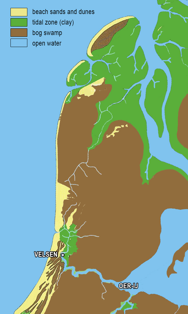
Geographer A. Beelaerts van Blokland reasoned in 1942 that it must have been near Velsen in the Netherlands. Not much later, in 1945, the first Roman shards were found where now the Velsertunnel lies under the North Sea Canal, but they soon turned out to be several decades too young to be the fort of 28 AD mentioned by Tacitus.
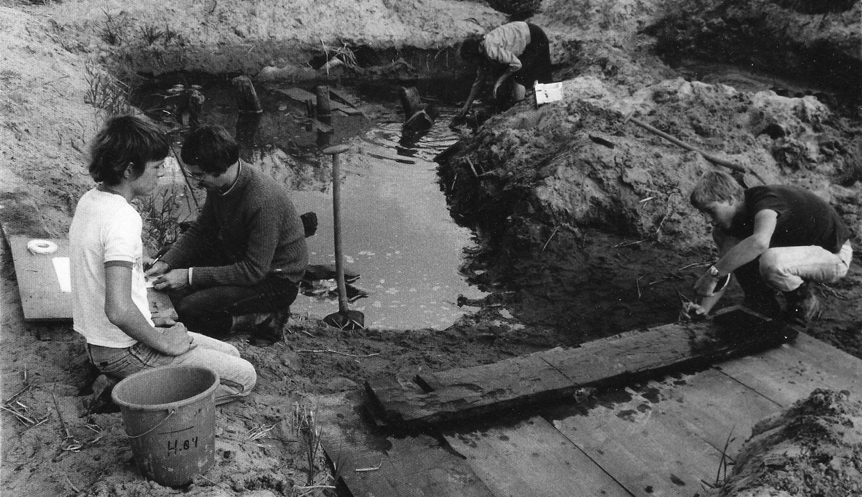
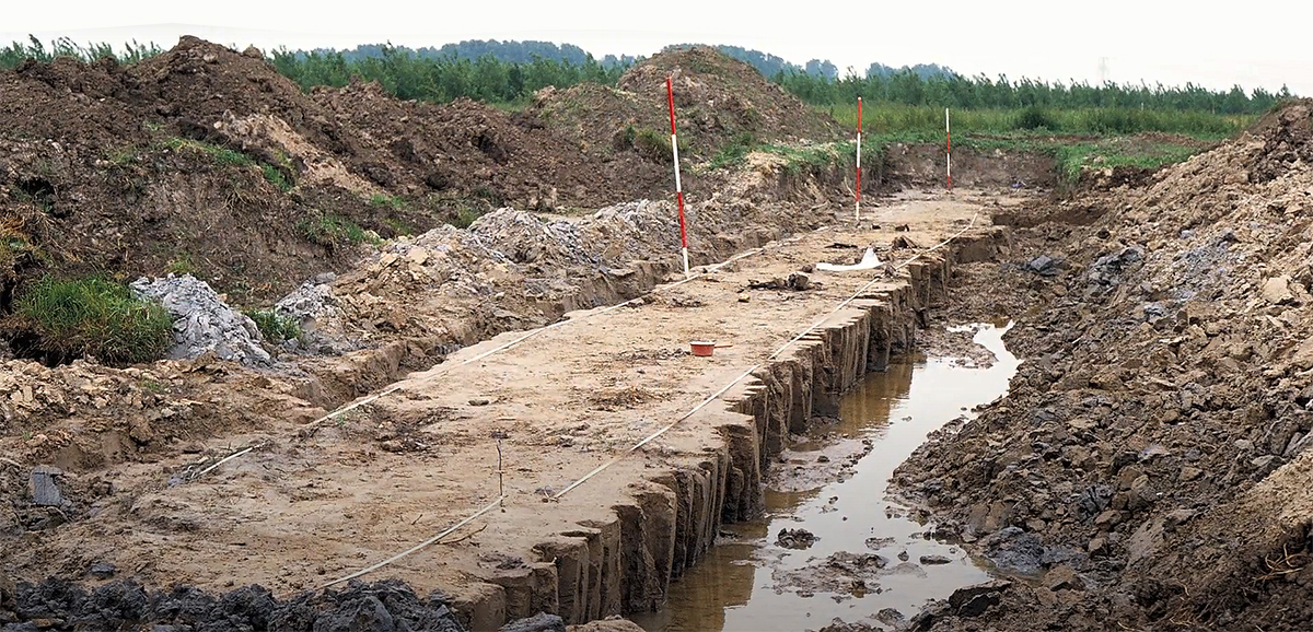
When in 1972 a second tunnel, the Wijkertunnel, was built next to the Velser Tunnel, the exact location of the fort mentioned by Tacitus was really found. This spot was called Velsen 16 and the spot near the Velsertunnel became Velsen 2. Both locations were located on the south bank of the Oer-ij. Because the construction of the Wijkertunnel would irrevocably obliterate all traces of the soil, including those from the Roman period, the soil survey had to be done as soon as possible an quickly. In that way it would be possible to map out the entire ground plan of the fort and a Roman harbour, which would later turn out to be a part of the fort.
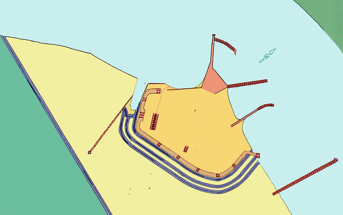
The construction of Velsen 1
The fort was probably erected as a supply point and to control shipping on the Oer-IJ, the Sea and the beach ridges7 (Konen, 2000:281).
Immediately after their arrival in 15 AD, the Romans started the construction which went through several phases. Archaeologist Jaap Morel, who led the research from the IPP (Institute for Prae- and Protohistory Amsterdam), identified no less than five building phases (1a, 1b, 1c, 2a and 2b).
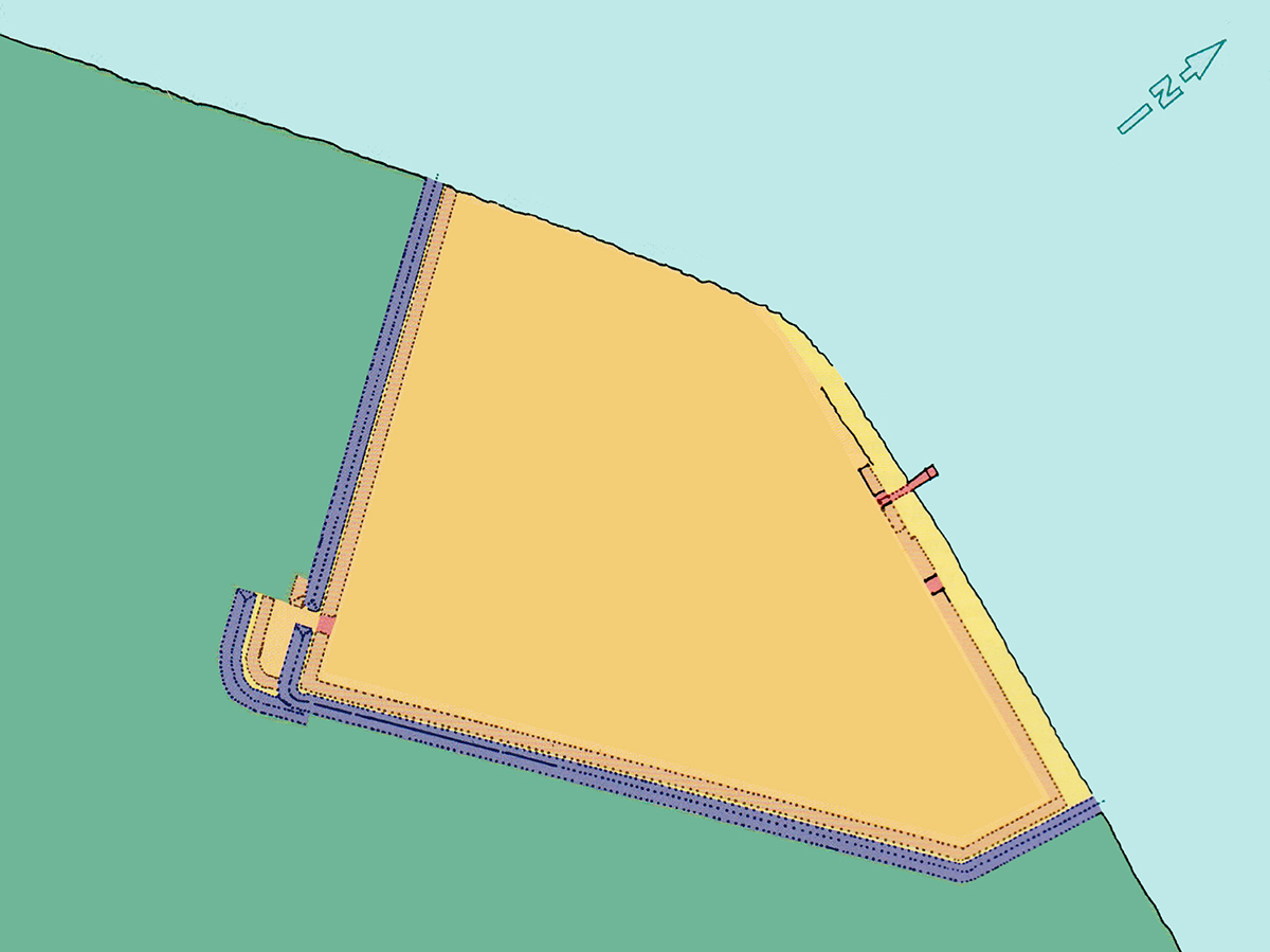
The reconstructed floor plan of phase 1 was more or less triangular, with one of the sides being the bank of the Oer-IJ.
Around the fort was a V-shaped ditch, a typical Roman phenomenon that was easy to fall into and, because of the V-shape, difficult to climb out again. Furthermore, a rampart consisting of double wooden palisades with soil from the ditch between them was built. Towers were probably placed on the rampart, at regular intervals, of which only the traces of one have been survived.
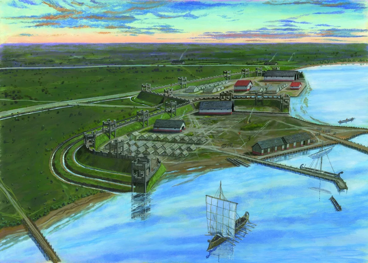
On the side of the Oer-IJ, a mole, a mooring quay and storage facilities were built.
The very first phase from 15 AD (phase 1a) was intended as a temporary camp to provide a safe haven during the construction of the permanent camp.
Phase 1b was the first real camp. It had an entrance gate in the southwest corner, which lasted only a short time. There was also a boathouse with a slipway. Pollen analyses has shown that from the arrival of the Romans, many trees were felled for the construction of the camp and the harbour. This created sand drifts and required regular dredging. At the same time, the bank west of the harbour structures in particular, soon suffered from erosion and, in what we now call phase 1c, adjustments had to be made by placing a sheet-piling.
A wooden palisade containing a small gate was also built along the bank, east of the harbour structures. A section of the bank, north of the harbour constructions, that had already been swept away was changed into a dock, which meant that the boathouse also had to be moved to the rear (see Figure 6).
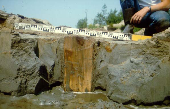
Unfortunately, in Velsen the Romans never built with stone, but only with wood. Although wood decays quickly if not kept airtight, traces are often left behind in the form of soil discolouration and post holes. Of the buildings within the fort, only the post holes of two boathouses and another small building have been found.
It is likely that the camp's residents initially were housed in tents, but certainly wooden houses were built during the camp's permanent phase. Because no direct traces were found, it is assumed that these houses did not rest on posts driven into the ground but on wooden girders.
Te harbour
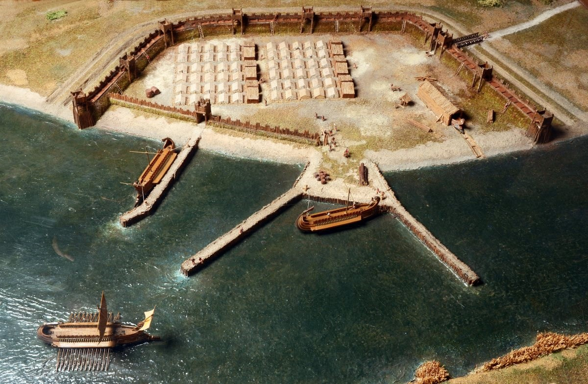
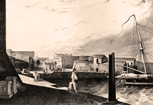
What makes Velsen 1 unique, especially as a Roman fortification in Western Europe, is the harbour, traces of which were still clearly visible during the excavation.
In the main channel of the Oer-IJ, a harbour platform with two piers connected to it was built, following Mediterranean models. The platform and the piers had a shoring of alder wood driven close together. Within the shoring, rammed soil was inserted on which probably planks were laid. At regular intervals, angled side walls were placed, forming caissons that were filled with faggots, reed baskets wrapped in fat clay and stones. This filling was still in situ at the head of the western pier.
Another pier was built east of the platform. This pier gave direct access to the fort through the small gate in the bank wall already mentioned. The piers were 50, 55 and 65 metres long.
At the start the west side did not have any sheet piling, as ships were towed ashore at this spot. However, the fort was built on a bend in the Oer-IJ, which caused the water to erode the bank at that very spot. Therefore, it was decided later on to build a, albeit simple, revetment.
South-west of the fort was a dug-out ditch with probably a rampart and a palisade on top of it. This would have served to defend the so-called annex, an area where goods were stored and where people travelling with the army, such as traders or suppliers of all kinds of services and the wives and children of soldiers were quartered.
In this annex traces of a building have been found in the form of four rows of six posts forming an area of 4.72 by 3.54 m (16 x 12 Roman feet). This could have been part of a building with a hypocaustum (floor heating), such as a bathhouse. Bathhouses ensured basic hygiene and were very important for an army. Because of the danger of fire, bathhouses were never built in the camp itself, but in the annex. Some bathhouse-related articles have also been found here, such as various sculponea (open bath slippers).
The courtyard of Velsen 1 had the standard size for a Roman castellum of about 1 hectare.
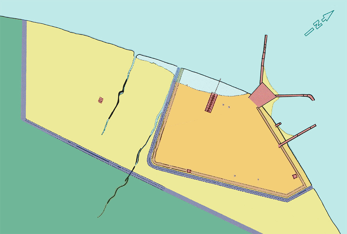
Phase 2
Between phase 1 and 2, the fort may have been temporarily abandoned and replaced by another unit responsible for the new phase. In this second phase, the defences were made heavier and the shape changed from a triangle to a trapezium. Again a wood-earth wall was constructed, but now with three V-shaped ditches in front of it. Whereas the first rampart was mainly founded on vertically buried wooden posts, the foundation of the second rampart consisted of horizontally positioned beams on the floor on which a fence was built.
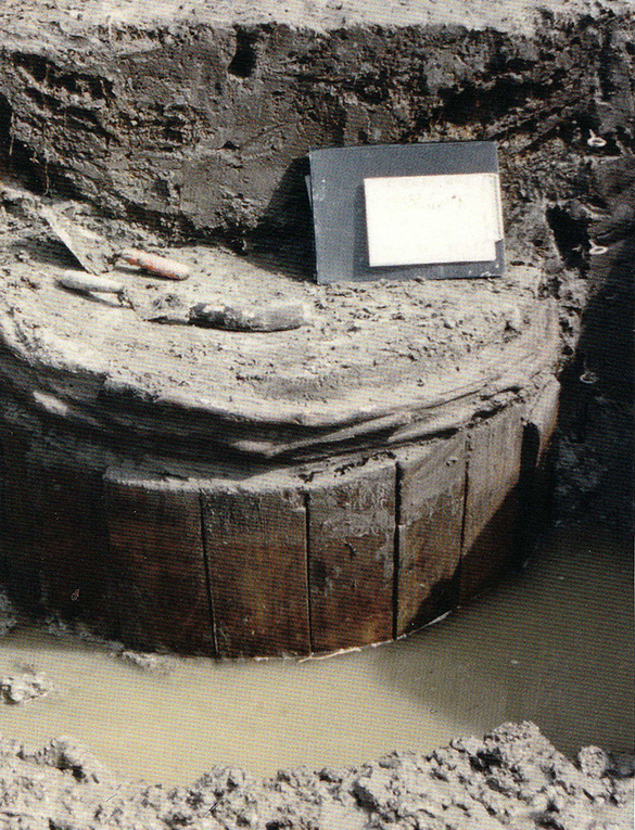
Every thirty metres (one hundred Roman feet) a tower was erected with a foundation of four posts.
There was a double gate in the western part of the rampart. On the most eastern side of the rampart, a heavier tower foundation was found. It consisted of eight posts and was probably used as a lighthouse or as a platform for heavier artillery.
Another modification was the complete removal of the quay wall. The annex, which was larger than the fort itself, was located both west and east of the fort. The eastern side of the annex had its own mooring pier.
The platform in the harbour was expanded at this stage, presumably to increase the transfer and storage capacity. The shoring up of the basin between the west and north piers, a bank which was apparently used frequently, was reinforced with oak posts. Here, boats could moor along both piers and the platform served as a quay.
The end of the western pier was also reinforced with oak posts and extended with a section that ran eastwards. The new posts tell us from their year rings that they were felled in situ and probably processed immediately in the winter of 20-21 AD.
The east pier was also extended to the east and the north pier was replaced with an open jetty. The piles of the new jetty were driven exactly every ten feet under water. Near the head of the jetty, traces of the pile-driving operation have been preserved in the deepest part of the Oer-IJ. They are the silent but impressive witnesses of the magnificent technique used by the Romans to complete this hydraulic job.
The replacement of the piers with open jetties had everything to do with a better flow of the water to prevent silting up of the harbour.
Phase 3
In phase 3, phase 2 was maintained with, on the west side, a trapezoid-shaped extension with one side along the bank of the Oer-IJ. It was surrounded by two canals and connected to the outer two canals of phase 2. The new construction was surrounded by a wood-earth wall that was connected to the existing wall from phase 2. This rampart also had towers at regular intervals. However, all the posts of these towers were removed from the ground when the fort was demolished. Recent excavations only revealed traces of post holes and a single wooden plank used as foundation.
Thus, the surface of the fortress was doubled in the final phase.
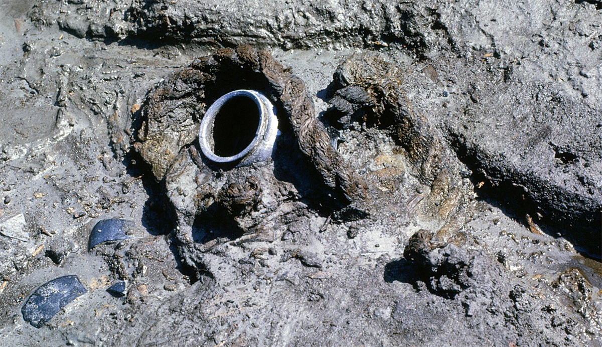
In the courtyard was a huge well, which probably already functioned when the extension was still an anex. From this 3 x 3 m. water well ran a 95 m. long channel towards the harbour. It is assumed that clean water was sent from this well to the harbour to supply the ships.
The dating of Velsen 1 was done on the basis of coins, pottery, objects found and dendrochronologicale12 dating, and confirms that the Romans were stationed in the fort between 15 and 28 AD. The start date would then be historically linked to the second campaign to northern Europe of Germanicus13 and the end date to the revolt of the Friesians.
After abandoning the fort, the harbour and the defence works were made unusable, possibly during the construction of Velsen 2, whereby the wood from the first fort was used for the construction of Velsen 2.
Velsen 2
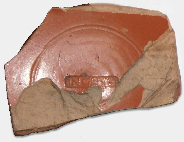
Already before 1940 it was decided to build a tunnel under the North Sea Canal near Velsen in the Netherlands, the Velsertunnel. The project was halted by the Second World War. Shortly after 1945, the aforementioned potsherds were found, one of which belonged to a Roman bowl marked INGENVI. It was soon suspected that this was the site of a Roman fort dating from 40-50 AD15. It was decided to organize an excavation campaign in 1947. For various reasons, this never materialized. However, the findings, finds and interpretations of the material found up to that point were recorded.
The few finds that still appeared in and near the construction pit confirmed the existence of a Roman settlement. The leader of the investigation by the newly established ROB (Rijksdienst voor bodemkundig onderzoek), P.J.R. Modderman16, concluded that finding the whole fort was virtually impossible, as this area had been completely inundated by water in the Middle Ages.
Meanwhile, most of the soil was covered by the new tunnel. However, further archaeological research was carried out around the tunnel, especially during new excavation works. Of course, after 1972, the main focus was on Velsen 1. This fort was completely exposed.
Despite the limited possibilities, there is still some information about Velsen 2, which also had at least three building phases. During research to Velsen 2 in 1994 it emerged that both forts were built on the left bank of the same main channel of the Oer-IJ, some 600 metres apart. No harbour has (yet) been found in Velsen 2, although the same layer of Roman finds was found in the trench that shows great similarity to the waste layers in the harbour of Velsen 1.
Velsen 2 still shows traces of at least one ditch and a wooden rampart. However, this may be the result of the relatively short survey of this fort. It is very likely that both forts had the same function and therefore Velsen 2 must have been provide with a harbour. This harbour, together with the nearby castellum Helinium (Valkenburg neat The Hague), could have had a function in the crossing to England or in the preparations for this under the emperor Claudius in 43 AD18 (read Londinium).
One of the tasks of the northern forts was to safeguard the northern regions of the mainland from unwanted pirate attacks.
Within the finds, it is striking that many more military artefacts have been found in Velsen 2 than in Velsen 1, such as parts of weapons and equipment. This includes a number of long-range weapons such as arrows and ammunition for artillery such as the ballista19. These weapons were not only used on land but also on board ships.
Neither in Velsen nor in Velsen 2 vessels have been found yet, but parts of them have, such as parts of pulleys of the rigging and a fragment of an oar. The difference in finds shows that the forts were certainly not in use at the same time.
- Sources
- - Arjen V.A.J. Bosman and his boek Rome by the North Sea, citizens and barbarians at Velsen'.-Sidestone Press, 2016-ISBN 978-90-8890-363-2 and other publications
- - Comparative study of Roman military port infrastructures (first century BC - second century) Master's Thesis Archaeology Alexander Cattrysse 00604371 Academic Year 2009-2010
- - https://www2.rgzm.de/Navis2/Harbours/Morel/JaapEnLucas/VelsenNederlands.htm
- - Municipality Velsen
- - Foundation Oer-IJ
- - Wikipedia
Notes- 1: This article is largely based on the articles by Dutch archaeologist Arjen V.A.J. Bosman and his book 'Rome at the North Sea, Civilians and Barbarians at Velsen'-Sidestone Press, 2016-ISBN 978-90-8890-363-2
- 2: Buste Nero Claudius Drusus BC). Stepson of Augustus and brother of Tiberius
- 4: Publius Cornelius Tacitus (ca. 56-117 AD.) - Roman consul, historian, writer and orator
- 5: Tacitus: Ann. 4. 72
- 6: Although the fort near the Wijkertunnel was discovered second, it was given the name Velsen 1 because it was built earlier.
- 7: Beach ridge: a sand bank raised above sea level by the surf. Higher up, beach ridges provided the opportunity for the first overland transport routes and settlements were soon established there
- 8: Archeologieopdekaart.nl
- 9: Photo P. Vons
- 10: Photo IPP, Amsterdam
- 11: Artist impression: Graham Sumner
- 12: Dendrochronology - determination of the age of wood from its annual rings
- 13: Germanicus Julius Caesar (16 BC – 19 AD). Roman general, son of Nero Claudius Drusus, adopted son of Emperor Tiberius
- 14: Photo IPP, Amsterdam
- 15: Velsen 2 was discovered earlier than Velsen 1 but clearly dates from a chronologically later period
- 16: Pieter Jan Remees Modderman (1919-2005), Nederlands hoogleraar in de prehistorie, volkenkundige en archeoloog
- 17: Photo M. Bosman
- 18: Morel & Weerd, 1980: 477
- 19: Ballista: Roman artillery weapon for throwing stones or arrows
- 20: Archive IPP Amsterdam
- 21: Archive IPP Amsterdam


 We are committed to providing versions of our articles and interviews in several languages, but our first language is English.