Tarracina (modern Terracina) is a municipality in the Italian province of Latina located on the coast and Via Appia, about 56 kilometers southeast of Rome.
Tarracina was located at a fairly strategic point: namely where the Volsci hills flow into the Tyrrhenian Sea and, according to Livius, was a "urbs prona in paludes" (a city surrounded by swamps = the Pontine swamps).
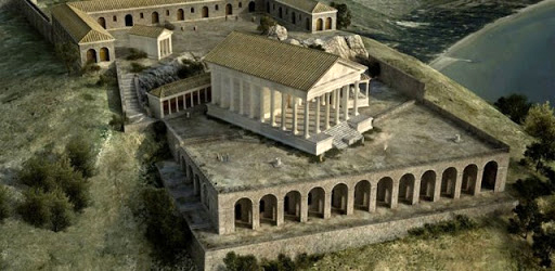
The city was probably founded by the Volsci and is known in ancient sources as Anxur1. The name Anxur was an equivalent of the young God Zeus (Greeks) and Jupiter (Romans). This God Iuppiter Anxur or Anxurus was the guardian god of Tarracina and was worshiped in a temple on the Mons Neptune (today Monte S. Angelo) built at the end of the second century BC.
Ancient Terracina was on the top of a sloped hill with terraces on which several other temples were built. Next to the temple of Jupiter was a smaller temple dedicated to Venus Obsequens (benevolent Venus).
Tarracina was already under the authority of Rome since 509 BC as evidenced by the First Treaty between Rome and Carthage2. Shortly afterwards, the city was recaptured by the Volsci and eventually became a Roman colony in 329 BC under the name Colonia Anxurnas.
During Sulla3, several monuments in the city were built in opus incertum4 and opus reticulatum5, such as the Roman theater, the wall around Mons Neptune and the temple of Iuppiter Anxur.
In the imperial period, between the first and second centuries AD, a new construction period began, including the large Forum that, according to an inscription, had been paved by a certain Aulus Aemilius (AVLVS AEMILIVS STRAVIT), and many religious and social buildings and as a highlight; the port of Trajan.
Trajan's Ports
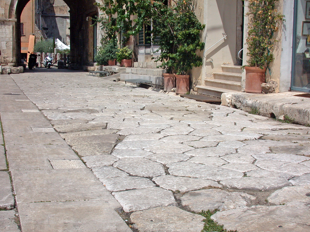
Probably there was some sort of harbour or anchorage in or near Tarracina at the time of the Roman Republic. The construction of the Via Appia in 312 BC. played an important role in the development of the city. The road, from Rome to present-day Brindisi in southeast Italy, ran over the hill straight through the old town.
The Tyrrhenian coastline was almost completely devoid of natural harbours that were so important to the development of Rome. Not only militarily but also economically. As trade became more and more seaborne, ships increasingly needed places where they could transfer their cargo into smaller ships in the lee before they could bring them ashore. However, this remained a perilous and costly undertaking.
Another option was to look for navigable rivers where loading and unloading could be done more inland8.
With the invention of the hydraulic concrete at the end of the third century BC. this soon changed. It was now possible to build artificially sheltered harbours where there was no natural protection. For example, in 179 BC. a mole to protect the ships was built near Tarracina by a certain M. Aemilius Lepidus9, which had major positive consequences for trade in the entire area10.
In 37 BC. M. Vipsianus Agrippa11 ordered the architect Lucius Cocceius to build Portus Iulius on the northwest side of the Gulf of Naples. The harbour, intended as a military harbour, had only a short life due to silting up and was moved to nearby Misenum12 quite soon.
Nevertheless, the construction of Portus Iulius was more or less the starting signal for the construction of more large artificial harbours along the Tyrrhenian coast. In addition, between the second century BC. and the second century AD. a significant number of coastal villas were built that also needed to be supplied and often traded. Private ports were often built for this. Whereas in republican times preference was still given to river ports, in the imperial era it was mainly the coastal ports that were the focus of attention.
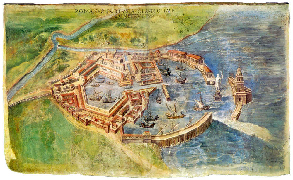
At the beginning of the second century AD. The emperor Trajan (98-17 AD) invested in a large infrastructure program in Italy. On the Adriatic coast he built the port of Ancona13 and on the Tyrrhenian coast he expanded Portus, the huge but risky port of Claudius at the mouth of the Tiber, with a new hexagonal basin14. Portus had special status because of her relationship with Rome and with Ostia. Ostia was not only the grain supplier of the largest city in the empire, but also a distribution centre for the entire western Mediterranean.
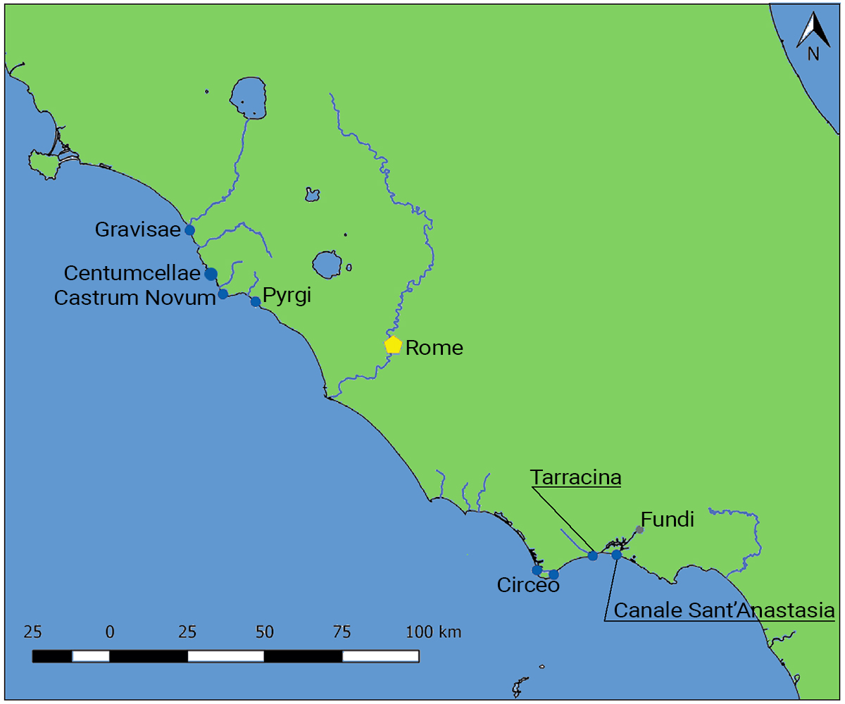
When Portus was no longer able to guarantee sufficient capacity for the ever-expanding Rome, he decided to build two more ports. One in Centumcellae15 (Civitavecchia) in Etruria and Tarracina in Latium. These two ports were intended as the satellite port of Portus16.
The port of Tarracina covered approximately 11 hectares and had a length of 1200 meters17, roughly the size of the port of Lepcis Magna in present-day Libya18.
To connect the port of Tarracina with the hinterland and Rome even better, Trajan cut off the foot of the rock (Pisco Montano) on which the city was built, to create space around the harbour for a road. The Via Appia, which used to run over the hill, right through the city, was now diverted to the foot of the hill, ran along the Canneto canal and was reconnected to the old road on the northwest bank of Lago di Fondi .
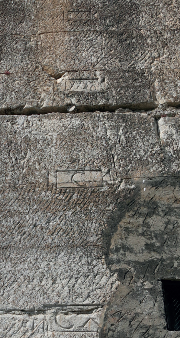
The height of the chopped rock can still be seen today from the marks placed every 10 Roman feet on the vertical wall. The lowest mark, CXX (120 feet), is located about 1 meter above the current street level.
Now several important buildings could be built at the bottom of the hill, right next to the harbour. Sulla in particular has had built many new buildings in the harbour quarter20.
In addition to the Via Appia, the construction of the coastal road, the Via Severiana, which ran from Portus to Tarracina, was also very important.
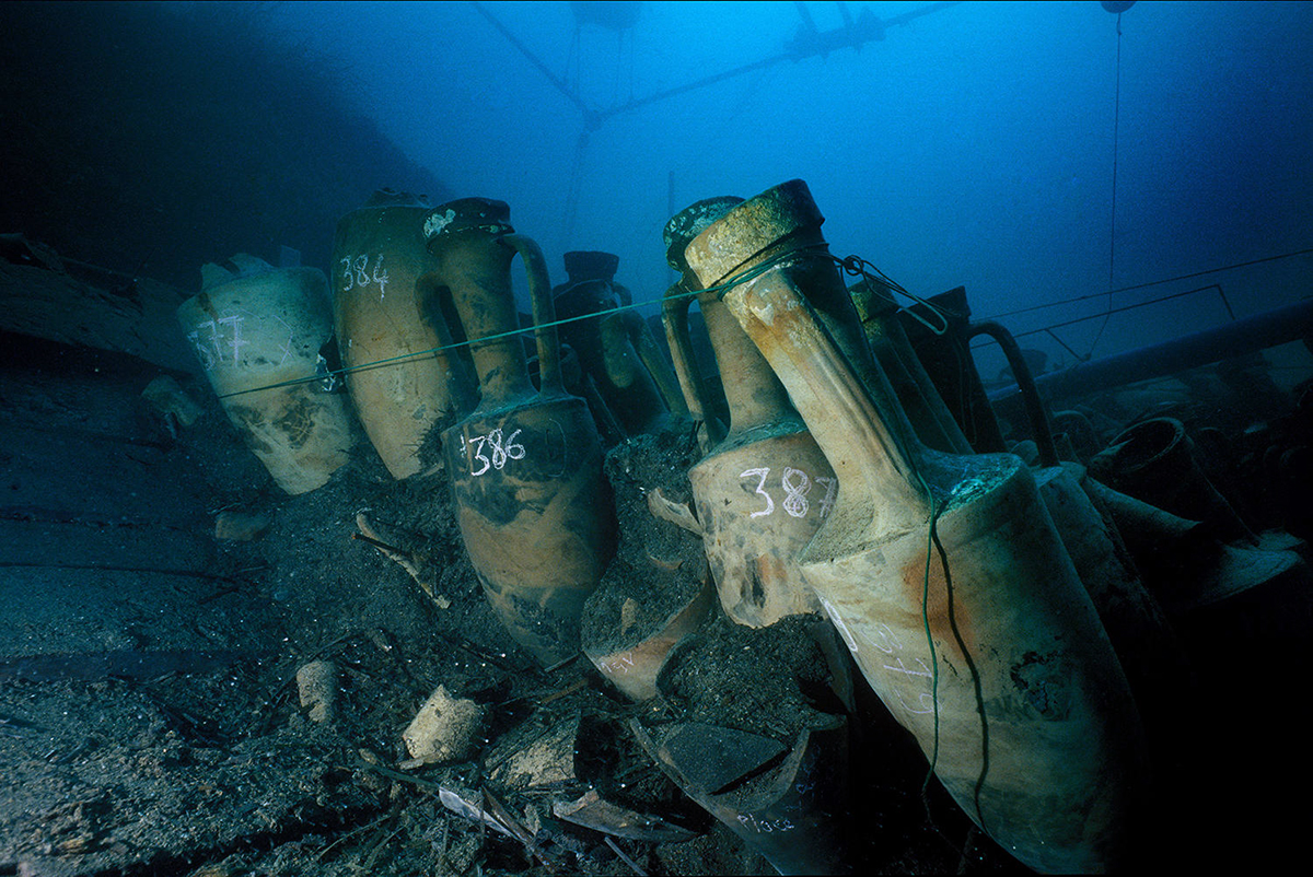
From then on, Tarracina was well connected by land and by sea, and remained an important port city not least by supplying wood and glue for the construction industry in Rome. In addition, it was also involved in the export of the famous Caecubian21 wine. The Dressel 18 amphorae found in the Madrague Giens wreck were found to have been produced in the Terracina region22.
Both Centumcellae and Tarracine were surrounded by older and smaller ports.
At Centumcellae, these were Pyrgi 24, Castrum Novum and Graviscae; Tarracina was flanked by Circeo and Fundi.
Tarracina was a harbour on the Tyrrhenian Sea built by an emperor but, unlike the other harbours, there was no connection with an imperial villa.
 Circeo
Monte Circeo is the only hill in the flat landscape of the Platinian marshes. The oldest known settlement has been found on the east side. Neanderthal bones have been found in caves at the foot of the hill. The mid-hill Roman colony is one of the oldest colonies25.
On the west side of the hill was a small harbour situated on a canall that was conceived by Nero and realized by Domitian. Nero's plan was to create a waterway system for inland waterway skippers that would ensure independent transport of goods, without hindrance from weather and waves, between Puteoli and Rome. This system has never been established. In any case, the canal system connected the villas in the hinterland with the Mediterranean Sea.
Two of the canals planned by Nero ran around Mount Circeo. The Fossa Augusta ran along the north side of the hill, although it is not certain whether this canal was fully completed.
A second, but smaller canal was the so-called "harbour canal" with the small harbour on the sea side. This canal connected the sea to Lake Paola where Domitian had his villa, which was apparently more important to him than the connection with Rome. There is no evidence that Domitian finished any other canal of Nero. The 1 km long canal, built from opus caementicium26, opus reticulatum and opus mixtum27, still connects the lake and is now mainly used by fishermen.
The 17th-century German historian and geographer, Lucas Holstenius, recalled the presence of various iron rings on the canal wall that were probably intended to moor ships28.
Fundi
The city of Fundi is located east of Terracina, more inland. The city was connected to the Tyrrhenian Sea by several small canals and Lago di Fondi. The Canale Canneto runs parallel to the Via Appia Traiana. The Canale Sant'Anastasia is less straight and was probably navigable.
Several classical authors mentionned the white caecubo wine as the main export product29, which is also confirmed by the loads of shipwrecks found. Wine trade amphorae were produced at the mouths of the two aforementioned canals.
There is not really found a harbour at the mouths of the rivers, only the already mentioned mole of Lepidus near the canals is mentioned by Livius30. This anchorage with a protective dam probably contributed to the construction of his own villa.
From the second half of the first century AD. most villas were abandoned and the amphorae production also ceased. Pliny gives as a reason that viticulture was neglected because no one was really interested anymore in the shipping route between Puteoli and Rome of Nero.
Tarracina
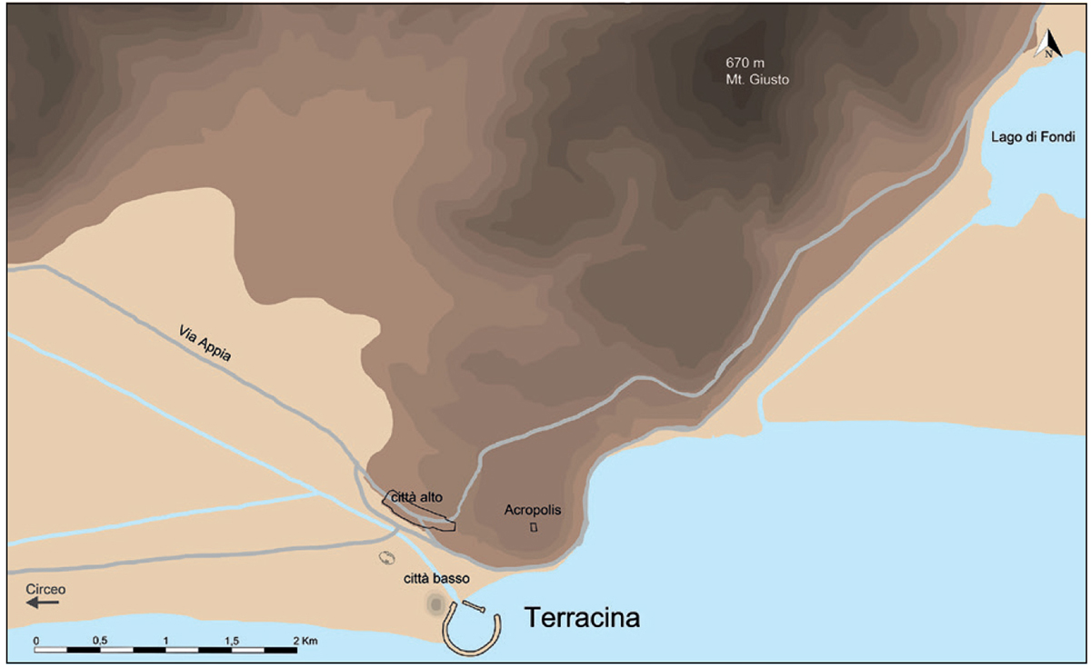
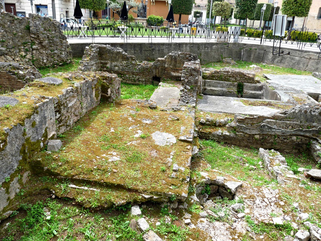
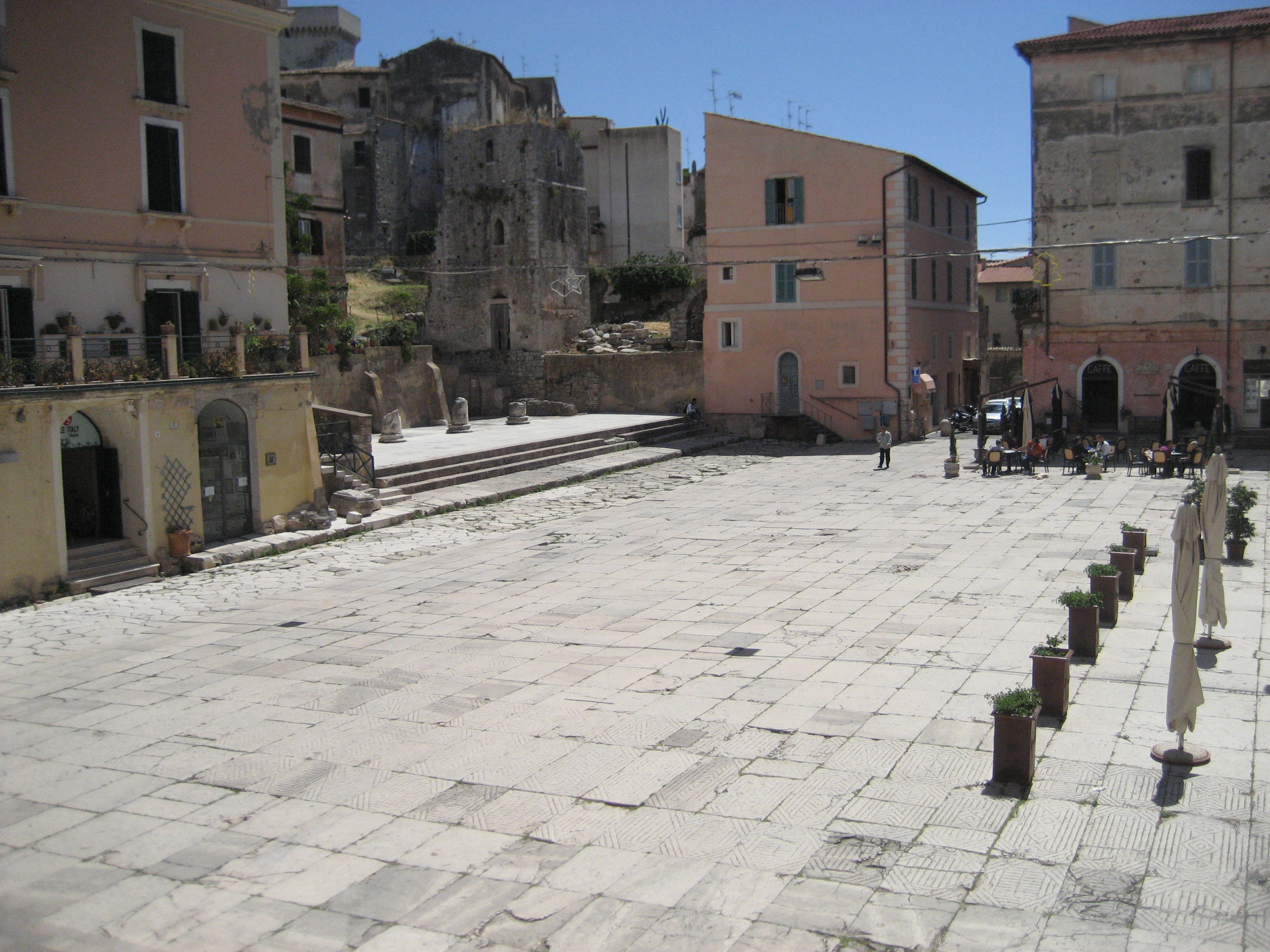
The city was actually divided into three sectors: the oldest sector was the upper town, on a small hill and surrounded by a city wall.
At the foot of the hill, by the sea, is the lower town with the harbour quarters.
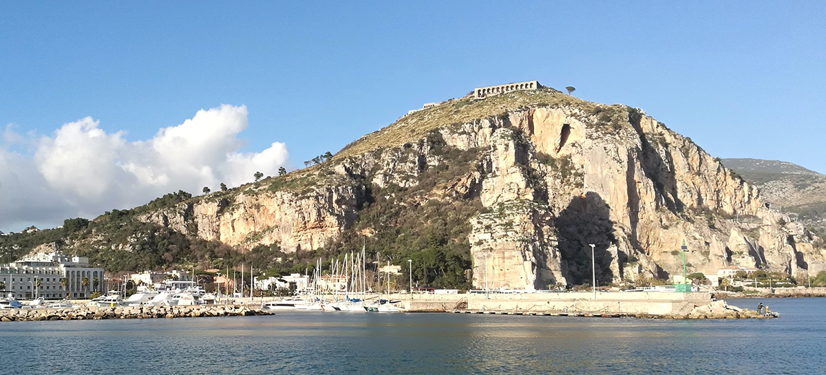
The third section is high on the tip of the hill and forms the Acropolis with the temple of Jupiter Anxur that still can be seen from the sea.
No details of a port in Tarracina are known from before the 2nd century AD. Striking is a report from 68/69 AD. in which Tacitus describes the civil war battles of that year: Vespasian's troops were entrenched on the hill in the city. When his men fled to their ships, they are described as running towards the beach to reach their ships31 - however no harbour is mentioned.
The first mentioned harbour is that of Trajan. This was later extended by Antoninus Pius with a new pier32.
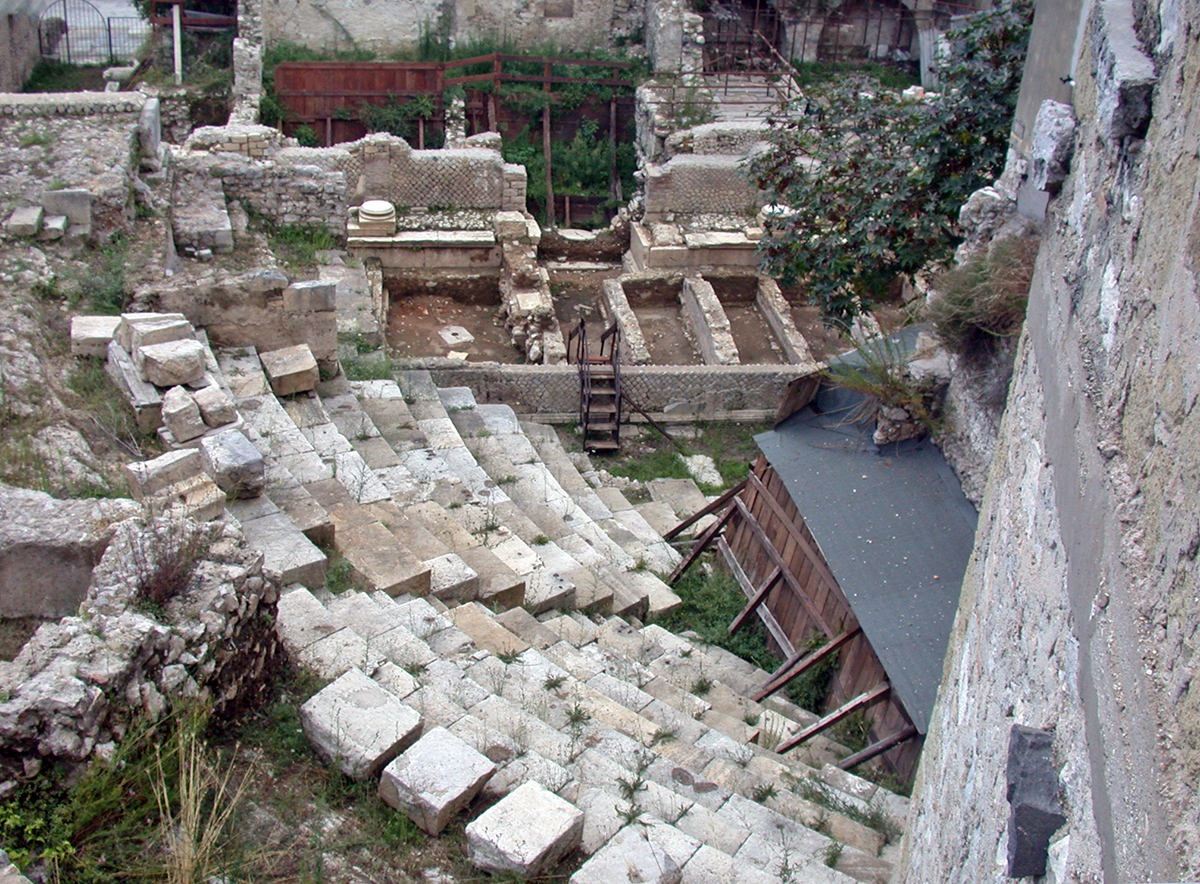
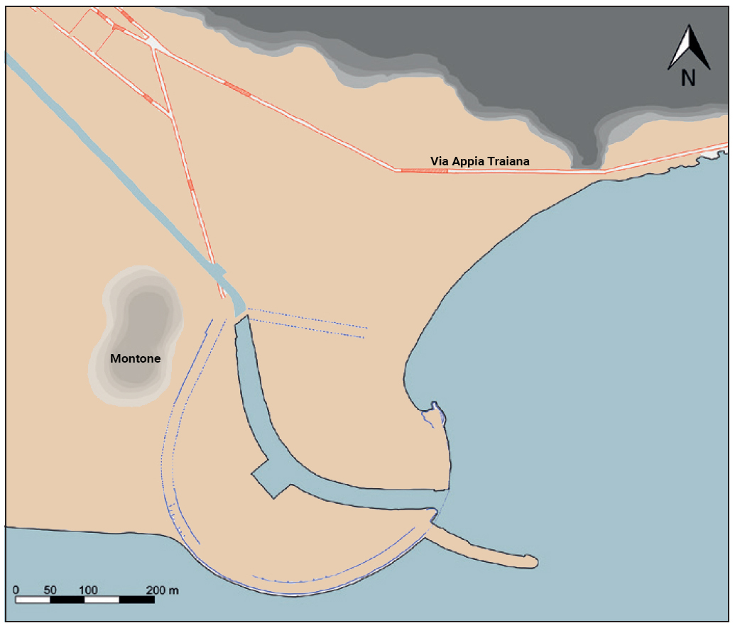
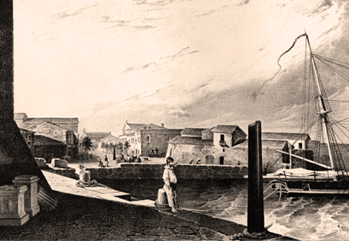
The most extensive research on the port of Tarracina dates from 188133. From this we know that the harbour was located at the mouth of a small canal that ran parallel to the Via Appia.
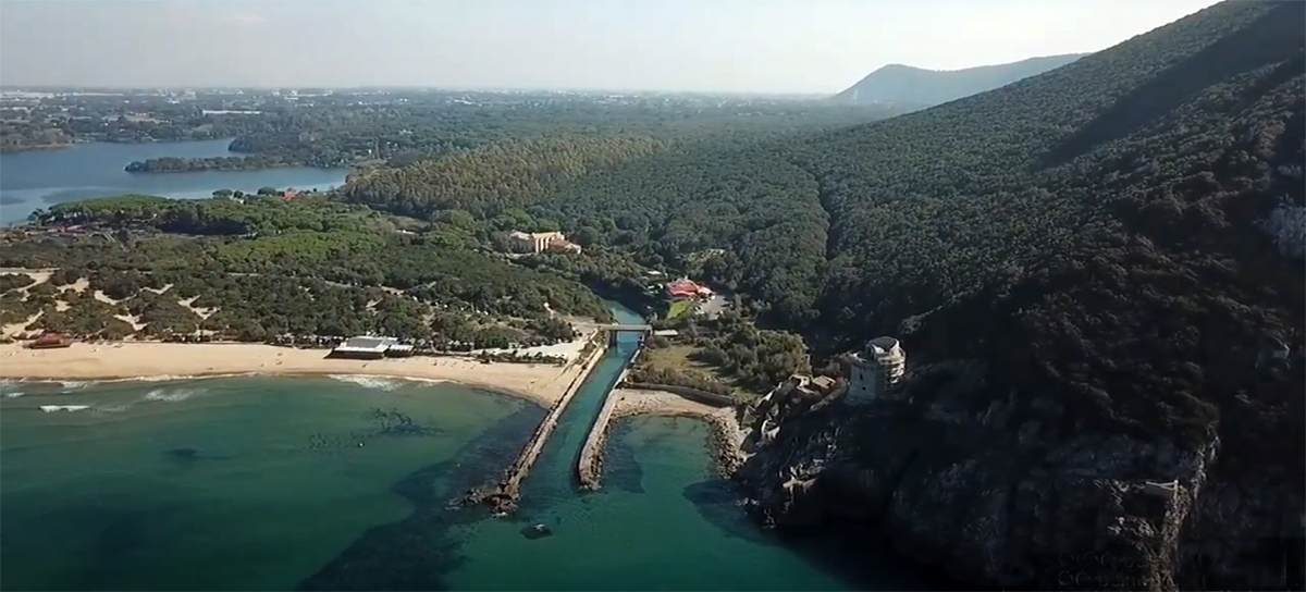
Apart from the foundation of the eastern pier of Trajan, you can no longer see the harbour today. The antique harbour basin is almost completely silted up and the canal has been extended to the Tyrrhenian Sea (see Photo 12).
The old basin had a diameter of 375 meters and the harbour entrance, which had been dug artificially inland, was 120 meters. The removed soil can still be seen in the small hill "Montone" in the otherwise flat landscape.
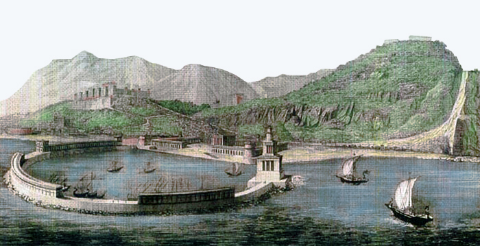
The old basin had a diameter of 375 meters and the harbour entrance, which had been dug artificially inland, was 120 meters. The removed soil can still be seen in the small hill "Montone" in the otherwise flat landscape. The harbour structures consisted of two straight piers on either side of the canal. The eastern pier of about 170 meters ended at the old harbour entrance. The western one, also built by Trajan, was 230 meters long and straight. In a later adaptation, it was extended in an arc to the other side of the harbour entrance. The piers were 15 meters wide and clearly show traces of buildings on them. These descended step by step to the water. Thus the description from 1881.
The east pier can be seen, while the west pier is covered by modern buildings. In 1881, a prison was built on the remains of the east pier of the old harbour. The southern part of the pier had a width of 18 meters and shows also traces of a building development. Along the promenade there are still large pieces of vaults that testify to the large warehouses that used to stand on the piers.
Het Trajan Relief
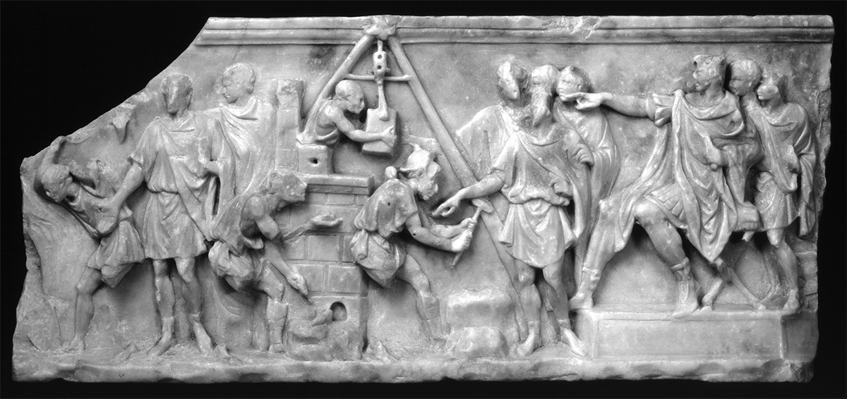
It is not entirely clear to what extent Trajan has himself really been involved in the expansion of the port. This is based on a relief showing a port construction scene. In the immediate vicinity of the harbour, there has been also found a one-and-a-half-meter-high stela, stating that in the ninth year of his reign, Trajan financed something from his own resources34. This stela was probably found at the mouth of the canal.
The relief is 55 cm long and 24 cm high and, at both ends, not complete. It represents craftsmen on the left who build a quay wall or mole. Four workers are involved in that construction. On the left, one of the workers, in a stooped position, carries something out of the picture while he receives instructions from a man beside him. To the right behind this "overseer" is another man in tunic and cloak. A bricklayer is working on the right in front of the "supervisor". The wall has now reached its full height with a cornice and an anchor stone. Behind the wall is a construction crane with which a third worker moves a block of stone. A fourth sits in front of the crane working a boulder with a hammer.
On the right side of the relief, six people watch how the work proceeds. One of the men is sitting on a platform, a sella curulis (seat of office for higher magistrates). This man is depicted larger than the others. He wears armor with a cloak over it. Because his head has been cut away, this person cannot be identified. He points to the structure.
On the platform are two more men, the man in front also wears a tunic and a cloak. To the right of the right-most person, the shape can be recognized from the tip of a rostrum (ship's snipe), which suggests that a ship was depicted on the missing right-hand section.
In any case, this relief creates controversial opinions. In 1881 de la Blanchère saw the sitting person as the Emperor Trajan35. Fifty years later, in 1938, the relief was classified as a falsification. It was not until the 1990s that the relief was once again seen as real by the Italian professor Filippo Coarelli36. He dated the relief in the late republican period, or at the latest, in the early augustian period. As a result, the alleged port construction by Trajan was out of the picture. However, when looking at the seated man's shoes, the dating from the republican era should also be questioned, as they more closely resemble the emperor's fur boots than the shoes of senators or patricians depicted in the republic. So we will have to wait for the correct date of the relief to be able to determine whether Trajan was depicted here or which other person?
- Sources
- - Julia Daum - Die Häfen Centumcellae und Terracina: Zwei Kaiserliche Bauprojekte an der Tyrrhenischen Küste; 2015
- - Julia Daum – Trajan’s harbours on the Tyrrenian Coast; 2018
- -Katia Schörle - Constructing port hierarchies: harbours of the central Tyrrhenian coast
- Notes
- 1:Pliny, Natural History 3.59: "lingua Volscorum Anxur dictum", "called Anxur in the language of the Volsci"
- 2: Polybius, Histories 3.22 http://www.perseus.tufts.edu/cgi-bin/ptext?lookup=Plb.+3.22
- 3: Lucius Cornelius Sulla, later named Lucius Cornelius Sulla Felix, was a Roman politicus, general and dictator in thr time of the late Republican.
- 4:Opus incertum: rectangular blocks of tuff
- 5:Opus reticulatum: mosaic shape consisting of rectangular tuff stone tiles fixed in a diamond-shaped wet substrate.
- 6+7:Photo Wikipedia-MM
- 8:Strabo Geographica 5.35; Pliny Epistulae 6.31; Dionysius of Halicarnassus Antiquitates Romanae 3.44 ships with more than 3,000 amphorae must anchor offshore.
- 9:Marcus Aemilius Lepidus: Consul in 187 and 175 BC, Pontifex Maximus and Censor
- 10:Livius Ab Urbe Condita 40.51.2.
- 11:Marcus Vipsianus Agrippa, Roman general, friend and advisor Octavianus (Augustus).
- 12:Read: "The ports of Campi Flegrei"
- 13:Read: "The Elbow ruling the Adriatic Sea"
- 14:Read: "Portus, Roman's imperial port"
- 15:Read: "Centumcellae, the port of Trajan"
- 16: Rickman 1991: 109.
- 17: De Rossi 1980: 100, fig. 25; Blackman 2008: 648–50.
- 18: Read: "Leptis Magna, the maingate to Africa"
- 19: www.aspassoconsara.it
- 20: Lugli 1926, XV
- 21: Caecubum: marshy plain along the coast in South Latium
- 22: Roman wreck found in 1967 near Madrague de Giens off the Mediterranean coast of France. The ship could accommodate 4,500 - 6,500 amphorae.
- 23:Photo – G. Reveillac, CCJ, AMU-CNRS
- 24:Read: "Santa Severa, a town behind a bathing resort"
- 25:Grimali / Spinapolice 2010, 415.
- 26:Roman concrete
- 27:Mix of brick and opus reticulatum (see note 5)
- 28: Holstenius 1666, 1002 line 29.
- 29: ‘The caecubo one of the winest Rome white wines’ - Plin. nat. 14, 61. – Di Fazio 2006, 3.
- 30: ‘The general public was not happy with such use of their money’ - Liv. 40, 51, 2 f.
- 31: Tac. hist. 3, 77.- pauci gladiatorum resistentes neque inulti cecidere: ceteri ad navis ruebant, ubi cuncta pari formidine implicabantur, permixtis paganis, quos nullo discrimine Vitelliani trucidabant. sex Liburnicae inter primum tumultum evasere, in quis praefectus classis Apollinaris; reliquae in litore captae, aut nimio ruentium onere pressas mare hausit. Iulianus ad L. Vitellium perductus et verberibus foedatus in ore eius iugulatur. fuere qui uxorem L. Vitellii Triariam incesserent, tamquam gladio militari cincta inter luctum cladisque expugnatae Tarracinae superbe saeveque egisset. ipse lauream gestae prospere rei ad fratrem misit, percontatus statim regredi se an perdomandae Campaniae insistere iuberet. quod salutare non modo partibus Vespasiani, sed rei publicae fuit. nam si recens victoria miles et super insitam pervicaciam secundis ferox Romam contendisset, haud parva mole certatum nec sine
- 32:Hist. Aug. Ant. Pius 8.
- 33:De la Blanchère 1881.
- 34:”Imp Caesar Divi Nerva P Filius Nerva Traianus Aug Germanicus Dacicus Pontif Max Trib Pot XIIII Impui Cosu PP Sua Pecunia Fecit”.The stela is currently in the City Museum of Terracina.
- 35:De La Blanchère 1881, 326.
- 36: Coarelli 1996.


 We are committed to providing versions of our articles and interviews in several languages, but our first language is English.